National Weather Service Norman, Oklahoma

Last updated
National Weather Service
Weather Forecast Office
Norman, Oklahoma
US-NationalWeatherService-Logo.svg
National Weather Center 6-20-2006 3-48-27 PM.jpg
The National Weather Center complex, which has housed the NWS Norman office since the facility opened in 2006.
Agency overview
FormedNovember 1, 1890 (1890-11-01)
Preceding agencies
  • National Weather Service Oklahoma City, Oklahoma
  • Weather Bureau Oklahoma City, Oklahoma
Jurisdiction Federal Government of the United States
Headquarters120 David L Boren Blvd, Norman, Oklahoma 73072
35°10′55″N97°26′24″W / 35.182°N 97.440°W / 35.182; -97.440
Employees25
Agency executives
  • Mark Fox, Meteorologist in Charge
  • Rick Smith, Warning Coordination Meteorologist
Parent agency National Weather Service
(operating as a branch of the NWS Southern Region Headquarters)
Website www.weather.gov/oun

National Weather Service - Norman, Oklahoma (office identification code: OUN) is a Weather Forecast Office (WFO) of the National Weather Service based in Norman, Oklahoma, which is responsible for forecasts and the dissemination of weather warnings and advisories for central and most of western Oklahoma (with the exception of the panhandle), and western portions of north Texas. It is located in the National Weather Center on the University of Oklahoma campus, where it acts as one of the NOAA Weather Partners, a group of close-together weather-related agencies of the National Oceanic and Atmospheric Administration. [1] NWS Norman is currently overseen by Mark Fox, who serves as the Meteorologist In Charge of the office. [2]

Contents

The Norman Weather Forecast Office – which operates as a branch of the National Weather Service's Southern Region Headquarters (SRH) division – manages three NEXRAD (WSR-88D) Doppler weather radar sites that cover its area of forecasting responsibility, based in Oklahoma City (radar identification code: TLX), serving central Oklahoma; Frederick (FDR), serving southwestern Oklahoma and western north Texas; and at Vance Air Force Base (VNX), serving north-central and northwestern parts of Oklahoma, and portions of southern Kansas. [2] The office has earned widespread recognition from local media outlets, especially in concern with certain weather conditions that are or are forecast to occur. [3] [4] It has also received attention from national media, and was even recognized by United States President Barack Obama. [5] [6] [7]

History

Location

Former office of NWS Norman located near Max Westheimer Airport, where it was based from 1987 to 2006. National Weather Center Night, North Campus.jpg
Former office of NWS Norman located near Max Westheimer Airport, where it was based from 1987 to 2006.

The U.S. Weather Bureau created the Central Oklahoma forecast office on November 1, 1890; it was originally based in Oklahoma City at the Overholser Opera House, on the southeast corner of Robinson Avenue and Grand Boulevard in the city's downtown district. Twelve years later, the Weather Bureau relocated the Oklahoma City office's operations to the Culbertson Building, at the southeast corner of Grand and Broadway Avenue, where it began operating from on July 1, 1902. (The former location at the Overholser Opera House was eventually demolished in 1964; the Myriad Convention Center was later built on the property, where it remains to this day, having since been repurposed as the film production facility Prairie Surf Studios.)

The offices at the Culbertson Building was closed four years later on January 16, 1906, with the operations moving once again, this time to a newly constructed weather observatory located at 1923 Classen Boulevard in northwest Oklahoma City. [2] In 1932, the office began to slowly migrate its forecasting operations and other functions from the observatory to a new Weather Bureau office based in an existing building at Will Rogers Airport on the city's southwestern edge, which opened on April 2 of that year. Eventually, an actual proprietary building to solely house the Weather Bureau office was constructed at the airport, where it moved on October 22, 1965. Shortly afterward, the U.S. Weather Bureau was renamed the National Weather Service (NWS). On January 27, 1987, the National Weather Service moved its central Oklahoma office away from Oklahoma City (and Oklahoma County), and relocated its operations into a building that had been constructed specifically for NWS use in Cleveland County, at Max Westheimer Airport (now the University of Oklahoma Westheimer Airport) in Norman. [2]

The National Severe Storms Laboratory (NSSL) followed the central Oklahoma office there in 1990. Then, in October 1995, the National Severe Storms Forecast Center – was subsequently renamed the Storm Prediction Center (SPC) – migrated its operations from Kansas City, Missouri to a wing of the Max Westheimer Airport campus. [8] On August 7, 2006, the National Weather Service office, the Storm Prediction Center and the National Severe Storms Laboratory began moving their respective operations into the newly constructed National Weather Center building on the southern portion of the University of Oklahoma's Research Campus. [2] [9]

Weather forecasting

The forecasting and warning area for the National Weather Service office in Norman, Oklahoma National Weather Service in Norman, Oklahoma Forecasting Area.jpg
The forecasting and warning area for the National Weather Service office in Norman, Oklahoma

The Norman Weather Forecast Office handles responsibility for the general forecasting and the issuance of watches, warnings and advisories for hazardous weather conditions for 48 counties in Oklahoma and eight counties in western north Texas (with major cities served by the office including Oklahoma City, Lawton, Enid and Wichita Falls). Though, as the Storm Prediction Center is responsible for issuing severe thunderstorm and tornado watches, the Norman WFO only composes outline and status updates for SPC-issued watches affecting any portion of its designated County Warning Area.

Radar base reflectivity of the first supercell thunderstorm to form during the May 3, 1999 tornado outbreak; at the time of this imagery, the supercell - which carries the distinct, "classic" appearance, including a prominent hook echo - had produced a violent tornado near Bridge Creek as it was approaching Moore. The tornado did not dissipate until 7:48 p.m. Central Time that evening as it was moving through southeastern Oklahoma City. Tornadic classic supercell radar.gif
Radar base reflectivity of the first supercell thunderstorm to form during the May 3, 1999 tornado outbreak; at the time of this imagery, the supercell – which carries the distinct, "classic" appearance, including a prominent hook echo – had produced a violent tornado near Bridge Creek as it was approaching Moore. The tornado did not dissipate until 7:48 p.m. Central Time that evening as it was moving through southeastern Oklahoma City.

Under NOAA operational guidelines for such situations, responsibility over the issuance of forecasts – both routine and short-term – and weather alert products can be transferred to the National Weather Service office in Tulsa in the event of an outage (such as a computer system failure or building-wide power disruption) or an emergency necessitating the enactment of evacuation procedures for NWS and guidance center personnel (such as an approaching strong tornadic circulation or tornado on the ground) that affects the Norman campus. (Prior to this plan of action being implemented, the NWS would also authorize local media to take over warning responsibilities. One notable instance in which such a situation occurred was on June 8, 1974, when a gas line rupture caused by an F3 tornado that touched down just southwest of the former Will Rogers Airport office – the first of 22 that hit Oklahoma and of five that affected the Oklahoma City area on that date, taking an 8.9-mile [14.3 km] northeastward track across the city – forced NWS officials to evacuate the building until the line was repaired; this resulted in NWS officials requesting to NBC affiliate WKY-TV's [channel 4, now KFOR-TV] chief meteorologist at the time, Jim Williams, to temporarily assume responsibility for issuing warnings on the unfolding outbreak until the office could resume operations.) [10]

The forecast office has been responsible for advance warning dissemination and short-term forecasting during many severe weather and winter weather events that have happened within the County Warning Area, including notable tornado outbreaks and other significant weather events that the Norman office's area of responsibility has been the site of.

During the first week of May 1999, a major tornado outbreak affected portions of the Central and Southeastern United States, with the most severe activity impacting much of Oklahoma – especially locations within the Norman County Warning Area – on the late-afternoon and evening of May 3. The ninth tornado produced by the first supercell was the most significant, becoming the first tornado recorded to have produced damage costs surpassing US$1 billion. [11] [12] This tornado affected much of the southern portion of the Oklahoma City metropolitan area, and as it progressed over Bridge Creek in northeastern Grady County, a mobile Doppler on Wheels radar recorded maximum wind speeds within the tornado at upper elevations at 301 ± 20 mph (484 ± 32 km/h), among the highest winds known to have ever been observed on or near the Earth's surface. [13] [14] [15] [16]

At 6:57 p.m. Central Time that evening, as the tornado tracked near Newcastle, the Norman office disseminated the first tornado emergency ever issued by the National Weather Service for Moore and southern Oklahoma City; the enhanced warning statement – which in its initial version, was issued as a separate Severe Weather Statement, and is now incorporated within a newly issued or a Special Weather Statement on an existing tornado warning to denote a damaging tornado affecting densely populated areas – was drafted by staff meteorologist David Andra (who would later be appointed Meteorologist in Charge of the Norman office in 2012), in order to convey to the public and local media outlets the heightened danger and imminent impact of the destructive tornado. [17] [18] [19]

Websites

The National Weather Service Weather Forecast Office in Norman maintains a multitude of websites available to the public, which provide weather information for the Norman forecast area of responsibility. The Norman office's subpage within the main Weather.gov website includes a main page that contains a variety of information, including, but not limited to, pages featuring current conditions and extended point forecasts for cities served by the office, which can also be accessed through a point map that features active watches, warnings and advisories for the western two-thirds of Oklahoma and western north Texas; an updated roundup of weather observations throughout the County Warning Area at the current hour; information about past and present events involving the Norman forecast area; and, generally, a text-based Hazardous Weather Outlook. [2]

The NWS Norman office also operates social media accounts on Facebook and Twitter to provide short-term forecasts and weather alert information. [20] [21]

Local map

An example of the forecast map displayed on the NWS Norman website's main page. NWS Norman Local Map.JPG
An example of the forecast map displayed on the NWS Norman website's main page.

Among the features included by the Norman office's website is a localized forecast map that is accessible from its front page (similar to others that exist on the sites of other offices operating within the Southern Region Headquarters), which typically outlines current weather observations and forecasted weather conditions over the next two to five days within the Norman Forecast Area, and a diagram depicting a generalized seven-day forecast for the region (accessible through a selection of tabs which varies depending on the conditions expected). However, specialized maps are sometimes incorporated for expected hazardous weather events, including regionalized outlines of SPC-issued severe thunderstorm risk threats, and estimated precipitation amounts for upcoming and ongoing hydrological and winter weather events. [22]

Observation data

The Norman office's website contains a list of Automated Surface Observing System sites overseen by the National Weather Service within its area of forecasting responsibility, which can be accessed through either the main page of the current weather subpage of the site. These include landing pages containing a log of observation data collected over the past three days at individual sites in region, with updated information generally being added at constant intervals that vary depending on each location. [23]

Social media

The Norman WFO, like many of the other National Weather Service forecast offices, maintains a large social media presence in order to better communicate hazardous weather information and short-term forecast data to the public. The Norman office posts and uploads weather-related information of determined significance, such as warnings, forecasts, and other updates relevant to its area of forecast responsibility, via Facebook, Twitter and YouTube. [20] On occasion, it also shares important or otherwise relevant links to other sites, as part of an attempt to keep people aware of upcoming weather conditions, particularly those of potential hazard to travel, life or property. [20] As of 2 August 2013, the Norman office's Twitter page had the most followers of any account on that site operated by a NWS WFO, with 26,866 followers, over 19,000 more than the 7,625 that follow the Boston WFO's page, which is the second highest total. [24] In 2023, the Norman office's Twitter account had over 116,500 followers, just 400 more than the Boston's office Twitter account. [25] [26]

NOAA Weather Radio

NOAA Weather Radio logo Noaa all hazards.svg
NOAA Weather Radio logo

The Norman Weather Forecast Office maintains twelve NOAA Weather Radio transmitters across Oklahoma and one in western north Texas to transmit routine extended and specialized short-term forecasts, current weather observations, hazardous weather outlooks and historical weather information. Each of the transmitters, through the Emergency Alert System, also disseminate watches, warnings and advisories issued by the NWS office, severe thunderstorm and tornado watches issued by the Storm Prediction Center and other emergency information to the public. [27]

The office schedules a required weekly test of the Specific Area Message Encoding system for public alert dissemination on all thirteen NOAA Weather Radio transmitters in the region each Wednesday at 12:00 and 7:00 p.m. Central Time; exceptions exist if there is a threat of severe weather that day within the listening area of any or all of the stations, in which case the test will be postponed until the following Wednesday, barring that severe weather is not forecast to occur then. [27]

City of license Call sign Frequency (MHz)Sign-on dateService area of transmitter
Altus, Oklahoma WWG97 162.425June 17, 1998 Altus WWG-97 County Map.png
Ardmore, Oklahoma KXI57 162.525September 6, 1999 Ardmore KXI-57 County Map.png
Atoka, Oklahoma KWN49 162.5002003 Atoka KWN-49 County Map.gif
Chickasha, Oklahoma KJY94 162.450January 7, 2007 Chickasha KJY-94 County Map.png
Clinton, Oklahoma WXK87 162.525January 6, 1979 Clinton WXK-87 County Map.png
Enid, Oklahoma WXL48 162.475June 13, 1979 Enid WXL-48 County Map.png
Lawton, Oklahoma WXK86 162.550December 15, 1978 Lawton WXK-86 County Map.gif
Oklahoma City, Oklahoma WXK85 162.400September 18, 1978 Oklahoma City WXK-85 County Map.gif
Ponca City, Oklahoma WWF42 162.450September 30, 1994 Ponca City WWF-42 County Map.gif
Stillwater, Oklahoma WNG654 162.500July 13, 2004 Stillwater WNG-654 County Map.gif
Wewoka, Oklahoma KJY95 162.550November 29, 2006 Wewoka KJY-95 County Map.gif
Wichita Falls, Texas WXK31 162.475May 2, 1978 Wichita Falls WXK-31 County Map.gif
Woodward, Oklahoma WWG46 162.500September 25, 1997 Woodward WWG-46 County Map.gif

Related Research Articles

<span class="mw-page-title-main">Tornado warning</span> Weather warning indicating imminent danger of tornadoes

A tornado warning is a public warning that is issued by weather forecasting agencies to an area in the direct path of a tornado or a thunderstorm that is capable of producing a tornado. Modern weather surveillance technology such as Doppler weather radar allow for early detection of rotation in a thunderstorm, and for subsequent warnings to be issued before a tornado actually develops. It is nevertheless still not uncommon that warnings are issued based on reported visual sighting of a tornado, funnel cloud, or wall cloud, typically from weather spotters or the public, but also law enforcement or local emergency management. In particular, a tornado can develop in a gap of radar coverage, of which there are several known in the United States.

<span class="mw-page-title-main">Tornado watch</span> Weather watch indicating conditions favorable for tornado development in severe thunderstorms

A tornado watch is a severe weather watch product of the National Weather Service that is issued by national weather forecasting agencies when meteorological conditions are favorable for the development of severe thunderstorms capable of producing tornadoes. In addition to the potential for tornado development, thunderstorms that develop within the watch area may contain large hail, straight-line winds, intense rainfall and/or flooding that pose a similar damage risk as the attendant tornado threat. A tornado watch does not mean a tornado is active or will appear, just that favorable conditions increases the likelihood of such happening. A watch must not be confused with a tornado warning.

<span class="mw-page-title-main">Severe thunderstorm watch</span> Weather watch indicating conditions favorable for the development of severe thunderstorms

A severe thunderstorm watch is a statement issued by weather forecasting agencies to advise the public that atmospheric conditions in a given region may lead to the development of severe thunderstorms within the region over several hours. The criteria for issuing a watch varies from country to country and may also include torrential rainfall and tornadoes. A watch may also be issued several hours ahead of the arrival of a mature and organized complex of storms, such as a mesoscale convective system.

<span class="mw-page-title-main">National Weather Service</span> U.S. forecasting agency of the National Oceanic and Atmospheric Administration

The National Weather Service (NWS) is an agency of the United States federal government that is tasked with providing weather forecasts, warnings of hazardous weather, and other weather-related products to organizations and the public for the purposes of protection, safety, and general information. It is a part of the National Oceanic and Atmospheric Administration (NOAA) branch of the Department of Commerce, and is headquartered in Silver Spring, Maryland, within the Washington metropolitan area. The agency was known as the United States Weather Bureau from 1890 until it adopted its current name in 1970.

<span class="mw-page-title-main">Storm Prediction Center</span> American severe weather forecasting center

The Storm Prediction Center (SPC) is a US government agency that is part of the National Centers for Environmental Prediction (NCEP), operating under the control of the National Weather Service (NWS), which in turn is part of the National Oceanic and Atmospheric Administration (NOAA) of the United States Department of Commerce (DoC).

The National Severe Storms Laboratory (NSSL) is a National Oceanic and Atmospheric Administration (NOAA) weather research laboratory under the Office of Oceanic and Atmospheric Research. It is one of seven NOAA Research Laboratories (RLs).

<span class="mw-page-title-main">Cooperative Institute for Mesoscale Meteorological Studies</span> American atmospheric research organization

The Cooperative Institute for Mesoscale Meteorological Studies is a research organization created in 1978 by a cooperative agreement between the University of Oklahoma (OU) and the National Oceanic and Atmospheric Administration (NOAA). CIMMS promotes collaborative research between NOAA and OU scientists on problems of mutual interest to improve basic understanding of mesoscale meteorological phenomena, weather radar, and regional climate to help produce better forecasts and warnings that save lives and property. CIMMS research contributes to the NOAA mission through improvement of the observation, analysis, understanding, and prediction of weather elements and systems and climate anomalies ranging in size from cloud nuclei to multi-state areas.

<span class="mw-page-title-main">National Weather Center</span> Building in Oklahoma, United States

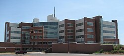
The National Weather Center (NWC), on the campus of the University of Oklahoma, is a confederation of federal, state, and academic organizations that work together to better understand events that take place in Earth's atmosphere over a wide range of time and space scales. The NWC partners give equal attention to applying that understanding to the development of improved observation, analysis, assimilation, display, and prediction systems. The National Weather Center also has expertise in local and regional climate, numerical modeling, hydrology, and weather radar. Members of the NWC work with a wide range of federal, state, and local government agencies to help reduce loss of life and property to hazardous weather, ensure wise use of water resources, and enhance agricultural production. They also work with private sector partners to develop new applications of weather and regional climate information that provide competitive advantage in the marketplace.

<span class="mw-page-title-main">Severe weather terminology (United States)</span> Terminology used by the National Weather Service to describe severe weather in the US

This article describes severe weather terminology used by the National Weather Service (NWS) in the United States. The NWS, a government agency operating as an arm of the National Oceanic and Atmospheric Administration (NOAA) branch of the United States Department of Commerce (DoC), defines precise meanings for nearly all of its weather terms.

In weather forecasting in the United States, "particularly dangerous situation" (PDS) is enhanced wording used by the National Weather Service to convey special urgency in some watch or warning messages when there is a significant risk of extreme weather, most commonly from types of weather events that are usually less severe by comparison, such as a severe thunderstorm outbreak or flash flooding. It is used in the format "This is a particularly dangerous situation..." at the discretion of the issuing forecaster. A watch or warning bearing the phrase is referred to as a PDS watch or PDS warning as shorthand jargon.

A tornado emergency is an enhanced version of a tornado warning, which is used by the National Weather Service (NWS) in the United States during imminent, significant tornado occurrences in highly populated areas. Although it is not a new warning type from the NWS, issued instead within a severe weather statement or in the initial tornado warning, a tornado emergency generally means that significant, widespread damage is expected to occur and a high likelihood of numerous fatalities is expected with a large, strong to violent tornado.

<span class="mw-page-title-main">1999 Bridge Creek–Moore tornado</span> 1999 tornado in Oklahoma, US

On the evening of Monday, May 3, 1999, a large and exceptionally powerful F5 tornado registered the highest wind speeds ever measured globally; winds were recorded at 301 ± 20 miles per hour (484 ± 32 km/h) by a Doppler on Wheels (DOW) radar. Considered the strongest tornado ever recorded to have affected the metropolitan area, the tornado devastated southern portions of Oklahoma City, Oklahoma, along with surrounding suburbs and towns to the south and southwest. The tornado covered 38 miles (61 km) during its 85-minute existence, destroying thousands of homes, killing 36 people, and leaving US$1 billion in damage, ranking it as the fifth-costliest on record not accounting for inflation. Its severity prompted the first-ever use of the tornado emergency statement by the National Weather Service.

<span class="mw-page-title-main">2010 New Year's Eve tornado outbreak</span> 2010 windstorm in the midwestern and southern United States

The 2010 New Year's Eve tornado outbreak was a three-day-long tornado outbreak that impacted the central and lower Mississippi Valley from December 30, 2010 to January 1, 2011. Associated with a low pressure system and a strong cold front, 37 tornadoes tracked across five states over the length of the severe event, killing nine and injuring several others. Activity was centered in the states of Missouri and later Mississippi on December 31. Seven tornadoes were rated EF3 on the Enhanced Fujita Scale; these were the strongest during the outbreak. Non-tornadic winds were recorded to have reached as high as 80 mph (130 km/h) at eight locations on December 31, while hail as large as 2.75 in (7.0 cm) was documented north-northeast of Mansfield, Missouri. Overall, damage from the outbreak totaled US$123.3 million, most of which was related to tornadoes. This is the most prolific tornado outbreak in Missouri in the month of December.

<span class="mw-page-title-main">National Weather Service Shreveport, Louisiana</span>

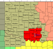
National Weather Service - Shreveport, LA (SHV) is one of 122 weather forecast offices around the United States. It is responsible for issuing public and aviation forecasts and warning for South Central and Southwestern Arkansas, Southeastern Oklahoma, and Eastern and Northeastern Texas Counties, as well as for North Central and Northwestern Louisiana Parishes. It is co-located with a weather radar (KSHV) of the NEXRAD network and an upper air sounding facility. It controls the issuance of weather information and bulletins on a certain number of NOAA Weather Radio.

<span class="mw-page-title-main">Tornado outbreak of April 13–16, 2012</span> Tornado outbreak in the United States

From April 13 to 16, 2012, a major tornado outbreak occurred across a large portion of the Great Plains. The storms resulted in six tornado-related fatalities, all of which occurred as a result of a nighttime EF3 tornado that caused major damage in and around Woodward, Oklahoma. Numerous other tornadoes occurred, including a violent EF4 tornado that passed near Marquette, Kansas, and an EF3 that caused major damage in Wichita.

<span class="mw-page-title-main">Tornado outbreak of November 17, 2013</span> Natural disaster

On November 17, 2013, the deadliest and costliest November tornado outbreak in Illinois history took shape, becoming the fourth-largest for the state overall. With more than 30 tornadoes in Indiana, it was that state's largest tornado outbreak for the month of November, and the second largest outbreak recorded in Indiana. Associated with a strong trough in the upper levels of the atmosphere, the event resulted in 77 tornadoes tracking across regions of the Midwest United States and Ohio River Valley, impacting seven states. Severe weather during the tornado outbreak caused over 100 injuries and eleven fatalities, of which eight were tornado related. Two tornadoes—both in Illinois and rated EF4 on the Enhanced Fujita scale—were the strongest documented during the outbreak and combined for five deaths. In addition to tornadoes, the system associated with the outbreak produced sizeable hail peaking at 4.00 in (10.2 cm) in diameter in Bloomington, Illinois, as well as damaging winds estimated as strong as 100 mph (160 km/h) in three locations.

<span class="mw-page-title-main">Tornado outbreak sequence of May 5–10, 2015</span>

The tornado outbreak sequence of May 5–10, 2015 was a six-day outbreak of tornado activity that affected the Great Plains of the United States in early May 2015. On May 6, strong tornadoes impacted the Oklahoma City area, along with rural parts of Kansas, Texas, Arkansas, South Dakota, and Nebraska. The outbreak coincided with major flooding, with large amounts of rain falling in parts of Nebraska, Kansas, Oklahoma, and Texas. The National Weather Service forecast office in Norman, Oklahoma issued a "flash flood emergency" for Oklahoma City following record-breaking rainfall that occurred in the area that evening. The outbreak sequence resulted in five tornado-related deaths, along with two flood-related deaths. A total of 127 tornadoes were confirmed and rated as a result of this outbreak sequence. Damage from the outbreak was estimated at $1.5 billion.

<span class="mw-page-title-main">National Weather Service Kansas City/Pleasant Hill, Missouri</span>

National Weather Service - Pleasant Hill/Kansas City, Missouri is a Weather Forecast Office (WFO) of the National Weather Service, which is responsible for forecasts and the dissemination of weather warnings and advisories for 37 counties in northern and western Missouri and seven counties in extreme eastern Kansas, including the Kansas City and St. Joseph metropolitan areas. Though, as the Storm Prediction Center (SPC) in Norman, Oklahoma is responsible for issuing severe thunderstorm and tornado watches, the Pleasant Hill/Kansas City WFO only composes outline and status updates for SPC-issued watches affecting any portion of its designated County Warning Area.

<span class="mw-page-title-main">National Weather Service Fort Worth, Texas</span>

The National Weather Service Fort Worth, Texas is a local weather forecast office of the National Weather Service responsible for monitoring weather conditions for 46 counties in north central Texas, including the Dallas-Fort Worth Metro Area and Waco, Texas.

<span class="mw-page-title-main">Tornado outbreak of March 3, 2019</span> Severe weather effect in the Southeastern United States

A significant and deadly severe weather event that affected the Southeastern United States on March 3, 2019. Over the course of 6 hours, a total of 41 tornadoes touched down across portions of Alabama, Georgia, Florida, and South Carolina. The strongest of these was an EF4 tornado that devastated rural communities from Beauregard, Alabama, through Smiths Station, Alabama to Talbotton, Georgia, killing 23 people and injuring at least 100 others. Its death toll represented more than twice the number of tornado deaths in the United States in 2018 as well as the deadliest single tornado in the country since the 2013 Moore EF5 tornado. An EF3 tornado also destroyed residences to the east of Tallahassee in Leon County, Florida, and was only the second tornado of that strength in the county since 1945. Several other strong tornadoes occurred across the region throughout the evening of March 3 and caused significant damage. A large number of EF0 and EF1 tornadoes also touched down.

References

  1. "National Weather Center Partners". National Weather Center. Retrieved September 24, 2014.
  2. 1 2 3 4 5 6 OUN Webmaster. "National Weather Service Weather Forecast Office Norman, Oklahoma" . Retrieved September 24, 2014.
  3. Bryan Painter (December 5, 2013). "Your Oklahoma City metro weather from the National Weather Service, Norman". The Oklahoman . The Anschutz Corporation . Retrieved January 4, 2014.
  4. Bryan Painter (December 20, 2013). "More on the Ice Storm Warnings, National Weather Service, Norman". The Oklahoman. The Anschutz Corporation . Retrieved January 4, 2014.
  5. "President meets with NWS forecasters following devastating Oklahoma tornado". WeatherReady. National Oceanic and Atmospheric Administration. May 28, 2013. Retrieved January 4, 2014.
  6. "Norman's National Weather Service staff meet President Obama". KOCO-TV . Hearst Television. May 28, 2013. Retrieved January 4, 2014.
  7. Andrea Thompson (May 28, 2013). "Pres. Obama Thanks Tornado Forecasters in Oklahoma". LiveScience. Retrieved January 4, 2014.
  8. Stephen F. Corfidi (December 27, 2009). "A brief history of the Storm Prediction Center". Storm Prediction Center. National Oceanic and Atmospheric Administration . Retrieved January 31, 2010.
  9. Greg Carbin; Roger Edwards; Greg Grosshans; David Imy; Mike Kay; Jay Liang; Joe Schaefer; Rich Thompson. "Storm Prediction Center Frequently Asked Questions (FAQ)". Storm Prediction Center. National Oceanic and Atmospheric Administration. Retrieved May 13, 2010.
  10. Nancy Mathis (2007). Storm Warning: The Story of a Killer Tornado . Touchstone. pp.  44–47. ISBN   978-0-7432-8053-2.
  11. Robert Henson (2000). "Unsettled Skies: Billion-Dollar Twister" (PDF). Scientific American . Scientific American, Inc. Retrieved April 30, 2014 via University of Arizona.
  12. OUN Webmaster (April 28, 2014). "The Great Plains Tornado Outbreak of May 3-4, 1999". National Weather Service Norman, Oklahoma. National Oceanic and Atmospheric Administration. Retrieved April 30, 2014.
  13. "Doppler On Wheels". Center for Severe Weather Research. 2014. Archived from the original on February 5, 2007. Retrieved February 10, 2014.
  14. "Tornado Speeds May 3, 1999". Sizes.com. Sizes, Inc. 2000. Retrieved September 24, 2014.
  15. Jack Williams (May 13, 1999). "Doppler radar measures 318 mph wind in tornado". USA Today . Gannett Company . Retrieved October 14, 2013.
  16. David Whitehouse (May 13, 1999). "US tornado breaks records". BBC News . BBC . Retrieved October 14, 2013.
  17. Bill Murray (May 2, 2008). "First Ever Tornado Emergency Message". WBMA-LD . Allbritton Communications Company . Retrieved April 30, 2014.
  18. "South Oklahoma Metro Tornado Emergency". National Weather Service in Norman, Oklahoma. May 3, 1999. Retrieved October 1, 2010.
  19. "May 3rd, 1999 from the NWS's Perspective". The Southern Plains Cyclone. National Weather Service. 2 (2). Spring 2004. Archived from the original on November 8, 2004. Retrieved February 15, 2008.
  20. 1 2 3 NWS Norman, OK. "NWS Norman Facebook" . Retrieved October 2, 2013.
  21. NWS Norman, OK. "NWS Norman Twitter" . Retrieved October 2, 2013.
  22. SRH Webmaster. "SRH Main Page". NWS Southern Region Headquarters. National Oceanic and Atmospheric Administration. Retrieved October 3, 2013.
  23. OUN Webmaster. "Norman Forecast Area Current Weather Conditions". National Weather Service Norman, Oklahoma. National Oceanic and Atmospheric Administration. Retrieved October 3, 2013.
  24. Louis W. Uccellini (March 2014). "May 2013 Oklahoma Tornadoes and Flash Flooding" (PDF). Department of Commerce . Retrieved March 23, 2013.
  25. "NWS Norman". Twitter. National Weather Service. Retrieved 8 April 2023.
  26. "NWS Boston". Twitter. National Weather Service. Retrieved 8 April 2023.
  27. 1 2 OUN Webmaster (November 2, 2010). "National Weather Service Weather Radio Norman". National Weather Service Norman, Oklahoma. National Oceanic and Atmospheric Administration. Retrieved October 15, 2013.