Related Research Articles

Sonar is a technique that uses sound propagation to navigate, measure distances (ranging), communicate with or detect objects on or under the surface of the water, such as other vessels.
The United States Naval Research Laboratory (NRL) is the corporate research laboratory for the United States Navy and the United States Marine Corps. It was founded in 1923 and conducts basic scientific research, applied research, technological development and prototyping. The laboratory's specialties include plasma physics, space physics, materials science, and tactical electronic warfare. NRL is one of the first US government scientific R&D laboratories, having opened in 1923 at the instigation of Thomas Edison, and is currently under the Office of Naval Research.

The Naval Undersea Warfare Center (NUWC) is the United States Navy's full-spectrum research, development, test and evaluation, engineering and fleet support center for submarines, autonomous underwater systems, and offensive and defensive weapons systems associated with undersea warfare. It is one of the corporate laboratories of the Naval Sea Systems Command. NUWC is headquartered in Newport, Rhode Island and has two major subordinate activities: Division Newport and Division Keyport in Keyport, Washington. NUWC also controls the Fox Island facility and Gould Island. It employs more than 4,400 civilian and military personnel, with budgets over $1 billion.

A research vessel is a ship or boat designed, modified, or equipped to carry out research at sea. Research vessels carry out a number of roles. Some of these roles can be combined into a single vessel but others require a dedicated vessel. Due to the demanding nature of the work, research vessels may be constructed around an icebreaker hull, allowing them to operate in polar waters.

USNS Mizar (MA-48/T-AGOR-11/T-AK-272) was a vessel of the United States Navy. She was named after the star Mizar.
Naval Facility Bermuda, or NAVFAC Bermuda, was the operational shore terminus for one of the Atlantic Sound Surveillance System (SOSUS) array systems installed during the first phase of system installation and in commission from 1955 until 1992. The true surveillance mission was classified and covered by "oceanographic research" until the mission was declassified in 1991. The system's acoustic data was collected after the facility was decommissioned until the system was routed to the central processing facility, the Naval Ocean Processing Facility (NOPF), Dam Neck, Virginia in 1994.

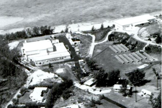
INS Sagardhwani (A74) is a marine acoustic research ship (MARS) owned by the Naval Physical and Oceanographic Laboratory (NPOL), a DRDO laboratory and is maintained and operated by the Indian Navy, and based at Southern Naval Command, Kochi.

A multibeam echosounder (MBES) is a type of sonar that is used to map the seabed. It emits acoustic waves in a fan shape beneath its transceiver. The time it takes for the sound waves to reflect off the seabed and return to the receiver is used to calculate the water depth. Unlike other sonars and echo sounders, MBES uses beamforming to extract directional information from the returning soundwaves, producing a swath of depth soundings from a single ping.

Project Artemis was a United States Navy acoustics research and development experiment from the late 1950s into the mid 1960s to test a potential low-frequency active sonar system for ocean surveillance. The at sea testing began in 1960 after research and development in the late 1950s. The project's test requirement was to prove detection of a submerged submarine at 500 nmi. The experiment, covering a number of years, involved a large active element and a massive receiver array.

Underwater acoustics or hydroacoustics is the study of the propagation of sound in water and the interaction of the mechanical waves that constitute sound with the water, its contents and its boundaries. The water may be in the ocean, a lake, a river or a tank. Typical frequencies associated with underwater acoustics are between 10 Hz and 1 MHz. The propagation of sound in the ocean at frequencies lower than 10 Hz is usually not possible without penetrating deep into the seabed, whereas frequencies above 1 MHz are rarely used because they are absorbed very quickly.
Diver detection sonar (DDS) systems are sonar and acoustic location systems employed underwater for the detection of divers and submerged swimmer delivery vehicles (SDVs). The purpose of this type of sonar system is to provide detection, tracking and classification information on underwater threats that could endanger property and lives. Further, this information is useful only to the extent that it is made available to authorities in time to make possible the desired response to the threat, be it deterrent or defensive action. Subsurface threats are a difficult problem, because reliable detection is available to date chiefly by use of high-resolution active sonar or trained dolphins or sea lions. The threat of an underwater terrorist attack is a concern to the maritime industry and port law enforcement agencies. Ports face a range of threats from swimmers, boat-delivered ordnance such as limpet mines and other forms of improvised underwater explosive devices. DDS systems have been developed to provide underwater security for ports, coastal facilities, offshore installations, pipelines and ships. Due to the variety of life and objects that exist under the water, it is desirable that a DDS system be capable of distinguishing between large sea mammals, shoals of fish; a ship's wake; a diver with an open circuit scuba set and a stealth diver with a rebreather. DDS systems have been developed that can be mounted on the seabed, on a pier or on the hull of a vessel. For complete port security these systems are integrated with the surface surveillance and security systems employed at ports, coastal facilities and offshore installations. Various systems provide specialized features to facilitate their use in port security systems including automatic detection features.

The K family of missiles, is a family of submarine-launched ballistic missiles (SLBM) developed by India to boost its second strike abilities and thus augment its nuclear deterrence. Information about this family of missiles has mostly been kept classified. It is reported that 'K missiles' are faster, lighter and stealthier than their Agni missile counterparts. High Energy Materials Research Laboratory (HEMRL) developed a new formulation of composite propellant that is more efficient and provide greater thrust compare to Agni missile series. The objective behind the development is to make K missile family faster and lighter without compromising on operational range.

The Sandhayak-class survey ships are a series of eight vessels built by Garden Reach Shipbuilders and Engineers (GRSE), Kolkata and Goa Shipyard, Ltd., Vasco for the Indian Navy. While Sandhayak, Investigator, Nirdeshak, Nirupak were built in GRSE; Sarveshak, Jamuna, Darshak, Sutlej were built by Goa Shipyard. The vessels equipped with four survey motor boats, two small boats and are powered by two diesel engines with a top speed of 16 knots. They have a helicopter deck and are also armed with a Bofors 40 mm/60 gun mount for self-defense.

INS Kadmatt (P29) is the second of four anti-submarine warfare corvettes built for the Indian Navy by the Garden Reach Shipbuilders and Engineers of Kolkata under Project 28. She was inducted into the Eastern Naval Command of the Indian Navy.
Panchendriya is a sonar suite that has been developed by the Defence Research and Development Organisation, India for the submarines of the Indian Navy. It has been described as India's "first indigenously developed sonar system for submarines".
USHUS is an integrated sonar system developed by the Naval Physical and Oceanographic Laboratory (NPOL) of the Defence Research and Development Organisation (DRDO), India, for use in submarines of the Indian Navy. It is primarily designed to be used in Sindhughosh class submarines, though it is reported to be fitted in the Arihant-class nuclear-powered ballistic missile submarines as well. USHUS is reported to be superior to its Russian equivalents.

Argus Island was an acoustic research tower and platform located on Plantagenet Bank, a guyot about 30 miles southwest of the island of Bermuda. The tower was originally part of the facilities supporting Project Artemis and Project Trident under auspices of the Tudor Hill Laboratory, a facility of the US Navy's Underwater Sound Laboratory. Later the tower was used for additional acoustic experiments as well as oceanographic observations, wave height measurements, optical observations, air containment measurements and measurements of the effects of the ocean environment on the structure itself.

INS Sandhayak (J18)(Hindi: संधायक lit. coordinator) was the lead ship of the Sandhayak class of survey ships. The ship operates as a hydrographic survey ship in the Indian Navy, under the Eastern Naval Command. Apart from a helicopter and Bofors 40 mm gun for self defence, the ship is also equipped with four survey motor boats, two small boats. The ship can also analyse the level of pollution, sea level at various places, sea bed and marine wealth. Sandhayak is capable of conducting shallow coastal and deep oceanic hydrographic survey and collect oceanographic and geophysical data. The ship was decommissioned on 4 June 2021 after 40 years in service.
INS Dhruv (A40) is a research vessel and missile range instrumentation ship built by India's Hindustan Shipyard Limited (HSL). The ship was earlier only known by its shipyard designated yard number as VC-11184.

The Integrated Coastal Surveillance System (ICSS) is a coastal surveillance system operated by India with the goal to protect its coastline, ensure regional security, and assist friendly navies by quickly detecting, locating and monitoring maritime activity in the Indian Ocean. The system was developed by the Defence Research and Development Organisation (DRDO) and Bharat Electronics, and forms part of the National Command Control Communication and Intelligence System (NC3I). Although the ICSS was built primarily for coastal and maritime security, the system can also be used for vessel traffic management, harbour surveillance and navigation. The core of the ICSS is a network of remote ground-based radar stations called the Coastal Surveillance Network (CSN). In addition to radars, stations are also fitted with optical sensors, electro-optical sensors, thermal imagers, cameras, meteorological systems, an Automatic Identification System (AIS), a distress alert transmission system (DATS), electronic warfare support measures, and very high frequency (VHF) radio communication systems.
References
- 1 2 "DRDO gets it right when it's unlike DRDO". Indian Express. 27 November 2006. Retrieved 8 June 2013.
- ↑ "DRDO to develop unmanned underwater vehicles". The Hindu . 13 December 2007. Archived from the original on 15 December 2007. Retrieved 7 February 2008.
- ↑ M. Somasekhar (6 February 2008). "DRDO plans satellite-based coastal surveillance system". The Hindu Business Line. Retrieved 7 February 2008.