
Rizal, officially the Province of Rizal, is a province in the Philippines located in the Calabarzon region in Luzon. Its capital is the city of Antipolo. It is about 16 kilometers (9.9 mi) east of Manila. The province is named after José Rizal, one of the main national heroes of the Philippines. It is bordered by Metro Manila to the west, Bulacan to the north, Quezon to the east and Laguna to the southeast. The province also lies on the northern shores of Laguna de Bay, the largest lake in the country. Rizal is a mountainous province perched on the western slopes of the southern portion of the Sierra Madre mountain range.

Caloocan, officially the City of Caloocan, is a 1st class highly urbanized city in Metro Manila, Philippines. According to the 2020 census, it has a population of 1,661,584 people making it the fourth-most populous city in the Philippines.

Malabon, officially the City of Malabon, is a 1st class highly urbanized city in the National Capital Region of the Philippines. According to the 2020 census, it has a population of 380,522 people.

Valenzuela, officially the City of Valenzuela, is a 1st class highly urbanized city in the National Capital Region of the Philippines. According to the 2020 census, it has a population of 714,978 people.

Navotas, officially the City of Navotas, is a 1st class highly urbanized city in the National Capital Region of the Philippines. According to the 2020 census, it has a population of 247,543 people.

Santa Cruz, officially the Municipality of Santa Cruz, is a 1st class municipality and capital of the province of Laguna, Philippines. According to the 2020 census, it has a population of 123,574 people.

Obando, officially the Municipality of Obando, is a 2nd class municipality in the province of Bulacan, Philippines. According to the 2020 census, it has a population of 59,978 people.

General Trias, officially the City of General Trias, formerly known as San Francisco de Malabon is a 1st class component city in the province of Cavite, Philippines. According to the 2020 census, it has a population of 450,583 people.

Bato, officially the Municipality of Bato, is a 5th class municipality in the province of Catanduanes, Philippines. According to the 2020 census, it has a population of 21,748 people.

San Jose, officially the Municipality of San Jose, is a 5th class municipality in the province of Northern Samar, Philippines. According to the 2020 census, it has a population of 17,641 people.

San Miguel, officially the Municipality of San Miguel, is a 4th class municipality in the province of Iloilo, Philippines. According to the 2020 census, it has a population of 30,115 people.

Jaen, officially the Municipality of Jaen is a 2nd class municipality in the province of Nueva Ecija, Philippines. According to the 2020 census, it has a population of 79,189 people.

The Tullahan River is a river in the Philippines. It is located to the north of Manila and has an approximate length of 27.1 kilometers (16.8 mi). It starts at the La Mesa Reservoir in Quezon City and flows through Caloocan, Malabon, Valenzuela, and Navotas and empties into Manila Bay. In 2019, San Miguel Corporation pledged ₱1 billion for the cleanup of the Tullahan River as part of the Manila Bay rehabilitation effort.

Poblacion is an administrative division of southern Metro Manila, the Philippines. It is an urban barangay of Makati, named and centered on the city's historic poblacion area and serves as the second most important commercial center in Makati behind the Makati Central Business District. It is also the city's center of government, culture, history and entertainment and a major business district of Metro Manila.
Tanza was one of the fourteen barangays of the city of Navotas in Metro Manila, Philippines. It occupied the northernmost portion of the city including Isla Pulo which is separated from the city proper, and was bounded by Brgy. Binauangan and Salambao in Obando, Bulacan to the north, Manila Bay and Brgy. San Roque to the west, Brgy. Hulong Duhat and Dampalit, Malabon to the east and Brgy. Tangos North to the south.
The Navotas City Council is Navotas's Sangguniang Panlungsod or legislature. It is composed of 14 councilors, with six councilors elected from each of Navotas' two councilor districts and two councilors elected from the ranks of barangay (neighborhood) chairmen and the Sangguniang Kabataan. The presiding officer of the council is the Vice Mayor, who is elected citywide.

North Bay Boulevard is a 2.34-kilometer-long (1.45 mi) two- to four-lane access road in the Navotas Fish Port Complex of northern Metro Manila, Philippines. It is one of the main roads in Navotas which travels north-south through the southern parts of the city running parallel to Radial Road 10 (R-10) to the west. The road links the Balut area of Tondo in Manila and San Rafael Village in the south to the central Navotas barangay of Bagumbayan South in the north. It was named after its location in Manila Bay north of the Manila North Harbor complex.

The following is an alphabetical list of articles related to the Philippine capital region of Metro Manila.

Governor Wenceslao Pascual Avenue, commonly known as simply Governor Pascual Avenue, is the principal east–west artery in the city of Malabon in Metro Manila, the Philippines. It is an unsigned route in the Philippine highway network classified by the Department of Public Works and Highways as a national tertiary road. The 4.43-kilometre (2.75 mi) two-lane avenue is the longest of the city's national roads. Portions of it are prone to flooding from the Tullahan River which flows just north of the avenue in east-central Malabon.

 Diocesan Center and San Jose Parish church located in the poblacion of Navotas
 Navotas Centennial Park in Barangay Bagumbayan South
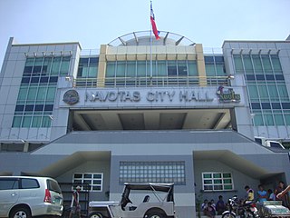
 City Hall of Navotas
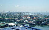 Aerial Shot of Navotas


