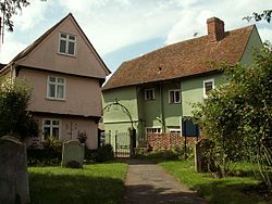
Nayland is a village and former civil parish in the Stour Valley on the Suffolk side of the border between Suffolk and Essex in England. In 2011 the built-up area had a population of 938. In 1881 the civil parish had a population of 901.

A civil parish is a country subdivision, forming the lowest unit of local government in England. There are 125 civil parishes in the ceremonial county of Bedfordshire, most of the county being parished: Luton is completely unparished; Central Bedfordshire is entirely parished. At the 2001 census, there were 312,301 people living in the 125 parishes, which accounted for 55.2 per cent of the county's population.

A civil parish is a subnational entity, forming the lowest unit of local government in England. There are 101 civil parishes in the ceremonial county of West Yorkshire, most of the county being unparished. At the 2001 census, there were 557,369 people living in the parishes, accounting for 26.8 per cent of the county's population.

A civil parish is a subnational entity, forming the lowest unit of local government in England. There are 21 civil parishes in the ceremonial county of West Midlands, most of the county being unparished; Dudley, Sandwell, Walsall and Wolverhampton are completely unparished. At the 2001 census, there were 89,621 people living in the parishes, accounting for 3.5 per cent of the county's population.

Rushmere St Andrew is a village, civil parish and electoral ward adjacent to part of the eastern edge of the borough of Ipswich in the East Suffolk district of Suffolk, England. The parish includes most of Rushmere Heath and parts of the Ipswich suburb of Broke Hall as well as the village of Rushmere St. Andrew, from which it draws its name.

Stoke-by-Nayland is a village and civil parish in the Babergh district, in the county of Suffolk, England, close to the border with Essex. The parish includes the village of Withermarsh Green and the hamlets of Thorington Street and Scotland Street. The village has many cottages and timber-framed houses and all surround a recreation field. Possibly once the site of a monastery, the population of the civil parish at the 2001 census was 703, falling to 682 at the Census 2011.

Melford Rural District was a rural district in the county of West Suffolk, England. It was created in 1894, under the Local Government Act 1894 from that part of the Sudbury rural sanitary district in West Suffolk. It was named after Long Melford and administered from Sudbury. Shortly after its creation, in 1896, the parish of Glemsford was made a separate urban district.

Wrentham is a village and civil parish in the East Suffolk district, in the north-east of the English county of Suffolk. It is located about 2 miles (3.2 km) from the North Sea coast on the A12 trunk road, about 7 miles (11 km) south-west of Lowestoft, 4 miles (6.4 km) north of Southwold and 6 miles (9.7 km) south-east of Beccles.
Wiston is a village, parish and community in Pembrokeshire, Wales, in the United Kingdom. It was once a marcher borough. George Owen, in 1603, described it as one of nine Pembrokeshire "boroughs in decay". It continued as a constituent parliamentary borough until the end of the 19th century.

Boxford is a large village and civil parish in the Babergh district of Suffolk, England. Located around six miles east of Sudbury straddling the River Box and skirted by the Holbrook, in 2005 the parish had a population of 1,270. decreasing to 1,221 at the 2011 Census.

Erpingham is a village and civil parish in the English county of Norfolk. Its area of 2,490 acres (1,010 ha) had a population of 541 in 210 households at the 2001 Census. Including Ingworth it increased to 700 at the 2011 Census.

Davenham is a rural village and civil parish approximately 3 kilometres (1.9 mi) south of the town of Northwich, part of the Borough of Cheshire West and Chester and the ceremonial county of Cheshire in England. It has a population of 5,655, reducing following reorganisation to 2,745 at the 2011 Census. The village is close to the A556 and A533 roads and both the River Dane and River Weaver. It is the birthplace of former marathon world record holder, Paula Radcliffe.

Wissington or Wiston is a small village and former civil parish, now in the parish of Nayland-with-Wissington in the Babergh district, in south Suffolk, England. In 1881 the civil parish had a population of 191. On the 1 April 1844 it was merged to create Nayland-with-Wissington.

Levens is a village and civil parish in the South Lakeland district of the modern English county of Cumbria. It lies within the historic county of Westmorland. In the 2001 census the parish had a population of 1,007, increasing at the 2011 census to 1,049. The village lies four miles (6.4 km) south of Kendal off the A6 and A590 roads. Levens Hall is within the parish.

Brettenham is a village and civil parish in the Babergh district of Suffolk, England. In 2005 it had a population of 270, increasing to 353 at the 2011 Census.
Leavenheath is a village and civil parish located on the Essex - Suffolk border. Located on the A134 between Sudbury and Colchester, it is part of Babergh district. The parish also contains the hamlets of Cock Street and Honey Tye, and in 2001 had a population of 1,373, falling slightly to 1,370 at the 2011 Census.

Horringer is a village and civil parish in the West Suffolk district of Suffolk in eastern England. It lies on the A143 about two miles south-west of Bury St Edmunds. The population in 2011 was 1055.

A civil parish is a country subdivision, forming the lowest unit of local government in England. There are 218 civil parishes in the ceremonial county of Cornwall, which includes the Isles of Scilly. The county is effectively parished in its entirety; only the unpopulated Wolf Rock is unparished. At the 2001 census, there were 501,267 people living in the current parishes, accounting for the whole of the county's population. The final unparished areas of mainland Cornwall, around St Austell, were parished on 1 April 2009 to coincide with the structural changes to local government in England.

Hacheston is a village and a civil parish in the East Suffolk district, in the English county of Suffolk. The population of the parish at the 2011 census was 345.
Linstead Parva is a small village and civil parish in the East Suffolk district of Suffolk in eastern England. It has a small but notable 13th-century parish church, still in regular use. The village pub, The Greyhound, was already established and trading when referenced in 1874, but it closed permanently in March 1955, and is now a private dwelling.