Nemo, Missouri

Last updated

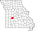
Nemo is an unincorporated community in Hickory County, in the U.S. state of Missouri. [1]

History

A post office called Nemo was established in 1893, and remained in operation until 1913. [2] It is uncertain why the name "Nemo" was applied to this community. [3] It has been researched with the earliest mention that people found (so far) was on a map date 1904. [4]

Related Research Articles

<span class="mw-page-title-main">Hickory County, Missouri</span> County in Missouri, United States

Hickory County is located in the U.S. state of Missouri. As of the 2020 census, the population was 8,279. Its county seat is Hermitage. The county was organized February 14, 1845, and named after President Andrew Jackson, whose nickname was "Old Hickory." The Pomme de Terre Dam, a Corps of Engineers facility, is located three miles south of Hermitage and forms Lake Pomme de Terre by damming the Pomme de Terre River and Lindley Creek. Truman Reservoir, also a Corps of Engineers facility, floods the Pomme de Terre Reservoir from the northern border of the county southward to the city limits of Hermitage.

<span class="mw-page-title-main">Quincy, Missouri</span> Unincorporated community in Missouri, U.S.

Quincy is a small unincorporated community in northwestern Hickory County, Missouri, United States. It is located on Route 83, north of U.S. Route 54. A post office and a few homes are located there.

<span class="mw-page-title-main">Pittsburg, Missouri</span> Unincorporated community in Missouri, U.S.

Pittsburg is an unincorporated community in Hickory County, Missouri, United States. It is located approximately ten miles south of Hermitage on Route 64. The community lies on the shores of Pomme de Terre Lake. The ZIP Code for Pittsburg is 65724.

Tyrone is an unincorporated community in southern Texas County, Missouri, United States. The community is located on Missouri Route H, approximately 1.5 miles west of Missouri Route 137. It consists of several houses.

Hickory Ridge is an unincorporated community in Cape Girardeau County, in the U.S. state of Missouri.

Seybert is an extinct town in Dade County, in the U.S. state of Missouri. The GNIS classifies it as a populated place.

Hico is an extinct town in Dallas County, in the U.S. state of Missouri. The community was located adjacent to the Niangua River, approximately two miles northeast of Spring Grove and six miles southeast of Buffalo. The Hico Bridge over the Niangua on County Road JJ-203 is approximately 1000 feet west of the Hico location.

Hickory Barren is an unincorporated community in northern Greene County, in the U.S. state of Missouri. The community is on Missouri Route H, two miles north of Fellows Lake. Fair Grove is approximately four miles to the northeast.

Hickory Creek is an unincorporated community in southwest Grundy County, in the U.S. state of Missouri. The community is on the banks of Hickory Creek along the west margin of the Thompson River bottomland and six miles south-southwest of Trenton.

Elkton is an unincorporated community in Hickory County, in the U.S. state of Missouri.

Jordan is an unincorporated community in Hickory County, in the U.S. state of Missouri.

Center Township is an inactive township in Hickory County, in the U.S. state of Missouri.

Green Township is an inactive township in Hickory County, in the U.S. state of Missouri.

Jordan Township is an inactive township in Hickory County, in the U.S. state of Missouri.

Stark Township is an inactive township in Hickory County, in the U.S. state of Missouri.

Tyler Township is an inactive township in Hickory County, in the U.S. state of Missouri.

Weaubleau Township is an inactive township in Hickory County, in the U.S. state of Missouri.

Wheatland Township is an inactive township in Hickory County, in the U.S. state of Missouri.

Mohawk Corner is an unincorporated community in northeast Polk County, in the U.S. state of Missouri. The community is at the intersection of Missouri Routes 64 and D. Pittsburg and the Pomme de Terre Lake area are five miles to the north on Route 64 in Hickory County. Polk is two miles to the south on Route D.

Sentinel is an unincorporated community in northern Polk County, in the U.S. state of Missouri.

References

  1. U.S. Geological Survey Geographic Names Information System: Nemo, Missouri
  2. "Post Offices". Jim Forte Postal History. Retrieved October 6, 2016.
  3. "Hickory County Place Names, 1928–1945 (archived)". The State Historical Society of Missouri. Archived from the original on June 24, 2016. Retrieved October 6, 2016.{{cite web}}: CS1 maint: bot: original URL status unknown (link)
  4. "Nemo (Hickory County, MO)". roadsidethoughts.com. Retrieved November 29, 2023.
37°52′36″N93°15′43″W / 37.87667°N 93.26194°W / 37.87667; -93.26194