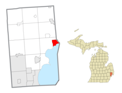
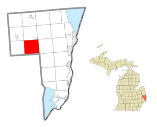
New Baltimore incorporated as a village in 1867 and as a city in 1931.[6] Previously, it was split between Macomb and St. Clair counties; however, in the 1970s, the city was able to petition to adjust the county boundaries such that it would align with the city's eastern border. This placed New Baltimore completely in Macomb County, where it remains to this day. The town sits on the waterfront along Lake St. Clair'sAnchor Bay, and offers a public park, beach, and downtown-shopping district.
Prior to the arrival of European settlers, indigenous tribes are known to have inhabited much of New Baltimore's shoreline for thousands of years, and in the 1800s the land was recorded to have many ancient burial mounds and man made earth-works.[7] W.B Hinsdale excavated multiple sites in New Baltimore, and recorded his countless findings in his novels in the early 20th century. Most of these locations have long been destroyed by treasure hunters and developed over, with an unfortunate though seemingly familiar lack of regard to the public's knowledge of the city's vast history with indigenous tribes.[8]
German explorer Pierre Yax (b.1763) in Grosse Pointe, New France (now Michigan) was the first recorded non-Native American in the New Baltimore area.[9][10] Pierre Yax was a son of Johan Michael Jacks, the first German in what would eventually become the state of Michigan.[10] Pierre Yax arrived in New Baltimore in 1796 and subsequently obtained a land grant signed by President John Quincy Adams on July 23, 1826. The land grant tracked back to a land patent Yax had in 1812, when Michigan was still part of the Michigan Territory.[11]
Later, other French settlers came to this area and took residence along the waterfront and rivers. They developed farms that had narrow frontage of 400 of 900 feet and extended inland from the water. Generally, the depth of the parcel was determined by how far a man could plow or cultivate in a day.[12]
The first evidence of a settled community came in 1845, when a Mount Clemens businessman, Alfred Ashley, platted 60 acres (24ha) of land lying on both sides of Washington Street. This would become known as the village of Ashley. On September 20, 1851, a post office called Ashleyville was established with Ashley as postmaster. Ashley also opened businesses in lumbering, shipping, and real estate.[6] The original village of Ashley occupied what is now the center part of downtown New Baltimore, extending northwest along Clay, Base and Maria Streets from Anchor Bay. The land was subdivided in the typical gridiron fashion used in most American communities at that time. Over the years, irregularities developed in the gridiron subdivision pattern because of the lack of local controls, conflicts with French claims, and changing land uses, particularly along the waterfront area. This created problems in both subdivision patterns in general and waterfront use in particular that remain today.[citation needed] This original settlement bore Ashley's name until 1867, when the village name was changed to New Baltimore.[6]
Throughout its history, New Baltimore has been linked to the regional economy by virtue of the city's access to the waterfront and the region's transportation network. In its early years, New Baltimore took advantage of its waterfront location to operate port facilities exporting agriculture and manufacturing products to other communities. The area was known for the manufacturing of barrels, brooms, bricks, coffins, corsets, and creamery products. Lumber products and building materials were shipped by boat from the local mills. Development was heavily oriented to the waterfront, where shipping piers extended a hundred or more feet into the lake.[6]
As automobile transportation increased in importance and travel patterns changed, so did the development of the city. Goods were no longer shipped by water and the waterfront slowly changed. Between 1860 and 1880, New Baltimore changed from a strong manufacturing and exporting community to a thriving community in Macomb County with many resort activities and well-known commercial establishments. The community was a popular getaway spot for Metro Detroiters and boasted an opera house, hotels, salt baths (which nearby city of Mount Clemens was famous for in the late 19th and early 20th centuries), summer and winter recreational activities, saloons, a brewery and numerous resort and commercial establishments. The city was in the path of a steam locomotive line that ran between Detroit and Port Huron in the late 19th century.[12] As technology changed, the city constructed an electricity plant to accommodate inter-urban passenger trains, which lasted until the mid-1920s.[6] Today, access to the city is provided via Interstate 94. The historic New Baltimore water tower was demolished in the summer of 2015 and raised in the park to take its place was the State's tallest flag. The flagpole stands at 160 feet tall on the shores of Anchor Bay at Walter and Mary Burke Park. The New Baltimore Lions Club raised more than $100,000 to have the flagpole installed with the intention of creating a landmark for boaters after the city's historic water tower was demolished. A dedication ceremony took place in October 2016.
Geography
New Baltimore's water tower over Anchor Bay of Lake St. Clair
According to the United States Census Bureau, the city has a total area of 6.73 square miles (17.43km2), of which 4.60 square miles (11.91km2) are land and 2.12 square miles (5.49km2), or 31.6%, are water.[1]
As of the census[14] of 2010, there were 12,084 people, 4,434 households, and 3,187 families living in the city. The population density was 2,621.3 inhabitants per square mile (1,012.1/km2). There were 4,740 housing units at an average density of 1,028.2 per square mile (397.0/km2). The racial makeup of the city was 94.4% White, 2.7% African American, 0.4% Native American, 0.9% Asian, 0.2% from other races, and 1.4% from two or more races. Hispanic or Latino of any race were 1.8% of the population.
There were 4,434 households, of which 41.3% had children under the age of 18 living with them, 60.0% were married couples living together, 8.2% had a female householder with no husband present, 3.6% had a male householder with no wife present, and 28.1% were non-families. 23.3% of all households were made up of individuals, and 9.1% had someone living alone who was 65 years of age or older. The average household size was 2.72 and the average family size was 3.25.
The median age in the city was 37.1 years. 28.8% of residents were under the age of 18; 6.6% were between the ages of 18 and 24; 29.6% were from 25 to 44; 25.1% were from 45 to 64; and 9.8% were 65 years of age or older. The gender makeup of the city was 48.9% male and 51.1% female.
2000 census
As of the census[3] of 2000, there were 7,405 people, 2,942 households, and 1,994 families living in the city. The population density was 1,604.5 inhabitants per square mile (619.5/km2). There were 3,218 housing units at an average density of 697.3 per square mile (269.2/km2). The racial makeup of the city was 96.89% White, 0.53% African American, 0.36% Native American, 0.47% Asian, 0.04% Pacific Islander, 0.46% from other races, and 1.27% from two or more races. Hispanic or Latino of any race were 1.34% of the population.
There were 2,942 households, out of which 33.1% had children under the age of 18 living with them, 56.3% were married couples living together, 8.2% had a female householder with no husband present, and 32.2% were non-families. 27.4% of all households were made up of individuals, and 10.4% had someone living alone who was 65 years of age or older. The average household size was 2.48 and the average family size was 3.05.
In the city, the population was spread out, with 25.4% under the age of 18, 6.8% from 18 to 24, 34.3% from 25 to 44, 23.7% from 45 to 64, and 9.7% who were 65 years of age or older. The median age was 36 years. For every 100 females, there were 94.6 males. For every 100 females age 18 and over, there were 92.7 males.
The median income for a household in the city was $60,699, and the median income for a family was $72,046. Males had a median income of $49,648 versus $33,083 for females. The per capita income for the city was $26,921. About 1.0% of families and 3.5% of the population were below the poverty line, including 1.3% of those under age 18 and 8.0% of those age 65 or over.
Government
New Baltimore is a home-rule city with an elected mayor and six at-large council members. Since 2022, Tom Semaan has served as mayor.
The city of New Baltimore is within the boundaries of the Anchor Bay School District, and hosts Lighthouse Elementary, Ashley Elementary, Anchor Bay Middle School North, and Anchor Bay's Aquatic Center.
Michigan's largest flag
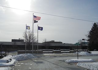
Since 2016 the focal point of the community has been Michigan's largest flag and tallest flagpole. The pole is 160 feet (49m) high and the American flag it holds is 30 by 60 feet (9.1 by 18.3m) and sits on the edge of Lake Saint Clair's Anchor Bay. The $103,000 cost was paid for with donations led by an initial contribution of $10,000 by the New Baltimore Lions Club.[15]
Macomb County is a county on the eastern shore of the U.S. state of Michigan. It is part of the Detroit metropolitan area, bordering Detroit to the north and containing many of its northern suburbs. Its seat of government is Mt. Clemens, and its largest community is Warren. As of the 2020 census, the county had a population of 881,217, making it the third-most populous county in the state, behind neighboring Wayne and Oakland. Macomb County contains 27 cities, townships and villages, including three of the ten most-populous municipalities in Michigan. Most of this population is concentrated south of Hall Road (M-59), one of the county's main thoroughfares.
Armada is a village in Macomb County in the U.S. state of Michigan. The population was 1,684 at the 2020 census. The village is located within Armada Township. It is best known for its annual Armada Fair.
Center Line is a city in Macomb County in the U.S. state of Michigan. An inner-ring suburb of Metro Detroit, Center Line is located roughly 11 miles (17.7 km) north of downtown Detroit, and is completely surrounded by the larger city of Warren. As of the 2020 census, the city had a population of 8,552.
Chesterfield Charter Township is a charter township of Macomb County in the U.S. state of Michigan. As of the 2020 census the population was 45,376.
Fraser is a city in Macomb County in the U.S. state of Michigan. A northern suburb of Detroit, Fraser is located roughly 15 miles (24.1 km) northeast of downtown Detroit. As of the 2020 census, the city had a population of 14,726.
Harrison Charter Township is a charter township of Macomb County in the U.S. state of Michigan. The population was 24,314 at the 2020 census.
Lake Township is a former civil township located in Macomb County in the U.S. state of Michigan. The small township consisted of 0.6 mi2 (1.7 km2) of the Macomb County portion of the village of Grosse Pointe Shores, which was part of Grosse Pointe Township and mostly located in Wayne County on the western shores of Lake Saint Clair. At the 2000 census, the township population was 80.
Lenox Township is a civil township of Macomb County in the U.S. state of Michigan. As of the 2020 census, the population was 12,119, up from 10,470 in 2010.
Mount Clemens is a city in the U.S. state of Michigan. The population was 15,697 at the 2020 census. It is the seat of government of Macomb County and part of the Detroit metropolitan area.
New Haven is a village in Lenox Township within Macomb County in the U.S. state of Michigan. The population was 6,097 at the 2020 census, up from 4,642 in 2010.
Ray Township is a civil township of Macomb County in the U.S. state of Michigan. As of the 2020 census, the township population was 3,780.
Roseville is a city in Macomb County in the U.S. state of Michigan. A northern suburb of Detroit, Roseville is located roughly 13 miles (20.9 km) northeast of downtown Detroit. As of the 2020 census, the city had a population of 47,710.
St. Clair Shores is a city in Macomb County in the U.S. state of Michigan. An inner-ring suburb of Detroit, St. Clair Shores is located roughly 14 miles (22.5 km) northeast of downtown Detroit. As of the 2020 census, the city had a population of 58,874.
Utica is a city in Macomb County in the U.S. state of Michigan. The population was 5,245 at the 2020 census, up from 4,757 in 2010.
Pearl Beach is an unincorporated community and census-designated place (CDP) in St. Clair County in the U.S. state of Michigan. The population of the CDP was 4,698 at the 2020 census. The community is located within Clay Township.
Riley Township is a civil township of St. Clair County in the U.S. state of Michigan. The population was 3,199 at the 2020 Census.
Grosse Pointe Shores is a city in Wayne and Macomb counties in the U.S. state of Michigan. The population was 2,647 at the 2020 census, down from 3,008 in 2010.
Memphis is a city that straddles the border between Macomb and St. Clair counties in the U.S. state of Michigan. The population was 1,084 at the 2020 census.
Richmond is a city within Metro Detroit in the U.S. state of Michigan. The population was 5,878 at the 2020 census. Most of the city is located in Macomb County, though there is a small portion in neighboring St. Clair County.
Richmond Township is a civil township of Macomb County, Michigan, United States. At the 2020 census, the township population was 3,544, Which makes Richmond Township the least populated township in Macomb County. A portion of the city of Richmond is adjacent to the township, but is administratively autonomous.
↑ "Search Results". The United States Census Bureau. United States Census Bureau. Retrieved December 12, 2021.
1 2 3 4 5 Skinner, Elmer; Skinner, Grace (1958). Skinner's History Stories of New Baltimore. Self-published. Republished in 1979 by the New Baltimore Public Library.
This page is based on this Wikipedia article Text is available under the CC BY-SA 4.0 license; additional terms may apply. Images, videos and audio are available under their respective licenses.