New Canton, Illinois

Last updated

New Canton
Pike County Illinois Incorporated and Unincorporated areas New Canton Highlighted.svg
Location of New Canton in Pike County, Illinois.
Coordinates: 39°38′14″N91°05′54″W / 39.63722°N 91.09833°W / 39.63722; -91.09833 [1]
CountryUnited States
StateIllinois
County Pike
IncorporatedMarch 31, 1869 (1869-03-31)
Area
[2]
  Total0.88 sq mi (2.28 km2)
  Land0.88 sq mi (2.28 km2)
  Water0.00 sq mi (0.00 km2)
Elevation
[1]
472 ft (144 m)
Population
 (2020)
  Total334
  Density379.11/sq mi (146.44/km2)
Time zone UTC-6 (CST)
  Summer (DST) UTC-5 (CDT)
ZIP Code(s)
62356
Area code 217
FIPS code 17-52311
GNIS feature ID2396799 [1]
[3]

New Canton is an incorporated town in Pleasant Vale Township, Pike County, Illinois, United States. The population was 359 at the 2010 census, a decline from 417 in 2000.

Contents

Geography

New Canton is located about 26 miles southeast of Quincy along Illinois Route 96. The town is on the edge of the Mississippi River floodplain about six miles from the river. [4]

According to the 2010 census, New Canton has a total area of 0.76 square miles (1.97 km2), all land. [5]

Demographics

Historical population
CensusPop.Note
1880 424
1890 4240.0%
1900 47612.3%
1910 473−0.6%
1920 54014.2%
1930 479−11.3%
1940 5177.9%
1950 449−13.2%
1960 4490.0%
1970 4868.2%
1980 420−13.6%
1990 405−3.6%
2000 4173.0%
2010 359−13.9%
2020 334−7.0%
U.S. Decennial Census [6]

As of the census [7] of 2000, there were 417 people, 176 households, and 124 families residing in the town. The population density was 535.8 inhabitants per square mile (206.9/km2). There were 206 housing units at an average density of 264.7 per square mile (102.2/km2). The racial makeup of the town was 100.00% White.

There were 176 households, out of which 33.5% had children under the age of 18 living with them, 54.5% were married couples living together, 9.7% had a female householder with no husband present, and 29.0% were non-families. 27.3% of all households were made up of individuals, and 16.5% had someone living alone who was 65 years of age or older. The average household size was 2.37 and the average family size was 2.82.

In the town, the population was spread out, with 25.4% under the age of 18, 7.2% from 18 to 24, 29.0% from 25 to 44, 18.5% from 45 to 64, and 19.9% who were 65 years of age or older. The median age was 38 years. For every 100 females, there were 87.8 males. For every 100 females age 18 and over, there were 82.9 males.

The median income for a household in the town was $24,583, and the median income for a family was $30,893. Males had a median income of $31,094 versus $15,893 for females. The per capita income for the town was $11,571. About 17.8% of families and 19.9% of the population were below the poverty line, including 26.2% of those under age 18 and 16.9% of those age 65 or over.

Related Research Articles

<span class="mw-page-title-main">Friendship, Arkansas</span> Town in Arkansas, United States

Friendship is a town in Hot Spring County, Arkansas, United States. The population was 176 at the 2010 census, down from 206 at the 2000 census.
<span class="mw-page-title-main">Liverpool, Illinois</span> Village in Illinois, United States

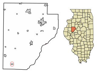
Liverpool is a village in Fulton County, Illinois, United States. The population was 94 at the 2010 census.

<span class="mw-page-title-main">London Mills, Illinois</span> Village in Illinois, United States

London Mills is a village in Fulton and Knox counties in the U.S. state of Illinois. The population was 350 at the 2020 census.

<span class="mw-page-title-main">Reynolds, Illinois</span> Village in Illinois, United States

Reynolds is a village mainly in Rock Island County in the U.S. state of Illinois. The population was 498 at the 2020 census. A small portion on the south side is in Mercer County. The village was founded in 1876.

<span class="mw-page-title-main">Wilkinson, Indiana</span> Town in Indiana, United States

Wilkinson is a town in Brown Township, Hancock County, Indiana, United States. The population was 449 at the 2010 census.

Waltham is a town in Hancock County, Maine, United States. The population was 332 at the 2020 census.

Cannon Falls Township is a township in Goodhue County, Minnesota, United States. The population was 1,236 at the 2000 census.
<span class="mw-page-title-main">Urbana, Missouri</span> City in Missouri, United States

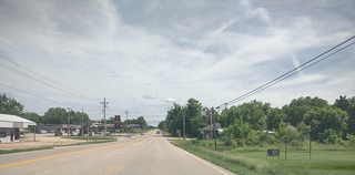
Urbana is a city in Dallas County, Missouri, United States. The population was 414 at the 2010 census. It is part of the Springfield, Missouri Metropolitan Statistical Area.

<span class="mw-page-title-main">East Canton, Ohio</span> Village in Ohio, United States

East Canton is a village in central Stark County, Ohio, United States. The population was 1,521 at the 2020 census. It is part of the Canton–Massillon metropolitan area.

<span class="mw-page-title-main">Armenia Township, Pennsylvania</span> Township in Pennsylvania, United States

Armenia Township is a township in Bradford County, Pennsylvania, United States. It is part of Northeastern Pennsylvania. The population was 206 at the 2020 census.

<span class="mw-page-title-main">Sand Fork, West Virginia</span> Town in West Virginia, United States

Sand Fork is a town in Gilmer County, West Virginia, United States. The population was 182 at the 2020 census. It is located along the Little Kanawha River, at the mouth of the Sand Fork.
<span class="mw-page-title-main">New Diggings, Wisconsin</span> Town in Wisconsin, United States

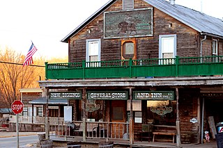
New Diggings is a town in Lafayette County, Wisconsin, United States. The population was 502 at the 2010 census, up from 473 in 2000. The unincorporated communities of Etna, Lead Mine, and New Diggings are located in the town.

<span class="mw-page-title-main">Wayne, Lafayette County, Wisconsin</span> Town in Wisconsin, United States

Wayne is a town in Lafayette County, Wisconsin, United States. The population was 490 at the 2010 census.

<span class="mw-page-title-main">Richland, Rusk County, Wisconsin</span> Town in Wisconsin, United States

Richland is a town in Rusk County, Wisconsin, United States. The population was 206 at the 2000 census. The village of Ingram is located in the town.

<span class="mw-page-title-main">Morris, Wisconsin</span> Town in Wisconsin, United States

Morris is a town in Shawano County, Wisconsin, United States. As of the 2020 Census, the town population was 417. The unincorporated community of Five Corners is located in the town.

<span class="mw-page-title-main">Harrison, Waupaca County, Wisconsin</span> Town in Wisconsin, United States

Harrison is a town in Waupaca County, Wisconsin, United States. The population was 509 at the 2000 census. The unincorporated communities of Northland, Norske, and Schmidt Corner are located in the town.

<span class="mw-page-title-main">Banner Township, Fulton County, Illinois</span> Township in Illinois, United States

Banner Township is one of twenty-six townships in Fulton County, Illinois, USA. As of the 2020 census, its population was 325 and it contained 184 housing units. The township was known as Utica Township, then Monterey Township, before becoming Banner Township.

<span class="mw-page-title-main">Canton Township, Fulton County, Illinois</span> Township in Illinois, United States

Canton Township is one of twenty-six townships in Fulton County, Illinois, USA. As of the 2020 census, its population was 14,217 and it contained 6,284 housing units.

<span class="mw-page-title-main">Joshua Township, Fulton County, Illinois</span> Township in Illinois, United States

Joshua Township is one of twenty-six townships in Fulton County, Illinois, USA. As of the 2020 census, its population was 465 and it contained 192 housing units.

<span class="mw-page-title-main">Young Hickory Township, Fulton County, Illinois</span> Township in Illinois, United States

Young Hickory Township is one of twenty-six townships in Fulton County, Illinois, USA. As of the 2020 census, its population was 548 and it contained 260 housing units.

References

  1. 1 2 3 U.S. Geological Survey Geographic Names Information System: New Canton, Illinois
  2. "2020 U.S. Gazetteer Files". United States Census Bureau. Retrieved March 15, 2022.
  3. Illinois Regional Archives Depository System. "Name Index to Illinois Local Governments". Illinois State Archives. Illinois Secretary of State . Retrieved May 2, 2013.
  4. Missouri Atlas & Gazetteer, DeLorme, 1998, First edition, p. 32-3, ISBN   0-89933-224-2
  5. "G001 - Geographic Identifiers - 2010 Census Summary File 1". United States Census Bureau. Archived from the original on February 13, 2020. Retrieved August 1, 2015.
  6. "Census of Population and Housing". Census.gov. Retrieved June 4, 2015.
  7. "U.S. Census website". United States Census Bureau . Retrieved January 31, 2008.