New Hall Valley Country Park

Last updated

New Hall Valley Country Park
New Hall Valley Country Park.jpg
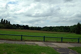
New Hall Valley Country Park from the New Hall Manor Estate with Maney in the distance
New Hall Valley Country Park
Location New Hall Valley, Birmingham, England
Coordinates 52°32′58″N1°48′30″W / 52.5493389°N 1.808361°W / 52.5493389; -1.808361 Coordinates: 52°32′58″N1°48′30″W / 52.5493389°N 1.808361°W / 52.5493389; -1.808361
Operated by Birmingham City Council
Website www.birmingham.gov.uk/newhallvalleycp

New Hall Valley Country Park is a country park located in New Hall Valley between Walmley, Wylde Green and Pype Hayes in the Sutton Coldfield area of north Birmingham. It is the first new country park in the UK for over a decade. The park is split into "phases".

It was created in 2005 by Birmingham City Council with funding raised from the release of land for the New Hall Manor Estate development and formally opened on August 29, 2005.

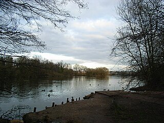
The park covers over 160 acres (0.6 km2) of designated green belt land to the south east of Sutton Park, including ancient woodland, historic wetland grazing meadows, former farmland, and part of Plants Brook. It borders on a number of privately owned listed buildings including the 17th century Grade II listed New Hall Mill, a corn mill. This is one of only two working water mills surviving in Birmingham water mills in Birmingham, with the other being Sarehole Mill in Hall Green. It has been restored and is open to the public on certain days or by prior arrangement. Bishop Walsh Catholic School borders the land, with the school's playing fields running adjacent for nearly 1.5 miles.

The park also includes a network of cycle routes and footpaths ( 52°33′03″N1°48′25″W / 52.550930°N 1.806816°W / 52.550930; -1.806816 , a plant nursery, a nature conservation site and two play areas for children.

The park is crossed by Wylde Green Road, which links Walmley and Wylde Green at either end. This road was crossed by a ford until around 1967.

Coopers Wood, [1] the ancient woodland in the park, is under threat of being destroyed due to concerns that its trees, which are Crack Willow, may fall onto people using the paths that have been driven through them.[ citation needed ]

You can access the park:

Related Research Articles

<span class="mw-page-title-main">Sutton Coldfield</span> Town in West Midlands, England

Sutton Coldfield or the Royal Town of Sutton Coldfield, known locally as Sutton, is a town and civil parish in the City of Birmingham, West Midlands, England. The town lies around 8 miles northeast of Birmingham city centre, 9 miles south of Lichfield, 7 miles southwest of Tamworth and 7 miles east of Walsall.

<span class="mw-page-title-main">Erdington</span> Suburb of Birmingham, England

Erdington is a suburb and ward of Birmingham in the West Midlands County, England. Historically part of Warwickshire and located 5 miles (8 km) northeast of central Birmingham, bordering Sutton Coldfield. It was also a council constituency, managed by its own district committee. The former council district consisted of the ward of Erdington, and Tyburn,, Stockland Green and Kingstanding, although all of Kingstanding and most of both Tyburn and Stockland Green wards lie outside the historical boundaries of Erdington. Stockland Green was formerly part of Aston, Kingstanding part of Perry Barr and Tyburn partially split between Aston and Hodge Hill. Erdington (ward) was part of the Sutton Coldfield constituency before 1974.

Wylde Green is a residential area within the town of Sutton Coldfield in Birmingham, England in the West Midlands. It was in the county of Warwickshire. The area is in the Sutton Vesey ward.

<span class="mw-page-title-main">Walmley</span> Human settlement in England

Walmley is a suburban village situated in the civil parish of Sutton Coldfield, West Midlands. It lies within the City of Birmingham on its northeastern outer fringe, where it forms part of the Sutton Walmley and Minworth electoral ward. It is in southern Sutton Coldfield, close to Minworth, Wylde Green, Pype Hayes and south of Thimble End. It is approximately 7 miles (11.3 km) northeast of Birmingham City Centre. It is the main focus of the Sutton New Hall Birmingham City Council ward.

<span class="mw-page-title-main">New Hall Manor</span> Building in West Midlands, England

New Hall Manor is a medieval manor house, now used as a hotel, in Sutton Coldfield, West Midlands, England.

<span class="mw-page-title-main">New Hall Estate</span>

The New Hall Estate is the older of the two major private housing estates named after New Hall Manor in the Royal Town of Sutton Coldfield in the West Midlands in England. The newer being New Hall Manor Estate.

Sutton New Hall is one of the 40 electoral wards in Birmingham, England and is named after New Hall, a medieval manor house.

Minworth is a suburban village situated in the civil parish of Sutton Coldfield, West Midlands. It lies within the City of Birmingham on its northeastern outer fringe, where it forms part of the Sutton Walmley and Minworth electoral ward and borders the North Warwickshire district, some 4.5 miles southeast of Sutton Coldfield town centre.

<span class="mw-page-title-main">Wiggins Hill</span> Village in West Midlands, England

Wiggins Hill is a hamlet situated in the civil parish of Sutton Coldfield, West Midlands. It lies within the City of Birmingham on its northeastern outer fringe, where it forms part of the Sutton Walmley and Minworth electoral ward and borders the North Warwickshire district.

<span class="mw-page-title-main">Maney</span>

Maney is an area of Sutton Coldfield, Birmingham, England. It is situated close to the town centre of Sutton Coldfield and is also near Wylde Green and Walmley. The main thoroughfare is Birmingham Road, which runs through Maney.

<span class="mw-page-title-main">Chester Road railway station</span> Station in Birmingham, England

Chester Road railway station is a railway station serving the Pype Hayes, Erdington, Wylde Green and Boldmere areas of north-east Birmingham, in the West Midlands county of England. It is situated on the Redditch/Bromsgrove-Birmingham New Street-Lichfield Cross-City Line.

Thimble End is a neighbourhood on the outskirts of Sutton Coldfield, Birmingham, England. It has been developed several times with the construction and expansion of housing estates on the land with the most recent being completed in 2005.

<span class="mw-page-title-main">Pype Hayes</span> Housing estate area in the Erdington district of Birmingham

Pype Hayes is a modern housing estate area in the east of the Erdington district of Birmingham. It is within the Tyburn ward. Covering the postcodes of B24 and B76.

Plants Brook is a stream in Erdington and Sutton Coldfield, Birmingham, England. It is a tributary of the River Tame, whose waters ultimately flow, via the River Trent and the Humber, into the North Sea.

<span class="mw-page-title-main">Plantsbrook Local Nature Reserve</span>

Plantsbrook Local Nature Reserve is a nature reserve on the Plants Brook in The Royal Town of Sutton Coldfield, near Birmingham, England, consisting of open water, wetland, woodland and meadow. It is located on Eachelhurst Road, on the border of the Pype Hayes and Walmley districts. It was designated a Local Nature Reserve in 1991.

Pype Hayes Park is one of the larger parks in Birmingham, England. The park is in Erdington Constituency and straddles the boundary between Pype Hayes and Erdington (now Tyburn ward. It covers B72 and B24. The northern boundary of the park is the traditional boundary between Erdington and Sutton Coldfield. Pype Hayes Park reaches from the corner where Eachelhurst Road joins Chester Road to a point close to Park Close off Chester Road and in places borders Pitts Farm estate. It also leads to Berwood Farm Road and Welwyndale Road.

<span class="mw-page-title-main">Sutton Walmley and Minworth</span> Electoral ward in Birmingham, England

Sutton Walmley and Minworth is one of 69 electoral wards in Birmingham, England.

References

  1. "New Hall".