Related Research Articles

Wormleysburg is a borough in Cumberland County, Pennsylvania, United States. The population was 3,070 at the 2010 census. It is part of the Harrisburg–Carlisle Metropolitan Statistical Area.

Bowling Green is an incorporated town in Caroline County, Virginia, United States. The population was 1,111 at the 2010 census.

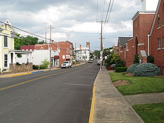
Stanardsville is a town in Greene County, Virginia, United States. The population was 349 at the 2020 census, down from 367 at the 2010 census. It is the county seat of Greene County. The name is from Robert Stanard, a benefactor who donated land for public use. It is part of the Charlottesville Metropolitan Statistical Area.

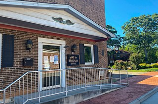
Broadway is a town in Rockingham County, Virginia, United States. The population was 3,691 at the 2010 census. It is included in the Harrisonburg Metropolitan Statistical Area.
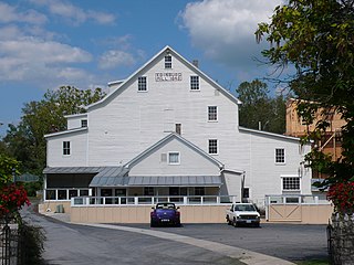
Dayton is a town in Rockingham County, Virginia, United States. The population is 1,530 as of the 2010 census. It is included in the Harrisonburg, Virginia Metropolitan Statistical Area.

Mount Crawford is a town in Rockingham County, Virginia, United States. It is included in the Harrisonburg Metropolitan Statistical Area, and the town's population was 433 at the 2010 census.
Edinburg is a town in Shenandoah County, Virginia, United States. The population was 1,041 at the 2010 census.
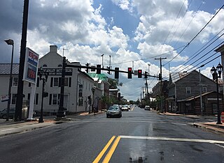
New Market is a town in Shenandoah County, Virginia, United States. Founded as a small crossroads trading town in the Shenandoah Valley, it has a population of 2,146 as of the most recent 2010 U.S. census. The north–south U.S. 11 and the east–west U.S. 211 pass near it and cross Massanutten Mountain at the town's titular gap.

Middlebourne is a town in Tyler County, West Virginia, United States. The population was 715 at the 2020 census. It serves as the county seat of Tyler County.

Grottoes is an incorporated town in Augusta and Rockingham counties in the U.S. state of Virginia. The population was 2,668 at the 2010 census.
Brodnax is a town in Brunswick and Mecklenburg counties in the U.S. state of Virginia. The population was 298 at the 2010 census.
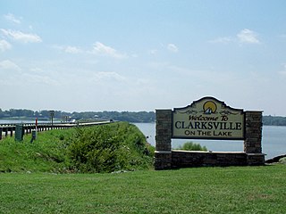
Clarksville is a town in Mecklenburg county in the U.S. state of Virginia, near the southern border of the commonwealth. The population was 1,139 at the 2010 census. Since the town has numerous buildings of the 18th-, 19th-, and early 20th-century architecture, the downtown area of Clarksville has been designated a Historic District on the National Register of Historic Places and Virginia's Historic Register. Clarksville claims the title of Virginia's only Lakeside town. Nearby the town of Clarksville is Occoneechee State Park.

Gordonsville is a town in Orange County in the Commonwealth of Virginia in the United States. Located about 19 miles northeast of Charlottesville and 65 miles northwest of Richmond, the population was 1,496 at the 2010 census.

Nottoway, or Nottoway Court House, is a census-designated place (CDP) in and the county seat of Nottoway County, Virginia, United States. The population as of the 2010 Census was 84.
Nellysford is a census-designated place (CDP) in Nelson County, Virginia, United States. The population as of the 2010 Census was 1,076. It is home to the Wintergreen golf course at Stoney Creek. Its zip code is 22958.
Arrington is a census-designated place (CDP) in Nelson County, Virginia, United States. The population as of the 2010 Census was 708. Harmony Hill Bed and Breakfast is the only lodging location in Arrington, run by innkeepers Wendie and Jay Fines.
Shipman is a census-designated place (CDP) in Nelson County, Virginia, United States. The population as of the 2010 Census was 507.
Wintergreen is a census-designated place (CDP) in Augusta and Nelson counties, Virginia, United States, located near Wintergreen Resort. The population as of the 2010 Census was 165.

Dyke is an unincorporated community in Greene County, Virginia, United States. It is located along Virginia Secondary State Route 810. In 2020, the small store in Dyke was replaced with a new larger store and gas station.
Maurertown is a census-designated place (CDP) in Shenandoah County, Virginia, United States. The population as of the 2010 Census was 770.
References
Municipalities and communities of Augusta County, Virginia, United States | ||
|---|---|---|
| Cities |  | |
| Towns | ||
| CDPs | ||
| Unincorporated communities | ||
| Footnotes | ‡This populated place also has portions in an adjacent county or counties | |
38°11′52″N78°54′21″W / 38.19778°N 78.90583°W
| | This Augusta County, Virginia state location article is a stub. You can help Wikipedia by expanding it. |