Newhall School District

Last updated
Newhall School District
Address
25375 Orchard Village Road
Valencia
, California, 91355
United States
Coordinates 34°23′21″N118°32′51″W / 34.3892°N 118.5475°W / 34.3892; -118.5475
District information
TypePublic
GradesK–6 [1]
Established1876
SuperintendentLeticia Hernandez
Schools10
NCES District ID 0627180 [1]
Students and staff
Students5,834 (2021–2022) [1]
Teachers238.01 (FTE) [1]
Staff287.08 (FTE) [1]
Student–teacher ratio24.51:1 [1]
Other information
Website www.newhallschooldistrict.com

The Newhall School District is an elementary school district in the Santa Clarita Valley that serves the Valencia and Newhall communities within the city of Santa Clarita, California, as well as the Stevenson Ranch community in unincorporated Los Angeles County. It currently includes ten schools.

Contents

History

The first school in the district was Newhall Elementary. The school opened in 1876, near the current location of the Saugus Cafe. The school is named for Henry Mayo Newhall, as is the town. The school and the town of Newhall moved two years later, to a location 2 miles south of its original location. An oil boom in the Santa Clarita Valley brought the families of 53 students to area and the school was placed where the current Valencia Marketplace (Target store) currently stands. One year later, in 1879, a proper school house was built at the corner of 9th and Walnut streets, in the current town of Newhall. The building was a wooden, two-story building. The second story was used on weekends, for Sunday school classes. This original building succumbed to a fire in 1890.

A new two-story school was built on the same site as the first two-story building. Those students who continued on to high school faced a long horseback ride to San Fernando High School, in the San Fernando Valley, once that school was built in 1896. In 1914, a fire struck Newhall Elementary School again. Another building was built at the northwest corner of Lyons and Newhall Avenues. The older students were able to catch a ride in a converted automobile to San Fernando High School. In 1932, an actual bus was purchased. As the town grew, so did its school-aged population. The schoolhouse at Lyons and Newhall Ave. was not able to be expanded and so a new school was built in 1928 at the corner of 11th and Walnut streets. Fire hit the school again in 1939; however, the school was rebuilt where it stood. The school re-opened in 1940. This is the current location of Newhall Elementary School (2012).

Newhall Elementary School, located on the corner of Walnut and 11th streets. The current school buildings date to 1940. Newhall Elementary School, Santa Clarita.jpg
Newhall Elementary School, located on the corner of Walnut and 11th streets. The current school buildings date to 1940.

As for the older students, they would continue to travel until 1945 when Hart High School opened. The original grades were 9th–12th. In 1948, the 7th and 8th graders moved to Hart High School. Hart High stayed a 7th–12th grade school until Placerita Junior High School opened in 1961.

The second school in the Newhall School District was Peachland Elementary School which opened in 1959. The third was Wiley Canyon Elementary School which opened in 1966.

On January 13, 1945, the California State Board of Education approved the petitions of five Santa Clarita Valley school districts — Newhall, Saugus, Castaic, Mint Canyon and Sulphur Springs — to form the Santa Clarita Union High School District, later renamed the William S. Hart Union High School District. Two weeks later, on January 29, local voters approved a bond measure to build the valley's first high school on a 27-acre parcel on Newhall Avenue, just down the street from Newhall School (Hart High School).

The first Hart District school board was composed of school board members from each of the elementary districts. Tom Frew III and S.S. Donaldson represented the Newhall district. Donaldson was a sitting Newhall school board member, while Frew had already retired from a lengthy tenure on the Newhall board which included several years as president.

Schools

All schools within the Newhall School District are located within the Newhall neighborhood of Santa Clarita or the unincorporated community of Stevenson Ranch.

Newhall School District elementary schools
SchoolAddressFoundedEnrollment (2022-23) [2]
Dr. J. Michael McGrath Elementary21501 Deputy Jake Drive, Santa Clarita, CA 913212003492
Meadows Elementary25577 Fedala Road, Santa Clarita, CA 913551975672
Newhall Elementary24607 Walnut Street, Santa Clarita, CA 913211879536
Oak Hills Elementary26730 Old Rock Road, Stevenson Ranch, CA 913812005567
Old Orchard Elementary25141 Avenida Rondel, Santa Clarita, CA 913551969504
Peachland Avenue Elementary24800 Peachland Avenue, Santa Clarita, CA 913211959450
Pico Canyon Elementary25255 Pico Canyon Road, Stevenson Ranch, CA 91381808
Stevenson Ranch Elementary25820 Carroll Lane, Stevenson Ranch, CA 913811995746
Valencia Valley Elementary23601 Carrizo Drive, Santa Clarita, CA 91355741
Wiley Canyon Elementary24240 La Glorita Circle, Santa Clarita, CA 913211966409

Student demographics

As of the 2022-23 school year, 5,927 students were enrolled in Newhall District schools. 45.9% of students were Hispanic or Latino, 29.7% were non-Hispanic white, 10.7% were Asian American, 6.1% were multiracial, 3.4% were Filipino, 1.7% were African American, 0.3% were Indigenous American, and 0.1% were Pacific Islander. [2]

See also

Related Research Articles

<span class="mw-page-title-main">Valencia, Santa Clarita, California</span> Neighborhood of Santa Clarita in Los Angeles County, California

Valencia is a neighborhood in Santa Clarita located within Los Angeles County, California. It is one of the four unincorporated communities that merged to create the city of Santa Clarita in 1987. It is situated in the western part of Santa Clarita, stretching from Lyons Avenue to the south to north of Copper Hill Drive, and from Interstate 5 east to Bouquet Canyon and Seco Canyon Roads. Valencia was founded as a master-planned community with the first development, Old Orchard I, built on Lyons Avenue behind Old Orchard Elementary School.
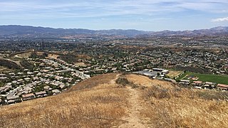
<span class="mw-page-title-main">Santa Clarita Valley</span> Valley in Los Angeles County, California, United States

The Santa Clarita Valley (SCV) is part of the upper watershed of the Santa Clara River in Southern California. The valley was part of the 48,612-acre (19,673 ha) Rancho San Francisco Mexican land grant. Located in Los Angeles County, its main population center is the city of Santa Clarita which includes the communities of Canyon Country, Newhall, Saugus, and Valencia. Adjacent unincorporated communities include Castaic, Stevenson Ranch, Val Verde, and the unincorporated parts of Valencia.
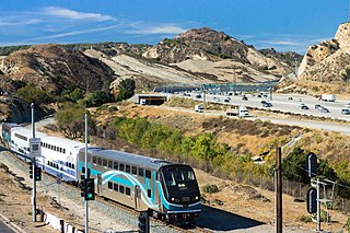
<span class="mw-page-title-main">Newhall Pass</span> Mountain pass in Los Angeles County, California

Newhall Pass is a low mountain pass in Los Angeles County, California. Historically called Fremont Pass and San Fernando Pass, with Beale's Cut, it separates the Santa Susana Mountains from the San Gabriel Mountains. Although the pass was visited in August 1769 by Catalan explorer Gaspar de Portolá, it eventually was named for Henry Newhall, a significant businessman in the area during the 19th century.

<span class="mw-page-title-main">Newhall, Santa Clarita, California</span> Community of Santa Clarita in California, United States of America

Newhall is the southernmost and oldest community in the city of Santa Clarita, California. Prior to the 1987 consolidation of Canyon Country, Saugus, Newhall, and Valencia into the city of Santa Clarita, it was an unincorporated area. It was the first permanent town in the Santa Clarita Valley.

<span class="mw-page-title-main">Canyon Country, Santa Clarita, California</span> Largest neighborhood of Santa Clarita, California, United States

Canyon Country is a neighborhood in the eastern part of the city of Santa Clarita, in northwestern Los Angeles County, California, United States. It lies along the Santa Clara River between the Sierra Pelona Mountains and the San Gabriel Mountains. It is the most populous of Santa Clarita's four neighborhoods.

<span class="mw-page-title-main">Saugus, Santa Clarita, California</span> Neighborhood of Santa Clarita in Los Angeles, California

Saugus is a neighborhood in Santa Clarita, California. It was one of four communities that merged in 1987 to create the city of Santa Clarita. Saugus includes the central and north-central portions of the city. It is named after Saugus, Massachusetts, the hometown of Henry Newhall, upon whose land the town was originally built.

Saugus Union School District (SUSD) is a public California school district located in Santa Clarita, Los Angeles County, California. The district serves students in grades TK/K-6 in Saugus, most of Valencia, and parts of Canyon Country. There are also pre-school programs on-site at many of the schools. The district includes 15 elementary schools.

<span class="mw-page-title-main">Saugus High School (California)</span> Comprehensive school in Santa Clarita, California, United States

Saugus High School is a public high school located in the neighborhood of Saugus in the city of Santa Clarita, California, United States. It is part of the William S. Hart Union High School District.
<span class="mw-page-title-main">Santa Clarita, California</span> City in California, United States

Santa Clarita is a city in northwestern Los Angeles County in the U.S. state of California. With a 2020 census population of 228,673, it is the third-largest city by population in Los Angeles County, the 17th-largest in California, and the 99th-largest city in the United States. It is located about 30 miles (48 km) northwest of downtown Los Angeles, and occupies 70.75 square miles (183.2 km2) of land in the Santa Clarita Valley, along the Santa Clara River. It is a classic example of a U.S. edge city, satellite city, or boomburb.

<span class="mw-page-title-main">City of Santa Clarita Transit</span> Public transit agency serving the Santa Clarita Valley

City of Santa Clarita Transit is a local bus service, administered by the City's transit division, that serves the City of Santa Clarita, California and nearby surrounding unincorporated areas. In 2022, the system had a ridership of 2,111,800, or about 11,600 per weekday as of the fourth quarter of 2022. Daily operations and maintenance of the fleet are under contract with MV Transportation. City of Santa Clarita Transit routes connect with services operated by Metro and Metrolink.

Los Angeles City High School District was a school district that served high school-aged residents of western Los Angeles County, California from 1890 to 1962. At times the district included Beverly Hills, Culver City, and Torrance.
<span class="mw-page-title-main">Valencia, California</span> Community in Los Angeles County, California, United States

Valencia is an unincorporated community in northwestern Los Angeles County, California. This area, with major commercial and industrial parks, straddles State Route 126 and the Santa Clara River.

Castaic Union School District is a public school district serving unincorporated Castaic, portions of unincorporated Valencia, and a very small portion of the city of Santa Clarita within Los Angeles County, California, offering elementary and secondary instruction, grades pre-K through eighth. Until 1890, it was known as the "Castec School District."
<span class="mw-page-title-main">Lang Southern Pacific Station</span> Historic site in Los Angeles County, California

Lang Southern Pacific Station is a former Southern Pacific railway station located in Soledad Canyon near the eastern end of Santa Clarita, California. On September 5, 1876 the first railway to Los Angeles was completed at this site. The Lang Southern Pacific Station was designated a California Historic Landmark on May 22, 1957.

<span class="mw-page-title-main">Tick Fire</span> Wildfire that burned in the Sierra Pelona near Santa Clarita, California in October 2019

The Tick Fire was a wildfire that burned in Los Angeles County, California. The fire broke out on October 24, 2019, and burned several thousand acres. The fire forced the mass evacuation of 40,000 people from the Santa Clarita Valley.

<span class="mw-page-title-main">2019 Saugus High School shooting</span> 2019 mass shooting in Santa Clarita, California, USA

On November 14, 2019, at Saugus High School in Santa Clarita, California, United States, a school shooting occurred when a student with a pistol, identified as 16-year-old Nathaniel Berhow, shot five schoolmates, killing two, before killing himself.

<span class="mw-page-title-main">Castaic High School</span> High school in Castaic, California, U.S.

Castaic High School (CHS) is a high school in the unincorporated community of Castaic, California, in the Santa Clarita Valley. It is part of the William S. Hart Union High School District. The school officially opened in August 2019.

<span class="mw-page-title-main">William S. Hart Regional Park</span> County park in Santa Clarita, California

William S. Hart Regional Park, colloquially called Hart Park, is a 265-acre county park located within the Newhall neighborhood of Santa Clarita, California.

References

  1. 1 2 3 4 5 6 "Search for Public School Districts – District Detail for Newhall". National Center for Education Statistics . Institute of Education Sciences . Retrieved 2023-05-16.
  2. 1 2 "2022-23 Enrollment by Ethnicity". California Department of Education. Retrieved 2023-05-16.