Newman Grove, Nebraska

Last updated

Newman Grove, Nebraska
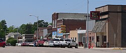
Newman Grove, Nebraska downtown.JPG
Downtown Newman Grove: north side of Hale Avenue, May 2010
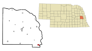
Madison County Nebraska Incorporated and Unincorporated areas Newman Grove Highlighted.svg
Location of Newman Grove, Nebraska
Coordinates: 41°44′49″N97°46′36″W / 41.74694°N 97.77667°W / 41.74694; -97.77667
Country United States
State Nebraska
Counties Madison, Platte
Area
[1]
  Total0.55 sq mi (1.41 km2)
  Land0.55 sq mi (1.41 km2)
  Water0.00 sq mi (0.00 km2)
Elevation
[2]
1,745 ft (532 m)
Population
 (2020)
  Total667
  Density1,223.85/sq mi (472.45/km2)
Time zone UTC-6 (Central (CST))
  Summer (DST) UTC-5 (CDT)
ZIP code
68758
Area code 402
FIPS code 31-34230 [3]
GNIS feature ID838343 [2]
Website www.ci.newman-grove.ne.us/index.asp

Newman Grove is a city in Madison and Platte counties in Nebraska, United States. The population was 721 at the 2010 census.

Contents

The Madison County portion of Newman Grove is part of the Norfolk, Nebraska Micropolitan Statistical Area.

History

Newman Grove was platted in 1887 when the Fremont, Elkhorn and Missouri Valley Railroad was extended to that point. [4] It was named for a grove of trees nearby planted by Newman Warren. [5] [4]

Geography

According to the United States Census Bureau, the city has a total area of 0.55 square miles (1.42 km2), all land. [6]

Demographics

Historical population
CensusPop.Note
1890 330
1900 696110.9%
1910 85022.1%
1920 1,26048.2%
1930 1,146−9.0%
1940 1,036−9.6%
1950 1,004−3.1%
1960 880−12.4%
1970 863−1.9%
1980 9307.8%
1990 787−15.4%
2000 7971.3%
2010 721−9.5%
2020 667−7.5%
U.S. Decennial Census [7]

2010 census

As of the census [8] of 2010, there were 721 people, 320 households, and 183 families residing in the city. The population density was 1,310.9 inhabitants per square mile (506.1/km2). There were 382 housing units at an average density of 694.5 per square mile (268.1/km2). The racial makeup of the city was 91.1% White, 0.3% Native American, 0.7% Asian, 7.1% from other races, and 0.8% from two or more races. Hispanic or Latino of any race were 10.1% of the population.

There were 320 households, of which 25.3% had children under the age of 18 living with them, 46.6% were married couples living together, 7.8% had a female householder with no husband present, 2.8% had a male householder with no wife present, and 42.8% were non-families. 38.8% of all households were made up of individuals, and 22.8% had someone living alone who was 65 years of age or older. The average household size was 2.15 and the average family size was 2.86.

The median age in the city was 50.1 years. 21.8% of residents were under the age of 18; 3.6% were between the ages of 18 and 24; 16.7% were from 25 to 44; 32.8% were from 45 to 64; and 25.2% were 65 years of age or older. The gender makeup of the city was 46.6% male and 53.4% female.

2000 census

As of the census [3] of 2000, there were 797 people, 323 households, and 190 families residing in the city. The population density was 1,567.9 people per square mile (605.4 people/km2). There were 372 housing units at an average density of 731.8 per square mile (282.5/km2). The racial makeup of the city was 90.72% White, 0.25% Native American, 1.00% Asian, 7.53% from other races, and 0.50% from two or more races. Hispanic or Latino of any race were 13.17% of the population.

There were 323 households, out of which 27.9% had children under the age of 18 living with them, 52.3% were married couples living together, 4.0% had a female householder with no husband present, and 40.9% were non-families. 38.4% of all households were made up of individuals, and 24.5% had someone living alone who was 65 years of age or older. The average household size was 2.29 and the average family size was 3.10.

In the city, the population was spread out, with 24.8% under the age of 18, 4.8% from 18 to 24, 22.0% from 25 to 44, 20.6% from 45 to 64, and 27.9% who were 65 years of age or older. The median age was 43 years. For every 100 females, there were 89.8 males. For every 100 females age 18 and over, there were 80.4 males.

As of 2000 the median income for a household in the city was $30,329, and the median income for a family was $39,653. Males had a median income of $26,786 versus $20,000 for females. The per capita income for the city was $16,247. About 3.5% of families and 11.9% of the population were below the poverty line, including 18.5% of those under age 18 and 11.4% of those age 65 or over.

Education

Newman Grove Public Schools is a K-12 public school district that serves the area. [9]

Religion

There are 5 churches in town. The Methodist Church, Trinity Lutheran Church, Shell Creek Lutheran Church, Zion Lutheran Church, and Bible Fellowship Church. There are also a few country churches surrounding the area.

See also

Related Research Articles

<span class="mw-page-title-main">Clarks Grove, Minnesota</span> City in Minnesota, United States

Clarks Grove is a city in Freeborn County, Minnesota, United States. The population was 706 at the 2010 census.
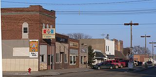
<span class="mw-page-title-main">Laurel, Nebraska</span> City in Nebraska, United States

Laurel is a city in Cedar County, Nebraska located at the merger of Highway 20 and Highway 15 in the northeast corner of the state. Laurel sits roughly 40 miles east of Norfolk, Nebraska, west of Sioux City, Iowa, and south of Yankton, South Dakota. Wayne State College in Wayne, Nebraska is 15 miles south of Laurel. Its population was 975 at the 2020 census.
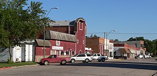
<span class="mw-page-title-main">Fairfield, Nebraska</span> City in Nebraska, United States

Fairfield is a city in Clay County, Nebraska, United States. The population was 387 at the 2010 census. It is part of the Hastings, Nebraska Micropolitan Statistical Area.

<span class="mw-page-title-main">Bennington, Nebraska</span> City in Douglas County, Nebraska, United States

Bennington is a city in Douglas County, Nebraska, United States. The population was 2,026 at the 2020 U.S. Census.

<span class="mw-page-title-main">Burwell, Nebraska</span> City in Nebraska, United States

Burwell is a city in Garfield County, Nebraska, United States. The population was 1,210 at the 2010 census. It is the county seat of Garfield County.

<span class="mw-page-title-main">Stamford, Nebraska</span> Village in Nebraska, United States

Stamford is a village in Harlan County, Nebraska, United States. The population was 183 at the 2010 census.

<span class="mw-page-title-main">Elba, Nebraska</span> Village in Nebraska, United States

Elba is a village in Howard County, Nebraska, United States. The population was 215 at the 2010 census. It is part of the Grand Island, Nebraska Micropolitan Statistical Area.

<span class="mw-page-title-main">Holdrege, Nebraska</span> City in Nebraska, United States

Holdrege is a city in Phelps County, Nebraska, United States. The population was 5,495 at the 2010 census. It is the county seat of Phelps County. The Nebraska Prairie Museum is located in Holdrege.
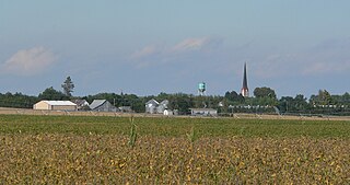
<span class="mw-page-title-main">Humphrey, Nebraska</span> City in Platte County, Nebraska, United States

Humphrey is a city in Platte County, Nebraska, United States. The population was 760 at the 2010 census.

<span class="mw-page-title-main">Crete, Nebraska</span> City in Saline County, Nebraska, United States

Crete is a city in and the most populous municipality of Saline County, Nebraska, United States. The population was 7,099 at the 2020 census. The city is home to Doane University.
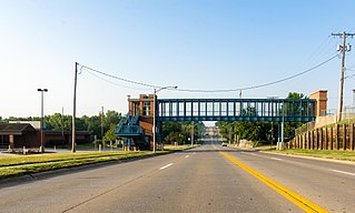
<span class="mw-page-title-main">La Vista, Nebraska</span> City in Sarpy County, Nebraska, United States

La Vista is a city in Sarpy County, Nebraska, United States. The population was 16,746 at the 2020 census, making it the 12th most populous city in Nebraska. The city was incorporated on February 23, 1960.
<span class="mw-page-title-main">Ashland, Nebraska</span> City in Saunders County, Nebraska, United States

Ashland is a city in Saunders County, Nebraska, United States. The population was 3,086 at the 2020 census.

<span class="mw-page-title-main">Ceresco, Nebraska</span> Village in Saunders County, Nebraska, United States

Ceresco is a farming village in Saunders County, Nebraska, United States. The population was 919 at the 2020 census. It is located near U.S. Highway 77, just north of Lincoln, just south of Wahoo, and a short distance southwest of Omaha.

<span class="mw-page-title-main">Yutan, Nebraska</span> City in Saunders County, Nebraska, United States

Yutan is a city in Saunders County, Nebraska, United States.

<span class="mw-page-title-main">Seward, Nebraska</span> City in and county seat of Seward County, Nebraska, United States

Seward is a city and county seat of Seward County, Nebraska, United States. The population was 6,964 at the 2010 census. Seward is part of the Lincoln, Nebraska Metropolitan Statistical Area.

<span class="mw-page-title-main">Kennard, Nebraska</span> Village in Washington County, Nebraska, United States

Kennard is a village in Washington County, Nebraska, United States. The population was 361 at the 2010 census.

<span class="mw-page-title-main">Wayne, Nebraska</span> City in Wayne County, Nebraska, United States

Wayne is a city in Wayne County, Nebraska, United States. The population was 5,660 at the 2010 census. It is the county seat of Wayne County and the home of Wayne State College.

<span class="mw-page-title-main">York, Nebraska</span> City in and county seat of York County, Nebraska, United States

York is a city in and the county seat of York County, Nebraska, United States. At the 2010 census, the city population was 7,766. It is the home of York University and the Nebraska Correctional Center for Women.

<span class="mw-page-title-main">Pine Grove, West Virginia</span> Town in West Virginia, United States

Pine Grove is a town in Wetzel County, West Virginia, United States. The population was 363 at the 2020 census. The community was named for a grove of pine trees near the original town site.

<span class="mw-page-title-main">Wakefield, Nebraska</span> City in Dixon and Wayne counties in Nebraska, United States

Wakefield is a city in Dixon and Wayne Counties in the State of Nebraska. The population was 1,451 at the 2010 census.
References

  1. "ArcGIS REST Services Directory". United States Census Bureau. Retrieved September 18, 2022.
  2. 1 2 U.S. Geological Survey Geographic Names Information System: Newman Grove, Nebraska
  3. 1 2 "U.S. Census website". United States Census Bureau . Retrieved January 31, 2008.
  4. 1 2 "Newman Grove, Madison County". Center for Advanced Land Management Information Technologies. University of Nebraska. Retrieved August 19, 2014.
  5. Fitzpatrick, Lillian L. (1960). Nebraska Place-Names. University of Nebraska Press. p. 101. ISBN   0-8032-5060-6. A 1925 edition is available for download at University of Nebraska—Lincoln Digital Commons.
  6. "US Gazetteer files 2010". United States Census Bureau. Archived from the original on January 25, 2012. Retrieved June 24, 2012.
  7. "Census of Population and Housing". Census.gov. Retrieved June 4, 2015.
  8. "U.S. Census website". United States Census Bureau . Retrieved June 24, 2012.
  9. "Newman Grove". www.newman.esu8.org.