
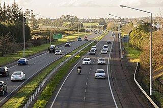
The Newmarket Viaduct is a seven-lane state highway viaduct in Auckland, New Zealand. The 700 m long viaduct, which is up to 20 m high, carries the Southern Motorway over the Newmarket suburb.
The Newmarket Viaduct is a seven-lane state highway viaduct in Auckland, New Zealand. The 700 m long viaduct, which is up to 20 m high, carries the Southern Motorway over the Newmarket suburb.
The viaduct was opened on 3 September 1966 at a cost of NZ$2.26 million, and was constructed as New Zealand's first pair of balanced cantilever bridges. [1] With its long spans, the s-curvature and the varying superelevation of the motorway, it is a complex structure even today, and at the time was a ground-breaking design for New Zealand. [2]
Constructed between 1962 and 1966, it was the largest pre-stressed concrete bridge in New Zealand at the time. [3] An initial steel girder proposal was considered; however, a concrete structure was chosen, due to the costs of steel importation and maintenance. [3]
While considered a successful design, it was built to far lower earthquake standards than those which other New Zealand structures now fulfill, being built to survive only a 1 in 500-year return period earthquake. It could have received significant damage in an earthquake as common as once in 200 years. [4] This made the structure the weakest strategic transport infrastructure link in the Auckland area, with a potential collapse cutting off all motorway transport to the south. [5] Also, during design, temperature stresses were not yet understood to a sufficient degree, leading to cracking between the black bitumen coat and the light-coloured concrete beams below. [1] [3] This issue was rectified by the additional of additional pre-stressed cables and an additional light-coloured stone chip placed on top of the bitumen. [3]

The limited earthquake stability, together with increasing traffic demands (over 200,000 vehicles a day, more than on the Auckland Harbour Bridge and the most traffic on a section of road anywhere in New Zealand), [6] led to the planning for a new viaduct structure, which would be able to withstand an earthquake with a 2,500-year return period. Other factors were the very low safety barriers (which once allowed an out-of-control truck to fall onto its roof 15 m below, in 2004), which were also insufficient to prevent debris from falling onto the properties beneath, [5] and the fact that the viaduct was a prohibited route for overweight vehicles, forcing more trucks through the city streets. [1]
Major repair of the structure was considered as an option. However, its structural elements did not lend themselves to easy strengthening, and even a reconditioned viaduct would only have provided an estimated life expectancy of 40–50 more years. With a new structure costing only around 15% more than a repair, and expected to last for over 100 years, it was decided to go for a full replacement. [1]
The new Transit New Zealand structure was estimated to cost NZ$150 million, and cleared planning hurdles quicker than expected, leading to hopes that it would be possible to build it in time for the 2011 Rugby World Cup. Originally, the three-year duration project was expected to start in 2009/2010. Factors that influenced the quick decision process were the lack of any archeological evidence in the construction area, as well as the lack of substantial numbers of residential properties affected by the new structure. [7]
The new structure was to be constructed in a way to minimally affect the traffic flow on this crucial motorway link, by first constructing a new viaduct of four southbound lanes to the north-east of the existing structure, then demolishing the existing three southbound lanes, before constructing the three new northbound lanes in the gap and finally demolishing the three old northbound lanes. It was originally considered whether to build a 'steel box' or a 'concrete box' structure, though both would look similar to the existing viaduct structure. [5] [8] It was eventually decided to construct a segmented structure built from 468 pre-cast concrete sections constructed off-site in East Tāmaki, and moved into place with a lifting gantry truss. [9]
Tonkin + Taylor and URS New Zealand, as part of the Northern Gateway Alliance, were assigned to develop the new bridge, and one of their design targets included full recycling of all material during the project. The consultant team was also to use the experience gained at the Waiwera Viaduct in this new project. [10] However, estimated costs in June 2008 had risen to NZ$187 million, and it was unclear whether the funds would be made accessible quickly enough to achieve the ambitious schedule of finishing the bridge in time for the 2011 World Cup. [11] In October 2008, funding was confirmed, but the estimated price later increased to NZ$195 million, with rising prices for fuel, construction materials and labour cited as the reasons. While still ahead of schedule, only part of the viaduct replacement was completed in time for the Rugby World cup in 2011. [12]
The new viaduct features better noise protection for the surrounding communities, thanks to noise-absorbing asphalt, solid concrete crash barriers, and partial noise walls. [4] Some further urban design improvements were also part of the project, such as a volcanic-themed walkway from Gillies Avenue down towards Newmarket (connecting to Clovernook Road). [13] [14]


Construction began in earnest in April 2007, with the first foundations for the up to 18m high piers of the southbound part of the new viaduct. A bracing structure under the section carrying over the railway line was established over Easter 2009, and a 140m long, 800 ton heavy [15] launching gantry was erected above the Newmarket skyline, which moved into place new sections and stabilised parts to be demolished (with the demolition considered the most difficult part of the project). The southbound addition was to be finished by the end of 2010, while the northbound section was expected to take at least until March 2012. [16] During construction, sight screens reduced visual distractions of passing drivers, though the construction still required narrowing of the traffic lanes and reduction of the maximum speed on the viaduct to 70 km/h. A number of temporary support girders around the structure were also required to safely cater for the stresses put on the structure while parts of it were demolished and rebuilt. [9]
Construction involved building the new southbound viaduct first, then demolition of the old southbound viaduct, followed by the construction of the new northbound section in the resulting gap, before the old northbound section was finally demolished. This ensured that except for short interruptions, normal motorway capacity would remain available throughout the construction period. [4] Further work also took place around the viaduct, including the construction of a volcanic-themed walkway from Gillies Avenue to Broadway (via Clovernook Road) and an upgraded footbridge over State Highway 1 at Mt Hobson Road. [15]
The new viaduct is composed of 468 separate bridge deck sections, produced in a precast facility in East Tāmaki. [17]
Over 150 people were employed directly by the project. [14]
The work on demolishing the old viaduct sections while the new sections were constructed directly adjacent won the Civils Demolition Award in the 2012 World Demolition Awards. [18]
The replacement work was formally completed in March 2013. [19]

The Auckland Harbour Bridge is an eight-lane motorway bridge over the Waitematā Harbour in Auckland, New Zealand. It joins St Marys Bay on the Auckland city side with Northcote on the North Shore side. It is part of State Highway 1 and the Auckland Northern Motorway. The bridge is operated by the NZ Transport Agency (NZTA). It is the second-longest road bridge in New Zealand, and the longest in the North Island.
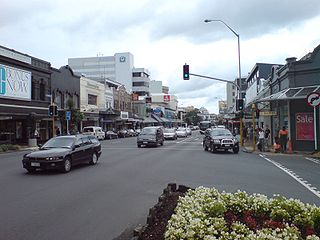
Newmarket is an Auckland suburb to the south-east of the central business district. With its high building density, especially of retail shops, it is considered New Zealand's premier retailing area, and a rival of local competitor Auckland CBD.

Māngere Bridge, officially also called the Manukau Harbour Crossing, is a dual motorway bridge over the Manukau Harbour in south-western Auckland, New Zealand, crossing between the suburb also known as Māngere Bridge and the suburb of Onehunga.

The Cypress Street Viaduct, often referred to as the Cypress Structure or the Cypress Freeway, was a 1.6-mile-long (2.5 km), raised two-deck, multi-lane freeway constructed of reinforced concrete that was originally part of the Nimitz Freeway in Oakland, California, United States.

The Central Motorway Junction or CMJ, is the intersection of State Highways 1 and 16, just south of the central business district of Auckland. A multilevel structure, it has been described as a "fiendishly complicated, multi-layered puzzle of concrete, steel and asphalt". Carrying around 200,000 vehicles a day, it is one of the busiest stretches of road in New Zealand.

The Northern Busway is a segregated busway that runs along the eastern side of the Northern Motorway, part of State Highway 1, in the north of Auckland, New Zealand, linking the North Shore with the northern end of the Auckland Harbour Bridge. As of May 2022, the busway consists of two-way lanes running between Albany Station and Akoranga Station, and from Akoranga Station a southbound-only lane that joins the Harbour Bridge approaches just south of the Onewa Road on-ramp system. The busway previously ended at Constellation before an extension to Albany was constructed in 2022.
Transport in Auckland, New Zealand's largest city, is defined by factors that include the shape of the Auckland isthmus, the suburban character of much of the urban area, a history of focusing investment on roading projects rather than public transport, and high car-ownership rates.

Grafton Bridge is a road bridge spanning Grafton Gully in Auckland, New Zealand. Built of reinforced concrete in 1910, it connects the Auckland CBD and Karangahape Road with Grafton. It spans about 97.6 metres, rises 25.6 metres above the abutments to a height of around 43 metres over the gully. When the bridge was constructed, it contained the largest reinforced concrete arch in the world.
O Mahurangi Penlink, is a 7-kilometre-long (4.3-mile), two-lane future state highway. Construction began in late 2022 and is expected to conclude in late 2026. Once completed the new state highway will create a more direct and quicker route between the Whangaparaoa Peninsula and central Auckland in New Zealand.

The Auckland Northern Motorway in the Auckland Region of New Zealand links Central Auckland and Warkworth in the former Rodney District via the Hibiscus Coast and North Shore. It is part of State Highway 1.
The Auckland Southern Motorway is the major route south out of the Auckland Region of New Zealand. It is part of State Highway 1.

The Wellington Urban Motorway, part of State HIghway 1, is the main road into and out of Wellington, New Zealand. It is 7 km long, ranges from three to seven lanes wide, and extends from the base of the Ngauranga Gorge into the Wellington CBD.
The Dunedin Southern Motorway is the main arterial route south from the South Island city of Dunedin, part of New Zealand's State Highway 1. Despite its name, only a portion of the route is officially classified as motorway. The route is the southernmost section of median-divided highway in the world.

The Johnsonville–Porirua Motorway is a motorway in Wellington, New Zealand. The majority of the motorway forms part of State Highway 1, the main route of traffic in and out of the city, with the northernmost 2.1 km (1.3 mi), formerly part of SH 1 until 7 December 2021, designated as State Highway 59. Completed in the 1950s, it was New Zealand's first motorway.

The Victoria Park Viaduct is a major motorway viaduct carrying the Auckland Northern Motorway over the Victoria Park area in the Auckland city centre, New Zealand. Construction began in 1959, and the bridge was opened on 5 April 1962. Due to the high traffic volumes passing through on their way to and from North Shore City, and because the viaduct is only four lanes wide in total, the bridge over the park is considered "one of the country's worst traffic bottlenecks", with around 200,000 vehicles a day.

The Waterview Connection is a motorway section through west/central Auckland, New Zealand. It connects State Highway 20 in the south at Mt Roskill to State Highway 16 in the west at Point Chevalier, and is a part of the Western Ring Route.
Moses Wheeler Bridge carries Interstate 95 over the Housatonic River between Stratford and the Devon section of Milford. The current bridge is a 14-span continuous girder and floorbeam structure that carries three lanes of traffic in each direction, with full inside and outside shoulders. The current bridge, completed in 2016, replaces a pre-existing structure that was completed as part of the original Connecticut Turnpike in 1958. The original bridge was a 34-span plate girder structure with a concrete deck with three 12-foot travel lanes in each direction and no shoulders. The central span of the original bridge over the river's navigation channel included a pin and hanger assembly, which are no longer used in bridge construction in the United States. Construction on the Moses Wheeler Bridge began in 1955 and opened on January 2, 1958.

The Victoria Park Tunnel is a motorway tunnel completed in 2012 on New Zealand State Highway 1 in Auckland, New Zealand, taking northbound traffic off the Victoria Park Viaduct, which was converted to all southbound traffic. It lies mostly under Victoria Park.

The Second Harbour Crossing is the name given to the proposed second transport link across the Waitematā Harbour in Auckland, New Zealand. Planners have also referred to new links across the harbour as the Additional Waitematā Harbour Crossing (AWHC) or the Waitematā Harbour Connections.

The Nelson Street Cycleway is a cycleway in Auckland, New Zealand. The most well-known section of the path is Te Ara I Whiti, translated as, and commonly known as Lightpath. The cycleway then continues on to the Nelson Street arterial road into the City Centre.