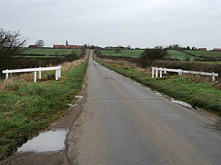
Newton and Haceby

Last updated

Newton and Haceby is a civil parish in North Kesteven, Lincolnshire, England. It includes the separate hamlets of Newton and Haceby. The population of the civil parish (including Walcot) at the 2011 census was 137. [1]

North Kesteven District in England

North Kesteven is a local government district in the East Midlands. Just over 100 miles (160 km) north of London, it is east of Nottingham and south of Lincoln. North Kesteven is one of seven districts in Lincolnshire, England and is in the centre of the County. Its council, North Kesteven District Council, is based in Sleaford in the former offices of Kesteven County Council.

Lincolnshire County of England

Lincolnshire is a county in eastern England, with a long coastline on the North Sea to the east. It borders Norfolk to the south east, Cambridgeshire to the south, Rutland to the south west, Leicestershire and Nottinghamshire to the west, South Yorkshire to the north west, and the East Riding of Yorkshire to the north. It also borders Northamptonshire in the south for just 20 yards (19 m), England's shortest county boundary. The county town is the city of Lincoln, where the county council has its headquarters.

Newton, Lincolnshire village in the United Kingdom

Newton is a hamlet in the North Kesteven district of Lincolnshire, England. The hamlet is situated approximately 8 miles (13 km) east from the town of Grantham, 7 miles (11 km) south from Sleaford, and less than 1 mile (1.6 km) south from the A52 road. Newton forms part of the civil parish of Newton and Haceby.

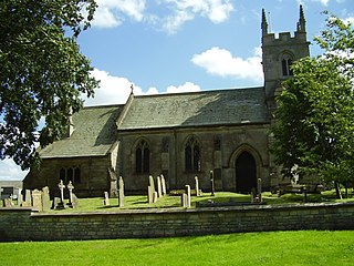
Leaving Haceby by the lane to the north Country Road at Haceby, Lincolnshire - geograph.org.uk - 155360.jpg
Leaving Haceby by the lane to the north
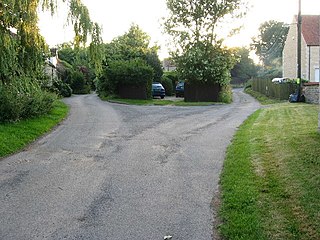
Cottage in Newton Cottage in Newton (geograph 3109535).jpg
Cottage in Newton
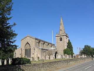
Green lane, Haceby Green Lane - geograph.org.uk - 1397271.jpg
Green lane, Haceby
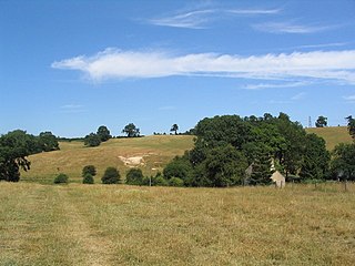
A52 near Haceby. The right hand side of the picture is in the parish Sainfoin Holt - geograph.org.uk - 429545.jpg
A52 near Haceby. The right hand side of the picture is in the parish

Local democracy is handled together with the adjacent parish of Walcot near Folkingham in the Newton, Haceby and Walcot Parish Meeting. [2] [3]

Walcot, Lincolnshire village in United Kingdom

Walcot is a village and civil parish in the North Kesteven district of Lincolnshire, England. It lies 1 mile (1.6 km) west from the A15, 7 miles (11 km) south from Sleaford, 9 miles (14 km) east from Grantham, and 1 mile north from Folkingham. The population is included in the civil parish of Newton and Haceby.

The parish is bounded on the north by the A52 Grantham to Boston road, and on the east by the A15 Bourne to Sleaford road. There are no major routes within the parish, only minor roads linking the farms and hamlets. Most of the parish is about 200 feet (61 m) above sea level, though a small stream lies in a narrow valley down to the road junction known as Newton Bar. A number of small woodlands are scattered through the parish, which is otherwise mostly open farmland. [4]
A52 road Major road in the East Midlands of England

The A52 is a major road in the East Midlands, England. It runs east from a junction with the A53 at Newcastle-under-Lyme near Stoke-on-Trent via Ashbourne, Derby, Stapleford, Nottingham, West Bridgford, Bingham, Grantham, Boston and Skegness to the east Lincolnshire coast at Mablethorpe. It is approximately 147 miles (237 km) long.

Grantham Market town in Lincolnshire, England

Grantham is an English town in the South Kesteven district of Lincolnshire. It straddles the London–Edinburgh East Coast Main Line and the River Witham and is bounded to the west by the A1 north–south trunk road. Grantham lies about 23 miles (37 km) south of the county town, Lincoln and about 22 miles (35 km) east of Nottingham. The population in 2016 was put at 44,580. Grantham is known as the birthplace of UK Prime Minister Margaret Thatcher, for educating Isaac Newton at its King's School, for producing the UK's first female police officer, Edith Smith in 1914 and for producing the UK's first running diesel engine in 1892 and tractor in 1896. Thomas Paine worked in the town as an excise officer in the 1790s.

Boston, Lincolnshire town in Lincolnshire, England

Boston is a town and small port in Lincolnshire, on the east coast of England, approximately 100 miles (160 km) north of London. It is the largest town of the wider Borough of Boston local government district. The town itself had a population of 35,124 at the 2001 census, while the borough had a total population of 66,900, at the ONS mid-2015 estimates. It is north of Greenwich on the Prime Meridian.

Related Research Articles

Ashby de la Launde and Bloxholm is a civil parish in the North Kesteven district of Lincolnshire, England. According to the 2001 Census it had a population of 796, increasing to 837 at the 2011 census. The parish includes the villages of Ashby de la Launde and Bloxholm, and the southern part of Scopwick Heath. For administrative reasons the parish council is also responsible for the adjacent parish of Temple Bruer with Temple High Grange.

Aubourn Haddington and South Hykeham

Aubourn Haddington and South Hykeham was a former civil parish in the North Kesteven district of Lincolnshire, England. According to the 2001 census it had a population of 885.

Belton and Manthorpe civil parish in South Kesteven

Belton and Manthorpe is a civil parish in the South Kesteven district of Lincolnshire, England, consisting of Belton and Manthorpe, just north of Grantham. According to the 2001 census it had a population of 517 in 192 households. By 2011 the authorities recorded 528 people in 216 homes.

Braceby and Sapperton civil parish in South Kesteven

Braceby and Sapperton is a civil parish in the South Kesteven district of Lincolnshire, England. According to the 2001 census it had a population of 47. The parish consists of the two small villages of Braceby and Sapperton. Each village contains a small church dating from the 12th or 13th century.

Gunby, South Kesteven village in South Kesteven, Lincs

Gunby is a hamlet in the South Kesteven district of Lincolnshire, England. It is situated close to the borders with Leicestershire and Rutland, and 9 miles (14 km) south from Grantham, and 2 miles (3 km) west from the A1 road. It is in the civil parish of Gunby and Stainby.Its most notable citizen is John Wearing

Stainby village in Lincolnshire

Stainby is a hamlet in the South Kesteven district of Lincolnshire, England. It is situated 2 miles (3.2 km) west from the A1 road, 1.5 miles (2.4 km) east from the Viking Way and the Leicestershire border, and 8 miles (13 km) south from Grantham.

Witham on the Hill village in United Kingdom

Witham on the Hill is a village and civil parish in the South Kesteven district of Lincolnshire, England. The population of the civil parish was 260 at the 2011 census.

Toft, Lincolnshire village in Lincolnshire

Toft is a small village in the South Kesteven district of Lincolnshire, England. It is situated approximately 2 miles (3 km) south-west from Bourne on the A6121. Toft is part of the civil parish of Toft with Lound and Manthorpe. The population of the civil parish at the 2011 census was 333.

Haconby village in South Kesteven

Haconby is a village and civil parish in the South Kesteven district of Lincolnshire, England. The population of the civil parish at the 2001 census was 448 increasing to 532 at the 2011 census. It is situated on the western edge of the Lincolnshire Fens, 3 miles (5 km) north from Bourne.

Stroxton village in Lincolnshire

Stroxton is a village in the South Kesteven district of Lincolnshire, England. It is situated 3 miles (4.8 km) south from the centre of Grantham and about 1 mile (1.6 km) north-west from Great Ponton and the A1 road.

Careby Aunby and Holywell Civil parish in South Kesteven, England

Careby Aunby and Holywell is a civil parish in the district of South Kesteven, south-west Lincolnshire, in England. It stretches from the county border with Rutland in the west to the River West Glen in the east. The B1176 road from Corby Glen passes through Careby and on past Aunby toward Stamford. The main London to Scotland railway line passes through the parish, the line upon which Mallard took the speed record for the LNER.

Haceby human settlement in United Kingdom

Haceby is a hamlet in the civil parish of Newton and Haceby in the district of North Kesteven, Lincolnshire, England. It is situated 8 miles (13 km) east from Grantham, 8 miles south from Sleaford, and 1 mile (1.6 km) south from the A52 road.

Westborough and Dry Doddington civil parish in South Kesteven, Lincolnshire, UK

Westborough and Dry Doddington is a civil parish in the north-west of South Kesteven in the county of Lincolnshire. The population of the civil parish was 335 at the 2001 census increasing to 365 at the 2011 census.

Stainfield near Bourne village in South Kesteven

Stainfield is a hamlet in the South Kesteven district of Lincolnshire, England. It is situated 3 miles (5 km) north from Bourne and 1 mile (1.6 km) west from the main A15 trunk road. The hamlet is in the civil parish of Haconby.

Aubourn and Haddington

Aubourn and Haddington is a civil parish in the North Kesteven district of Lincolnshire, England. The population of the civil parish at the 2011 census was 460.

Ewerby and Evedon is a civil Parish in North Kesteven, Lincolnshire, England. It includes the villages of Ewerby and Evedon, the hamlet of Haverholme, and is situated immediately west of Sleaford. The population of the civil parish at the 2011 census was 509.

Gunby and Stainby civil parish in South Kesteven

Gunby and Stainby is a civil parish in the South Kesteven district of Lincolnshire, England. According to the 2001 Census it had a population of 141, falling to 136 at the 2011 census. It includes the hamlets of Gunby and Stainby.

Little Ponton and Stroxton civil parish in South Kesteven

Little Ponton and Stroxton is a civil parish in the South Kesteven district of Lincolnshire, England. According to the 2001 Census it had a population of 135 across 62 homes, increasing to 235 at the 2011 census.

Londonthorpe and Harrowby Without civil parish in South Kesteven

Londonthorpe and Harrowby Without is a civil parish in the South Kesteven district of Lincolnshire, England. According to the 2001 Census it had a population of 4,344, in 1743 households, increasing to a population of 5,133 at the 2011 census. It includes the village of Londonthorpe and the hamlet of Harrowby, Lincolnshire.

References

  1. "Civil Parish population 2011". Neighbourhood Statistics. Office for National Statistics. Retrieved 25 May 2016.
  2. "Newton, Haceby and Walcot Parish Meeting". Parish councils. North Kesteven district council. Retrieved 8 September 2013.
  3. "Newton and Haceby CP/AP through time". A Vision of Britain through Time. GB Historical GIS / University of Portsmouth. Retrieved 8 September 2013.
  4. Bourne & Heckington:Billingborough & Morton (Map) (A1 ed.). 1:25 000. OS Explorer. Ordnance survey of Great Britain. 3 January 2006. § 248. ISBN   9780319238110.

Coordinates: 52°55′N0°27′W / 52.91°N 0.45°W / 52.91; -0.45

Geographic coordinate system Coordinate system

A geographic coordinate system is a coordinate system that enables every location on Earth to be specified by a set of numbers, letters or symbols. The coordinates are often chosen such that one of the numbers represents a vertical position and two or three of the numbers represent a horizontal position; alternatively, a geographic position may be expressed in a combined three-dimensional Cartesian vector. A common choice of coordinates is latitude, longitude and elevation. To specify a location on a plane requires a map projection.