Epworth, Lincolnshire

Last updated

Epworth
Epworth Market Place - geograph.org.uk - 291656.jpg
Epworth Market Place. To the right of the picture is the base of the medieval market cross where John Wesley preached
Lincolnshire UK location map.svg
Red pog.svg
Epworth
Location within Lincolnshire
Population3,734 (Parish)
OS grid reference SE780039
  London 150 mi (240 km)  SSE
Unitary authority
Ceremonial county
Region
Country England
Sovereign state United Kingdom
Post town DONCASTER
Postcode district DN9
Dialling code 01427
Police Humberside
Fire Humberside
Ambulance East Midlands
UK Parliament
List of places
UK
England
Lincolnshire
53°31′30″N0°49′12″W / 53.525°N 0.820°W / 53.525; -0.820

Epworth is a town and civil parish on the Isle of Axholme, in the North Lincolnshire unitary authority of Lincolnshire, England. [1] The town lies on the A161, about halfway between Goole and Gainsborough. As the birthplace of John Wesley and Charles Wesley, it has given its name to many institutions associated with Methodism. Their father, Samuel Wesley, was the rector from 1695 to 1735.

Contents

History

Epworth is in the Isle of Axholme. The Isle is so called because, until it was drained by the Dutch engineer Sir Cornelius Vermuyden in 1627–1629, it was an inland island, surrounded by rivers, streams, bogs and meres.

The Domesday Book in 1086 recorded:

"Manor In Epeuerde, Ledwin had eight carucates of land to be taxed. Land to twelve ploughs. Geoffrey de Wirce has there two ploughs, and eight sokemen, with two carucates and five oxgangs of this land; and thirteen villanes and nine bordars with six ploughs, and eleven fisheries of five shillings, and sixteen acres [6.5 hectares] of meadow. Wood pasture one mile [1.5 km] long and one mile [1.5 km] broad.. Value in King Edword's time £8 now £5. Tallaged at twenty shillings. [2]

A grant of the common land to the freeholders and other tenants, made by deed in 1360 by John de Mowbray, Lord of the Manor, gave privileges and freedoms over the use of common land, reed gathering, rights over fish and fowl and such wildlife as could be taken by the commoners for food. The deed caused repercussions in the reign of King Charles I (1625-1649) when Vermuyden was granted the task of draining the Isle and he and his Dutch partners came under regular attack in their stockade at Sandtoft. The draining of the land saw the ancient rights of the commoners encroached upon: as the land dried up they lost their supply of wildfowl for food, foraging rights and employment as mere men, swanniers, and ferry operators in addition to their grazing rights. A whole way of life that had seen annual otter hunts on the Trent, not to mention abundant salmon, was lost along with many livelihoods. The resentment felt by the Isle of Axholme towards the king doubtless explains their siding with Parliament in the English Civil War (1642-1651). [3] Nevertheless, Vermuyden's work, an outstanding piece of irrigation engineering, turned thousands of acres of marsh and bog, which had been impassable except in high summer or hard frost, into the rich arable farmland that the Isle benefits from today.

The Isle of Axholme was originally the eight parishes of Althorpe, Belton, Crowle, Epworth, Haxey, Luddington, Owston and Wroot. [4]

Nathan Francis Young was born here in 1654 and is commonly referred to as a ‘founding farmer’ of the original town. He is recorded as the first to monopolise the local land between the farmers spread throughout the area. There is a plaque dedicated to him in the town centre as well as a small museum that now stands near the site of his original home.

The Old Rectory, where the Wesley family lived in the 18th century Epworth Rectory Front View.png
The Old Rectory, where the Wesley family lived in the 18th century

Landmarks

St Andrew's parish church Saint Andrew's Church (overview), Epworth.jpg
St Andrew's parish church

The Old Rectory, a Queen Anne style building, rebuilt after the fire of 1709, has been completely restored and is now the property of the World Methodist Council. It is maintained as a museum. It is also the site of supposed paranormal events that occurred there in 1716, while the Wesley family was living in the house. [5] [6]

The Church of England parish church of Saint Andrew is on a hill overlooking the town. Its architecture suggests[ according to whom? ] that its oldest part may have been built in the late 12th century with later additions in the 14th and 15th centuries. The Rev. Samuel Wesley, father of John and Charles Wesley, was Rector here (and is buried in the churchyard).

Wesley Memorial church Wesley Memorial Church - geograph.org.uk - 292499.jpg
Wesley Memorial church

Epworth is described as the 'Home of Methodism' and there is a Methodist church in the centre of the town. This was built in 1888 (opened for worship in 1889) and continues to be a busy hub in the centre of the community. The church (along with the town as a whole) attracts hundreds of visitors from around the world each year tracing the history of the Methodist movement. There is a trail Archived 23 September 2017 at the Wayback Machine around the town linking the sites which were significant for the Wesley family.

Transport

Epworth is served by buses provided by Isle Coaches, Stagecoach Buses and First South Yorkshire which give the town services to towns such as Doncaster, Scunthorpe and Haxey. [7] The town was served by a station on the Axholme Joint Railway which ran from Goole to Lincoln via a connecting spur to the Doncaster to Lincoln Line. The station closed to passengers in 1933 and the line closing to freight and excursion services in 1956. The site has been redeveloped and is now occupied by a farm store. Another station was opened on the Doncaster to Lincoln Line in the town of Haxey. However, this station closed in 1964 lasting longer than the previous station of the same name. The nearest mainline station is now in the nearby town of Crowle.

Media

Television signals are received from either the Emley Moor or Belmont TV transmitters. The town is served by both BBC Radio Humberside and BBC Radio Sheffield. Other radio stations are Greatest Hits Radio Yorkshire, Viking FM, Lincs FM and TMCR 95.3, a community based radio station which broadcast from its studios in Thorne. [8] Local newspaper is served by the Doncaster Free Press (formerly The Epworth Bells). [9]

Events

Epworth Show Logo Edaslogo.png
Epworth Show Logo

Epworth Show

The Epworth Show has been held for over 60 years, and takes place on the August Bank Holiday Monday.

The show was first held before the Second World War on Battle Green, later moving to Scawcett Lane. Today it is held at Wroot Road the site has been enlarged and extra facilities added where a number of other community events are held.[ citation needed ]

Originally the show catered only for the local area. Over the years it has grown, and whilst still having an agricultural aspect with cattle, sheep, goats, shire horses and vintage tractors it provides entertainment and activities including show jumping, mountain & moorland ponies, trade stands, vintage vehicles, a beer tent, children's entertainment and a dog show.[ citation needed ]

Epworth Show has links with the three Epworth churches which come together for a prior Sunday evening service, and on show day share an information tent.

The Show is run by the Epworth and District Agricultural Society, a charitable organisation. Its committee comprises community and honorary members, and patrons. Other activities run by the society between May and September include four horse & pony events, and an August Bank Holiday weekend Beer Festival with live bands.[ citation needed ]

Festival of the Plough

Epworth has hosted the Epworth Festival of the Plough agricultural fair for a number of years.

Notable people

Beside John and Charles Wesley, other notable people associated with Epworth are:

Related Research Articles

<span class="mw-page-title-main">Crowle, Lincolnshire</span> Town in North Lincolnshire, England

Crowle is a market town in the civil parish of Crowle and Ealand, on the Isle of Axholme in the North Lincolnshire unitary authority of Lincolnshire, England. The civil parish had a population at the 2011 census of 4,828. The town lies on the Stainforth and Keadby Canal.

<span class="mw-page-title-main">Axholme Joint Railway</span> Successor to the Goole and Marshland Railway and Axholme Light Railway

The Axholme Joint Railway was a committee created as a joint enterprise between the Lancashire and Yorkshire Railway (L&Y) and the North Eastern Railway (NER) and was established by the North Eastern Railway Act of 31 July 1902. It took over the Goole and Marshland Railway, running from Marshland Junction near Goole to Reedness Junction and Fockerby, and the Isle of Axholme Light Railway, running from Reedness Junction to Haxey Junction. Construction of the Goole and Marshland Railway had begun in 1898, and by the time of the takeover in early 1903, was virtually complete. The Isle of Axholme Light Railway was started in 1899, but only the section from Reedness Junction to Crowle was complete at the takeover. The northern section opened on 10 August 1903, and the line from Crowle to Haxey Junction opened for passengers on 2 January 1905.

<span class="mw-page-title-main">Isle of Axholme</span> Region on the border of Lincolnshire and Yorkshire in England

The Isle of Axholme is a geographical area in England: a part of North Lincolnshire that adjoins South Yorkshire. It is located between the towns of Scunthorpe and Gainsborough, both of which are in the traditional West Riding of Lindsey, and Doncaster.

<span class="mw-page-title-main">Boothferry (district)</span> Former local government district in England

The Borough of Boothferry was, from 1 April 1974 to 1 April 1996, a local government district with borough status within the non-metropolitan county of Humberside. The district is now split between the East Riding of Yorkshire and North Lincolnshire.

<span class="mw-page-title-main">Isle of Axholme Rural District</span>

Isle of Axholme was a rural district in Lincolnshire, Parts of Lindsey from 1894 to 1974. It was formed under the Local Government Act 1894 based on the Lincolnshire parts of the Thorne rural sanitary district and two parishes of the Goole RSD.

<span class="mw-page-title-main">Luddington, Lincolnshire</span> Village in North Lincolnshire, England

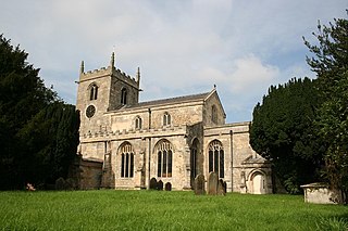
Luddington is a village and former civil parish, now in the parish of Luddington with Haldenby, on the Isle of Axholme in the North Lincolnshire district, in the ceremonial county of Lincolnshire, England. The population of the civil parish of "Luddington with Haldenby" at the 2011 census was 419. It is 6 miles (10 km) north-west from Scunthorpe, 6 miles south-east from Goole and 18 miles (29 km) north-east from Doncaster.

<span class="mw-page-title-main">Swinefleet</span> Village and civil parish in the East Riding of Yorkshire, England

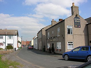
Swinefleet is a village and civil parish in the East Riding of Yorkshire, England. It is situated approximately 2 miles (3.2 km) south-east of the town of Goole on the A161 road from Goole to Crowle. It lies on the south bank of the River Ouse. According to the 2011 UK census, Swinefleet parish had a population of 787, an increase on the 2001 UK census figure of 748. The main centre of population is at the extreme north of the parish, close to the River Ouse. The southern part of the parish is part of Swinefleet and Reedness Moors, and is characterised by drainage ditches and a few farm buildings.

<span class="mw-page-title-main">Eastoft</span> Village and civil parish in North Lincolnshire, England

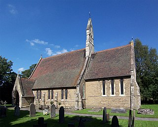
Eastoft is a village and civil parish in North Lincolnshire, England. It is situated within the Isle of Axholme, 3 miles (5 km) north-east from Crowle, and on the A161 road.

<span class="mw-page-title-main">Misterton, Nottinghamshire</span> Village and civil parish in the Bassetlaw district of Nottinghamshire, England

Misterton is a village and civil parish in the Bassetlaw district of Nottinghamshire, England. The parish population at the 2011 census was 2,140, and has risen to 2,191 residents in the 2021 census.

<span class="mw-page-title-main">Haxey</span> Town in North Lincolnshire, England

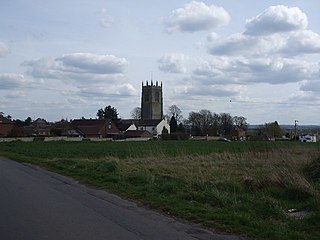
Haxey is a town and civil parish on the Isle of Axholme in the North Lincolnshire unitary authority of Lincolnshire, England. It is directly south of Epworth, south-west of Scunthorpe, north-west of Gainsborough, east of Doncaster and north-north-west of Lincoln, with a population of 4,584 at the 2011 census. The town was regarded as the historic capital of the Isle of Axholme.

<span class="mw-page-title-main">Garthorpe, Lincolnshire</span> Village in North Lincolnshire, England

Garthorpe is a village in the North Lincolnshire, England. It is situated approximately 8 miles (13 km) south-east from Goole, 1 mile (1.6 km) west from the River Trent, and in the Isle of Axholme.

<span class="mw-page-title-main">Wroot</span> Human settlement in England

Wroot is a linear village and civil parish in North Lincolnshire, England, south of the River Torne on the Isle of Axholme, close to the boundary with South Yorkshire. The population at the 2011 census was 455.

<span class="mw-page-title-main">Misson, Nottinghamshire</span> Village and civil parish in Nottinghamshire, England

Misson is a village and civil parish in Nottinghamshire, England. It is located 12 miles north of Retford, and not directly accessible from the rest of Nottinghamshire, as it is on the north bank of the River Idle. Misson Springs, which lie north of the village itself, is the northernmost place within the county. The parish also includes the hamlet of Newington, at its western edge. According to the 2001 census it had a population of 698, increasing to 711 at the 2011 census, and marginally more to 713 residents at the 2021 census.

<span class="mw-page-title-main">Haxey Junction railway station</span> Former railway station in England

Haxey Junction railway station was a station south of the town of Haxey, on the Isle of Axholme in Lincolnshire, England. It was the terminus of the Axholme Joint Railway which ran from Marshland Junction near Goole, and was adjacent to Haxey and Epworth station on the Great Northern and Great Eastern Joint Railway line which ran from Doncaster to Lincoln. Both stations are now closed, although the former Great Northern and Great Eastern Joint Railway line is still operational.

<span class="mw-page-title-main">Crowle North railway station</span> Railway station in Crowle, Lincolnshire, England

Crowle North railway station, officially known as Crowle railway station, was a station that served the market town of Crowle, on the Isle of Axholme in Lincolnshire, England on the Axholme Joint Railway. The North designation was used to avoid confusion with Crowle railway station on a neighbouring line.

<span class="mw-page-title-main">Reedness Junction railway station</span> Disused railway station in the East Riding of Yorkshire, England

Reedness Junction railway station was a railway junction near Reedness, East Riding of Yorkshire, England on the Axholme Joint Railway. Immediately to the west of the station, the Fockerby Branch, which continued eastwards, turned off from the main line to Epworth, which curved to the south.

South Axholme Academy is an academy school in Epworth, in the Isle of Axholme area of North Lincolnshire, England.

<span class="mw-page-title-main">Graizelound</span> Hamlet in the civil parish of Haxey in North Lincolnshire, England

Graizelound is a hamlet in the civil parish of Haxey in North Lincolnshire, England. It is approximately 22 miles (35 km) to the north-west from the city and county town of Lincoln, and centred on the crossroad junction of Haxey Lane, Station Road, Akeferry Road and Ferry Road. The village of Haxey is less than 1 mile (1.6 km) to the north. Owston Ferry on the River Trent is 2.5 miles (4.0 km) to the north-east. Graizelound forms part of the Isle of Axholme.

<span class="mw-page-title-main">East Lound</span> Hamlet in the civil parish of Haxey in North Lincolnshire, England

East Lound is a hamlet in the civil parish of Haxey in North Lincolnshire, England. It is situated approximately 22 miles (35 km) to the north-west from the city and county town of Lincoln, and on Brackenhill Road within the parish of Haxey, a village less than 1 mile (1.6 km) to the west. Owston Ferry on the River Trent is 1.5 miles (2.4 km) to the east. East Lound forms part of the Isle of Axholme.

References

Notes

  1. OS Explorer Map 280: Isle of Axholme, Scunthorpe and Gainsborough: (1:25,000) : ISBN   0 319 46432 6
  2. "Epworth | Domesday Book". Archived from the original on 5 December 2014. Retrieved 27 November 2014. Domesday Online - Epworth
  3. see James Boyce Imperial Mud: The Fight for the Fens, Icon Books, 2020
  4. "Epworth Equestrian in the Isle of Axholme | Local Riding". www.localriding.com. Archived from the original on 1 June 2023. Retrieved 31 May 2022.
  5. Crain 2009 , p. 109
  6. Hall, Trevor H (1965). New Light on Old Ghosts. Gerald Duckworth. pp. 14–25. ISBN   0715602314.
  7. "Epworth". Bustimes.org. Retrieved 31 May 2022.
  8. "TMCR 95.3" . Retrieved 5 November 2023.
  9. "The Epworth Bells". British Papers. 5 December 2013. Retrieved 5 November 2023.
  10. John de Mowbray, 4th Baron Mowbray, 3rd par.; as seen July 15, 2013, 9.55pm CET-Summer.
  11. Ball, F. Elrington The Judges in Ireland 1221-1921 London John Murray 1926
  12. [ permanent dead link ]
  13. Alexander, Don (2007). What made the Steel city. ISBN   1901587681 [ page needed ]
  14. "Sheridan Smith. Musical talent through the generations...", S & N Genealogy Supplies
  15. "John Wesley". Epworth Old Rectory. 12 September 2019. Retrieved 4 February 2024.

Bibliography