North Killingholme Haven

Last updated

North Killingholme Haven, view north from the Haven towards the Humber Sea Terminal (2008) North Killingholme Haven - geograph.org.uk - 844315.jpg
North Killingholme Haven, view north from the Haven towards the Humber Sea Terminal (2008)

North Killingholme Haven is a water outlet on the south bank of the Humber Estuary in the civil parish of North Killingholme, to the north-west of the Port of Immingham.

Contents

The area was used at the beginning of the 20th century for clay extraction with a jetty transhipping clay to Hull; in 1912 construction of a jetty for the Admiralty was consented, for fuel oil shipment. During the First World War a large seaplane facility was operated, known as RNAS Killingholme.

In the 1990s a Simon Group established a Roll on-Roll off river terminal at the Haven, known as Humber Sea Terminal; the terminal was expanded to six berths through the 1990s and 2000s.

History

At the end of the 19th century North Killingholme Haven was used as a drainage point for networks of drainage canals in the fields in the North Killingholme area – the outfall of the waterway onto the Humber was sluiced. There was a single dwelling at the outfall – the New Inn. [1]

Former clay pits (2008) North Killingholme Bird Sanctuary - geograph.org.uk - 1007906.jpg
Former clay pits (2008)

Between 1909 and 1913 Earles Cement works in Wilmington was supplied with clay from pits at North Killingholme, shipped by barge. [2] Clay dug by hand, and transported by horse, later steam winch and then narrow gauge locomotive to a jetty at the mouth of Killingholme Haven. [3] The disused clay pits are since flooded and now form a saline lagoon habitat, with some scarce birds and invertebrates. [4] [5]

North Killingholme (Admiralty Pier) Act 1912
Act of Parliament
Coat of arms of the United Kingdom (1901-1952).svg
Citation 2 & 3 Geo. 5. c. clx
Dates
Royal assent 13 December 1912
Text of statute as originally enacted
North Killingholme Admiralty Pier Act 1931
Act of Parliament
Coat of arms of the United Kingdom (1901-1952).svg
Citation 21 & 22 Geo. 5. c. lxiv
Dates
Royal assent 31 July 1931
Text of statute as originally enacted

Construction and extension of a pier at the haven was consented by the North Killingholme (Admiralty Pier) Act 1912 (2 & 3 Geo. 5. c. clx); [6] [7] The Admiralty's jetty was to be 800 by 20 feet (243.8 by 6.1 m) long by wide with a T-shaped head. [8] The jetty was receiving oil by the mid 1910s. [9] The North Killingholme Admiralty Pier Act 1931 (21 & 22 Geo. 5. c. lxiv) allowed the extension of the existing pier's head, replacing two sunken ships which had been used as dolphins at the head of the pier. [10] [11] [12] The station soon became an important refuelling point for the Royal Navy. [13] The oil storage site was served by the Killingholme Admiralty Platform station from 1930 to 1963.

North Killingholme Pier Act 1912
Act of Parliament
Coat of arms of the United Kingdom (1901-1952).svg
Citation 2 & 3 Geo. 5. c. clxvi
Dates
Royal assent 13 December 1912
Text of statute as originally enacted

Another act, the North Killingholme Pier Act 1912 (2 & 3 Geo. 5. c. clxvi) sanctioned a commercial pier to be constructed by the Yorkshire Transport Company. [14] [15] The company's jetty was to be west of the Admiralty's jetty, 981 by 27 feet (299.0 by 8.2 m), with a westward "L" arm, 600 by 46 feet (183 by 14 m) long by wide, [8] intended for shipment of coal from collieries accessible from the River Ouse. [16] (unbuilt)

Adjacent to the Admiralty oil depot an seaplane station was opened in August 1914. Originally called RNAS Immingham it was renamed as RNAS Killingholme. By late 1914 Facilities at the site included a 177 by 56 feet (54 by 17 m) hangar and four 68 by 77 feet (21 by 23 m) seaplane hangars, as well as a 700 by 60 feet (213 by 18 m) slipway for the seaplanes. Facilities were increased during the First World War, including larger hangars and further slipways- with staff levels reaching 900 operating over 100 aeroplanes, one of the main seaplane bases in the UK. The facility was disbanded after the end of the war- some of the hangars were used to construct a bus depot in Grimsby (Victoria Street). [17] [18] [19]

The riverside at and around North Killingholme Haven has been identified as a viable expansion point for further port facilities on the south bank of the Humber – an £80 million port was proposed in the 1980s but not proceeded with – a report by Coopers and Lybrand in the same period identified demand for both Roll-on/Roll-off and containerised handling facilities in the area. [20] Later in the 1990s Ro-Ro facilities were established by Simon Group (see § Humber Sea Terminal).

The haven is currently (2015) used by dredging contractors Humber Work Boats Ltd.. [21]

Humber Sea Terminal (2000–present)

Humber Sea Terminal from the east (2007) Humber Sea Terminal, Killingholme - geograph.org.uk - 387100.jpg
Humber Sea Terminal from the east (2007)

In the late 1994 Simon Group gained a statutory instrument enabling it to construct a jetty at Killingholme North Haven. [22] The development was to be a deepwater roll-on/roll-off terminal aimed at container traffic from European ports such as Rotterdam. A tender in 1998 from Edmund Nuttall and consultants Posford Duvivier led to a contract in 1999. The works included a 143 metres (469 ft) two berth jetty supported on fifty 1,067 millimetres (42.0 in) tubular steel piles with a concrete deck; a cellular concrete pontoon 40 by 80 metres (130 by 260 ft) secured by two restraining dolphins consisting of outer and inner tubular steel piles of 1,700 and 1,067 millimetres (66.9 and 42.0 in) ring filled with concrete; and a 227 metres (745 ft) pier linking to land also on 1,067 millimetres (42.0 in) piles, connected to the pontoon by an 80 by 10 metres (262 by 33 ft) bridge. Shoreside construction was contracted to Clark Construction. [23]

The two berth "Phase I" opened June 2000, with Stena Line sailing to Hook of Holland. [23]

The facility's capacity of 14 sailings per week was soon reached, and in 2002 the developer, Simon Group began planning for a "Phase Two", with two further berths. The initial plan was for a third Ro-Ro berth from the original pontoon, plus a fourth berth for Load-on/Load-off (Lo-Lo) use, connection to the original land pier by a new spur. [23] [24] The "Phase Two" of the development was consented (2003); A £9.6 million contract for the third berth was awarded in 2003 to Edmund Nuttall, with the work including a new 240 metres (790 ft) jetty, as well as approach bridge and adjustable ramp. [25]

Container handling at the Humber Sea Terminal (2010) Moving Cobelfret Containers at Humber Sea Terminal.jpg
Container handling at the Humber Sea Terminal (2010)

The third berth was completed February 2004, consisting of a 240 by 13 metres (787 by 43 ft) concrete decked finger pier supported on tubular piles; the design gave a 17 metres (56 ft) water depth at high tide (8 metres (26 ft) tidal range), and allowed berthing of ships up to 35,000 gross tons and 200 metres (660 ft) long. [23]

The fourth berth was re-designed to be either a Lo-Lo or Ro-Ro berth, and was constructed as a Ro-Ro facility with Belgian shipper Cobelfret signing a twenty-year agreement. Nuttall was selected as contractor for the £8 million fourth berth contract, including the approach bridge spur; 80 by 9.8 metres (262 by 32 ft) linkspan; and additional 40 by 35 metres (131 by 115 ft) cellular steel pontoon. The approach spur was begun in May 2003. [23]

For phase 2 an additional £14.5 million was expended on onshore storage groundworks, covering 60 acres (24 ha). [23]

Kia Motors relocated its import activities to a 55 acres (22 ha) vehicle import centre served by the port c.2005, in association with ABLE UK and the port operators. [26] [27]

By late 2005 clients included Stena Line, Colbefret, UECC, Norfolkline, Ferryways and Eukor. Planning for a third phase of the terminal, initially estimated as costing £25 million for two further berths was underway in 2005. [28] A harbour revision order allowing a new jetty, pier and link bridge was enacted in 2006. [29]

As of 2012 the terminal was owned by C.RO nv as subsidiary C.RO Ports Killingholme Ltd.. The port had 6 ro-ro berths; 260 acres (107 ha) of port land for development; with facilities include a Pre-Delivery Inspection centre for cars, and a rail connection. [30]

Related Research Articles

<span class="mw-page-title-main">Poole Harbour</span> Natural harbour in England

Poole Harbour is a large natural harbour in Dorset, southern England, with the town of Poole on its shores. The harbour is a drowned valley (ria) formed at the end of the last ice age and is the estuary of several rivers, the largest being the Frome. The harbour has a long history of human settlement stretching to pre-Roman times. The harbour is extremely shallow, with one main dredged channel through the harbour, from the mouth to Holes Bay.

<span class="mw-page-title-main">Portland Harbour</span> Port in Dorset, England

Portland Harbour is located beside the Isle of Portland, Dorset, on the south coast of England. Construction of the harbour began in 1849; when completed in 1872, its 520-hectare (1,300-acre) surface area made it the largest human-made harbour in the world, and it remains one of the largest in the world today. It is naturally sheltered by Portland to the south, Chesil Beach to the west and mainland Dorset to the north. It consists of four breakwaters: two southern and two northern. These have a total length of 4.57 km (2.84 mi) and enclose approximately 1,000 ha of water.

<span class="mw-page-title-main">Saint Peter Port Harbour</span> Port Harbour located in Guernsey

Saint Peter Port Harbour is located in Saint Peter Port, Guernsey. It was a natural anchorage used by the Romans which has been changed into an artificial harbour that is now the island's main port for passengers. Loose cargo, liquids and gas are shipped to and from St Sampson's harbour.

<span class="mw-page-title-main">North Killingholme</span> Small village and civil parish in North Lincolnshire, England

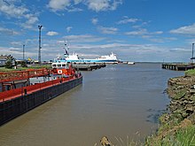
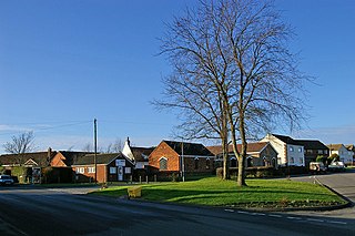
North Killingholme is a small village and civil parish in North Lincolnshire, England.

Braye Harbour is the main harbour on the north side of the island of Alderney, in the Channel Islands, a dependency of the British Crown. A 3,000 feet (910 m) breakwater was built by the Admiralty to protect the Navy in the 19th century shelters Braye Harbour. The harbour faces out onto the Swinge, which is part of the English Channel, and it is at Braye that most of the island's freight comes in. Braye is more or less a suburb of St Anne, the island capital; the centre of St Anne lies approximately 1 mile from the harbour.

<span class="mw-page-title-main">Chennai Port</span> Container port in India

Chennai Port, formerly known as Madras Port, is the second largest container port of India, behind Mumbai's Jawaharlal Nehru Port also known as Nhava Sheva. The port is the largest one in the Bay of Bengal. It is the third-oldest port among the 13 major ports of India with official port operations beginning in 1881, although maritime trade started much earlier in 1639 on the undeveloped shore. It is an artificial and all-weather port with wet docks. Once a major travel port, it became a major container port in the post-Independence era. An established port of trade of British India since the 1600s, the port remains a primary reason for the economic growth of Tamil Nadu, especially for the manufacturing boom in South India, and has contributed greatly to the development of the city of Chennai. It is due to the existence of the port that the city of Chennai eventually became known as the Gateway of South India.

<span class="mw-page-title-main">South Killingholme</span> Village and civil parish in Lincolnshire, England

South Killingholme is a village and civil parish in North Lincolnshire, England. The population of the civil parish at the 2011 census was 1,108.

<span class="mw-page-title-main">Port of Dover</span> Cross-channel port situated in Dover, Kent, south-east England

The Port of Dover is a cross-channel ferry, cruise terminal, maritime cargo and marina facility situated in Dover, Kent, south-east England. It is the nearest English port to France, at just 34 kilometres (21 mi) away, and is one of the world's busiest maritime passenger ports, with 11.7 million passengers, 2.6 million lorries, 2.2 million cars and motorcycles and 80,000 coaches passing through it in 2017, and with an annual turnover of £58.5 million a year. This contrasts with the nearby Channel Tunnel, the only fixed link between the island of Great Britain and the European mainland, which now handles an estimated 20 million passengers and 1.6 million trucks per year.

<span class="mw-page-title-main">Mumbai Port Trust</span> Port in India

Mumbai Port Trust is a port which lies midway on the West coast of India, on the natural deep-water harbour of Mumbai (Bombay) in Maharashtra.The harbour spread over 400 square kilometres (150 sq mi) is protected by the mainland of Konkan to its east and north and by the island city of Mumbai to its west. The harbour opens to the south to the Arabian Sea.

<span class="mw-page-title-main">Port of Hull</span> Port in Kingston upon Hull, England

The Port of Hull is a port at the confluence of the River Hull and the Humber Estuary in Kingston upon Hull, in the East Riding of Yorkshire, England.

The Port of Constanța is located in Constanța, Romania, on the western coast of the Black Sea, 179 nautical miles (332 km) from the Bosphorus Strait and 85 nmi (157 km) from the Sulina Branch, through which the Danube river flows into the sea. It covers 3,926 ha, of which 1,313 ha is land and the rest, 2,613 ha is water. The two breakwaters located northwards and southwards shelter the port, creating the safest conditions for port activities. The present length of the north breakwater is 8,344 m (5.185 mi) and the south breakwater is 5,560 m (3.45 mi). The Port of Constanța is the largest on the Black Sea and the 17th largest in Europe.

<span class="mw-page-title-main">Port of Durban</span> Major shipping terminal in Durban, South Africa

The Port of Durban, commonly called Durban Harbour, is the largest and busiest shipping terminal in sub-Saharan Africa. It handles up to 31.4 million tons of cargo each year. It is the fourth largest container terminal in the Southern Hemisphere, handling approximately 4.5 million TEU in 2019.

<span class="mw-page-title-main">Aberdeen Harbour</span> Port on the north east coast of Scotland

Aberdeen Harbour, rebranded as the Port of Aberdeen in 2022, is a sea port located in the city of Aberdeen on the east coast of Scotland. The port was first established in 1136 and has been continually redeveloped over the centuries to provide a base for significant fishing and ship building industries. Since the 1970s it has provided support to the offshore oil and gas industry operating in the North Sea and it is the main commercial port in the north east of Scotland.

<span class="mw-page-title-main">Douglas Harbour</span> Port

Douglas Harbour is located near Douglas Head at the southern end of Douglas, the capital of the Isle of Man. It is the island's main commercial shipping port. The Port of Douglas was the first in the world to be equipped with radar.

<span class="mw-page-title-main">Marchwood Military Port</span> Port in UK

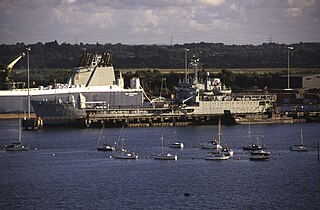
Marchwood Military Port (MMP) or Marchwood Sea Mounting Centre (SMC) is a military port located in Marchwood, Southampton on the south coast of the UK, and the base of 17 Port & Maritime Regiment Royal Logistic Corps. The port was built in 1943 to aid in the D-Day assault on Normandy in 1944 and has since been used to support the Falklands War. The port is now used largely by the Royal Fleet Auxiliary, as a base for their ships, including the Tide-class tankers, and it is also still employed for military cargo and personnel movement.

<span class="mw-page-title-main">Port of Grimsby</span> Port in United Kingdom

The Port of Grimsby is located on the south bank of the Humber Estuary at Grimsby in North East Lincolnshire. Sea trade out of Grimsby dates to at least the medieval period. The Grimsby Haven Company began dock development in the late 1700s, and the port was further developed from the 1840s onwards by the Manchester, Sheffield and Lincolnshire Railway (MSLR) and its successors. The port has had three main dock systems:

<span class="mw-page-title-main">Port of Immingham</span> Major port located near Immingham, Lincolnshire, England

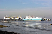
The Port of Immingham, also known as Immingham Dock, is a major port on the east coast of England, located on the south bank of the Humber Estuary in the town of Immingham, Lincolnshire. In 2019, the Port of Grimsby & Immingham was the largest port in the United Kingdom by tonnage with 54.1 million tonnes of cargo passing through that year.

<span class="mw-page-title-main">North Mole, Gibraltar Harbour</span> Sector of a major port

The North Mole is a breakwater located in the northern section of Gibraltar Harbour, in the British Overseas Territory of Gibraltar, at the southern end of the Iberian Peninsula. The North Mole, with the rest of harbour, is just north of the east entrance to the Strait of Gibraltar. The breakwater was formerly known as the Commercial Mole, and is the site of the commercial port in the harbour. It was the consequence of a late nineteenth century plan by the British Admiralty to create a modern dockyard and large defensive harbour in Gibraltar.

<span class="mw-page-title-main">Killingholme Admiralty Platform railway station</span> Former railway station in England

Killingholme Admiralty Platform railway station, known locally as Admiralty Platform, was near North Killingholme Haven, Lincolnshire, England.

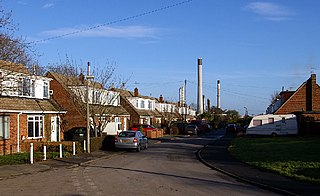
The south bank of the Humber Estuary in England is a relatively unpopulated area containing large scale industrial development built from the 1950s onward, including national scale petroleum and chemical plants as well as gigawatt scale gas fired power stations.

References

  1. Ordnance Survey, 1:2500. 1888
  2. Moore, Dylan (2011), "Wilmington", www.cementkilns.co.uk, retrieved 23 August 2014
  3. Plant, K.P. (December 1968), "Industrial Railways of Lincolnshire : 4. North Killingholme Clayfields", The Industrial Railway Record (22): 359–364
  4. "Killingholme Haven Pits", www.lincstrust.org.uk, retrieved 5 August 2015
  5. NORTH KILLINGHOLME HAVEN PITS, Natural England, retrieved 5 August 2015
  6. "ADMIRALTY PIER OR JETTY IN RIVER HUMBER", The London Gazette (28552): 8602–8603, 21 November 1911
  7. 2 & 3 Geo. 5. c. clx 1912.
  8. 1 2 "_", The Railway News, 96: 261, 1911
  9. "Supplement to the Commerce Reports", Commerce Reports, Department of Commerce, vol. 1, p. 51, 1916
  10. "NORTH KILLINGHOLME. (ADMIRALTY PIER)", The London Gazette (33703): 2150, 31 March 1931
  11. "NORTH KILLINGHOLME (ADMIRALTY PIER) BILL.", Hansard – House of Commons, vol. 253, cc586-8, 5 June 1931
  12. 21 & 22 Geo. 5. c. 64 1931.
  13. "_", The Petroleum Gazette, 18–19: 43, 1913
  14. "NORTH KILLINGHOLME PIER", The London Gazette (28554): 8976–8977, 28 November 1911
  15. 2 & 3 Geo. 5. c. clxvi 1912.
  16. "Engineering Proposals in Parliament 1912" (PDF), The Engineer, 113: 74, 19 January 1912
  17. "Naval Air Station Killingholme", www.raf-lincolnshire.info, retrieved 5 August 2015
  18. "Killingholme", www.forgottenairfields.com, 3 August 2012, retrieved 5 August 2015
  19. "RNAS Killingholme, Lincolnshire", www.airfieldarchaeology.co.uk, 27 February 2012, retrieved 5 August 2015
  20. Symes, David, ed. (1987), Humberside in the Eighties, University of Hull, p. 110
  21. "Humber Work Boats", www.humberworkboats.co.uk, retrieved 5 August 2015
  22. North Killingholme Haven Harbour Empowerment Order 1994.
  23. 1 2 3 4 5 6 "Simon Says Humber Sea Terminal", Maritime Journal, 1 June 2004, retrieved 5 August 2015
  24. Mylius, Andrew (1 August 2004), "Ports and harbours – Ro-ro on the go", www.nce.co.uk, retrieved 5 August 2015
  25. "Nuttall Wins Humber Sea Terminal Contract", Maritime Journal, 1 June 2003, retrieved 5 August 2015
  26. "New Vehicle Import Centre for Killingholme", www.gbagroup.com, 18 April 2005, retrieved 5 August 2015
  27. Carter, Melanie (13 April 2005), "New Import Centre For Kia On Humberside", www.carpages.co.uk, retrieved 5 August 2015
  28. "First Car Carrier Arrives on Humber", Maritime Journal, 1 October 2005, retrieved 5 August 2015
  29. Humber Sea Terminal (Phase III) Harbour Revision Order 2006.
  30. C.RO Ports 2012.

Sources

53°39′51″N0°14′07″W / 53.6642°N 0.2352°W / 53.6642; -0.2352