Todd Creek is an unincorporated community and a census-designated place (CDP) located in and governed by Adams County, Colorado, United States. The CDP is a part of the Denver–Aurora–Lakewood, CO Metropolitan Statistical Area. The population of the Todd Creek CDP was 5,028 at the United States Census 2020. The Todd Creek Village Metropolitan District and the Todd Creek Village Park and Recreation District provide services to the community, which lies in ZIP Code 80602.

Columbine is census-designated place (CDP) in and governed by Jefferson and Arapahoe counties in Colorado, United States. The CDP is a part of the Denver metropolitan area. Located primarily in Jefferson County, Columbine lies immediately south of Denver. The population of the Columbine CDP was 25,229 at the 2020 census. The community lies in ZIP code 80123.

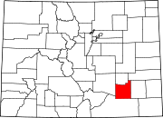
The Pinery is an unincorporated community and a census-designated place (CDP) located in and governed by Douglas County, Colorado, United States. The CDP is a part of the Denver–Aurora–Lakewood, CO Metropolitan Statistical Area. The population of The Pinery CDP was 11,311 at the United States Census 2020. Douglas County governs the unincorporated community. The Parker post office serves the area.
Westcreek is an unincorporated community and a census-designated place (CDP) located in and governed by Douglas County, Colorado, United States. The CDP is a part of the Denver–Aurora–Lakewood, CO Metropolitan Statistical Area. The population of the Westcreek CDP was 120 at the United States Census 2020. The Sedalia post office serves the area.

Cascade-Chipita Park is a census-designated place (CDP) comprising the unincorporated communities of Cascade and Chipita Park located in and governed by El Paso County, Colorado, United States. The CDP is a part of the Colorado Springs, CO Metropolitan Statistical Area. The population of the Cascade-Chipita Park CDP was 1,628 at the United States Census 2020. The Cascade post office serves the area.
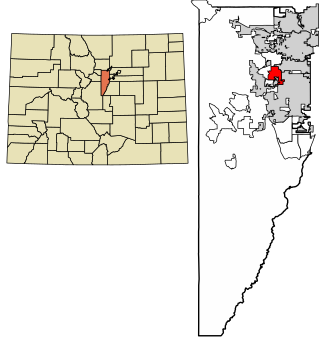
Applewood is an unincorporated community and a census-designated place (CDP) located in and governed by Jefferson County, Colorado, United States. The CDP is a part of the Denver–Aurora–Lakewood, CO Metropolitan Statistical Area. The population of the Applewood CDP was 7,833 at the 2020 United States Census. The Golden post office serves the area.

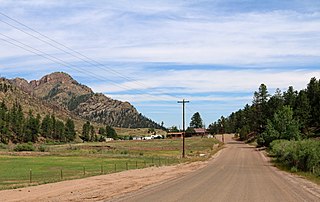
Aspen Park is an unincorporated community and a census-designated place (CDP) located in Jefferson County, Colorado, United States. The CDP is a part of the Denver–Aurora–Lakewood, CO Metropolitan Statistical Area. The population of the Aspen Park CDP was 810 at the United States Census 2020. The Aspen Park Metropolitan District provides services. The Conifer post office serves the area.
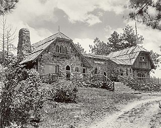
Genesee is an unincorporated community and a census-designated place (CDP) located in and governed by Jefferson County, Colorado, United States. The CDP is a part of the Denver–Aurora–Lakewood, CO Metropolitan Statistical Area. The population of the Genesee CDP was 3,610 at the United States Census 2020. The Golden post office serves the area.
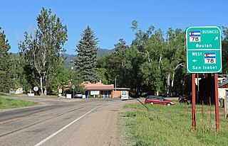
Beulah Valley is a census-designated place (CDP) in and governed by Pueblo County, Colorado, United States. The CDP is a part of the Pueblo, CO Metropolitan Statistical Area. The population of the Beulah Valley CDP was 518 at the United States Census 2020. The Beulah post office (Zip Code 81023) serves the area.

Peoria is an unincorporated community and a census-designated place (CDP) located in and governed by Arapahoe County, Colorado, United States. The CDP is a part of the Denver–Aurora–Lakewood, CO Metropolitan Statistical Area. The population of the Peoria CDP was 153 at the United States Census 2020. The Byers post office serves the area.

Hidden Lake is an unincorporated community and a census-designated place (CDP) located in and governed by Boulder County, Colorado, United States. The CDP is a part of the Boulder, CO Metropolitan Statistical Area. The population of the Hidden Lake CDP was 24 at the United States Census 2020. The Ward post office serves the area.

Lazy Acres is an unincorporated community and a census-designated place (CDP) located in and governed by Boulder County, Colorado, United States. The CDP is a part of the Boulder, CO Metropolitan Statistical Area. The population of the Lazy Acres CDP was 957 at the United States Census 2020. The Boulder post office serves the area.

Cathedral is a census-designated place (CDP) located in and governed by Hinsdale County, Colorado, United States. The population of the Cathedral CDP was 15 at the United States Census 2020. The Powderhorn post office serves the area.

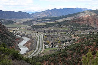
Cattle Creek is a census-designated place (CDP) in and governed by Garfield County, Colorado, United States. The CDP is a part of the Glenwood Springs, CO Micropolitan Statistical Area. The population of the Cattle Creek CDP was 662 at the United States Census 2020. The Glenwood Springs post office serves the area.
Chacra is a census-designated place (CDP) in and governed by Garfield County, Colorado, United States. The CDP is a part of the Glenwood Springs, CO Micropolitan Statistical Area. The population of the Chacra CDP was 331 at the United States Census 2020. The Glenwood Springs post office serves the area.

Southern Ute is a census-designated place (CDP) on the Southern Ute Indian Reservation in southern La Plata County, Colorado, United States. The CDP is a part of the Durango, CO Micropolitan Statistical Area. The population of the Southern Ute CDP was 158 at the United States Census 2020. The Ignacio post office serves the area.

Portland is a census-designated place (CDP) located in and governed by Ouray County, Colorado, United States. The CDP is a part of the Montrose, CO Micropolitan Statistical Area. The population of the Portland CDP was 136 at the United States Census 2020. The Ridgway post office (Zip Code 81432) serves the area.

El Moro is an unincorporated community and a census-designated place (CDP) located in and governed by Las Animas County, Colorado, United States. The population of the El Moro CDP was 216 at the United States Census 2020. The Trinidad post office serves the area.

La Junta Gardens is a Census-designated place (CDP) in and governed by Otero County, Colorado, United States. The population of the La Junta Gardens CDP was 123 at the United States Census 2020. The La Junta post office (Zip Code 81050) serves the area.

Lynn is an unincorporated community and a census-designated place (CDP) located in and governed by Las Animas County, Colorado, United States. The population of the Lynn CDP was 11 at the United States Census 2020. The Aguilar post office serves the area.