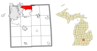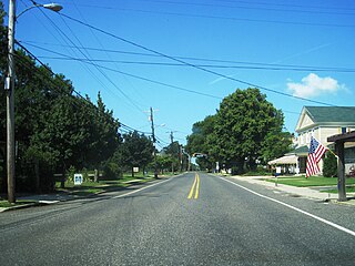
Haslett is a census-designated place (CDP) in Ingham County in the U.S. state of Michigan. It is located mostly within Meridian Charter Township with a small portion extending east into Williamstown Township. The population was 19,220 at the 2010 census. Haslett contains its own school district, as well as its own post office with the 48840 ZIP Code.

Powers Lake is a census-designated place (CDP) in the towns of Randall and Wheatland, in Kenosha County in the U.S. state of Wisconsin. As of the 2020 census, the CDP had a population of 1,401. Part of the Powers Lake CDP was in Walworth County, but on December 20, 2011, it became part of the village of Bloomfield.

Elm Hall is an unincorporated community and census-designated place (CDP) in Gratiot County in the U.S. state of Michigan. The CDP had a population of 279 at the 2020 census. The community is located within Sumner Township.
Deerfield is an unincorporated community and census-designated place (CDP) located within Upper Deerfield Township, Cumberland County, in the U.S. state of New Jersey. It was first listed as a CDP in the 2020 census with a population of 230.

Newport is an unincorporated community and census-designated place (CDP) located within Downe Township in Cumberland County, in the U.S. state of New Jersey. The area is served as United States Postal Service ZIP Code 08345.

Crystal Bay is a census-designated place (CDP) on the north shore of Lake Tahoe in Washoe County, Nevada, United States. The population was 305 at the 2010 census. It is part of the Reno−Sparks Metropolitan Statistical Area. Prior to 2010, it was listed by the U.S. Census Bureau within the Incline Village–Crystal Bay CDP.

Brandon is a census-designated place (CDP) in and governed by Kiowa County, Colorado, United States. The population of the Brandon CDP was 21 at the United States Census 2020. The Sheridan Lake post office serves Brandon postal addresses.
Topaz Lake is a census-designated place (CDP) in Douglas County, Nevada, United States. The population was 157 at the 2010 census.

Summit Lake is an unincorporated community and census-designated place (CDP) in Langlade County, Wisconsin, United States. Summit Lake is located along U.S. Route 45 17 miles (27 km) north of Antigo, in the towns of Upham and Elcho. Summit Lake has a post office with ZIP code 54485. As of the 2010 census its population was 144.

Packwaukee is an unincorporated census-designated place located in the town of Packwaukee, Marquette County, Wisconsin, United States. Packwaukee is located on the north bank of Buffalo Lake, a lake on the Fox River; it is 7 miles (11 km) west-southwest of Montello. Packwaukee has a post office with ZIP code 53953. As of the 2010 census, its population was 262.

Long Lake is an unincorporated census-designated place in the town of Long Lake, Florence County, Wisconsin, United States. Long Lake is located on the eastern shore of Long Lake along Wisconsin Highway 139, 21 miles (34 km) west-southwest of Florence. As of the 2020 census, its population was 59. The community became a census-designated place in 2010. The community has the 54542 ZIP code.
Lyons is an unincorporated community and census-designated place located in the town of Lyons, in Walworth County, Wisconsin, United States. Lyons is located on Wisconsin Highway 36 4.5 miles (7.2 km) west-southwest of Burlington. Lyons has a post office with ZIP code 53148. It was first named a CDP at the 2020 census, which showed a population of 932.

Ashippun is an unincorporated census-designated place located in the town of Ashippun, Dodge County, Wisconsin, United States. Ashippun is located on Wisconsin Highway 67 7 miles (11 km) south of Neosho. Ashippun has a post office with ZIP code 53003. At the 2020 census, its population was 1,166, more than triple the population of 333 in 2010.
Lake Tomahawk is an unincorporated census-designated place located in the town of Lake Tomahawk, Oneida County, Wisconsin, United States. Lake Tomahawk is located on Wisconsin Highway 47 15 miles (24 km) northwest of Rhinelander. Lake Tomahawk has a post office with ZIP code 54539. As of the 2010 census, its population was 228.

Minocqua is a census-designated place located in the town of Minocqua, Oneida County, Wisconsin, United States. Minocqua is located on a peninsula on Minocqua Lake, 21.5 miles (34.6 km) northwest of Rhinelander. The community is served by U.S. Route 51. Minocqua has a post office with ZIP code 54548. As of the 2010 census, its population is 451.

Three Lakes is an unincorporated census-designated place located in the town of Three Lakes, Oneida County, Wisconsin, United States. Three Lakes is located at the junction of U.S. Route 45 and Wisconsin Highway 32 9 miles (14 km) south-southeast of Eagle River. Three Lakes has a post office with ZIP code 54562. As of the 2010 census, its population is 605.

Lakewood is an unincorporated census-designated place located in the town of Lakewood, Oconto County, Wisconsin, United States. Lakewood is located on Wisconsin Highway 32 22 miles (35 km) north-northwest of Suring. Lakewood has a post office with ZIP code 54138. As of the 2010 census, its population was 323.

Hidden Lake is an unincorporated community and a census-designated place (CDP) located in and governed by Boulder County, Colorado, United States. The CDP is a part of the Boulder, CO Metropolitan Statistical Area. The population of the Hidden Lake CDP was 24 at the United States Census 2020. The Ward post office serves the area.

Loomis is an unincorporated community and census-designated place (CDP) in Isabella County in the U.S. state of Michigan. The population of the CDP was 194 at the 2020 census. The community is located within Wise Township.
Grenloch is an unincorporated community and census-designated place (CDP) located within Washington Township, in Gloucester County, in the U.S. state of New Jersey. Grenloch is located along New Jersey Route 168 10.25 miles (16.50 km) south-southeast of Camden. Grenloch has a post office with ZIP Code 08032.


