
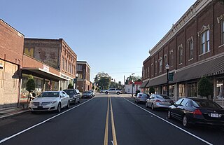
Franklin is the southwesternmost independent city in Hampton Roads, Commonwealth of Virginia. As of the 2020 census, the population was 8,180. The Bureau of Economic Analysis combines the city of Franklin with Southampton County for statistical purposes.

Washington County is a county located in the U.S. state of North Carolina. As of the 2020 census, the population was 11,003. Its county seat is Plymouth. The county was formed in 1799 from the western third of Tyrrell County. It was named for George Washington.

Tyrrell County is a county located in the U.S. state of North Carolina. As of the 2020 census, the population was 3,245, making it the least populous county in North Carolina. Its county seat is Columbia. The county was created in 1729 as Tyrrell Precinct and gained county status in 1739.

Carteret County is a county located in the U.S. state of North Carolina. As of the 2020 census, the population was 67,686. Its county seat is Beaufort. The county was created in 1722 as Carteret Precinct and gained county status in 1739. It was named for Sir George Carteret, one of the 17th century English Lords Proprietor, or for his descendant and heir John Carteret, 2nd Earl Granville.

Beaufort County is a county located in the U.S. state of North Carolina. As of the 2020 census, the population was 44,652. Its county seat is Washington. The county was founded in 1705 as Pamptecough Precinct. Originally included in Bath County, it was renamed Beaufort Precinct in 1712 and became Beaufort County in 1739.
Weldon is a town in Halifax County, North Carolina, United States. The population was 1,655 at the 2010 census. It is part of the Roanoke Rapids, North Carolina Micropolitan Statistical Area.

Murfreesboro is a town in Hertford County, North Carolina, United States. The population was 2,835 at the 2010 census. The town is home to Chowan University.

The Tennessee River is the largest tributary of the Ohio River. It is approximately 652 miles (1,049 km) long and is located in the southeastern United States in the Tennessee Valley. The river was once popularly known as the Cherokee River, among other names, as the Cherokee people had their homelands along its banks, especially in what are now East Tennessee and northern Alabama. Additionally, its tributary, the Little Tennessee River, flows into it from Western North Carolina and northeastern Georgia, where the river also was bordered by numerous Cherokee towns. Its current name is derived from the Cherokee town, Tanasi, which was located on the Tennessee side of the Appalachian Mountains.

The Pocomoke River stretches approximately 66 miles (106 km) from southern Delaware through southeastern Maryland in the United States. At its mouth, the river is essentially an arm of Chesapeake Bay, whereas the upper river flows through a series of relatively inaccessible wetlands called the Great Cypress Swamp, largely populated by Loblolly Pine, Red Maple and Bald Cypress. The river is the easternmost river that flows into Chesapeake Bay. "Pocomoke", though traditionally interpreted as "dark water" by local residents, is now agreed by scholars of the Algonquian languages to be derived from the words for "broken ground."

The Roanoke River runs 410 miles (660 km) long through southern Virginia and northeastern North Carolina in the United States. A major river of the southeastern United States, it drains a largely rural area of the coastal plain from the eastern edge of the Appalachian Mountains southeast across the Piedmont to Albemarle Sound. An important river throughout the history of the United States, it was the site of early settlement in the Virginia Colony and the Carolina Colony. An 81-mile (130 km) section of its lower course in Virginia between the Leesville Lake and Kerr Lake is known as the Staunton River, pronounced, as is the Shenandoah Valley city of that name. It is impounded along much of its middle course to form a chain of reservoirs.

South Hampton Roads is a region located in the extreme southeastern portion of Virginia's Tidewater region in the United States with a total population of 1,177,742 as of 2020. It is part of the Virginia Beach-Norfolk-Newport News, VA-NC MSA, which itself has a population of 1,780,059 as of 2020.
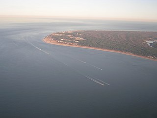
Cape Henry is a cape on the Atlantic shore of Virginia located in the northeast corner of Virginia Beach. It is the southern boundary of the entrance to the long estuary of the Chesapeake Bay.
The Ararat River is a tributary of the Yadkin River in southwestern Virginia and northwestern North Carolina in the United States. Via the Yadkin it is part of the watershed of the Pee Dee River, which flows to the Atlantic Ocean.
Ararat is an unincorporated community in Patrick County, Virginia, United States, south of the Blue Ridge Parkway and north of Mount Airy, North Carolina. Ararat is located near the Virginia–North Carolina state line about five miles (8.0 km) north of Mount Airy and about 25 miles (40 km) west of Stuart, Virginia. The community's name comes from the Ararat River which flows through the area. The River takes its name from the Jefferson Fry Map of 1751, which calls Pilot Mountain part of the "Mountains of Ararat." The Saura Indian name for nearby Pilot Mountain across the state line in Surry County, North Carolina is "The Pilot" and the mountain reverted to that. The large monadnock mountain was thought to resemble a bullfrog and the Native Americans named it "Ratratrat," after the sound the animal makes. Early white settlers thought what they were saying sounded like "Ararat," the mountain which, according to the Bible, was the landing point of Noah's Ark.
North Landing River Natural Area Preserve is a 3,441-acre (13.93 km2) Natural Area Preserve located in Virginia Beach, Virginia, United States. It almost entirely consists of wetlands, including five wetland types considered rare in the Commonwealth of Virginia. The preserve protects pocosins, an increasingly scarce type of wetland in the southeastern United States; also in the area are a number of forested swamps and freshwater tidal marshes, all found along the lower North Landing River and supporting numerous rare species. Breeding and wintering waterfowl also make their home in the area.
The Southern Branch Elizabeth River is a 14.5-mile-long (23.3 km), primarily tidal river in the U.S. state of Virginia. It flows from south to north through the city of Chesapeake and forms the boundary between the cities of Portsmouth and Chesapeake for its northernmost 3 miles (5 km). It is a tributary of the Elizabeth River, connecting to the harbor of Hampton Roads to the north. It is part of the Intracoastal Waterway of the Atlantic coast of the United States, connecting by it to the North Landing River, which flows into North Carolina.
The Department of Virginia and North Carolina was a United States Military department encompassing Union-occupied territory in the Confederate States during the Civil War. In 1863 it was formed by the merging of two previously existing departments: the Department of Virginia and the Department of North Carolina. In 1865 the two departments were once again separated.
Cypress Landing is a planned community and census-designated place (CDP) in Beaufort County, North Carolina, United States. It was first listed as a CDP in the 2020 census with a population of 1,257.

