Related Research Articles

The Au Sable River in Michigan, United States runs approximately 138 miles (222 km) through the northern Lower Peninsula, through the towns of Grayling and Mio, and enters Lake Huron at the town of Oscoda. It is considered one of the best brown trout fisheries east of the Rockies and has been designated a blue ribbon trout stream by the Michigan Department of Natural Resources. A map from 1795 located in the United States Gazetteer calls it the Beauais River. In French, the river is called the Rivière au sable, literally "Sand River".
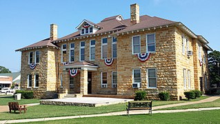
Stone County is located in the Ozark Mountains in the U.S. state of Arkansas. The county is named for rugged, rocky area terrain of the Ozarks. Created as Arkansas's 74th county on April 21, 1873, Stone County has two incorporated cities: Mountain View, the county seat and most populous city, and Fifty-Six. The county is also the site of numerous unincorporated communities and ghost towns.

Baxter County is a county in the U.S. state of Arkansas. As of the 2020 census, the county's population was 41,627. The county seat is Mountain Home. It is Arkansas's 66th county, formed on March 24, 1873, and named for Elisha Baxter, the tenth governor of Arkansas.
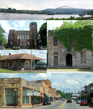
Ozark is a city in Franklin County, Arkansas, United States and one of the county's two seats of government. The community is located along the Arkansas River in the Arkansas River Valley on the southern edge of the Ozark Mountains. As of the 2010 census it had a population of 3,684.

The Ozarks, also known as the Ozark Mountains, Ozark Highlands or Ozark Plateau, is a physiographic region in the U.S. states of Missouri, Arkansas, Oklahoma and the extreme southeastern corner of Kansas. The Ozarks cover a significant portion of northern Arkansas and most of the southern half of Missouri, extending from Interstate 40 in central Arkansas to Interstate 70 in central Missouri.
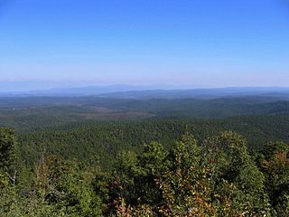
The Ouachita National Forest is a vast congressionally-designated National Forest that lies in the western portion of Arkansas and portions of extreme-eastern Oklahoma, USA.

The Boston Mountains is a Level III ecoregion designated by the Environmental Protection Agency (EPA) in the U.S. states of Arkansas and Oklahoma. Part of the Ozarks, the Boston Mountains are a deeply dissected plateau. The ecoregion is steeper than the adjacent Springfield Plateau to the north, and bordered on the south by the Arkansas Valley. The Oklahoma portion of the range is locally referred to as the Cookson Hills. There are several theories of how the mountains were named, though apparently none are related to the Massachusetts city.
The Ozark Highlands Trail roams 218 miles (351 km) through parts of seven counties in northwest Arkansas. It stretches from Lake Fort Smith State Park, across the Ozark National Forest, to the Buffalo National River. The trail passes through some of the most remote and scenic portions of the Ozark Mountains, like the Hurricane Creek Wilderness Area. It also crosses White Rock Mountain, Hare Mountain, the Marinoni Scenic Area, and many other scenic spots.

The Buffalo River, located in Northern Arkansas, was the first National River to be designated in the United States. The Buffalo River is 153 miles (246 km) long. The lower 135 miles (217 km) flow within the boundaries of an area managed by the National Park Service, where the stream is designated the Buffalo National River. The river flows through Newton, Searcy, Marion, and Baxter Counties, from west to east. The river originates in the highest part of the Boston Mountains of the Ozarks, flows out onto the Springfield Plateau near the historic community of Erbie, and finally crosses a portion of the Salem Plateau just before joining the White River. The Park is home to the state's only elk herd. The upper section of the river in the Ozark National Forest is managed by the U.S. Forest Service and is designated as a National Scenic River and a National Wild River; that section is not part of the area managed as a park by the Park Service but is managed as a part of the Ozark National Forest.
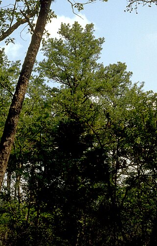
The Ozark – St. Francis National Forest is a United States National Forest that is located in the state of Arkansas. It is composed of two separate forests, Ozark National Forest in the Ozark Mountains; and St. Francis National Forest on Crowley's Ridge. Each forest has distinct biological, topographical, and geological differences.

The Illinois River is a tributary, about 56 miles (90 km) long, of the Rogue River in the U.S. state of Oregon. It drains part of the Klamath Mountains in northern California and southwestern Oregon. The river's main stem begins at the confluence of its east and west forks near Cave Junction in southern Josephine County. Its drainage basin includes Sucker Creek, which rises in the Red Buttes Wilderness, near Whiskey Peak on the California state line. The main stem flows generally northwest in a winding course past Kerby and through the Siskiyou National Forest and Kalmiopsis Wilderness. It joins the Rogue River from the south at Agness on the Curry–Josephine county line, 27 miles (43 km) from the Pacific Ocean.
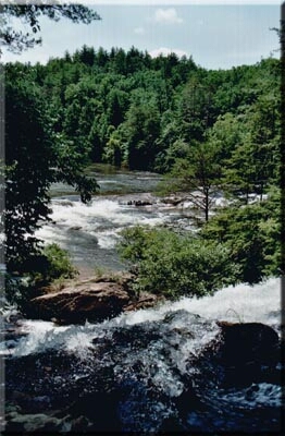
The Chattooga River is the main tributary of the Tugaloo River.
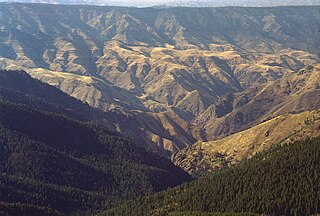
The Hells Canyon Wilderness is a wilderness area in the western United States, in Idaho and Oregon. Created 48 years ago in 1975, the Wilderness is managed by both the U.S. Bureau of Land Management and the U.S. Forest Service and contains some of the most spectacular sections of the Snake River as it winds its way through Hells Canyon, North America's deepest river gorge and one of the deepest gorges on Earth. The Oregon Wilderness Act of 1984 added additional acreage and currently the area protects a total area of 217,927 acres (88,192 ha). It lies entirely within the Hells Canyon National Recreation Area except for a small 946-acre (383 ha) plot in southeastern Wallowa County, Oregon which is administered by the Bureau of Land Management. The area that is administered by the Forest Service consists of portions of the Wallowa, Nez Perce, Payette, and Whitman National Forests.

The Mulberry River is a 70-mile-long (110 km) tributary of the Arkansas River in northwestern Arkansas in the United States. Via the Arkansas River, it is part of the watershed of the Mississippi River. It has been designated a National Wild and Scenic River. The drainage basin of the Mulberry River has an area of 373 square miles (970 km2) and the annual average mean flow of the river near its mouth is 557 cubic feet per second.
Carp River is a 40.2-mile-long (64.7 km) river in Chippewa and Mackinac counties in the U.S. state of Michigan. 21.7 miles (34.9 km) of the river were added to the National Wild and Scenic Rivers System in 1992.
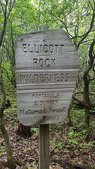
Ellicott Rock Wilderness is managed by the United States Forest Service and is part of the National Wilderness Preservation System. It was first designated by Congress in 1975 with the Eastern Wilderness Act. The majority of this land lays in South Carolina. Additional lands were added to Ellicott Rock Wilderness in 1984 with the passing of the North Carolina Wilderness Act and the Georgia Wilderness Act, today designated wilderness totals 8,274 acres (33.48 km2). Ellicott Rock Wilderness is the only wilderness that straddles three states, with boundaries located around the point at which Georgia, North Carolina, and South Carolina come together. Ellicott Rock Wilderness also spans three National Forests. Sumter National Forest in South Carolina is responsible for 2,859 acres (11.57 km2), receives the majority of recreation in the wilderness, and is also the lead manager of Ellicott Rock Wilderness. Nantahala National Forest in North Carolina is responsible for the majority of the wilderness at 3,394 acres (13.74 km2) and the Chattahoochee National Forest in Georgia manages 2,021 acres (8.18 km2) of the wilderness. In 1979, all Forest Service land was surveyed under the Roadless Area Review and Evaluation and 1,982 acres (8.02 km2) on the Sumter National Forest were classified as Roadless National Forest System land and named Ellicott Rock Extension. The Andrew Pickens Ranger district on the Sumter National Forest recommended the Ellicott Rock Extension as wilderness in 1995 in their Resource Management Plan. Although not fully designated, recommended wilderness is managed as if it were designated wilderness. In June 2017 during a land management plan revision, the Nantahala Ranger District on the Nantahala National Forest added 824 acres (3.33 km2) of proposed wilderness, currently called Ellicott Rock West Extension.

The Arkansas Scenic Byways Program is a list of highways, mainly state highways, that have been designated by the Arkansas Department of Transportation (ArDOT) as scenic highways. The Arkansas General Assembly designates routes for scenic byway status upon successful nomination. For a highway to be declared scenic, a group interested in preserving the scenic, cultural, recreational, and historic qualities of the route must be created. Mayors of all communities along the route and county judges from each affected county must be included in the organization. Scenic highways are marked with a circular shield in addition to regular route markers.

The Sylamore Scenic Byway is a scenic route in the Arkansas Scenic Byways program. The route runs through the Sylamore Ranger District of the Ozark National Forest in Arkansas for 26.5 miles (42.6 km) in Stone County. It passes through undeveloped forest land as a scenic route to Blanchard Springs Caverns.
The White Rock Wildlife Management Area (WMA) was designated in 1976 as 280,000 acres (110,000 ha) of protected area within the boundaries of the Ozark National Forest. The WMA is owned by the U. S. Forest Service and managed under the provisions of a Memorandum of Understanding by the Arkansas Game and Fish Commission, and is situated in the Boston Mountains of Northwest Arkansas.
Hurricane Creek is a tributary to the Big Piney Creek, a river in Ozark-St. Francis National Forest in the state of Arkansas, which is a tributary of the Arkansas River and which is, in turn, part of the Mississippi River System. It is managed by the United States Forest Service and categorized as one of the Wild and Scenic Rivers of the United States.
References
- ↑ "Explore Designated Rivers". Rivers.gov. Retrieved January 8, 2022.
- ↑ "North Sylamore Creek". Geographic Names Information System . United States Geological Survey, United States Department of the Interior.
- ↑ "North Sylamore Creek Trail".
{{cite web}}: CS1 maint: url-status (link)