Nunnington

Last updated

Nunnington
Aerial Photo of Nunnington.jpg
Nunnington from the air in 2005
North Yorkshire UK location map (2023).svg
Red pog.svg
Nunnington
Location within North Yorkshire
Population361 (2011 census) [1]
OS grid reference SE 666 793
Unitary authority
Ceremonial county
Region
Country England
Sovereign state United Kingdom
Post town YORK
Postcode district YO62
Police North Yorkshire
Fire North Yorkshire
Ambulance Yorkshire
UK Parliament
List of places
UK
England
Yorkshire
54°12′18″N0°58′42″W / 54.20500°N 0.97833°W / 54.20500; -0.97833

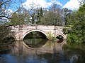
Nunnington is a village and civil parish in North Yorkshire, England. The River Rye runs through. Its population, including Stonegrave, taken at the 2011 census was 361. [1] It is rich in listed historic buildings.

Contents

History

Nunnington Hall is a Grade I listed mansion owned by the National Trust and open to the public. The village has 28 other houses and features listed Grade II, including an early 18th-century bridge over the river. [2]

Church

The parish church dedicated to All Saints and St James is a Grade I listed building. The nave and chancel date from the late 13th century and the tower from 1672. The tower, porch and vestry were rebuilt in 1883–1884. There is a fine 17th-century pulpit. [3] [4]

There is a tomb in the church said to belong to a man named Peter Loschy, who slew a dragon in Loschy Wood. In fact, the tomb belongs to Sir Walter de Teyes of Stonegrave Manor. [5]

Notable residents

Former residents of Nunnington have included the writers Annie Keary (1825–1879) and Eliza Harriett Keary (1827–1918) in the 1840s, while their father William Keary (died 1859) was rector. [6] Annie Keary's children's book Mia and Charlie; or a Week's Holiday at Ryedale Rectory (London/Winchester, 1855) recounts the story of a Proud Lady of "Nunningham", who haunts the hall. [7]

Sir Herbert Read, the anarchist poet and critic, was born at nearby Muscoates in 1893 and lived at Muscoates Grange Farm. [8]

Amenities

School

The nearest schools are at Kirkbymoorside and Malton. [9] Nunnington Church of England School dwindled and closed seemingly before the Second World War. [10]

Public transport

Nunnington railway station lay 1 mile (1.6 km) west of the village. It closed to passengers in 1953. [11] The nearest railway station is at Malton (10.2 miles, 16.4 km). There are no public bus services for the village at present. [12]

Related Research Articles

<span class="mw-page-title-main">Annie Keary</span> English novelist, poet and childrens writer, 1825–1879

Anna Maria (Annie) Keary was an English novelist, poet and an innovative children's writer.

<span class="mw-page-title-main">Helmsley</span> Market town in North Yorkshire, England

Helmsley is a market town and civil parish in North Yorkshire, England. Historically part of the North Riding of Yorkshire, the town is located at the point where Ryedale leaves the moorland and joins the flat Vale of Pickering.

<span class="mw-page-title-main">Gateley</span> Human settlement in England

Gateley is a village and civil parish in the Breckland district of Norfolk, England.

<span class="mw-page-title-main">Bilton-in-Ainsty</span> Village near York, North Yorkshire, England

Bilton-in-Ainsty is a village in the Harrogate district of North Yorkshire in England. It lies about 4 miles (6 km) east of Wetherby and 8 miles (13 km) west of York. It is part of the civil parish of Bilton-in-Ainsty with Bickerton. Bilton had a population of 147 in 2006.

<span class="mw-page-title-main">Vale of Pickering</span> Low-lying plain in North Yorkshire, England

The Vale of Pickering is a low-lying flat area of land in North Yorkshire, England. It is drained by the River Derwent. The landscape is rural with scattered villages and small market towns. It has been inhabited continuously from the Mesolithic period. The present economy is largely agricultural with light industry and tourism playing an increasing role.

<span class="mw-page-title-main">Appleton-le-Street with Easthorpe</span> Civil parish in North Yorkshire, England

Appleton-le-Street with Easthorpe is a civil parish in North Yorkshire, England, consisting of Appleton-le-Street and Easthorpe. The parish contained the townships of Swinton, Broughton, Hildenley with a chapel at Amotherby called All Saints. The parish also lies just north of the River Rye. The parish had a population of 117 in the 2001 census and 122 in the 2011 census.

<span class="mw-page-title-main">Bulmer, North Yorkshire</span> Village and civil parish in North Yorkshire, England

Bulmer is a village and civil parish in North Yorkshire, England. According to the 2001 census it had a population of 174, increasing to 202 at the census 2011. The village is about 7 miles (11 km) south-west of Malton.

<span class="mw-page-title-main">Newton-on-Ouse</span> Village and civil parish in North Yorkshire, England

Newton-on-Ouse is a village and civil parish in the Hambleton District of North Yorkshire, England, about 7 miles (11 km) north-west of York. It lies on the east bank of the River Ouse

<span class="mw-page-title-main">Sheriff Hutton</span> Village and civil parish in North Yorkshire, England

Sheriff Hutton is a village and civil parish in North Yorkshire, England. It lies about 10 miles (16 km) north by north-east of York.

<span class="mw-page-title-main">Sutton-under-Whitestonecliffe</span> Village and civil parish in North Yorkshire, England

Sutton-under-Whitestonecliffe is a village and civil parish in the Hambleton district of North Yorkshire, England. Historically part of the North Riding of Yorkshire, it is situated on the A170 at the foot of Sutton Bank, about three miles east of Thirsk.

<span class="mw-page-title-main">Slingsby, North Yorkshire</span> Village and civil parish in North Yorkshire, England

Slingsby is a village and civil parish in North Yorkshire, England. It is about 6 miles (10 km) west of Malton on the B1257 road. According to the 2001 Census had a population of 634, increasing to 665 at the 2011 Census.

<span class="mw-page-title-main">Hawnby</span> Village and civil parish in North Yorkshire, England

Hawnby is a small crossroads village and civil parish in Rye Dale in the North York Moors National Park, North Yorkshire, England. The village is about 7 miles (11 km) north-west of Helmsley.

<span class="mw-page-title-main">Stonegrave</span> Village and civil parish in North Yorkshire, England

Stonegrave is a village and civil parish in the Ryedale district of North Yorkshire, England. At the 2011 Census the population was less than 100 and so the details are included in the civil parish of Nunnington. By 2015, North Yorkshire County Council estimated the population as 110. It is situated in the Howardian Hills Area of Outstanding Natural Beauty (AONB) and 5 miles (8 km) south east of Helmsley on the Helmsley to Malton road.

<span class="mw-page-title-main">Hovingham</span> Village and civil parish in North Yorkshire, England

Hovingham is a large village and civil parish in the Ryedale district of North Yorkshire, England. It is on the edge of the Howardian Hills and about 7 miles (11 km) south of Kirkbymoorside.

<span class="mw-page-title-main">Foston, North Yorkshire</span> Village and civil parish in North Yorkshire, England

Foston is a small village and civil parish in North Yorkshire, England. The population of the civil parish as of the 2011 census was 263. Details are included in the civil parish of Whitwell-on-the-Hill. It is situated close to the A64 road and is approximately 9 miles (14 km) north-east from York.

<span class="mw-page-title-main">Appleton-le-Street</span> Village in North Yorkshire, England

Appleton-le-Street is a small village and in the Ryedale district of North Yorkshire, England. It is approximately 3 miles (5 km) west of Malton and in the parish of Appleton-le-Street with Easthorpe.

<span class="mw-page-title-main">Normanby, Ryedale</span> Village and civil parish in North Yorkshire, England

Normanby is a village and civil parish in the Ryedale district of North Yorkshire, England. It is about 4 miles (6.4 km) west of Pickering. It lies on the main road between Malton and Kirkbymoorside.

<span class="mw-page-title-main">Brandsby</span> Village in North Yorkshire, England

Brandsby is a village in North Yorkshire, England. The village is the main constituent of the Brandsby-cum-Stearsby Civil Parish in the District of Hambleton. The village is mentioned in the Domesday book. It lies between Easingwold and Hovingham, some 12.3 miles (19.8 km) north of York.

<span class="mw-page-title-main">Holy Cross Church, Gilling</span> Church in North Yorkshire, England

Holy Cross Church is a parish church which serves the village and parish of Gilling East in North Yorkshire, England. The parish contains the villages of Gilling, Cawton, and Grimston. The church is dedicated to the Holy Cross, although it has been referred to as either the church of Saint Mary or the church of Saint Helena in the past. It is part of a four-church benefice which includes Gilling, Oswaldkirk, Stonegrave, and Ampleforth under a single vicar, Rev James Trowsdale. The church was designated as a Grade I listed building on 4 January 1955.

<span class="mw-page-title-main">Muscoates</span> Hamlet in North Yorkshire, England

Muscoates is a hamlet and former civil parish, now in the parish of Nunnington, in North Yorkshire, England. It lies on the River Riccal, 4 miles (6 km) to the south of the town of Kirkbymoorside.

References

  1. 1 2 UK Census (2011). "Local Area Report – Nunnington Parish (1170217276)". Nomis. Office for National Statistics . Retrieved 16 March 2018.
  2. English Heritage Retrieved 22 October 2010
  3. Listing document
  4. Further church history detail
  5. "All Saints Church, Nunnington and the Dragon of Loschy Wood – Mysterious Britain & Ireland". Mysterious Britain & Ireland. Retrieved 27 August 2014.
  6. Lusting, Jodi (May 2006) [2004]. "Keary, Eliza Harriett (baptised 1827, died 1918)" . Oxford Dictionary of National Biography (online ed.). Oxford University Press. Retrieved 22 October 2010.(Subscription or UK public library membership required.)
  7. A History of the County of York North Riding: Volume 1 (1914) Retrieved 22 October 2010.
  8. 1901 Census.
  9. Retrieved 9 May 2019.
  10. Photographs. Retrieved 9 May 2019.
  11. Retrieved 22 October 2010.
  12. Retrieved 9 May 2019.

Commons-logo.svg Media related to Nunnington at Wikimedia Commons