Oak Street (Vancouver)

Last updated
Oak Street
Oak Street Vancouver 2018.jpg
Oak Street (2018)
Part ofBC-99.svg Hwy 99
Type Street
Length8.4 km (5.2 mi) [1]
Location Vancouver, British Columbia
South end Oak Street Bridge
Major
junctions
SW Marine Drive
70th Avenue
41st Avenue
Broadway
North end6th Avenue

Oak Street is a major north-south street in Vancouver, British Columbia, Canada. The street begins in the north at an intersection with 6th Avenue in the Fairview neighbourhood (just south of False Creek) and continues to the Oak Street Bridge in the south, leading towards Richmond. There is a small portion west of the bridge that is in the industrial area of Vancouver along the Fraser River From its intersection with 70th Avenue southwards, the route is a component section of Highway 99, except for the aforementioned industrial section. [2]

Contents

The street is two lanes wide for the first two blocks from its northern terminus, four lanes wide in the block between 8th Avenue and Broadway, and six lanes wide for the remainder to its southern terminus at the Oak Street Bridge. From north to south, it runs through a very busy commercial district, then by Vancouver General Hospital, British Columbia's Children's Hospital, B.C. Women's Hospital & Health Centre and the VanDusen Botanical Garden. The street serves as the division between Shaughnessy on the west and South Cambie on the east, then runs through Oakridge and into Marpole, a busy middle-class commercial and residential area, and finally onto the Oak Street Bridge into Richmond, for the Highway 99 branch. The industrial branch terminates south of 77 Avenue W.

History

Oak Street and other tree-themed streets in the area were named on an 1887 map by L.A. Hamilton, the Canadian Pacific Railway's land commissioner and an alderman on Vancouver's first city council. [3] The name was officially registered in 1891, and ended at the boundary between the City of Vancouver and the Municipality of Point Grey (16th Avenue), until Point Grey extended the street name in stages between 1910-1912 to Marine Drive. [3]

After World War I, Vancouver's Jewish community began to establish its presence in an area roughly bound by Granville Street and Cambie Street centred on Oak Street, [4] with the city's first Jewish Community Centre opening at the intersection of Oak and 11th Avenue in 1928. [5] Nonetheless, a large portion of Jewish residents remained in East Vancouver until after World War II, when increasing upward mobility attracted the community to the largely middle-class Oak Street corridor. [6] [7] The city's first synagogue, Schara Tzedeck, moved to its current location at Oak and 19th in 1947-48. [8]

Jewish settlement continued to intensify along the Oak Street corridor in the 1960s and 1970s, [9] although beginning to shift southwards and westwards into the Oakridge neighbourhood by that time, with the opening of a new Jewish Community Centre at the intersection of Oak and 41st Avenue in 1962. [7] Along with the establishment of various congregations and institutions, the corridor increasingly became the focal point of the city's Jewish community. [10] With rising property values along the corridor in the late 20th and early 21st centuries, the Jewish community had become dispersed around Greater Vancouver in search of less expensive housing. [11] At the same time, the corridor became increasingly popular among the Chinese community, with about 20% of residents along Oak Street identifying as Chinese by 1971. [6]

Major intersections

The entire route is in Vancouver.

km [1] miDestinationsNotes
0.0–
1.8
0.0–
1.1
BC-99.svgBritish Columbia G-050-5.svg Hwy 99 south Richmond, Tsawwassen ferry terminal, Canada–United States border Continues south
Oak Street Bridge crosses the North Arm Fraser River
1.81.1 Southwest Marine Drive Interchange; northbound signed as exit 41A (east) and 41B (west); no southbound exit number
2.01.2West 70th AvenueHwy 99 branches west onto 70th Avenue (officially); left turns prohibited; Hwy 99 north signed to 41st Avenue
3.22.0West 57th Avenue
4.02.5West 49th Avenue
4.83.0BC-99.svgBritish Columbia G-050-5.svg West 41st Avenue (Hwy 99 north) City Centre, Horseshoe Bay ferry terminal, Whistler North end of Hwy 99 concurrency
5.33.3West 37th AvenueAccess to VanDusen Botanical Garden
5.73.5West 33rd AvenueAccess to Queen Elizabeth Park
6.03.7Quebec I-280-1.svgaccess roadAccess to BC Children's Hospital
6.54.0King Edward Avenue
7.84.8West 12th Avenue
8.05.0Quebec I-280-1.svg West 10th AvenueAccess to Vancouver General Hospital
8.15.0BC-7.svgBC-99.svgBritish Columbia G-050-5.svg West Broadway (Hwy 7) to Hwy 99 north – City Centre, Horseshoe Bay ferry terminal, Whistler
8.45.2West 6th Avenue
1.000 mi = 1.609 km; 1.000 km = 0.621 mi

Related Research Articles

<span class="mw-page-title-main">Cambie Street</span> Street in Vancouver, Canada

Cambie Street is a street in Vancouver, British Columbia, Canada. It is named for Henry John Cambie, chief surveyor of the Canadian Pacific Railway's western division.

<span class="mw-page-title-main">Burrard Street</span>

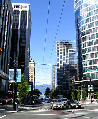
Burrard Street is a major thoroughfare in Vancouver, British Columbia, Canada. It is the central street of Downtown Vancouver and the Financial District. The street is named for Burrard Inlet, located at its northern terminus, which in turn is named for Sir Harry Burrard-Neale.

<span class="mw-page-title-main">Marpole</span> Neighbourhood in Vancouver, British Columbia, Canada

Marpole, originally a Musqueam village named c̓əsnaʔəm, is a mostly residential neighbourhood of 23,832 in 2011, located on the southern edge of the city of Vancouver, British Columbia, immediately northeast of Vancouver International Airport, and is approximately bordered by Angus Drive to the west, 57th Avenue to the north, Ontario Street to the east and the Fraser River to the south. It has undergone many changes in the 20th century, with the influx of traffic and development associated with the construction of the Oak Street Bridge and the Arthur Laing Bridge.

<span class="mw-page-title-main">Oakridge Centre</span> Shopping mall in British Columbia, Canada

Oakridge Park is a shopping centre in development in the Oakridge neighborhood of Vancouver, British Columbia, Canada. It is located at the intersection of West 41st Avenue and Cambie Street.

<span class="mw-page-title-main">Marine Drive station</span> Metro Vancouver SkyTrain station

Marine Drive is an elevated station on the Canada Line of Metro Vancouver's SkyTrain rapid transit system. The station is located at the intersection of Cambie Street and SW Marine Drive in Vancouver, British Columbia.

<span class="mw-page-title-main">Langara–49th Avenue station</span> Metro Vancouver SkyTrain station

Langara–49th Avenue is an underground station on the Canada Line of Metro Vancouver's SkyTrain rapid transit system. It is located at the intersection of West 49th Avenue and Cambie Street in Vancouver, British Columbia, Canada. The station serves the southern portion of the Oakridge neighbourhood, primarily the Langara community that surrounds the station, and is within walking distance of Langara College and the Langara Golf Course.

<span class="mw-page-title-main">Oakridge–41st Avenue station</span> Metro Vancouver SkyTrain station

Oakridge–41st Avenue is an underground station on the Canada Line of Metro Vancouver's SkyTrain rapid transit system. It is located at the intersection of West 41st Avenue and Cambie Street in Vancouver, British Columbia, Canada.

<span class="mw-page-title-main">Oakridge, Vancouver</span> Neighbourhood in Vancouver, British Columbia, Canada

Oakridge is a neighbourhood in Vancouver, British Columbia, Canada, with a multicultural residential and commercial area. It had a population of 13,030 in 2016, of which approximately 50 percent have Chinese as their mother tongue.

Vancouver Talmud Torah (VTT) is a Jewish community day school located in Vancouver, British Columbia, Canada serving students from preschool to grade 7.

<span class="mw-page-title-main">South Cambie</span>

South Cambie is a neighbourhood in the city of Vancouver, British Columbia, Canada, that is generally considered one of the smallest neighbourhoods in the city, both in size and in population. It is wedged between one of the city's largest parks and the upscale neighbourhood of Shaughnessy, and is known for a large cluster of medical facilities.

<span class="mw-page-title-main">Knight Street</span>

Knight Street is a major north-south roadway in Vancouver and Richmond, British Columbia, Canada. It is a four-to-six lane freeway from Westminster Highway in Richmond to Marine Drive in Vancouver, thus serving as an alternate way to exit Vancouver southbound, rather than the Granville Street/Oak Street corridor. Upon entering Vancouver, Knight Street provides major access routes to East Vancouver; at 14th Avenue, the road turns into Clark Drive, and runs northbound until it reaches the Port of Vancouver at Burrard Inlet. It is the busiest truck route in Vancouver, and a key link between Vancouver and its neighbours to the south.

<span class="mw-page-title-main">King David School, Vancouver</span> Independent jewish day school in Vancouver, British Columbia, Canada

King David High School is a pluralistic Jewish community high school in Vancouver, British Columbia. The high school offers comprehensive general and Judaic studies programs, enabling students to benefit from both the product and the process of learning.

<span class="mw-page-title-main">Georgia Street</span> Canadian urban road in Vancouver and Burnaby

Georgia Street is an east–west street in the cities of Vancouver and Burnaby, British Columbia, Canada. Its section in Downtown Vancouver, designated West Georgia Street, serves as one of the primary streets for the financial and central business districts, and is the major transportation corridor connecting downtown Vancouver with the North Shore by way of the Lions Gate Bridge. The remainder of the street, known as East Georgia Street between Main Street and Boundary Road and simply Georgia Street within Burnaby, is more residential in character, and is discontinuous at several points.

<span class="mw-page-title-main">Broadway (Vancouver)</span> Thoroughfare in Vancouver, British Columbia

Broadway is a major east–west thoroughfare in the city of Vancouver, British Columbia, Canada. In Vancouver's numbered avenue grid system, it runs in place of a 9th Avenue, between 8th and 10th. The street has six lanes for most of its course. Portions of the street carry the British Columbia Highway 7 designation.

<span class="mw-page-title-main">Congregation Schara Tzedeck</span>

Congregation Schara Tzedeck is an Modern Orthodox synagogue located in Vancouver, British Columbia, Canada. The synagogue is the oldest synagogue and the largest Orthodox synagogue in Greater Vancouver. From Hebrew, the transliteration of the synagogue's name is the "Gates of Righteousness".

The history of the Jews in Vancouver in British Columbia, Canada has been noted since the mid-19th century.

<span class="mw-page-title-main">R4 41st Ave</span> Express bus service in Metro Vancouver, Canada

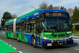
The R4 41st Ave is an express bus route with bus rapid transit elements in Metro Vancouver, British Columbia, Canada. Part of TransLink's RapidBus network, it replaced the 43 Express that travelled along 41st Avenue, a major east–west route that connects the University of British Columbia (UBC) to the SkyTrain system's Oakridge–41st Avenue station on the Canada Line and Joyce–Collingwood station on the Expo Line.

The SkyTrain rapid transit system in Greater Vancouver, Canada, was conceived as a legacy project of Expo 86 and was finished in time to showcase the fair's theme: "Transportation and Communication: World in Motion – World in Touch". Construction was funded by the provincial and federal governments. Vancouver had plans as early as the 1950s to build a monorail system, with modernist architect Wells Coates pencilled in to design it; that project was abandoned. The lack of a rapid transit system was said to be the cause of traffic problems in the 1970s, and the municipal government could not fund the construction of such a system. During the same period, Urban Transportation Development Corporation, then an Ontario crown corporation, was developing a new rapid transit technology known as an "Intermediate Capacity Transit System". In 1980, the need for rapid transit was great, and Ontario needed buyers for its new technology. "Advanced Rapid Transit" was selected to be built in Vancouver to showcase the Ontario project at Expo 86.

<span class="mw-page-title-main">Vancouver Granville</span> Federal electoral district in British Columbia, Canada

Vancouver Granville is a federal electoral district in British Columbia, Canada, that has been represented in the House of Commons of Canada since 2015. The district includes all or significant portions of the Kerrisdale, Marpole, Oakridge, Shaughnessy, South Cambie, Fairview and Riley Park–Little Mountain neighbourhoods. Based on the Canada 2011 Census data, the population of the district is 99,886.

References

Template:Attached KML/Oak Street (Vancouver)
KML is from Wikidata
  1. 1 2 Google (August 4, 2021). "Oak Street (Vancouver)" (Map). Google Maps . Google. Retrieved August 4, 2021.
  2. "Numbered Routes in British Columbia". British Columbia Ministry of Transportation and Infrastructure. 2012-12-05. Retrieved 2013-01-03.
  3. 1 2 Walker (1999), p.95
  4. Hiebert (1999), p.37
  5. "First Jewish Community Centre". Jewish Museum and Archives of British Columbia. Archived from the original on 2013-02-19. Retrieved 2013-01-04.
  6. 1 2 Hiebert (1999), p.40
  7. 1 2 "Vancouver". Jewish Virtual Library. Retrieved 2013-01-04.
  8. "Congregation Schara Tzedeck - History". Congregation Schara Tzedeck. Archived from the original on 2012-07-30. Retrieved 2013-01-04.
  9. Hiebert (1999), p.50
  10. Cohen (2001), p.ii
  11. Cohen (2001), pp.287, 310
Bibliography