Oakwood, Oklahoma

Last updated

Oakwood, Oklahoma
OKMap-doton-Oakwood.PNG
Location of Oakwood, Oklahoma
Coordinates: 35°55′54″N98°42′11″W / 35.93167°N 98.70306°W / 35.93167; -98.70306
Country United States
State Oklahoma
County Dewey
Area
[1]
  Total0.24 sq mi (0.61 km2)
  Land0.24 sq mi (0.61 km2)
  Water0.00 sq mi (0.00 km2)
Elevation
[2]
1,841 ft (561 m)
Population
 (2020)
  Total74
  Density312.24/sq mi (120.74/km2)
Time zone UTC-6 (Central (CST))
  Summer (DST) UTC-5 (CDT)
ZIP code
73658
Area code 580
FIPS code 40-53600 [3]
GNIS feature ID2413070 [2]

Oakwood is a town in Dewey County, Oklahoma, United States. The population was 74 as of the 2020 United States census, [4] an increase of about 13.8% from the population of 65 reported by the 2010 census. [5]

Contents

Geography

Oakwood is located in eastern Dewey County just southwest of U.S. Routes 270 and 281, which lead 20 miles (32 km) northwest to Seiling and southeast 19 miles (31 km) to Watonga.

According to the United States Census Bureau, Oakwood has a total area of 0.23 square miles (0.6 km2), all land. [5]

Demographics

Historical population
CensusPop.Note
1910 199
1920 22412.6%
1930 26618.8%
1940 233−12.4%
1950 161−30.9%
1960 122−24.2%
1970 1295.7%
1980 1408.5%
1990 107−23.6%
2000 72−32.7%
2010 65−9.7%
2020 7413.8%
U.S. Decennial Census [6]

As of the census [3] of 2000, there were 72 people, 35 households, and 17 families residing in the town. The population density was 305.8 inhabitants per square mile (118.1/km2). There were 48 housing units at an average density of 203.9 per square mile (78.7/km2). The racial makeup of the town was 94.44% White, 1.39% Native American, 1.39% from other races, and 2.78% from two or more races. Hispanic or Latino of any race were 1.39% of the population.

There were 35 households, out of which 22.9% had children under the age of 18 living with them, 42.9% were married couples living together, 2.9% had a female householder with no husband present, and 48.6% were non-families. 42.9% of all households were made up of individuals, and 20.0% had someone living alone who was 65 years of age or older. The average household size was 2.06 and the average family size was 2.83.

In the town, the population was spread out, with 16.7% under the age of 18, 12.5% from 18 to 24, 19.4% from 25 to 44, 29.2% from 45 to 64, and 22.2% who were 65 years of age or older. The median age was 47 years. For every 100 females, there were 89.5 males. For every 100 females age 18 and over, there were 106.9 males.

The median income for a household in the town was $18,125, and the median income for a family was $36,875. Males had a median income of $16,250 versus $30,625 for females. The per capita income for the town was $21,254. There were 18.2% of families and 22.0% of the population living below the poverty line, including no under eighteens and 50.0% of those over 64.

Related Research Articles

<span class="mw-page-title-main">Washington County, Oklahoma</span> County in Oklahoma, United States

Washington County is a county located in the northeastern part of the U.S. state of Oklahoma. As of the 2020 census, the population was 52,455. Its county seat is Bartlesville. Named for President George Washington, it is the smallest county in Oklahoma in total area, adjacent to the largest county in Oklahoma, Osage County.

<span class="mw-page-title-main">Dewey County, Oklahoma</span> County in Oklahoma, United States

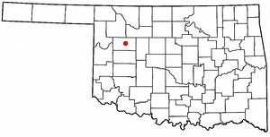
Dewey County is a county in the western part of the U.S. state of Oklahoma. As of the 2020 census, the population was 4,484. Its county seat is Taloga. The county was created in 1891 as "County D". In an 1898 election, county voters chose the name Dewey, honoring Admiral George Dewey.

<span class="mw-page-title-main">Oakwood, Cuyahoga County, Ohio</span> Village in Ohio, United States

Oakwood is a village in Cuyahoga County, Ohio, United States. The population was 3,572 at the 2020 census. An eastern suburb of Cleveland, it is a part of the Cleveland metropolitan area.

<span class="mw-page-title-main">Carter, Oklahoma</span> Town in Oklahoma, United States

Carter is a town in Beckham County, Oklahoma, United States. The population was 183 at the time of the 2020 census.

<span class="mw-page-title-main">Springer, Oklahoma</span> Town in Oklahoma, United States

Springer is a town in Carter County, Oklahoma, United States. As of the 2020 census, the community had 685 residents. It is part of the Ardmore, Oklahoma Micropolitan Statistical Area.

<span class="mw-page-title-main">Lawrence Creek, Oklahoma</span> Town in Oklahoma, United States

Lawrence Creek is a town in Creek County, Oklahoma, United States. Incorporated March 15, 1983, it is primarily a bedroom community whose employed residents work in Sapulpa and Tulsa. The population was 149 at the 2010 census, a gain of 25.2 percent over the figure of 119 recorded in 2000.

<span class="mw-page-title-main">Camargo, Oklahoma</span> City in Oklahoma, United States

Camargo is a town in Dewey County, Oklahoma, United States. The population was 193 as of the 2020 United States census, an increase over the 178 reported at the 2010 census, and the figure of 115 reported in 2000.

<span class="mw-page-title-main">Leedey, Oklahoma</span> Town in Oklahoma, United States

Leedey is a town in Dewey County, Oklahoma, United States. The population was 415 at the 2020 census.

<span class="mw-page-title-main">Putnam, Oklahoma</span> Town in Oklahoma, United States

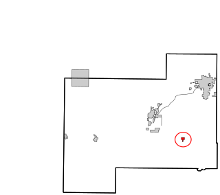
Putnam is a town in Dewey County, Oklahoma, United States. The population was 30 as of the 2020 United States census. The community lies along U.S. Route 183.

<span class="mw-page-title-main">Taloga, Oklahoma</span> Town in Oklahoma, United States

Taloga is a town in Dewey County, Oklahoma, United States. The population was 288 at the time of the 2020 census.

<span class="mw-page-title-main">Vici, Oklahoma</span> Town in Oklahoma, United States

Vici is a town in Dewey County, Oklahoma, United States. The population was 611 at the time of the 2020 census. No information appears on the origins of the town name, but Vici is Latin for “I conquered.”

<span class="mw-page-title-main">Renfrow, Oklahoma</span> Town in Oklahoma, United States

Renfrow is a town in Grant County, Oklahoma, United States. The population was 12 at the 2010 census, a decline of 33.3 percent from the figure of 16 at the 2000 census.

<span class="mw-page-title-main">Kendrick, Oklahoma</span> Town in Oklahoma, United States

Kendrick is a town in Lincoln County, Oklahoma, United States. The population was 139 at the 2010 census.

<span class="mw-page-title-main">Meeker, Oklahoma</span> Town in Oklahoma, United States

Meeker is a town in Lincoln County, Oklahoma, United States. The population was 1,145 at the 2010 census.

<span class="mw-page-title-main">Cole, Oklahoma</span> Town in Oklahoma, United States

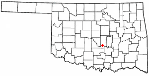
Cole is a town in McClain County, Oklahoma, United States. The population was 624 at the 2020 census, up from 555 at the 2010 census.

St. Louis is a town in Pottawatomie County, Oklahoma, United States. The population was 121 by the 2020 United States census.

<span class="mw-page-title-main">Wanette, Oklahoma</span> Town in Oklahoma, United States

Wanette is a town in Pottawatomie County, Oklahoma, United States. The population was 279 at the time of the 2020 Census. Wanette is part of the Purcell-Lexington retail trade area and is within the Greater Oklahoma City Metropolitan Area.

Dewey is a city in Washington County, Oklahoma, United States. The population was 3,179 at the 2000 census and 3,432 at the 2010 census, an increase of 8 percent. It is located near the north side of Bartlesville.

<span class="mw-page-title-main">Dewey, Portage County, Wisconsin</span> Town in Wisconsin, United States

Dewey is a town in Portage County, Wisconsin, United States. The population was 975 at the 2000 census. The unincorporated community of Torun is located in the town.

Arcadia is a town in Trempealeau County, Wisconsin, United States. The population was 3,737 at the 2020 census. The unincorporated communities of Dewey Corners, North Creek, and Tamarack are located in the town. The ghost towns of Cortland and Williamsburg were also located in the town.

References

  1. "ArcGIS REST Services Directory". United States Census Bureau. Retrieved September 20, 2022.
  2. 1 2 U.S. Geological Survey Geographic Names Information System: Oakwood, Oklahoma
  3. 1 2 "U.S. Census website". United States Census Bureau . Retrieved January 31, 2008.
  4. "Oakwood (town), Oklahoma". United States Census Bureau. Retrieved March 16, 2024.
  5. 1 2 "Geographic Identifiers: 2010 Demographic Profile Data (G001): Oakwood town, Oklahoma". U.S. Census Bureau, American Factfinder. Archived from the original on February 13, 2020. Retrieved December 11, 2015.
  6. "Census of Population and Housing". Census.gov. Retrieved June 4, 2015.