Oberwaltersdorf

Last updated
Oberwaltersdorf
Oberwaltersdorf Kirche, Europabrunnen.jpg
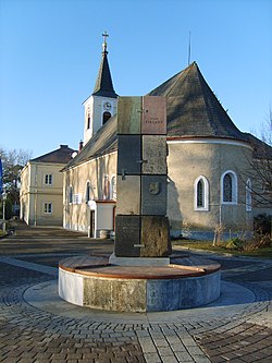
The Europe Well and the parish church in Oberwaltersdorf
AUT Oberwaltersdorf COA.jpg
Austria adm location map.svg
Red pog.svg
Oberwaltersdorf
Location within Austria
Coordinates: 47°59′N16°20′E / 47.983°N 16.333°E / 47.983; 16.333 Coordinates: 47°59′N16°20′E / 47.983°N 16.333°E / 47.983; 16.333
Country Austria
State Lower Austria
District Baden
Government
   Mayor Helene Auer
Area
[1]
  Total13.58 km2 (5.24 sq mi)
Elevation
214 m (702 ft)
Population
 (2018-01-01) [2]
  Total4,618
  Density340/km2 (880/sq mi)
Time zone UTC+1 (CET)
  Summer (DST) UTC+2 (CEST)
Postal code
2522
Area code 02253
Website www.oberwaltersdorf.at

Oberwaltersdorf is a town in the district of Baden in Lower Austria in Austria.

Population

Historical population
YearPop.±%
19712,020    
19812,030+0.5%
19912,416+19.0%
20013,343+38.4%
20113,939+17.8%

Related Research Articles

Horn, Austria Place in Lower Austria, Austria

Horn is a small town in the Waldviertel in Lower Austria, Austria and the capital of the district of the same name.

Wolfurt Place in Vorarlberg, Austria

Wolfurt is a municipality in the western Austrian state of Vorarlberg.

Weiz Place in Styria, Austria

Weiz is a town in the eastern part of the Austrian state of Styria.

Gutenstein, Austria Place in Lower Austria, Austria

Gutenstein is a market town in Wiener Neustadt-Land in the Austrian state of Lower Austria.

Bartholomäberg Place in Vorarlberg, Austria

Bartholomäberg is a municipality and a village in the district of Bludenz in the Austrian state of Vorarlberg.

Bildstein Place in Vorarlberg, Austria

Bildstein is a municipality in the district of Bregenz in the Austrian state of Vorarlberg.

St. Valentin Place in Lower Austria, Austria

St. Valentin is the most westerly town in the district of Amstetten in Lower Austria in Austria.

Herzogenburg Place in Lower Austria, Austria

Herzogenburg is a town in the district of Sankt Pölten-Land in the Austrian state of Lower Austria.

Traismauer is a municipality in the district of Sankt Pölten-Land in Lower Austria, Austria. It was established by the Romans, probably on a location of prior settlements. Some Roman buildings survive to this day.

Bad Erlach Place in Lower Austria, Austria

Bad Erlach is a municipality in the district of Wiener Neustadt-Land in the Austrian state of Lower Austria.

Bludesch Place in Vorarlberg, Austria

Bludesch is a municipality in the district of Bludenz in the Austrian state of Vorarlberg.

Dalaas Place in Vorarlberg, Austria

Dalaas is a municipality in the district of Bludenz in the Austrian state of Vorarlberg.

Lorüns Place in Vorarlberg, Austria

Lorüns is a municipality in the district of Bludenz in the Austrian state of Vorarlberg.

Silbertal Place in Vorarlberg, Austria

Silbertal is a municipality in the district of Bludenz in the Austrian state of Vorarlberg.

Sonntag, Austria Place in Vorarlberg, Austria

Sonntag is a municipality in the district of Bludenz in the Austrian state of Vorarlberg.

Höchst, Austria Place in Vorarlberg, Austria

Höchst is a municipality in the district of Bregenz in the Austrian state of Vorarlberg.

Altschwendt Place in Upper Austria, Austria

Altschwendt is a municipality in the district of Schärding in the Austrian state of Upper Austria.

Schwanenstadt Place in Upper Austria, Austria

Schwanenstadt is a town in the district of Vöcklabruck in the Austrian state of Upper Austria.

Hartl is a municipality in the district of Hartberg-Fürstenfeld in Styria, Austria.

Bad Waltersdorf Place in Styria, Austria

Bad Waltersdorf is a municipality in the district of Hartberg-Fürstenfeld in Styria, Austria.

References

  1. "Dauersiedlungsraum der Gemeinden Politischen Bezirke und Bundesländer - Gebietsstand 1.1.2018". Statistics Austria. Retrieved 10 March 2019.
  2. "Einwohnerzahl 1.1.2018 nach Gemeinden mit Status, Gebietsstand 1.1.2018". Statistics Austria. Retrieved 9 March 2019.