Occoquan River

Last updated
Occoquan River
Tributary to Potomac River
Occoquan River in Fountainhead Regional Park.jpg
Occoquan River near Fountainhead Regional Park
USA Virginia relief location map.svg
Red pog.svg
Location of Occoquan River mouth
Usa edcp relief location map.png
Red pog.svg
Occoquan River (the United States)
Location
Country United States
State Virginia
County Fairfax
Prince William
Town Occoquan
Physical characteristics
Sourceconfluence of Broad Run and Cedar Run [1]
  location Brentsville, Virginia
  coordinates 38°41′17″N077°29′19″W / 38.68806°N 77.48861°W / 38.68806; -77.48861 [2]
  elevation149 ft (45 m) [2]
Mouth Potomac River
  location
Belmont Bay, about 2 miles southeast of Woodbridge, Virginia [1]
  coordinates
38°39′15″N077°13′34″W / 38.65417°N 77.22611°W / 38.65417; -77.22611 [2]
  elevation
0 ft (0 m) [1]
Length26.81 mi (43.15 km) [3]
Basin size616.11 square miles (1,595.7 km2) [4]
Discharge 
  location Potomac River
  average775.94 cu ft/s (21.972 m3/s) at mouth with Potomac River [4]
Basin features
Progressionnortheast then southeast [3]
River system Potomac River
Tributaries 
  leftBroad Run, Piney Branch, Cabin Run, Bull Run, Wolf Run, Stillwell Run, Sandy Run, Elkhorn Run, Massey Creek
  rightCedar Run, Purcell Branch, Champs Mill Branch, Crooked Creek, Airport Creek, Hooes Run
WaterbodiesLake Jackson
Occoquan Reservoir
BridgesVA 234, VA 294, VA 663, VA 123, I-95, US 1


The Occoquan River is a tributary of the Potomac River in Northern Virginia, where it serves as part of the boundary between Fairfax and Prince William counties. The river is a scenic area, and several local high schools and colleges use the river for the sport of rowing. [5]

Contents

Watershed

The river is 24.7 miles (39.8 km) long, [6] and its watershed covers about 590 square miles (1,528 km2). It is formed by the confluence of Broad Run and Cedar Run in Prince William County; Bull Run, which forms Prince William County's boundary with Loudoun and the northerly part of Fairfax counties, enters it east-southeast of Manassas, as the Occoquan turns to the southeast. It reaches the Potomac at Belmont Bay. The Occoquan River is part of the Chesapeake Bay watershed. The name Occoquan is derived from a Doeg Algonquian word translated as "at the end of the water". [7]

History

Wolf Run Shoals on the Occoquan. Wolf Run Shoals.jpg
Wolf Run Shoals on the Occoquan.

Geographers, foremost Harm de Blij, defined the river as the most apt border between the American North and American South. Wolf Run Shoals was an important crossing point on the Occoquan between Alexandria and Richmond during the 18th and 19th centuries. It consisted of three islands and a mill, now submerged under the Occoquan due to higher water levels following damming for flood control, water supply, and power generation. [8]

Between c. 1900 and 1976, the Occoquan was frequently called "Occoquan Creek," but a campaign to restore its status as a river was successfully conducted by Rosemary Selecman. [9]

Dams

The Occoquan has three dams along its length. The first is at the town of Occoquan, a reservoir belonging to the Fairfax County Water Authority, which serves as a source of drinking water for parts of Fairfax and Prince William counties. The Occoquan Reservoir stretches from Occoquan to Bull Run. Further upriver is Lake Jackson. The dam that creates Lake Jackson is at Virginia State Route 234, Dumfries Road, and is a former hydroelectric facility. Today the dam contains the lake, but has not produced electricity in several decades. There is a third dam up Broad Run from its confluence with Cedar Run; this dam forms Lake Manassas, which is the primary water supply for the city of Manassas.

Parks

Sandy Run Regional Park is at Fairfax Station and consists of the northeastern arm of the Occoquan Reservoir. The park is used exclusively for the education, practice, and competition of rowing. The high schools who use this park for rowing are members of the Virginia Scholastic Rowing Association (VASRA). The member schools which call this park their home are Robinson Secondary School, W. T. Woodson High School, Thomas Jefferson High School for Science and Technology, James Madison High School, Fairfax High School, Oakton High School, West Springfield High School, Langley High School, Justice High School, and South County Secondary School.

Fountainhead Regional Park is also in Fairfax Station, further upriver from Sandy Run Regional Park, past Bull Run. Lake Braddock Secondary School, Westfield High School and (Virginia)], also VASRA members, use the park for rowing.

The Occoquan River is bordered by three parks administered by the Northern Virginia Regional Park Authority. The three parks are Bull Run, Occoquan, and Fountainhead. In addition to horse riding, trailing cycling, fishing and boating access, the Bull Run to Occoquan trail travels through all three parks from the beginning of the river to its end. The Oxford Boathouse hosts Hylton High School, Potomac High School, Gar-Field High School, and Forest Park High School Woodbridge High School and Colgan High school.

See also

Related Research Articles

<span class="mw-page-title-main">Prince William County, Virginia</span> County in Virginia, United States

Prince William County lies beside the Potomac River in the U.S. state of Virginia. At the 2020 census, the population was 482,204, making it Virginia's second most populous county. The county seat is the independent city of Manassas.

<span class="mw-page-title-main">Clifton, Virginia</span> Town in Virginia, United States

Clifton is an incorporated town located in southwestern Fairfax County, Virginia, United States, with a population of 243 at the time of the 2020 census.

<span class="mw-page-title-main">Woodbridge, Virginia</span> Census-designated place in Virginia, United States

Woodbridge is a census-designated place (CDP) in Prince William County, Virginia, United States, located 20 miles (32 km) south of Washington, D.C. Bounded by the Occoquan and Potomac rivers, Woodbridge had 44,668 residents at the 2020 census.

Bull Run or Bullrun may refer to:

The Potomac Heritage Trail, also known as the Potomac Heritage National Scenic Trail or the PHT, is a designated National Scenic Trail corridor spanning parts of the mid-Atlantic region of the United States that will connect various trails and historic sites in Virginia, Maryland, Pennsylvania, and the District of Columbia. The trail network includes 710 miles (1,140 km) of existing and planned sections, tracing the natural, historical, and cultural features of the Potomac River corridor, the upper Ohio River watershed in Pennsylvania and western Maryland, and a portion of the Rappahannock River watershed in Virginia. The trail is managed by the National Park Service and is one of three National Trails that are official NPS units.

NOVA Parks is an inter-jurisdictional organization that owns and operates more than 10,000 acres of woodlands, streams, parks, trails, nature reserves, countryside and historic sites in Northern Virginia in the United States. The Authority was organized in 1959. NOVA Parks presently operates 34 regional parks.

<span class="mw-page-title-main">Bull Run (Occoquan River tributary)</span> River in Virginia, United States


Bull Run is a 31.8-mile-long (51.2 km) tributary of the Occoquan River that originates from a spring in the Bull Run Mountains in Loudoun County, Virginia, and flows south to the Occoquan River. Bull Run serves as the boundary between Loudoun County and Prince William County, and between Fairfax County and Prince William County.

<span class="mw-page-title-main">Fountainhead Regional Park</span>

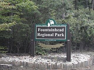
Fountainhead Regional Park is an approximately 2,000 acre regional park, bordering a tributary of the Potomac River, in Fairfax County, northern Virginia.

The Millard H. Robbins, Jr. Water Reclamation Plant, which is operated by the Upper Occoquan Service Authority (UOSA), is located in Centreville, Virginia and it was formerly known as the Upper Occoquan Sewage Authority. UOSA serves the western portions of Fairfax and Prince William Counties, and the Cities of Manassas and Manassas Park. The sewage treatment plant includes primary-secondary treatment and the following advanced wastewater treatment processes: chemical clarification, two-stage recarbonation with intermediate settling, multimedia filtration, granular activated carbon adsorption, chlorination for disinfection and dechlorination. The plant’s rated capacity is 54 million US gallons (200,000 m3) per day (mgd).

<span class="mw-page-title-main">Pohick Creek</span> Stream in Virginia, USA

Pohick Creek is a 14.0-mile-long (22.5 km) tributary stream of the Potomac River in Fairfax County in the U.S. state of Virginia. It takes its name from the Pohick Native American tribe once prevalent in the area.

<span class="mw-page-title-main">Difficult Run</span> River in Northern Virginia, United States

Difficult Run is a 15.9-mile-long (25.6 km) tributary stream of the Potomac River in Northern Virginia in the United States. The area has had many historical uses dating back to the early 1800s. Today, the area is used recreationally by visitors interested in the watershed's variety of options including hiking, biking, fishing, boating, climbing, and bird watching. The wildlife at Difficult Run is vast as 163 different species can be seen depending on the season. There are 41 different soil types found on the trail and alongside the stream. The stream is part of the greater 57.7- square-mile Drainage basin, or watershed, located in the north-central portion of Fairfax County and drains directly to the Potomac River.

<span class="mw-page-title-main">Broad Run (Loudoun County, Virginia)</span> River in Virginia, United States

Broad Run is a tributary of the Potomac River in Loudoun County, Virginia. The creek, located between Goose Creek and Sugarland Run, principally drains portions of eastern Loudoun County, as well as a small portion of western Fairfax County.

<span class="mw-page-title-main">Virginia State Route 612 (Fairfax and Prince William Counties)</span> Secondary state highway in Virginia, United States

State Route 612 in Fairfax and Prince William Counties, Virginia is a secondary state highway. The two counties are separated by water, so SR 612 contains a bridge that is one of only eight crossings between the counties. Because of this, SR 612 is heavily traveled during rush hour.

<span class="mw-page-title-main">Occoquan Reservoir</span> Reservoir in Fairfax County and Prince William County, Virginia

Occoquan Reservoir is a 2,100-acre (850 ha) reservoir in northeast Virginia, southwest of Washington, D.C., straddling part of the boundary between Fairfax County and Prince William County, west of Alexandria. It is formed by the Occoquan Dam on the Occoquan River.

<span class="mw-page-title-main">Virginia Scholastic Rowing Association</span>

The Virginia Scholastic Rowing Association (VASRA) is a 501(c)(3) that promotes and supports scholastic rowing in Virginia and sponsors and conducts competitive rowing regattas for high schools in Virginia.

<span class="mw-page-title-main">County Center, Virginia</span> CDP in Virginia, United States

County Center is a census-designated place in Prince William County, Virginia, United States. The population as of the 2010 Census was 3,270. In 2021, the United States Census Bureau estimated it to be 4,045. It is notable for including the county's McCoart Government Center off Prince William Parkway, along with adjoining Pfitzner Stadium, former home field of the Potomac Nationals, now the Fredericksburg Nationals.

<span class="mw-page-title-main">Bull Run-Occoquan Trail</span>

The Bull Run-Occoquan Trail (BROT) is a hiking trail in the U.S. state of Virginia. Designated in 2006 as a National Recreation Trail, the Bull Run-Occoquan Trail invites hikers and horseback riders to discover more than 4,000 acres of scenic woodlands.

The Cameron Run Watershed (CRW) is a highly urbanized, 44 square-mile watershed located in Northern Virginia. "The region is completely urbanized with nearly 95 percent of the watershed developed with mixed residential and commercial use". Seventy-five percent of the watershed lies in Fairfax County, and the rest lies in Arlington County and the cities of Falls Church and Alexandria. In addition to several streams (called “runs”), there are two lakes—Lake Barcroft (137 acres) and Fairview Lake (15 acres)—and four ponds. There are eight sub-watersheds within the CRW. The western part of the CRW lies within the Piedmont; the southeastern part in the Coastal Plain.

<span class="mw-page-title-main">Holmes Run</span> River in Virginia, United States

Holmes Run is a stream in the Cameron Run Watershed in Northern Virginia. It runs through Fairfax County and the City of Alexandria. It is a first-order tributary of the Potomac River.

References

  1. 1 2 3 "Map Viewer". www.arcgis.com. US Geological Survey. Retrieved May 2, 2024.
  2. 1 2 3 "Occoquan River". Geographic Names Information System . United States Geological Survey, United States Department of the Interior . Retrieved May 2, 2024.
  3. 1 2 "ArcGIS Web Application". epa.maps.arcgis.com. US EPA. Retrieved May 2, 2024.
  4. 1 2 "Occoquan River Watershed Report". watersgeo.epa.gov. US EPA. Retrieved May 2, 2024.
  5. "Sandy Run Regional Park". NOVA Parks. Retrieved 2023-06-13.
  6. U.S. Geological Survey. National Hydrography Dataset high-resolution flowline data. The National Map, accessed August 15, 2011
  7. "History of the Occoquan". Friends of the Occoquan. Retrieved 2008-11-08.
  8. "Wolf Run Shoals". 9 August 2009. Retrieved 2019-07-14.
  9. "Lorton History - One Woman's Campaign". 19 January 2011.