Okun people

Last updated
Okun
Total population
804,945 (2011)
Regions with significant populations
Kogi State - 804,945
 · Ijumu  : 137,790
 · Yagba West  : 162,570
 · Yagba East  : 171,530
 · Kabba/Bunu  : 167,980
 · Lokoja (50%): 114,235
 · Mopa - Muro  : 50,840
Related ethnic groups
Èkìtì, Àkókó, Ìgbómìnà,
Other Yoruba people

The Okun people are a Yoruba speaking people found majorly in Kogi, but with settlements in Kwara, Ekiti, and Ondo states of Nigeria. [1] Their dialects are generally classified in the Northeast Yoruba language (NEY) grouping. [2] They are collectively called "Okun", which in Okun dialects could mean "Sorry", "Well-done", or as an all-encompassing greeting. Similarly, this form of greeting is also found among the Ekiti and Igbomina groups of Yoruba people. It is also a mode of greeting among the Ijesa people of southwestern Nigeria.

Contents

This identity, which was probably first suggested by Eva Kraft-Askari during a 1965 field expedition, has gained wide acceptance among the indigenous Yoruba people and scholars. The individual Okun subgroups share some historical and linguistic affinity but still maintain individual peculiarities. [3] "Okun" therefore refers to the distinct, but culturally related Owé, Ìyàgbà, Addé, Gbẹdẹ, Bùnú or Abunu, Ikiri, and Òwòrò peoples, who together are said to make up 20% of the Kogi State population, according to the highly controversial 2006 National population census. It is also said that their indigenous food is Pounded yam, of which they share with the Ekiti people.

History

The individual historical accounts that state that the Okun people migrated from Ile-Ife is very popular and highly accepted among the people. In the version of Yagba oral tradition for instance, the man who led a group of people to their present location was sent from Ile-Ife to establish the settlement but did not return over a long period to give an account of his expenditure. When he eventually returned and explained that he lost a larger part of his acquired land to some other migrants, he was blamed for the loss. He responded thus in Yoruba, Ìyà àgbà ló jemí, the clause from which the name Iyagba or Yagba was coined.

However, Ade Obayemi posisted that the Okun people are aboriginals in the Niger-Benue confluence and may not have migrated to their present location from Ile-Ife. [4] Based on the above the history of the Okun people can be viewed on epochal basis. The first set of people might have been the aboriginal people who lived in rockshelters such as Itaakpa and Ogbogba hill in Iffe - Ijumu, Udeniwu mountain in Ayere and Ohura hill in Bunuland. This group of people were eventually met on ground when migrants from Oyo - Ile or Ile - Ife wandered into Okunland. thus, the peopling of Okunland is multifaceted and cannot be accounted for on the basis of the migrants from Ile - Ife alone. [5] The turn of events that followed the Nupe military incursion of the 19th century left the Okun people as minorities in the Northern Region of Nigeria, separated from their relatives in the southwest. [6]

Archaeology

Archaeological evidence implies that the Okun people may be native to their territory and linked to the Proto-Yoruba group who lived to the west of the Niger River, contradicting the Ile Ife migration legends. [7] At Ogidi-Ijumu, archaeological evidence from open sites and rock shelters revealed that the region had been inhabited since the Late Stone Age (LSA) of West Africa, circa 2000 BC. This date has not been established by any chronometric dating method. Thus, it is highly speculative in nature. However, potteries and microliths were discovered at the sites, indicating that Modern Humans may have lived there. [8] Similar evidence, including artefacts from the Ceramic Stone Age, which dates to between 300 and 400 BC, was discovered in Iffe-Ijumu. [9] The date from Itaakpa has been used extensively as one of the few evidence of the transition from Stone Age economy to Sedentary lifestyle in Nigeria. Thus from Archaeological perspective, the Okun people have been inhabiting their present locale from the Stone Age period till now. [5]

Geographical location and settlements

Okun land is located within longitude 5° 30' to 7°15' East and latitude 7°15' to 3°45'. They occupy the Niger-Benue confluence area along with the Southern Nupe, Kakanda, Ebira (Panda and Koto), Gbagyi and Igala. To the west of Okun land are the Igbomina and Ekiti Yoruba subgroups. [2]

Historically, Okun people lived in small social-political units with unfixed political boundaries that allowed social, cultural and commercial interaction. Till date, villages of hundreds or a few thousand people are scattered all over Okun land. Okun people are spread across six local government areas in Kogi State, namely: Kabba-Bunu, Yagba-West, Yagba-East, Mopa-Muro, Ìjùmú and Lokoja local government Areas. Settlements include Mopa, Ogidi, Ayetoro Gbede, Okedayo, Odo Ere, Ife, Egbe, Iyara, Iyamoye, Odoape, Ekinrin-Adde, Kabba, Isanlu, Obajana, Ikoyi, Agbaja. [10]

Language

Okun people speak varied Yoruba dialects such as Ikiri, Owé, Ìyàgbà, Addé, Bùnú and Ọwọrọ which are mutually intelligible to a great extent, and a large number of them speaking the Oyo Yoruba. [11] In recent times, there have been efforts into standardizing and reconciling the Okun dialects into a single language that is intelligible to all. The most notable of these efforts is the Okun Bible translated and published by the Bible Society of Nigeria in 2022. [12]

Writing System

The writing system adopted by the Bible Society of Nigeria in producing the translated Okun Bible is based on the modified Latin Yoruba writing script with few exceptions as exemplified in older Okun writings. [13] There is a difference in the manner in which the orthography is written in comparison with the traditional Yoruba and the orthography and phonological system used. In traditional Yoruba, the /x/ sound expressed as "GH" in Okun writing does not exist. In addition, the Okun Bible excludes the use of /ʃ/ despite some sub-dialects having this sound represented.

The full orthographical system used by the Okun Bible translators is expressed below:

A B D E Ẹ F G GB GH H I J K L M N O Ọ P R S T U Y

Example Sentences
EnglishOkunYoruba
The man who planted maizeOkunrin nghò gbẹ agbadoOkunrin to gbin agbado
I sang yesterdayMò kerin li anọMo kọrin li ana
Leave me!Jẹ mi hi[lẹ]!Fi mi silẹ!
I forgot to tell you about itMo hogbe ati wi ghọn ghinMo ti gbagbe lati so fun yin

Culture

The various Okun groups share similar dressing, cuisine, traditional religion, masquerading culture etc. The men practised farming and hunting while the women took care of the home and raised the children. Crops cultivated included coffee, cocoa, yams, cassava, maize, sorghum, groundnuts, beans, and cotton. The Abunu women (and to a lesser extent, their Owe and Ọwọrọ neighbours) were known for the weaving and trade of Aso-Ipo, a red textile used in the burial of the wealthy and for making masquerade dresses. This textile was also an object of trade for the Abunu women to their Ebira neighbours and others. [14]

The Okun people practice Christianity, Islam and traditional African religions. Although Okun people practice the worship of Orisa like Sango and Ogun and the consultation of Ifá (or Ihá) as the other larger Yoruba subgroups, prominence is given to the worship of ebora, believed to be spirits who live in forests, caves, mountains, stream or rivers. [2] Okun people share similar masquerading cultures and these masquerades (egungun or egun) are said to represent ancestral spirits. Although there are masquerades such as the Epa masquerade that are similar to those found among other Yoruba groups, Ina-oko, Onigabon, Ouna and the likes of other masquerades that are ubiquitous in Okun land [15] [16] are not found among the other Yoruba groups but rather found to be similar to those of some non-Okun inhabitants of the Niger-Benue confluence like the Bassa Nges. [4] While the Egungun cult groups are almost exclusive for men, women also had their group called Ofosi (Ohosi in Oworo). Ofosi women spoke a language that was not intelligible locally and were believed to be able to call people home from whatever location by mystical means.

Until the advent of the Nupes in the 19th century, each of the Okun subgroups lacked any form of central government but was organised into small city-states. [6] [17] Each 'state' was governed by leadership rotated amongst the constituent lineages or clans. The central kingship system has led to the establishment of royal stools such as Obaro of Kabba, Olubunu of Bunu, Olujumu of Ijumu, Agbana of Isanlu, Olu of Ọwọrọ. The Obaro of Kabba, Oba Michael Olobayo (Obaro Ero Il), is the chairman of the Okun traditional council. [18] [19]

In the early 20th century the Olu of Ọwọrọ (and head of Ọwọrọ district) was given a supervisory role over non-Okun districts of Kakanda, Kupa and Eggan while the Obaa ro of Kabba had a supervisory role over the other Okun people. [4] Kabba which was used as the administrative and military base of the Nupe expedition, became the capital of the Kabba province of the Northern region and remains the largest and most important town of the Okun people. Despite the similarities pointed out, there are yet identifiable differences in the culture of the various Okun subgroups. Some of these differences can be noticed in language, political arrangements, social institutions and the array of ebora (deities) worshipped. [2]

Cuisine

The Okun people are known to have delicacies. Soups include ora soup (ground dried okra), akuku, and tankelekon soup. These are usually eaten with pounded yam. A popular snack is called adun (fried beans with palm oil and sugar).

Political struggle

Before the creation of Kogi state on 27 August 1991, Okun Yoruba people were in Kwara state alongside some of their Ekiti and the Igbomina neighbours. The perceived continual marginalization of the Okun people in Kogi state has made them call for the creation of a state and propose that it be made part of the southwest geopolitical zone of Nigeria, or the excision of Okun dominated districts/communities from the present Kogi state and addition to a South Western state, with preference for Ekiti. [19] [20]

Notable people

Related Research Articles

<span class="mw-page-title-main">Kogi State</span> State of Nigeria

Kogi State is a state in the North Central region of Nigeria, bordered to the west by the states of Ekiti and Kwara, to the north by the Federal Capital Territory, to the northeast by Nasarawa State, to the northwest by Niger State, to the southwest by the Edo and Ondo states, to the southeast by the states of Anambra and Enugu, and to the east by Benue State. It is the only state in Nigeria to border ten other states. Named for the Hausa word for river (Kogi). Kogi State was formed from parts of Benue State, Niger State, and Kwara State on 27 August 1991. The state is nicknamed the "Confluence State" due to the fact that the confluence of the River Niger and the River Benue occurs next to its capital, Lokoja.
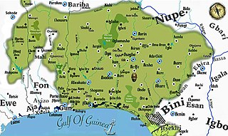
<span class="mw-page-title-main">Yorubaland</span> Cultural region of the Yoruba people in West Africa

Yorubaland is the homeland and cultural region of the Yoruba people in West Africa. It spans the modern-day countries of Nigeria, Togo and Benin, and covers a total land area of 142,114 km2 (54,871 sq mi). Of this land area, 106,016 km2 (74.6%) lies within Nigeria, 18.9% in Benin, and the remaining 6.5% is in Togo. Prior to European colonization, a portion of this area was known as Yoruba country. The geo-cultural space contains an estimated 55 million people, the majority of this population being ethnic Yoruba.

<span class="mw-page-title-main">Lokoja</span> Capital city of Kogi State, Nigeria

Lokoja is a city in Nigeria. It lies at the confluence of the Niger and Benue rivers and is the capital city of Kogi State. While the Yoruba (Oworo), Bassa Nge and Nupe are indigenous to the area, other ethnic groups of Nigeria, including the Kupa-Nupe, Hausa, Ebira, Igala, Igbo, Bini/Edo, and Tiv have recently established themselves. Projected to be the third fastest growing African continent city between 2020 and 2025, with a 5.93% growth. It was listed a second class township by the 1917 township ordinance of the colonial administration. This shows that Lokoja is an old city.
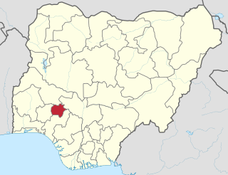
<span class="mw-page-title-main">Ekiti State</span> State of Nigeria

Ekiti State is a state in southwestern Nigeria, bordered to the north by Kwara State for 61 km, to the northeast by Kogi State for 92 km, to the south and southeast by Ondo State, and to the west by Osun State for 84 km. Named for the Ekiti people—the Yoruba subgroup that make up the majority of the state's population—Ekiti State was formed from a part of Ondo State in 1996 and has its capital as the city of Ado-Ekiti.

Kabba is a town in Kogi State in mid west Nigeria. It lies near the Osse River, at the intersection of roads from Lokoja, Okene, Ogidi, Ado-Ekiti, and Egbe. The town is about 295 kilometers away from Abuja. It is 511 kilometers from Lagos.

The Ìgbómìnà are a subgroup of the Yoruba ethnic group, which originates from the north central and southwest Nigeria. They speak a dialect called Ìgbómìnà or Igbonna, classified among the Central Yoruba of the three major Yoruba dialectical areas. The Ìgbómìnà spread across what is now southern Kwara State and northern Osun State. Peripheral areas of the dialectical region have some similarities to the adjoining Ekiti, Ijesha and Oyo dialects.

Òkè-Ìlá Òràngún is an ancient city in southwestern Nigeria that was capital of the middle-age Igbomina-Yoruba city-state of the same name.
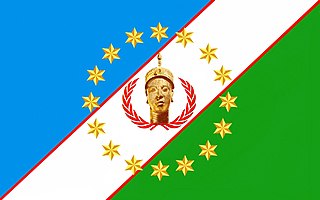
<span class="mw-page-title-main">Yoruba people</span> Ethnic group in West Africa

The Yoruba people are a West African ethnic group who mainly inhabit parts of Nigeria, Benin, and Togo. The areas of these countries primarily inhabited by the Yoruba are often collectively referred to as Yorubaland. The Yoruba constitute more than 48 million people in Africa, are over a million outside the continent, and bear further representation among members of the African diaspora. The vast majority of the Yoruba population is today within the country of Nigeria, where they make up 20.7% of the country's population according to Ethnologue estimations, making them one of the largest ethnic groups in Africa. Most Yoruba people speak the Yoruba language, which is the Niger-Congo language with the largest number of native or L1 speakers.

Ogidi is a Yoruba town in Kogi State, Nigeria, known for its formations of igneous rock mountains, a traditional art industry, hospitality, valor and a deep tradition of self-reliance.

Kabba/Bunu is a Local Government Area in Kogi State, Nigeria. Its headquarters are in the town of Kabba on the A123 highway in the southwest of the area at7°49′43″N6°04′23″E.

Oworo (Aworo) is a dialect of Yoruba spoken mainly in Oworo District of Lokoja LGA, Kogi State Nigeria. It is close to the Abinu (Bunu), Ikiri, Owe, Yagba and Ijumu dialects which are together known as Okun. The Okun dialects are mutually intelligible.

The Ọwọrọ ethnic nationality represents a group of people around the Niger-Benue confluence speaking a Yoruba dialect called Oworo. They are generally classified as part of Northeast Yoruba (NEY) of the Yoruba people.

Ayetoro Gbede (Ayetoro-Gbede) is a town along the Ilorin – Kabba federal highway in Ijumu, a kingdom and local government area in Kogi state, Nigeria. Ayetoro Gbede is located in central Nigeria, approximately 420 kilometers northeast of Lagos, while it is 315 kilometers away from Abuja, the nation's capital. It is 21 kilometers away from Kabba Town. It is in the Kogi west senatorial district and Kabba/Ijumu federal constituency. The town was established over ninety-one years ago. The inhabitants of the town speak their local dialect of Okun and Gbede, which is a Yoruba dialect. The current traditional ruler is Oba Sunday Ehindero.

<span class="mw-page-title-main">Ekiti people</span>

The Ekiti people are one of the largest historical subgroups of the larger Yoruba people of West Africa, located in Nigeria. They are classified as a Central Yoruba group, alongside the Ijesha, Igbomina, Yagba and Ifes. Ekiti State is populated exclusively by Ekiti people; however, it is but a segment of the historic territorial domain of Ekiti-speaking groups, which historically included towns in Ondo State such as Akure, Ilara-Mokin, Ijare, and Igbara-oke. Ogbagi, Irun, Ese, Oyin, Igasi, Afin and Eriti in the Akoko region, as well as some towns in Kwara State, are also culturally Ekiti, although belong in other states today.

Iffe-Ijumu is a town in the Ijumu local government area, located in Kogi State in midwest Nigeria. It lies between Ekinrin-Adde and Ikoyi-Ijumu, along the road from Lokoja to Ado-Ekiti. The town is near Kabba.

<span class="mw-page-title-main">S. A. Ajayi</span> Nigerian statesman

Chief S. A. Ajayi was a Nigerian statesman who played an active role in the negotiations of Nigeria's independence. He was a pioneer politician of Okun land in the old Kabba province, who represented the people of Kabba Division in the Northern region house of Assembly. He played a key role in the establishment of Kabba College of Agriculture, Division of Agricultural Colleges, The University of Northern Nigeria, the establishment of Kabba Teachers College now Federal Government Girls College Kabba in Kabba Province and the creation of Ijumu Division as an administrative headquarters.

Odo Ere, popularly called Ere Gajo, is the headquarters of Yagba West Local Government Area, Kogi State, Nigeria. The town is located in the old Kabba Province about 140 kilometres southeast of Ilorin. The people of Odo Ere share a common ancestry with the Yoruba people in South-West Nigeria and they are often referred to as Okun Yoruba people. The town is situated on a well-watered savannah plain consisting of dotted hills, forest and grassland. The topography earned the town the sobriquet: Ere Ọmọ Onilẹ Dun Rin, meaning "Odo Ere town with a beautiful flat terrain that enhances ease of movement".

Iyáh-Gbẹdẹ is a town located off Km 20 of the Kabba-Ilorin federal highway and along the Ayegunle-Abuji Road. It is in Ijumu local government area of Kogi State, central Nigeria. It is 300 kilometers away from Abuja, the country's capital, 430 kilometers from Lagos, and 23 kilometers from Kabba town. It has the GPS coordinates 7.85674 / 5.94916 and Postcode 261103.

Ekinrin-Adde is a town located in Ijumu L.G.A. of Kogi State, in the Western Senatorial District of Nigeria on latitude 7° 50’N and longitude 5° 50’E at an altitude of 523 metres above sea level. The town is a conglomerate of contiguous villages that amalgamated into one. The people trace their ancestry to Ile-Ife, the cradle of Yoruba civilization. The people are a sub-ethnic group within the Yoruba nationality, who speak a dialect generally referred to as Okun, widely spoken by the five local Government that make up the Kogi West Senatorial District although with slight variation from community to community. The Okun dialect is a sub-dialect of the Yoruba language.

<span class="mw-page-title-main">New Yam Festivals in Nigeria</span>

Yam is a staple food in West Africa and other regions classified as a tuber crop and it is an annual or perennial crop. The New Yam festival is celebrated by almost every ethnic group in Nigeria and is observed annually at the end of June.

References

  1. Obayemi, Ade. "THE SOKOTO JIHAD AND THE 'O-KUN' YORUBA: A REVIEW". Journal of the Historical Society of Nigeria. 9 (2).
  2. 1 2 3 4 Bayo Ijagbemi (1996)"O-OKUN YORUBA IN YORUBA ART HISTORIOGRAPHY: HISTORY, PROBLEMS AND PROSPECTS". PhD Thesis. The University of Arizona
  3. Otitoju, J. (2002) The Okun People of Nigeria. Lagos: WEPCOM Publishers Limited.
  4. 1 2 3 Ann O’Hear (2006)"The History of Okun Yoruba: Research Direction", Yorùbá Identity and Power Politics, Editors: Toyin Falola, Ann Genova, Volume: 22, Publishers: Boydell & Brewer, University of Rochester Press (February 2006) Page 111-126
  5. 1 2 Bakinde C.O.(2013) "Oral Narrations on the Origin and Settlement Patterns of Okun People of Central Nigeria". Journal of tourism and Heritage Studies. Vol 2 No.2
  6. 1 2 Ade Obayemi (1978)"THE SOKOTO JIHAD AND THE 'O-KUN' YORUBA: A REVIEW" Journal of the Historical Society of Nigeria. Vol. 9, No. 2, pp. 61-87. Published by: Historical Society of Nigeria.
  7. Akinwumi Ogundiran (2020). "The Yoruba: A new history". Indiana University Press
  8. Paul-Kolade Tubi (2020). "Anthropological-Archaeological Study of a Late Stone Age Site in Ogidi-Ijumu Northeast Yoruba Land". Journal of African Studies and Sustainable Development
  9. Asakitipi Alex (2001). "Aseye Rockshelter Excavations at Iffe-Ijumu, Kogi State Nigeria". West African Journal of Archaeology (WAJA), 31(1), 31-60
  10. "A Plea For the Creation of OKUN State – Olukoya Obafemi" . Retrieved 19 January 2020.
  11. Arokoyo Bolanle, "A survey of Okun phonology"
  12. Ayanfeoluwa, Providence. "BSN completes full translation of Okun Bible in five years".
  13. Arokoyo, Bolanle. OWÉ REVITALIZATION: A CALL TO ACTION (PDF).
  14. Elisha P. Renne (July, 1992 "Aso Ipo, Red Cloth from Bunu" African Arts.Vol. 25, No. 3, Special Issue: West African Textiles, pp.64-69+102. Published by: UCLA James S. Coleman African Studies Center. DOI: 10.2307/3337002.
  15. Olawole F.Famule( 2005) Art Spirituality: The Ijumu Northeastern-Yoruba Egungun. PhD Dissertation. University of Arizona
  16. , Orungbami T.S. "Oworo People of the Niger-Benue Confluence Area" JHL Nig.Ltd, Lokoja, Nigeria.
  17. Apata Z.O (1995)."ADMINISTRATIVE INTEGRATION AND CONFLICT IN NIGERIA, 1840-1940: THE CASE OF NORTH-EAST YORUBALAND", Trans-African Journal of History Vol. 24, pp. 106–122. Published by: Gideon Were Publications.
  18. NAN, "Council of Chiefs eulogises Obaro of Kabba on his 30th anniversary" "Thisdaylive", Nigeria, October 17, 2015, 4:04 PM, Retrieved 1 January 2016
  19. 1 2 Thisdaylive, "Okun Yoruba Opt to Join South-West" "Thisdaylive", Nigeria, 07 March 2014, Retrieved 14th Dec 2015
  20. Jide Ige.(1999) State Creation and the Minority Question in Nigeria. Issues in Contemporary Political Economy of Nigeria. Editor: Hassan A. Saliu. published by Sally and Associates, Ilorin, Nigeria. ISBN   978-34794-9-0

Further reading