
Bhopal District is a district of Madhya Pradesh state in central India. The city of Bhopal serves as its administrative headquarters. The district is part of Bhopal Division.

Bathinda district is in Malwa region of Punjab, India. The district encompasses an area of 3,385 square kilometers. By area, Bathinda district is the second-largest in Punjab, after Ludhiana district. It is bounded by Faridkot district and Moga district on the north, Muktsar district on the west, Barnala and Mansa districts on the east, and the state of Haryana on the south. Bathinda is cotton producing belt of Punjab.
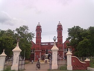
Pudukkottai District is one of the 38 districts of Tamil Nadu state in southern India. The city of Pudukkottai is the district headquarters. It is also known colloquially as Pudhugai.

Perambalur is a town in the Indian state of Tamil Nadu. It is the headquarters of Perambalur district and Perambalur taluk (sub-district). As of 2011 census, the town had a population of 49,648.
Vatsavai is a village in Krishna district of the Indian state of Andhra Pradesh. It is located in Vatsavai mandal of Vijayawada revenue division.
Ankathatti is a village in the state of Karnataka, India, situated 15 km away from Kolar. The village has a population of about 900, with 300 houses. Ankathatti is known for its religious culture, having a 4 ft (1.2 m) height Uthsava Murti, as well as its high production of silk and milk.
Chithara is a village in Kollam district in the state of Kerala, India.
Manikkal is a village in Thiruvananthapuram district in the state of Kerala, India.
Adwadgi is a village in the southern state of Karnataka, India. Administratively, Adwadgi is under Sugooru gram panchayat, Shorapur Taluka of Yadgir district in Karnataka. The village of Adwadgi is 3 km by road northeast of the village of Sugur and 7.5 km by road south of the village of Hemnoor. The nearest railhead is in Yadgir.
Egattur is a neighbourhood in Chennai, India. It is a village in Tiruvallur district of Tamil Nadu, located on the western outskirts of Chennai. In the 2011 census it had a population of 4842 in 1251 households.
Aldhal is a village in Belgaum district in the southern state of Karnataka, India. Administratively, it is part of the Naganur K D gram panchayat in Hukeri Taluka.
Gunji is a village in Belagavi district in the southern state of Karnataka, India.
Ingalagi is a panchayat village in Belgaum district in the southern state of Karnataka, India.
Khemewadi is a village in Belgaum district in Karnataka, India. As of 2011, Khemewadi had a population of 358. 69.44% of the population was literate, male literacy stood at 74.53%, while female literacy stood at 64.42%. A total of 73 houses were counted in 2011.
Kasare, is a small village in Ahmednagar district of Maharashtra, India. This village is located near Takli Dhokeshwar.
Nischintapur is a village in West Bengal, India. Administratively it is under Amta II of Uluberia subdivision, Haora District, West Bengal.
Ganora is a village and a Panchayat in Dewas district in the Indian state of Madhya Pradesh. Dulwa Village is a major agricultural production area in Madhya Pradesh. In the 2011 Census of India its population was reported as 585.
Golpura is a village and a Panchayat in Dewas district in the Indian state of Madhya Pradesh. Dulwa Village is a major agricultural production area in Madhya Pradesh. In the 2011 Census of India its population was reported as 585.
