Omereque Municipality

Last updated
Omereque Municipality
Municipality
Bolivia adm location map.svg
Red pog.svg
Omereque Municipality
Location within Bolivia
Coordinates: 18°2′S65°31′W / 18.033°S 65.517°W / -18.033; -65.517
CountryFlag of Bolivia.svg  Bolivia
Department Cochabamba Department
Province Narciso Campero Province
Seat Omereque
Government
  MayorHector Arce Rodriguez (2007)
  PresidentJulian Rocha Sejas (2007)
Population
 (2001)
  Total6,071
  Ethnicities
Quechuas
Time zone UTC-4 (BOT)

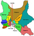
Omereque Municipality is the third municipal section of the Narciso Campero Province in the Cochabamba Department, Bolivia. Its seat is Omereque.

Contents

Cantons

The municipality is divided into six cantons. They are (their seats in parentheses):

Related Research Articles

Cochabamba Department Department of Bolivia

Cochabamba, from Quechua qucha or qhucha, meaning "lake", pampa meaning "plain", is one of the nine departments of Bolivia. It is known to be the "granary" of the country because of its variety of agricultural products from its geographical position. It has an area of 55,631 km2. Its population in the 2012 census was 1,758,143. Its capital is the city of Cochabamba, known as the "City of Eternal Spring" and "The Garden City" because of its spring-like temperatures all year.

Potosí Department Department of Bolivia

Potosí is a department in southwestern Bolivia. It comprises 118,218 km2 with 823,517 inhabitants. The capital is the city of Potosí. It is mostly a barren, mountainous region with one large plateau to the west, where the largest salt flat in the world, Salar de Uyuni, is located.

Sur Lípez Province Province in Potosí Department, Bolivia

Sur Lípez or Sud Lípez is a province in the Potosí Department in Bolivia. The seat of the province is San Pablo de Lípez.

Eloxochitlán de Flores Magón Municipality and town in Oaxaca, Mexico

Eloxochitlán de Flores Magón, formerly known as San Antonio Eloxochitlán, is a city and municipality in the Mexican state of Oaxaca. It is part of the Teotitlán District in the north of the Cañada Region. Approximately 96% of the inhabitants of the municipality speak the indigenous Tecóatl Mazatec.

Tiraque Municipality Municipality in Cochabamba Department, Bolivia

Tiraque Municipality is the first municipal section of the Tiraque Province in the Cochabamba Department, Bolivia. At the time of census 2001 - still including Shinahota Canton - it had a population of 35,017. Its seat is Tiraque.

Chacarilla Municipality Municipality in La Paz Department, Bolivia

Chacarilla Municipality is the third municipal section of the Gualberto Villarroel Province in the La Paz Department, Bolivia. Its seat is Chacarilla. It had 23 inhabitants in 2001.

Pucarani Municipality Municipality in La Paz Department, Bolivia

Pucarani Municipality is the first municipal section of the Los Andes Province in the La Paz Department, Bolivia. Its seat is Pucarani.

Aiquile Municipality Municipality in Cochabamba Department, Bolivia

Aiquile Municipality is the first municipal section of the Narciso Campero Province in the Cochabamba Department, Bolivia. Its seat is Aiquile.

Arque Municipality Municipality in Cochabamba Department, Bolivia

Arque Municipality is the first municipal section of the Arque Province in the Cochabamba Department, Bolivia. Its seat is Arque. At the time of census 2001 the municipality had 11,806 inhabitants. It has the lowest HDI of Bolivia with 0.311.

Cuchumuela Municipality Municipality in Cochabamba Department, Bolivia

Cuchumuela Municipality or Villa Gualberto Villarroel Municipality is the fifth municipal section of the Punata Province in the Cochabamba Department, Bolivia. Its seat is Cuchumuela.

Pasorapa Municipality Municipality in Cochabamba Department, Bolivia

Pasorapa Municipality is the second municipal section of the Narciso Campero Province in the Cochabamba Department, Bolivia. Its seat is Pasorapa.

Tacachi Municipality Municipality in Cochabamba Department, Bolivia

Tacachi Municipality is the fourth municipal section of the Punata Province in the Cochabamba Department in Bolivia. Its seat is Tacachi.

Toco Municipality Municipality in Cochabamba Department, Bolivia

Toco Municipality is the second municipal section of the Germán Jordán Province in the Cochabamba Department, Bolivia. Its seat is Toco.

Totora Municipality Municipality in Cochabamba Department, Bolivia

Totora Municipality is the first municipal section of the Carrasco Province in the Cochabamba Department, Bolivia. Its seat is Totora.

Vila Vila Municipality Municipality in Cochabamba Department, Bolivia

Vila Vila or Wila Wila (Aymara) is the second municipal section of the Mizque Province in the Cochabamba Department, Bolivia. Its seat is Vila Vila.

Tacopaya Municipality Municipality in Cochabamba Department, Bolivia

Tacopaya Municipality is the second municipal section of the Arque Province in the Cochabamba Department in Bolivia. Its seat is Tacopaya. At the time of census 2001 the municipality had 11,658 inhabitants.

Villa Rivero Municipality Municipality in Cochabamba Department, Bolivia

Villa Rivero Municipality or Muela Municipality is the second municipal section of the Punata Province in the Cochabamba Department in Bolivia. Its seat is Villa Rivero.

Vinto Municipality Municipality in Cochabamba Department, Bolivia

Vinto Municipality is the fourth municipal section of the Quillacollo Province in the Cochabamba Department, Bolivia. Its seat is Vinto.

Omereque Town in Cochabamba Department, Bolivia

Omereque is a location in the Cochabamba Department in central Bolivia. It is the seat of the Omereque Municipality, the third municipal section of the Narciso Campero Province.

Mount Nelly

Nelly is a stratovolcano in the Andes located in the Cordillera Occidental of Bolivia, about 5,676 m (18,622 ft) high. It is situated within the Eduardo Avaroa Andean Fauna National Reserve, north east of the Licancabur volcano, Laguna Verde and Laguna Blanca and next to Mount Laguna Verde in the Potosí Department, Sur Lípez Province, San Pablo de Lípez Municipality, Quetena Grande Canton.

References

    Coordinates: 18°02′00″S65°31′00″W / 18.0333°S 65.5167°W / -18.0333; -65.5167