Truro is a town in central Nova Scotia, Canada. Truro is the shire town of Colchester County and is located on the south side of the Salmon River floodplain, close to the river's mouth at the eastern end of Cobequid Bay.
Bass River is an unincorporated rural community in western Colchester County, north-central Nova Scotia, in the Maritimes of Canada. It is shares the name of the river located there, that flows into Cobequid Bay.
Londonderry is an unincorporated community located in Colchester County, Nova Scotia, Canada, formerly called Acadia Mines. A bustling iron ore mining and steel making town of some 5,000 in the late 19th century, the population today stands at around 200.

East Hants, officially named the Municipality of the District of East Hants, is a district municipality in Hants County, Nova Scotia, Canada. Statistics Canada classifies the district municipality as a municipal district.

The Musquodoboit River is a Canadian river located in central Nova Scotia in the northeastern part of Halifax Regional Municipality. The river is approximately 97 kilometres (60 mi) in length with roughly 88 kilometres (55 mi) being traversable by paddle. It has a watershed area of 1,409 square kilometres (544 sq mi)
The Shubenacadie Valley is a Canadian rural region in central Nova Scotia.

Berwick is a Canadian town in Kings County, Nova Scotia. The town is located in the eastern part of the Annapolis Valley on the Cornwallis River. The town site stretches south from the river and Exit 15 of Highway 101 to Highway 1. Berwick occupies 6.80 km2 and has an elevation of 43 m (141 ft) above sea level.
Earltown, Nova Scotia(Baile-an-Iarla) is a Canadian rural community in Colchester County, Nova Scotia.
Manganese Mines is an unincorporated community in Colchester County, Nova Scotia, Canada.

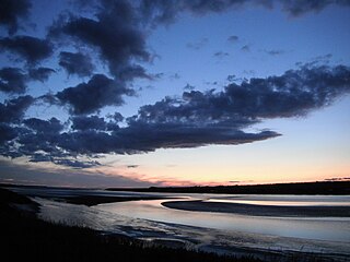
The Salmon River is a Canadian river in central Nova Scotia's Colchester County.
Brookfield is a Canadian rural community located in southern Colchester County, Nova Scotia, Canada. Brookfield is a growing community in the heart of Nova Scotia, just forty minutes from the provincial capital of Halifax, thirty minutes from the Stanfield International Airport and ten minutes from the Town of Truro. The community hosts both levels of public schools, two churches, restaurants, a bakery, a service station, a sportsplex, an 18 hole golf course, and a volunteer fire service.
Greenfield is a small rural community in the Canadian province of Nova Scotia, located in Colchester County. It is two miles south of the Salmon River and six miles east of Truro, NS. The name is intended to describe the landscape, annotated by surveyor Alexander Miller around 1817.
North River is a community in the Canadian province of Nova Scotia, located in Colchester County near Truro, Nova Scotia. It was settled in the 1760s as part of what was then Onslow Township, one of the many townships set up by the British Government in Halifax to encourage planters to come to Nova Scotia to work the land. Onslow Township was settled by New England Planters from the area around Boston, Massachusetts and from New Hampshire. The original occupation of the new immigrants was farming.
Folly Mountain is a mountain and a community in the Canadian province of Nova Scotia, located in Colchester County on Trunk 4 in the Cobequid Hills.
Portapique is a rural community in the Canadian province of Nova Scotia, located in Colchester County. It has about 100 residents in winter and increases to 250 residents in summer.
Lower Onslow is a small community in the Canadian province of Nova Scotia, located in Colchester County.
Bayhead is a community in the Canadian province of Nova Scotia, located in Colchester County. It is located at the head of Tatamagouche Bay, and geographic features in the area are historically associated with the name Gouzar.
Upper Onslow is a community in the Canadian province of Nova Scotia, located in Colchester County.

Fort Ellis was a British fort or blockhouse built during the French and Indian War, located at the junction of the Shubenacadie and Stewiacke Rivers, close to Stewiacke, Nova Scotia, Canada. The location was labelled Ville Pierre Hebert by Charles Morris. The 14 Acadian families in the area vacated with the Acadian Exodus. Charles Morris recommended a Fort on the Shubenacadie River in 1753. Governor Lawrence first considered the fort in 1754 as a means to protect Halifax from Mi'kmaq raids. Lawrence decided the fort would not be effective until after the Battle of Fort Beauséjour. The fort was completed on October 18, 1761, shortly after the Halifax Treaties were signed. The fort was to guard the new road built to connect Truro and Halifax against Mi'kmaq raids. The fort was called Fort Ellis after Governor Henry Ellis, who was appointed governor weeks after the forts completion. The fort was never garrisoned and eventually abandoned in 1767. Fort Belcher, named after Governor Jonathan Belcher, was built on Salmon River in Lower Onslow, Nova Scotia (1761–67). Fort Franklin was built at Tatamagouche in 1768, named after Michael Francklin and lasted only a year. Fort Morris was named after Charles Morris.

A township in Nova Scotia, Canada, was an early form of land division and local administration during British colonial settlement in the 18th century. They were created as a means of populating the colony with people loyal to British rule. They were typically rural or wilderness areas of around 100,000 acres (400 km2) that would eventually include several villages or towns. Some townships, but not all, returned a member to the General Assembly of Nova Scotia; others were represented by the members from the county. Townships became obsolete by 1879 by which time towns and counties had become incorporated.

