
The Sudbury District is a district in Northeastern Ontario in the Canadian province of Ontario. It was created in 1894 from townships of eastern Algoma District and west Nipissing District. In 1973, the Regional Municipality of Sudbury was created as a separate jurisdiction out of the district.
King's Highway 101, commonly referred to as Highway 101, is a provincially maintained highway in the Canadian province of Ontario. The 473.3-kilometre (294.1 mi) highway connects Highway 17 west of Wawa with Highway 11 in Matheson before continuing east to the Ontario–Quebec border where it becomes Route 388. The highway forms one of the only connections between the two routes of the Trans-Canada Highway between Nipigon and Temagami, and crosses some of the most remote regions of Northern Ontario. Major junctions are located with Highway 129 near Chapleau and Highway 144 southwest of Timmins, though the distance between these junctions is significant.
King's Highway 427, also known as Highway 427 and colloquially as the 427, is a 400-series highway in the Canadian province of Ontario that runs from the Queen Elizabeth Way (QEW) and Gardiner Expressway in Toronto to Major Mackenzie Drive in Vaughan. It is Ontario's second busiest freeway by volume and the third busiest in North America, behind Highway 401 and Interstate 405 in California. Like Highway 401, a portion of the route is divided into a collector-express system with twelve to fourteen continuous lanes. Notable about Highway 427 are its several multi-level interchanges; the junctions with the QEW/Gardiner Expressway and Highway 401 are two of the largest interchanges in Ontario and were constructed between 1967 and 1971, while the interchanges with Highway 409 and Highway 407 were completed in 1992 and 1995, respectively.
King's Highway 417, commonly referred to as Highway 417 and as the Queensway through Ottawa, is a 400-series highway in the Canadian province of Ontario. It connects Ottawa with Montreal via A-40, and is the backbone of the highway system in the National Capital Region. Within Ottawa, it forms part of the Queensway west from Highway 7 to Ottawa Road 174. Highway 417 extends from the Quebec border, near Hawkesbury, to Arnprior, where it continues westward as Highway 17. Aside from the urban section through Ottawa, Highway 417 passes through farmland that dominates much of the fertile Ottawa Valley.
King's Highway 400, commonly referred to as Highway 400, historically as the Toronto–Barrie Highway, and colloquially as the 400, is a 400-series highway in the Canadian province of Ontario linking the city of Toronto in the urban and agricultural south of the province with the scenic and sparsely populated central and northern regions. The portion of the highway between Toronto and Lake Simcoe roughly traces the route of the Toronto Carrying-Place Trail, a historic trail between the Lower and Upper Great Lakes. North of Highway 12, in combination with Highway 69, it forms a branch of the Trans-Canada Highway (TCH), the Georgian Bay Route, and is part of the highest-capacity route from southern Ontario to the Canadian West, via a connection with the mainline of the TCH in Sudbury. The highway also serves as the primary route from Toronto to southern Georgian Bay and Muskoka, areas collectively known as cottage country. The highway is patrolled by the Ontario Provincial Police and has a speed limit of 100 km/h (62 mph), except for the section south of Highway 401, where the speed limit is 80 km/h (50 mph) and the 60 km (37 mi) stretch between MacTier and Nobel, where the speed limit was raised to 110 km/h (68 mph) on April 22, 2022.
King's Highway 69, commonly referred to as Highway 69, is a provincially maintained north–south highway in the central portion of the Canadian province of Ontario. In conjunction with Highway 400, it links Toronto with the city of Greater Sudbury at Highway 17, via Parry Sound. It is part of the Trans-Canada Highway and the National Highway System. From its southern terminus of Highway 559 at Carling, Highway 69 begins as Highway 400 narrows from a four-laned freeway to a two lane highway. It travels northerly for approximately 68 kilometres (42 mi) to south of the French River before widening back to a divided four lane freeway for approximately 64 kilometres (40 mi) into Sudbury. The final 6 kilometres (3.7 mi) of the route, connecting to Highway 17, is a five lane arterial road that will be converted to freeway as the final phase of the four-laning.
King's Highway 27, commonly referred to as Highway 27, is a provincially maintained highway in the Canadian province of Ontario. The Ministry of Transportation of Ontario was once responsible for the length of the route, when it ran from Long Branch to Highway 93 in Waverley. Highway 27 followed a mostly straight route throughout its length, as it passed through the suburbs of Toronto, then north of Kleinburg the vast majority of the highway was surrounded by rural farmland. Today, only the southernmost 1.6 km (1 mi) from Highway 427 north to Mimico Creek is under provincial jurisdiction, the remainder of the route is maintained by the city of Toronto, York Region and Simcoe County.
The Thunder Bay Expressway, originally known as the Lakehead Expressway is a high-capacity at-grade suburban limited-access road around the western side of Thunder Bay in the Canadian province of Ontario. The 15.3 km (9.5 mi) route travels in a generally north–south direction on the city's west side. It is signed as part of Highway 61 at its southern end, and as part of the concurrent route of Highway 11 and Highway 17. The expressway features several at-grade intersections between its southern terminus at Arthur Street West and the Harbour Expressway and its northeastern terminus at Hodder Avenue.

Highway 655 is a secondary highway in the Cochrane District in Northern Ontario. The route is 74.7 kilometres (46.4 mi) in length. It is heavily used by trucks as a critical access road to Timmins. The highway is one of the widest, best-maintained secondary highways in the north, and has the distinction of being Ontario's only secondary highway that features a 90 km/h (55 mph) speed limit, due to its importance and high design standards.

Secondary Highway 537, commonly referred to as Highway 537, is a provincially maintained secondary highway in the Canadian province of Ontario. The highway is 16.1 kilometres (10.0 mi) in length, connecting Highway 69 near Wanup with Finni Road. It once continued 3.6 km (2.2 mi) further to intersect Highway 17 in Wahnapitae, but was truncated in 1998; this portion of the route is now designated as Greater Sudbury Municipal Road 537. Highway 537 is now the only secondary highway in the province located within a jurisdiction that also maintains its own county/regional road network.
King's Highway 37, commonly referred to as Highway 37, is a provincially maintained highway in the Canadian province of Ontario. It begins at Highway 401 in Belleville and travels 44.2 km (27.5 mi) north to Highway 7 in Actinolite. The route once continued south through Belleville to Highway 62, but was truncated in 1998. Prior to the re-routing, Highway 37 was 47.2 km (29.3 mi) long.
The Southwest Bypass and Southeast Bypass are two separately-constructed contiguous roads in the city of Greater Sudbury, in the Canadian province of Ontario, which form a bypass around the southern end of the city's urban core for traffic travelling on Highway 17, a portion of the Trans-Canada Highway. Most of the route is a Super two road with at-grade intersections, with the exception of short section of divided freeway at an interchange with Highway 69. Along with the Northwest Bypass from Lively to Chelmsford, the roads form a partial ring road around the city's urban core.
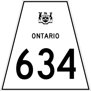
Secondary Highway 634, commonly referred to as Highway 634, is a remote highway in Northern Ontario that connects Highway 11 in Smooth Rock Falls to the Abitibi Canyon Generating Station in the community of Abitibi Canyon, Ontario. It is the second highway in Ontario to be designated Highway 634, with the original Highway 634 being near Sudbury. The current routing was at first designated as Highway 807, but was renumbered in 1977. The road was re-aligned around the eastern part of Smooth Rock Falls in the mid-1990s.
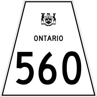
Secondary Highway 560, commonly referred to as Highway 560, is a provincially maintained secondary highway in the northern section of the Canadian province of Ontario. It begins in the west at an intersection with Highway 144 and the Sultan Industrial Road and proceeds 183.9 kilometres (114.3 mi) east to Highway 11 at Englehart.
The Sultan Industrial Road, also sometimes unofficially known as Ramsey Industrial Road, is a public–private forest access road in the Canadian province of Ontario. Originally built as a resource route for E. B. Eddy's logging and lumber operations in the northwestern Sudbury District, the road is now owned and operated by Eacom Timber. It is under a public access agreement with the province, permitting its use for public travel since 1978. The Sultan Industrial Road is gravel-surfaced throughout its length. There are no services along the remote route.
Highway 17B was formerly the designation for six business routes of Highway 17, the main route of the Trans-Canada Highway through the Canadian province of Ontario. Each generally followed the original route of Highway 17 through the town or city that it served, and was subsequently given the Highway 17B designation when a newer bypass route was constructed to either reduce traffic pressure on the local street network, or provide a better thoroughfare that avoided urban areas altogether.
King's Highway 38, commonly referred to as Highway 38, was a provincially maintained highway in the Canadian province of Ontario. The 66.9-kilometre (41.6 mi) road connected Highway 2 and Highway 401 in Kingston with Highway 7 west of Perth. It was designated in 1934 and remained relatively unchanged throughout its existence, aside from some minor diversions and a rerouting through Kingston as a result of the construction of Highway 401 in the mid-1950s. At the beginning of 1998, the entire highway was transferred to the municipalities of Frontenac County through which it travelled: Kingston, South Frontenac and Central Frontenac. Today the former highway is named Road 38 and Gardiners Road, but is still referred to as Highway 38 by locals.

Greater Sudbury Municipal Road 35 is a municipal road in the city of Greater Sudbury, Ontario, Canada. Extending from Chelmsford to Downtown Sudbury, most of the road's length is a former alignment of Highway 144, except for a short segment the city's downtown core which is a former alignment of Highway 17 and the Trans-Canada Highway.

Secondary Highway 536, commonly referred to as Highway 536, was a provincially maintained secondary highway in the Canadian province of Ontario. This highway connected Highway 17 near Lively with Wellington Street at the Creighton Mine. Highway 536 followed most of what is now Municipal Road 24, north from Greater Sudbury Road 55. The route existed from 1956 until the formation of the Regional Municipality of Sudbury in 1973.


