400-series highways

Last updated

400-series highways

Ontario 403.svg

Ontario QEW.svg


Ontario 407.svg

Highway markers for Highway 403, the Queen Elizabeth Way, and both the privately-maintained and provincial types for Highway 407
400-series highways map.svg
The current 400-series Highway network in Southern Ontario
System information
Maintained by Ministry of Transportation of Ontario (MTO)
Length1,997.3 km [1]  (1,241.1 mi)
FormedJuly 1, 1952 (1952-07-01)
Highway names
Provincial Ontario Highway 4XX
System links

The 400-series highways are a network of controlled-access highways in the Canadian province of Ontario, forming a special subset of the provincial highway system. They are analogous to the Interstate Highway System in the United States or the Autoroute system of neighbouring Quebec, and are regulated by the Ministry of Transportation of Ontario (MTO). The 400-series designations were introduced in 1952, although Ontario had been constructing divided highways for two decades prior. Initially, only Highways  400, 401 and 402 were numbered; other designations followed in the subsequent decades. The network is situated almost entirely in Southern Ontario, although Highway 400 extends into the more remote northern portion of the province.

Contents

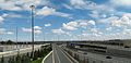
Modern 400-series highways have high design standards, speed limits of 100 kilometres per hour (62 mph), with a 110 kilometres per hour (68 mph) limit on select stretches, and various collision avoidance and traffic management systems. The design of 400-series highways has set the precedent for a number of innovations used throughout North America, including the parclo interchange and a modified Jersey barrier design known as the Ontario Tall Wall. As a result, they currently experience one of the lowest accident and fatality rates comparative to traffic volume in North America.

History

When the 400-series designations were first applied to Ontario freeways in 1952, [2] several divided highways had already been opened in Southern Ontario. [3] Originally inspired by German Autobahns, Minister of Highways Thomas McQuesten planned a network of "Dual Highways" across the southern half of the province during the 1930s. [4] [5] The Queen Elizabeth Way (QEW) was first, an upgrade to the partially constructed Middle Road in 1934. [6] McQuesten also sought out the economic opportunities that came with linking Toronto to Detroit and New York state by divided roadways with interchanges at major crossroads. Although he no longer served as Minister of Highways by the onset of World War II, his ambitious plans would come to fruition in the following decades as Highways 400, 401, 402, 403 (between Woodstock and Hamilton), and 405. [7]

The construction boom following the war resulted in many new freeway construction projects in the province. The Toronto–Barrie Highway (Highway 400), Trans-Provincial Highway (Highway 401), [8] a short expansion of Highway 7 approaching the Blue Water Bridge in Sarnia (Highway 402), [9] and an expansion of Highway 27 (eventually designated as Highway 427 by the mid-1970s) into part of the Toronto Bypass were all underway or completed by the early 1950s. [8] Seeking a way to distinguish the controlled-access freeways from the existing two-lane King's Highways, the Department of Highways created the 400-series designations in 1952. By the end of the year, Highway 400, 401, and 402 were numbered, although they were only short stubs of their current lengths. [2] Highway 401 was assembled across the province in a patchwork fashion, [8] becoming fully navigable between Windsor and the Quebec border on November 10, 1964; [10] Highway 400 was extended north to Coldwater on Christmas Eve 1959; [11] Highway 402 was extended to London between 1972 and 1982. [12] [13]

In addition to this network backbone, plans for additional 400-series highways were initiated by the late 1950s, comprising the Chedoke Expressway (Highway 403) through Hamilton; [14] the Don Valley Parkway Extension (Highway 404) northward from the soon-to-be constructed Toronto expressway; [15] Highway 405 to connect with the American border near St. Catharines; [16] Highway 406 south from St. Catharines to Welland; [17] Highway 407 encircling the Greater Toronto Area (GTA), though not built for another 40 years; [18] Highway 409 to connect Highway 401 with Toronto International Airport; [19] and The Queensway (Highway 417) through Ottawa. [20] The first sections of these freeways were opened in 1963, [21] 1977, [22] 1963, [21] 1965, [23] 1997, [24] 1974, [25] and 1960, [26] respectively.

Throughout the 1960s and 1970s, additional freeways were planned or built, including Highway 427 in Toronto, [27] Highway 403 through Mississauga, [28] Highway 410 north to Brampton and Highway 416 to connect Highways 401 and 417. [29] [30] Highway 420 was designated in Niagara Falls, [2] [31] though it had been built as part of the QEW in 1941. [32] Other major works included the skyway bridges along the QEW and the expansion of Highway 401 through most of Toronto into twelve-lane collector–express systems. [8] [33] [34]

By the mid-1980s, the network had more-or-less taken its current shape, with only Highways 407, 412, 416 and 418 yet to be built. [35] [36] Instead, emphasis was placed on expanding existing routes to accommodate increasing traffic volumes. [18] However, extensions of Highway 400 towards Parry Sound, [37] Highway 403 between Woodstock and Hamilton, [38] Highway 404 towards Newmarket, [39] and Highway 427 towards Vaughan were underway. [40] By the end of the decade, construction of Highway 407 and Highway 416 had begun, [18] [41] and Highway 410 was expanded from two to four lanes. [42]

Highways 407 and 416 opened in the late 1990s. [24] [43] Until early 2015, Highways 407 and 416 were the most-recently designated (and constructed) freeways in Ontario. This has changed with the construction of Highways 412 and 418. In addition to these new additions to the 400-series network, several extensions of existing freeways have been built or are underway, [36] including Highway 410 north of Brampton in 2009, [44] Highway 400 to north of Parry Sound in 2010, [45] Highway 417 to Arnprior in 2012, [46] Highway 404 to Keswick in 2014, [47] Highway 401 through Windsor in 2015, [48] and four-laning Highway 406 to Welland in late 2015. [49]

Design standards

The 400-series highways always have a minimum 4 lane cross-section with grade separation at all junctions. Interchanges tend to be spaced at least 1.5 kilometres apart in urban areas unless there are basket weave ramps or collector lanes to facilitated shorter merge distances. In rural areas, interchanges tend to be spaced at least 3 kilometres apart, although exceptions exist. When the cross-section of highway is larger than 10 lanes, the road is usually arranged into a local–express lane system, which exist on sections of Highways 400, 401, 403, 404 and 427. On all but a few interchanges in the whole system, ramps merge freely on the highway except if there are ramp meters in use, and stop or yield controlled ramps are rare. An interchange with stop-controlled ramps onto Highway 400 at Canal Road is currently scheduled for replacement.

While older freeways have some lapses in safety features, contemporary 400-series highways have design speeds of 130 km/h (81 mph), speed limits of 100 km/h (62 mph), various collision avoidance and traffic management systems, and several design standards adopted throughout North America. [50] Of note are the Ontario Tall Wall median barrier and the Parclo A-4 interchange design, the latter which became standard in the design for the widening of Highway 401 through Toronto in 1962. The Institute of Traffic Engineers subsequently recommended this design to replace the cloverleaf interchange throughout North America. [51] [52] Ontario highways rank fourth in North America for fatality rates, with 0.61 fatalities per 10,000 licensed drivers in 2017. However, this also includes two-lane provincial highways. [53] On May 1, 2019, the government of Ontario was looking towards raising the speed limits of the 400-series highways up to 120 km/h (75 mph). Jeff Yurek had stated that "The 400-series highways were built for, I believe, a speed limit of 120 km/h safely." [54] A 110 km/h trial was set up on select stretches to test the viability of increasing speed limits. [55] Several sections of highway were permanently changed to the higher speed limit in 2022.

Conforming with the Manual on Uniform Traffic Control Devices , Ontario utilizes green signs for guidance purposes, including distances to nearby interchanges and destinations. [56] Generally, blue signage is used to list services and attractions at upcoming exits, known as Tourism-Oriented Directional Signing. [57] However, several exceptions exist, notably blue guidance signage for toll highways such as Highway 407, in addition to the collector lanes of highways. [56] The baseline standard for the construction of or expansion to a freeway in Ontario is an average daily traffic count of 10,000 vehicles per day. However, other factors are considered as well, particularly future traffic volume forecasts. To promote economic development in a disadvantaged region (e.g., the current extension of Highway 400 to Northern Ontario), a 400-series highway may be built where the existing highway's traffic counts fall below 10,000. [58]

The MTO plans and finances the construction and maintenance of the King's Highway system, which includes the 400-series network. [59] The system includes 1,971.8 kilometres (1,225.2 mi) of freeways. Highway 401 is the longest freeway at 828.0 kilometres (514.5 mi), in addition to being the widest and busiest road in Canada. Highway 420 is the shortest of the routes at 3.3 kilometres (2.1 mi). [1]

There are four examples of 400 series standard highways in Ontario that are not signed as such. The Gardiner Expressway between Highway 427 and Parklawn Road was originally built as a section of QEW (Hwy 451) and therefore is built to 400-series standards but lost its QEW designation after being downloaded to the City of Toronto. The section of Highway 7 between the town of Carleton Place and its junction with Highway 417 is also built to 400-series standards, but a 400-series designation has yet to be applied. Highway 69 between Sudbury and Key River is built to 400-series standards in anticipation of it becoming part of Highway 400 once the 70-kilometre (43 mi) gap between the two freeways is filled. Highway 115 north of Highway 35/Highway115 concurrency and Peterborough is also built to 400-series standards, however a 400-series designation has yet to be applied. Most other freeways and expressways in Ontario that lack a 400-series designation have lower construction standards, lower design speeds and lower speed limits.

High-occupancy vehicle lanes

Map showing locations of HOV lanes in the province as of September 2021 400-series HOV lanes map.svg
Map showing locations of HOV lanes in the province as of September 2021

The MTO began planning for the use of high-occupancy vehicle (HOV) lanes with the HOV Opportunities Study, contracted to McCormick Rankin in 2001. This led to the test trial of three HOV lanes in the GTA in December 2005: southbound Highway 404 between Highway 7 and Highway 401, with a dedicated HOV ramp built to connect with westbound Highway 401, and Highway 403 in both directions between Highway 407 and Highway 401 in Mississauga. [60] Since then, HOV lanes have been opened on several 400-series freeways around the Golden Horseshoe and National Capital Region. In May 2007, the MTO introduced a multibillion-dollar Horseshoe Network Project, which included plans to incorporate HOV lanes into numerous 400-series highways. [61]

By then, work was already advanced on several projects, including the northbound HOV lane on Highway 404 (that opened on July 23, 2007) and an HOV lane along both directions of Highway 403 between Highway 407 and Highway 401. A third pair of HOV lanes has since been introduced to the QEW/403 through Oakville, and a fourth individual HOV lane travels eastbound on Highway 417 from just west of Eagleson Road in Ottawa to just east of Moodie Drive. [61]

More than 450 kilometres (280 mi) of HOV lanes are currently proposed for construction by 2031. Future plans include extending existing HOV lanes and introducing them to other 400-series freeways. [62] as of October 2014, two projects have been confirmed: Highway 410 between Highway 401 and Queen Street in Brampton, and Highway 427 between Highway 409 and Highway 7. The MTO has stated that HOV lanes will only be introduced through new construction and that no general-purpose lanes will be converted. The general goals of the project are to help increase highway efficiency (an HOV lane is claimed by the Ontario government to have the ability to move as many people as four general-purpose lanes), [62] reduce congestion, conserve energy and help protect the environment. [63]

During the 2015 Pan American Games and 2015 Parapan American Games held in Toronto, several HOV lanes had their minimum requirements increased from two passengers to three, and some highways had their general-purpose lanes temporarily converted to HOV lanes to accommodate increased traffic. These temporary restrictions lasted from June 29 to August 18. [64]

2021 saw several new HOV lanes opened. The southbound HOV lane on Highway 400 between King Road and Major Mackenzie Drive was opened on September 11, 2021; while the northbound lane opened two months later on November 11. The Highway 427 extension, which opened on September 18, included an HOV lane north of Finch Avenue. [65] [66] [67] [68]

Future HOV lanes

The following table lists planned expansions to the HOV network by 2031. [62] [69]

Near-term (anticipated completion by 2025)
HighwayStarting locationTerminating locationGeneral locationStatus
400King RoadLloydtown-Aurora RoadRegion of YorkLane construction underway
404Highway 7Stouffville RoadRegion of YorkLane and bridge construction underway
Long-term (2025–)
HighwayStarting locationTerminating locationGeneral location
400Lloydtown-Aurora RoadHighway 88/Bradford West Gwillimbury Region of York and Simcoe County
404Stouffville RoadRavenshoe Road Region of York
QEW Red Hill Valley Parkway Highway 406 Hamilton and Region of Niagara
QEW407/403Guelph Line Burlington
QEWTrafalgar RoadWinston Churchill Boulevard Oakville and Mississauga

Planned Extensions and New Routes

HighwayTypeLength (km)Length (mi)Southern or western terminusNorthern or eastern terminusStatusProposed Opening DateNotes
Highway 400 Extension [70] ~138~86Regional Road 559 near Parry Sound Highway 17 in Sudbury Partially Open / Under ConstructionLate 2020sCompleted sections numbered as Highway 69
Highway 401 Extension [71] ~3~2 I-75 in Detroit Ojibway Parkway in Windsor Under Construction2025Part of Gordie Howe International Bridge Project
Highway 404 Extension [72] ~31~19Regional Road 8 in Keswick Highway 12 north of Sunderland ProposedLate 2020s
Highway 410 Extension [73] ~3~2 Highway 10 in Brampton Future Highway 413 north of Brampton FundedLate 2020sPart of the Highway 413 project
Highway 413 New Route [73] ~52~32 Highway 401 and Highway 407 in NW Mississauga Highway 400 north of Vaughan FundedLate 2020s
Highway 417 Extension [74] ~16~10 Highway 60 in Renfrew Campbell Drive west of Arnprior ProposedLate 2020s
Highway 427 Extension [73] ~2~2Regional Road 49 south of Bolton Future Highway 413 South of BoltonFundedLate 2020sPart of the Highway 413 project
"Bradford Bypass"New Route [75] ~16~10Highway 400 near Bradford Highway 404 south of Keswick.FundedLate 2020sIntended to be a 400 series standard highway, designation is unclear. Construction began at the Yonge Street interchange in November 2022

Existing Network

NumberLength (km)Length (mi)Southern or western terminusNorthern or eastern terminusLocal namesFormedRemovedNotes
Ontario 400.svg Highway 400 226.0140.4Maple Leaf Drive in Toronto
(continues as Black Creek Drive)
Highway 69 in Carling Toronto–Barrie Highway01952-07-011952 [76] currentScheduled for extension to Sudbury. [76]
Ontario 401.svg Highway 401 828.0514.5Ojibway Parkway in Windsor A-20 towards Montreal, QC Macdonald–Cartier Freeway, Rt. Hon. Herb Gray Parkway, Highway of Heroes01952-07-011952 [76] currentBusiest highway in North America. [77] Scheduled for extension to American border following completion of the Gordie Howe International Bridge.
Ontario 402.svg Highway 402 102.563.7 I-69  / I-94 at Canada–United States border on Blue Water Bridge in Point Edward Highway 401 in London 01953-01-011953 [9] current
Ontario 403.svg Highway 403 125.277.8 Highway 401 near Woodstock Highway 401  / Highway 410 in MississaugaChedoke Expressway, Alexander Graham Bell Parkway01963-12-011963 [21] current
Ontario 404.svg Highway 404 50.131.1 Highway 401 / DVP in Toronto Regional Road 8 (Woodbine Avenue) in East Gwillimbury 01977-01-011977 [22] current
Ontario 405.svg Highway 405 8.75.4 Queen Elizabeth WaySt. Catharines I-190 at Canada–United States border on Queenston-Lewiston Bridge towards Lewiston, NY General Brock Parkway01963-09-111963 [21] current
Ontario 406.svg Highway 406 26.016.2East Main Street in Welland Queen Elizabeth Way in St. Catharines 01965-12-071965 [23] current
Highway407crest.svgOntario 407 Toll.svg Highway 407 151.494.1 Highway 403  / Queen Elizabeth Way in Burlington Highway 35  / Highway 115 in Clarington 01997-06-071997 [78] currentTollway divided into two sections; Highway 407E and 407 ETR, with the latter privately operated [79]
Ontario 409.svg Highway 409 5.63.5 Pearson Airport in Mississauga Highway 401 in Toronto Belfield Expressway01978-08-251978 [80] current
Ontario 410.svg Highway 410 20.312.6 Highway 401  / Highway 403 in Mississauga Highway 10 (Hurontario Street) in Caledon 01978-11-151978 [81] current
Ontario 412.svg Highway 412 10.06.2 Highway 401 in Whitby Highway 407 in WhitbyWest Durham Link02016-06-202016 [82] currentRoute number assigned February 5, 2015 [83] tolls removed, effective April 5, 2022 [84]
Ontario 416.svg Highway 416 76.447.5 Highway 401 towards Brockville Highway 417 in Ottawa Veterans Memorial Highway01999-09-231999 [43] current
Ontario 417.svg Highway 417 192.0119.3 Highway 17 in Arnprior A-40 (TCH) towards Montreal, QC Queensway, Trans-Canada Highway01971-01-011971 [26] currentUnlike most freeways, kilometre posts are numbered east to west.
Ontario 418.svg Highway 418 12.88.0 Highway 401 in Clarington Highway 407 in ClaringtonEast Durham Link02019-12-092019 [85] currentRoute number assigned February 5, 2015. [83] tolls removed, effective April 5, 2022 [84]
Ontario 420.svg Highway 420 3.32.1 Regional Road 98 (Montrose Road) US 62 at Canada–United States border on Rainbow Bridge in Niagara Falls Niagara Veterans Memorial Highway01941-11-011941 [86] current
Ontario 427.svg Highway 427 2717 Queen Elizabeth Way/Gardiner Expressway in Toronto Regional Road 25 (Major Mackenzie Drive) in Vaughan 01971-12-041971 [27] current6.6 km (4.1 mi) extension to Regional Road 25 (Major Mackenzie Drive) opened Sept 18 2021
Ontario QEW.svg Queen Elizabeth Way 139.186.4 I-190 at Canada–United States border on Peace Bridge in Fort Erie Highway 427 in Toronto 01937-12-311937 [87] currentInternally referred to as Highway 451 in the Ontario Ministry of Transportation

See also

Related Research Articles

King's Highway 401, commonly referred to as Highway 401 and also known by its official name as the Macdonald–Cartier Freeway or colloquially referred to as the four-oh-one, is a controlled-access 400-series highway in the Canadian province of Ontario. It stretches 828 kilometres (514 mi) from Windsor in the west to the Ontario–Quebec border in the east. The part of Highway 401 that passes through Toronto is North America's busiest highway, and one of the widest. Together with Quebec Autoroute 20, it forms the road transportation backbone of the Quebec City–Windsor Corridor, along which over half of Canada's population resides. It is also a Core Route in the National Highway System of Canada. The route is maintained by the Ministry of Transportation of Ontario (MTO) and patrolled by the Ontario Provincial Police. The speed limit is 100 km/h (62 mph) throughout its length, with the only exceptions being the posted 80 km/h (50 mph) limit westbound in Windsor and in most construction zones, along with a 110 km/h (68 mph) speed limit between Windsor and Tilbury.

King's Highway 407, commonly referred to as Highway 407 and colloquially as the "four-oh-seven", is a tolled 400-series highway in the Canadian province of Ontario. Comprising a privately leased segment as well as a publicly owned segment, the route spans the entire Greater Toronto Area (GTA) around the city of Toronto, travelling through the suburbs of Burlington, Oakville, Mississauga, Brampton, Vaughan, Markham, Pickering, Whitby, and Oshawa before ending in Clarington, north of Orono. At 151.4 km long, this is the fourth-longest freeway in Ontario's 400 series network, after Highways 417, 400, and 401. The segment between Burlington and Brougham in Pickering is leased to and operated by the 407 ETR Concession Company Limited and is officially known as the 407 Express Toll Route (407 ETR). It begins at the junction of the Queen Elizabeth Way (QEW) and Highway 403 in Burlington, and travels 108.0 km (67.1 mi) across the GTA to Brock Road in Pickering. East of Brock Road, the tollway continues east as Highway 407, a toll route operated by the provincial government, for 43.4 km (27.0 mi) to Highway 35/115 in Clarington. The route interchanges with nine freeways: the QEW, Highway 403, Highway 401, Highway 410, Highway 427, Highway 400, Highway 404, Highway 412, and Highway 418. Highway 407 is an electronically operated toll highway; there are no toll booths along the length of the route. Distances are calculated automatically using transponders or automatic number-plate recognition, which are scanned at entrance and exit portals.

The Queen Elizabeth Way (QEW) is a 400-series highway in the Canadian province of Ontario linking Toronto with the Niagara Peninsula and Buffalo, New York. The freeway begins at the Peace Bridge in Fort Erie and travels 139.1 kilometres (86.4 mi) around the western end of Lake Ontario, ending at Highway 427 as the physical highway continues as the Gardiner Expressway into downtown Toronto. The QEW is one of Ontario's busiest highways, with an average of close to 200,000 vehicles per day on some sections. Major highway junctions are at Highway 420 in Niagara Falls, Highway 405 in Niagara-on-the-Lake, Highway 406 in St. Catharines, the Red Hill Valley Parkway in Hamilton, Highway 403 and Highway 407 in Burlington, Highway 403 at the Oakville–Mississauga boundary, and Highway 427 in Etobicoke. Within the Regional Municipality of Halton the QEW is signed concurrently with Highway 403. The speed limit is 100 km/h (62 mph) throughout most of its length, with the exceptions being between Hamilton and St. Catharines where the posted limit is 110 km/h (68 mph).

The Provincial Highway Network consists of all the roads in Ontario maintained by the Ministry of Transportation of Ontario (MTO), including those designated as part of the King's Highway, secondary highways, and tertiary roads. Components of the system—comprising 16,900 kilometres (10,500 mi) of roads and 2,880 bridges —range in scale from Highway 401, the busiest highway in North America, to unpaved forestry and mining access roads. The longest highway is nearly 2,000 kilometres (1,200 mi) long, while the shortest is less than a kilometre. Some roads are unsigned highways, lacking signage to indicate their maintenance by the MTO; these may be remnants of highways that are still under provincial control whose designations were decommissioned, roadway segments left over from realignment projects, or proposed highway corridors.

<span class="mw-page-title-main">Ontario Highway 3</span> Ontario provincial highway

King's Highway 3, commonly referred to as Highway 3, is a provincially maintained highway in the Canadian province of Ontario which travels parallel to the northern shoreline of Lake Erie. It has three segments, the first of which travels from the Ambassador Bridge in Windsor to Highway 77 in Leamington. The second portion begins at Talbotville Royal outside of St. Thomas at Highway 4, and travels to the western city limits of Port Colborne. The road is regionally maintained within Port Colborne as Niagara Regional Road 3, but regains its provincial designation at Highway 140. Its third and final terminus is at Edgewood Park, within the Fort Erie town limits. From there, the road continues as Niagara Regional Road 3 to the Peace Bridge, where drivers can cross to the United States. The total length of Highway 3 is 258.2 km (160.4 mi), consisting of 49.2 km (30.6 mi) from Windsor to Leamington, 187.9 km (116.8 mi) from Talbotville Royal to Port Colborne and 21.1 km (13.1 mi) from Port Colborne to Edgewood Park.

King's Highway 427, also known as Highway 427 and colloquially as the 427, is a 400-series highway in the Canadian province of Ontario that runs from the Queen Elizabeth Way (QEW) and Gardiner Expressway in Toronto to Major Mackenzie Drive in Vaughan. It is Ontario's second busiest freeway by volume and the third busiest in North America, behind Highway 401 and Interstate 405 in California. Like Highway 401, a portion of the route is divided into a collector-express system with twelve to fourteen continuous lanes. Notable about Highway 427 are its several multi-level interchanges; the junctions with the QEW/Gardiner Expressway and Highway 401 are two of the largest interchanges in Ontario and were constructed between 1967 and 1971, while the interchanges with Highway 409 and Highway 407 were completed in 1992 and 1995, respectively.

King's Highway 409, commonly referred to as Highway 409 and historically as the Belfield Expressway, is a 400-series highway in the Canadian province of Ontario that extends from Highway 401 in Toronto to Pearson International Airport, west of Highway 427, in Mississauga. It is a short freeway used mainly as a spur route for traffic travelling to the airport or Highway 427 northbound from Highway 401 westbound, as these route movements are not accommodated at the complex interchange between Highways 401 and 427.

King's Highway 404, also known as Highway 404 and colloquially as the 404, is a 400-series highway in the Canadian province of Ontario. A continuation of the municipal Don Valley Parkway (DVP) north of Highway 401, it connects Toronto with East Gwillimbury. The 50.1-kilometre (31.1 mi) controlled-access freeway also connects with Highway 407 in Markham, which formed the northeastern ring road of the Greater Toronto Area until the opening of Highway 412 in 2016. Highway 404 provides access to the eastern edge of Richmond Hill, Aurora and Newmarket and the western edge of Whitchurch-Stouffville, in addition to the southern edge of Keswick.

King's Highway 400, commonly referred to as Highway 400, historically as the Toronto–Barrie Highway, and colloquially as the 400, is a 400-series highway in the Canadian province of Ontario linking the city of Toronto in the urban and agricultural south of the province with the scenic and sparsely populated central and northern regions. The portion of the highway between Toronto and Lake Simcoe roughly traces the route of the Toronto Carrying-Place Trail, a historic trail between the Lower and Upper Great Lakes. North of Highway 12, in combination with Highway 69, it forms a branch of the Trans-Canada Highway (TCH), the Georgian Bay Route, and is part of the highest-capacity route from southern Ontario to the Canadian West, via a connection with the mainline of the TCH in Sudbury. The highway also serves as the primary route from Toronto to southern Georgian Bay and Muskoka, areas collectively known as cottage country. The highway is patrolled by the Ontario Provincial Police and has a speed limit of 100 km/h (62 mph), except for the section south of Highway 401, where the speed limit is 80 km/h (50 mph).

King's Highway 403, or simply Highway 403, is a 400-series highway in the Canadian province of Ontario that travels between Woodstock and Mississauga, branching off from and reuniting with Highway 401 at both ends and travelling south of it through Hamilton and Mississauga. It is concurrent with the Queen Elizabeth Way (QEW) for 22 km (14 mi) from Burlington to Oakville. The Highway 403 designation was first applied in 1963 to a short stub of freeway branching off the QEW, and the entire route was completed on August 15, 1997, when the section from Brantford to the then-still independent Town of Ancaster was opened to traffic. The section of Highway 403 between Woodstock and Burlington was formally dedicated as the Alexander Graham Bell Parkway on April 27, 2016, in honour of Alexander Graham Bell.

King's Highway 410, also known as Highway 410 and colloquially as the four-ten, is a 400-series highway in the Canadian province of Ontario that connects Highways 401 and 403 to Brampton. North of Brampton, the commuter freeway ends and the route becomes Highway 10, which continues north through Caledon as a four-lane undivided highway. The route is patrolled by the Ontario Provincial Police and has a speed limit of 100 km/h (62 mph).

King's Highway 402, commonly referred to as Highway 402 and historically as the Blue Water Bridge Approach, is a 400-series highway in the Canadian province of Ontario that connects the Blue Water Bridge international crossing near Sarnia to Highway 401 in London. It is one of multiple trade links between Ontario and the Midwestern United States. It is four lanes for much of its length, though the approach to the Blue Water Bridge is six lanes.

King's Highway 406, commonly referred to as Highway 406, is a 400-series highway in the Canadian province of Ontario. The primary north–south route through the central portion of the Niagara Peninsula, Highway 406 connects Welland, Thorold and downtown St. Catharines to the Queen Elizabeth Way (QEW).

King's Highway 420, commonly referred to as Highway 420, is a 400-series highway in the Canadian province of Ontario that connects the Queen Elizabeth Way (QEW) with downtown Niagara Falls. It continues east as a limited-access expressway named Niagara Regional Road 420 to connect with the Rainbow Bridge international crossing between Canada and the United States over the Niagara River; this was part of Highway 420 until 1998. West of the QEW, the freeway ends at an at-grade intersection with Montrose Road. The highway has a speed limit of 80 kilometres per hour (50 mph), making it the only 400-series highway to have a speed limit less than 100 kilometres per hour (62 mph) for its entirety.

<span class="mw-page-title-main">Cancelled expressways in Toronto</span> Unbuilt freeways in Toronto, Canada

The cancelled expressways in Toronto were a planned series of expressways in Toronto, Ontario, Canada that were only partially built or cancelled due to public opposition. The system of expressways was intended to spur or handle growth in the suburbs of Toronto, but were opposed by citizens within the city of Toronto proper, citing the demolition of homes and park lands, air pollution, noise and the high cost of construction. The Spadina Expressway, planned since the 1940s, was cancelled in 1971 after being only partially constructed. After the Spadina cancellation, other expressway plans, intended to create a 'ring' around the central core, were abandoned.

King's Highway 27, commonly referred to as Highway 27, is a provincially maintained highway in the Canadian province of Ontario. The Ministry of Transportation of Ontario was once responsible for the length of the route, when it ran from Long Branch to Highway 93 in Waverley. Highway 27 followed a mostly straight route throughout its length, as it passed through the suburbs of Toronto, then north of Kleinburg the vast majority of the highway was surrounded by rural farmland. Today, only the southernmost 1.6 km (1 mi) from Highway 427 north to Mimico Creek is under provincial jurisdiction, the remainder of the route is maintained by the city of Toronto, York Region and Simcoe County.

King's Highway 418, or simply Highway 418, is a controlled-access highway and former tolled highway in the Canadian province of Ontario. The 400-series highway is 9.2 km (5.7 mi) long, travelling through the Regional Municipality of Durham to connect Highway 401 with the eastern extension of Highway 407. The freeway is located entirely within the Municipality of Clarington near Durham Regional Road 34.

COMPASS, also referred to as Freeway Traffic Management System, is a system run by the Ministry of Transportation of Ontario (MTO) to monitor and manage the flow of traffic on various roads in Ontario.

King's Highway 413, known as the GTA West Corridor or GTA West until 2021, is a proposed 400-series highway and bus transitway in the western Greater Toronto Area of the Canadian province of Ontario. The approximately 52-kilometre (32 mi) route is currently undergoing planning and analysis under an environmental impact assessment (EA) by the Ministry of Transportation of Ontario (MTO) and the Government of Ontario. If approved, a new four-to-six lane controlled-access highway would be built between the existing interchange of Highway 401 and the 407 ETR at the Halton–Peel boundary, and Highway 400 north of Vaughan. In addition, two new extensions would be built to connect Highway 410 and Highway 427 with Highway 413.

References

Sources

  1. 1 2 Ministry of Transportation of Ontario (2010). "Annual Average Daily Traffic (AADT) counts". Government of Ontario. Archived from the original on July 6, 2011. Retrieved March 29, 2016.
  2. 1 2 3 Walter, Karena (February 21, 2014). "Search Engine: Highway Mysteries Solved". The Niagara Falls Review. Archived from the original on December 22, 2015. Retrieved December 17, 2015.
  3. Robins, C.P. (1952). Ontario Road Map (Map). Ontario Department of Highways. § Q28–U41.
  4. "Hopes to Improve Roads". The Gazette. Montreal. February 18, 1936. p. 14. Retrieved February 9, 2010.
  5. Stamp (1987), pp. 11–12.
  6. English, Bob (March 16, 2006). "Remember That 'Little Four-Lane Freeway?'". The Globe And Mail. Toronto. ...the freeway concept was promoted by Hamiltonian Thomas B. McQuesten, then the highway minister. The Queen Elizabeth Way was already under construction, but McQuesten changed it into a dual-lane divided highway, based on Germany's new autobahns.
  7. Stamp (1987), p. [ page needed ].
  8. 1 2 3 4 Shragge, John G. (2007). "Highway 401: The Story". Archived from the original on March 28, 2008. Retrieved February 12, 2010.
  9. 1 2 Built Heritage, Cultural Landscape and Planning Section (January 2006). "2.0 Background History" (PDF). Heritage Impact Assessment: Christina Street Bridge over Highway 402, Sarnia (Report). Archaeological Services Inc. p. 4. Retrieved January 6, 2014.
  10. Ministry of Transportation and Communications (1972) , pp. 8–9.
  11. "Open 400 Link to Coldwater". The Toronto Star. December 24, 1959. p. 18. The new, 22-mile extension from south of Crown Hill to Coldwater will be ready for traffic this afternoon.
  12. Highway Construction Program: King's and Secondary Highways. Ministry of Transportation and Communications. 1972–1973. p. xi.
  13. Annual Report (Construction ed.). Ministry of Transportation and Communications. 1982–1983. p. 76.
  14. Annual Report for the Fiscal Year (Report). Ontario Department of Highways. March 31, 1958. Retrieved July 25, 2010.
  15. Don Valley Parkway Extension, Highway 401 to Steeles Avenue (Report). Desjardines. 1957.
  16. "Above the Regular Budget". The Ottawa Citizen. July 31, 1958. p. 7. Retrieved October 20, 2010.
  17. Annual Report. Department of Highways. March 31, 1961. Retrieved July 29, 2011.
  18. 1 2 3 Sewell, John (2009). The Shape of the Suburbs: Understanding Toronto's Sprawl. University of Toronto Press. p. 72. ISBN   978-0-8020-9884-9 . Retrieved July 1, 2010.
  19. Hicks, Kathleen A. (2006). "Road Controversy - 1968". Malton: Farms to Flying (PDF). Friends of the Mississauga Library System. pp. 208–209. ISBN   0-9697873-9-1 . Retrieved April 4, 2010.
  20. Robertson, Peter. "The Queensway Began with a Royal Blast: Flashback to 1957". Carlington Community Association. Archived from the original on April 26, 2012. Retrieved December 17, 2015.
  21. 1 2 3 4 Ontario Department of Highways (1970), p. 11.
  22. 1 2 Construction Program: King's and Secondary Highways (Report). Ministry of Transportation and Communications. 1976–1977. p. XV.
  23. 1 2 Ontario Department of Highways (1970), p. 12.
  24. 1 2 Settlement of Claim of Richard Prendiville (PDF) (Report). Ontario Superior Court of Justice. December 12, 2001. p. 7. Archived from the original (PDF) on July 27, 2014. Retrieved December 17, 2015.
  25. Construction Program: King's and Secondary Highways (Report). Ministry of Transportation and Communications. 1976–1977. p. XIV.
  26. 1 2 Clark, Glenn (April 14, 2012). A Historical Timeline for the Township of Gloucester. The Gloucester Historical Society. Retrieved July 1, 2012.
  27. 1 2 "Highway 27 Interchange Fully in Service". The Globe and Mail. Toronto. December 4, 1971. p. 5.
  28. Coleman, Thomas (July 12, 1975). "Drivers Will Wait Years Before Relief from QEW Jams". The Globe and Mail. Toronto. p. 5.
  29. The History of Toronto's Unfinished Expressway System (Report). Energy Probe. April 5, 2009. Retrieved January 23, 2012.
  30. "New 45-Mile Highway to Link Ottawa with 401". The Globe and Mail. Toronto. November 14, 1967. p. 4.
  31. "Queen Elizabeth Way - Hamilton to Fort Erie". Highway Construction Program 1972-73 (Report). Ministry of Transportation and Communications. April 1972. p. xv.
  32. Stamp (1992), p. 129.
  33. Stamp (1987), pp. 59–61.
  34. "Chronology". Annual Report (Report). Department of Highways. March 31, 1964. p. 296.
  35. Cartography Section (1986). Ontario Road Map (Map). Ministry of Transportation and Communications.
  36. 1 2 Cartography Section (2014–2015). Ontario Road Map (Map). Ministry of Transportation of Ontario.
  37. Ministry of Transportation of Ontario (May 2000). "Highway 69 Four-Laning Port Severn to Parry Sound" (PDF). Government of Ontario. Archived from the original (PDF) on August 23, 2000. Retrieved December 27, 2011.
  38. Transportation Capital Branch (1991–1992). "Provincial Highways Construction Projects". Northern Transportation, Construction Projects. Ministry of Transportation: 7. ISSN   0714-1149.
  39. Dexter, Brian (October 25, 1989). "Ontario Studies Plan to Extend Highway 404 Farther North". News. The Toronto Star. p. A8.
  40. Provincial Highways Construction Projects (Report). Ministry of Transportation. 1989–1990. p. 13. ISSN   0714-1149.
  41. Transportation Capital Branch (May 1991). Northern Transportation Construction Projects 1988–89 (Report). Ministry of Transportation of Ontario. p. 16. ISSN   0714-1149.
  42. Transportation Capital Branch (1986–1987). "Provincial Highways Construction Projects". Northern Transportation, Construction Projects. Ministry of Transportation and Communications: XII. ISSN   0714-1149.
  43. 1 2 "Ottawa Highway Link Opens". Ontario. Toronto Star. Canadian Press. September 24, 1999. p. A4.
  44. Abrey, Heather (November 20, 2009). "Hwy 410 Extension Causing Confusion". Caledon Enterprise. North Peel Media Group. Retrieved December 17, 2015.
  45. Ginn, Cameron (October 27, 2010). "$177-Million Section of Highway Now Open". Cottage Country Now. Metroland Media Group. Retrieved December 17, 2015.
  46. Chase, Sean (November 30, 2012). "Highway 417 opens at Arnprior". The Pembroke Observer. Canoe Sun Media. Retrieved December 2, 2012.
  47. Bradley, Dave (September 17, 2014). "Highway 404 Extension Opens". NewsTalk 1010. Retrieved September 17, 2014.
  48. "Newsroom: Highway 401 Section of the New Rt. Hon. Herb Gray Parkway Now Complete". News.Ontario.ca. Ministry of Transportation. November 20, 2015. Retrieved November 21, 2015.
  49. Forsyth, Paul (August 19, 2011). "406 Widening Underway". Niagara This Week. Metroland Media. Retrieved December 17, 2015.
  50. Revie, Nancy (September 19, 2005). "An Expressway in Name Only". The Guelph Mercury. p. A9.
  51. Proceedings ... Annual Meeting (Report). Institute of Traffic Engineers. 1962. pp. 100–103.
  52. "Partial Cloverleaf Interchange (Parclo)". The Canadian Design Resource. Retrieved June 4, 2015.
  53. Road Safety Policy Office - Vehicles (2017). "Overview" (PDF). Ontario Road Safety Annual Report (Report). Government of Ontario. p. 21. ISSN   1710-2480 . Retrieved March 7, 2021.
  54. Rodrigues, Gabby (May 1, 2019). "Ontario to Look At Raising Speed Limits Across 400-Series Highways". Global News. Retrieved May 6, 2019.
  55. "Consultation: Speed Limits on Ontario Highways". www.ontario.ca. Retrieved March 7, 2021.
  56. 1 2 Ministry of Transportation of Ontario (May 2010). "Ontario Traffic Manual Book 8: Guide and Information Signs – Volume 1" (PDF). Government of Ontario. p. 18. Archived from the original (PDF) on March 8, 2016. Retrieved February 24, 2016.
  57. Ministry of Tourism, Culture and Sport (November 23, 2015). "Tourism-Oriented Directional Signing (TODS) Program". Government of Ontario. Retrieved February 24, 2016.
  58. Ministry of Northern Development and Mines (June 2005). Highway 69 Action Plan (PDF) (Report). Government of Ontario. p. 3. Archived from the original (PDF) on March 9, 2014. Retrieved February 25, 2016.
  59. "Highway Traffic Act". Government of Ontario. 2016. Retrieved May 8, 2016.
  60. Nikolic, Goran; Pringle, Rob (2008). Evaluating HOV Plans and Priorities – the Case of Expressways in the GTA (PDF) (Report). Transportation Association of Canada. pp. 2–4. Retrieved January 1, 2016.
  61. 1 2 Ministry of Transportation of Ontario (May 24, 2015). "McGuinty Government To Improve Commuters Lives With HOV Lane Network" (Press release). CNW Group. Archived from the original on March 4, 2016. Retrieved January 1, 2016.
  62. 1 2 3 Ministry of Transportation of Ontario. "Ontario's High Occupancy Vehicle Lane Network Plan for the 400-Series Highways in the Greater Golden Horseshoe". Government of Ontario. Archived from the original on October 18, 2014. Retrieved June 9, 2015.
  63. "The Big Move - Strategy #3 - Improve the Efficiency of the Road and Highway Network". Metrolinx. Archived from the original on February 6, 2017. Retrieved June 9, 2015.
  64. Shum, David (June 29, 2015). "HOV Lane Restrictions Now in Effect for Pan Am Games". Global News. Retrieved August 22, 2015.
  65. "Adding More Lanes to Highway 400 to Keep People Moving". Ontario. Retrieved July 22, 2021.
  66. Lecce, Stephen [@sflecce] (September 10, 2021). "Excited to report that the new southbound HOV lanes on Highway 400 in the #KingTownship & #Vaughan community will open tomorrow!" (Tweet) via Twitter.
  67. "Ontario Opens Highway 427 Expansion". Ministry of Transportation of Ontario. September 16, 2021. Retrieved September 18, 2021.
  68. Ministry of Transportation of Ontario [@sflecce] (November 11, 2021). "Northbound HOV lanes on Highway 400 in the Vaughan area open by tonight!" (Tweet) via Twitter.
  69. "Ontario's highway programs". Ontario Ministry of Transportation. May 28, 2020. Retrieved August 2, 2020.
  70. "Connecting the North: A Draft Transportation Plan for Northern Ontario". Province of Ontario. 2020.
  71. "Project Overview". Gordie Howe International Bridge. 2022. Retrieved June 8, 2022.
  72. "Connecting the GGH: A Transportation Plan for the Greater Golden Horseshoe". Province of Ontario. 2022.
  73. 1 2 3 "Preferred Route Factsheet" (PDF). Highway 413. April 2022. Retrieved June 8, 2022.
  74. "Connecting the East: A draft transportation plan for eastern Ontario". Province of Ontario. 2022.
  75. "OVERVIEW - BRADFORD BYPASS". Bradford Bypass. 2020. Retrieved June 8, 2022.
  76. 1 2 3 Shragge & Bagnato (1984), pp. 89–92.
  77. Maier, Hanna (October 9, 2007). "Chapter 2". Long-Life Concrete Pavements in Europe and Canada (Report). Federal Highway Administration. Retrieved May 1, 2010. The key high-volume highways in Ontario are the 400-series highways in the southern part of the province. The most important of these is the 401, the busiest highway in North America, with average annual daily traffic (AADT) of more than 425,000 vehicles in 2004 and daily traffic sometimes exceeding 500,000 vehicles.
  78. Mitchell, Bob (June 6, 1997). "At Last — Opening Bell Tolls for the 407". The Toronto Star. pp. A1, A6.
  79. "Map / Toll Calculator". 407 ETR. February 1, 2014. Retrieved December 17, 2015.
  80. "New Shortcut Will Let Some 'Fly' to Airport". Metro News. The Toronto Star. August 19, 1978. p. A6. Highway 409, a new shortcut to Toronto International Airport, opens next Friday
  81. Public and Safety Information Section (November 9, 1978). "Highway 410 Opens November 15" (Press release). Ministry of Transportation and Communications.
  82. Pessian, Parvaneh (June 17, 2016). "UPDATE: Hwy. 407 From Pickering to Oshawa Opens June 20: Toll Free Until End of 2016". Whitby This Week. Retrieved June 17, 2016.
  83. 1 2 "New Highway Numbers". Highway 407 East. Archived from the original on April 19, 2015. Retrieved February 10, 2015.
  84. 1 2 Alberga, Hannah (April 5, 2022). "'Unfair tolls': Ford officially scraps tolls on two Ontario highways". CTV News Toronto. Retrieved April 6, 2022.
  85. "Extension of Ontario Hwy. 407, new Hwy. 418 open east of Toronto". On-Site Magazine. On-Site. December 9, 2019. Retrieved December 11, 2019. An eastern extension of Ontario Hwy. 407 and a new toll road to connect the lengthened highway to nearby Hwy. 401 opened Dec. 9 on the outskirts of Toronto.
  86. Stamp (1987), pp. 124–127.
  87. Shragge & Bagnato (1984), pp. 79–81.

Bibliography

  • Shragge, John; Bagnato, Sharon (1984). From Footpaths to Freeways. Ontario Ministry of Transportation and Communications, Historical Committee. ISBN   0-7743-9388-2.
  • Stamp, Robert M. (1987). QEW: Canada's First Superhighway. The Boston Mills Press. ISBN   0-919783-84-8.
  • Stamp, Robert M. (1992). Bridging the Border: Structures of Canadian–American Relations. Toronto: Dundurn Press. ISBN   1-55002-074-9.
  • '401' The Macdonald–Cartier Freeway. Toronto: Ministry of Transportation and Communications. 1972.
  • AADT Traffic Volumes 1955–1969 and Traffic Collision Data 1967–1969. Ontario Department of Highways. 1970.