Clarington

Last updated
Clarington
Municipality of Clarington
Downtown Bowmanville - King St.jpg
Newcastle, Ontario Community Hall IMG 5558.jpg
Bowmanville Water Tower 06-2022 001.jpg
Canadian Tire Motorsports Park (27560745441).jpg
Dawson's Point Trail Courtice IMG 7458.jpg
Ganaraska Wind Farm (BRK8367).jpg
Bomanwille limestone quarry & cement factory panorama.jpg
From top, left to right: Downtown Bowmanville, Newcastle Community Hall, Bowmanville Water Tower, Canadian Tire Motorsport Park, Courtice waterfront trail at Lake Ontario, Ganaraska Wind Farm in Orono, St. Mary's Cement plant
Coat of arms of Carington, Ontario.png
Logo of Clarington, Ontario.svg
Motto(s): 
"Wisdom Knowledge and Trust" or "Leading The Way"
Durham locator map 2021.svg
Red pog.svg
Clarington
Canada Southern Ontario location map 2.png
Red pog.svg
Clarington
Coordinates: 43°59′41″N78°40′30″W / 43.99472°N 78.67500°W / 43.99472; -78.67500
CountryCanada
Province Ontario
Region Durham Region
Established1974
Government
  Mayor Adrian Foster
  Governing bodyClarington Council
   MP Jamil Jivani (Durham)
Phillip Lawrence (Northumberland - Peterborough South)
   MPP Todd McCarthy (Durham)
David Piccini (Northumberland - Peterborough South)
Area
[1]
  Total611.3 km2 (236.0 sq mi)
Elevation
106 m (348 ft)
Population
 (2021) [2]
  Total101,427;(Ranked 55th)
  Density166.0/km2 (430/sq mi)
Time zone UTC-05:00 (EST)
  Summer (DST) UTC-04:00 (EDT)
Website www.clarington.net

Clarington (2021 population 101,427 [2] ) is a lower-tier municipality in the Regional Municipality of Durham in Ontario, Canada. It was incorporated in 1973 as the town of Newcastle with the merging of the town of Bowmanville, the Village of Newcastle and the townships of Clarke and Darlington, and was established on January 1 1974. [3] In 1993, the town was renamed Clarington, a portmanteau of the names of the two former townships. Darlington today is largely suburban, while Clarke remains largely rural. Bowmanville is the largest community in the municipality and is the home of the municipal offices.

Contents

Clarington is part of the Oshawa census metropolitan area in the eastern end of the Greater Toronto Area (GTA). Major employers in Clarington include the Darlington Nuclear Generating Station, General Motors Canada, and several medium to large-sized manufacturing businesses. Most residents commute for work in Durham Region or Toronto. [4]

Local government

A till cliff on the Lake Ontario shoreline Clarington, Ontario till 1.jpg
A till cliff on the Lake Ontario shoreline

Clarington is governed by an elected municipal council consisting of a mayor, and local councillors representing each of the municipality's four wards. In addition, two regional councillors each represent a pair of wards. The mayor and the regional councillors sit on both Clarington Council and Durham Region Council.

The current council was elected on October 24, 2022.

PositionName
Mayor Adrian Foster
Regional Councillor, Wards 1 & 2 Granville Anderson
Regional Councillor, Wards 3 & 4Willie Woo
Local Councillor, Ward 1Sami Elhajjeh
Local Councillor, Ward 2Lloyd Rang
Local Councillor, Ward 3Corinna Traill
Local Councillor, Ward 4Margaret Zwart

Demographics

In the 2021 Census of Population conducted by Statistics Canada, Clarington had a population of 101,427 living in 35,953 of its 36,852 total private dwellings, a change of

Ethnicity

A historic home located in Bowmanville. Bowmanville, Ontario - 8, Beech Avenue.jpg
A historic home located in Bowmanville.
Panethnic groups in the Municipality of Clarington (2001−2021)
Panethnic
group
2021 [5] 2016 [6] 2011 [7] 2006 [8] 2001 [9]
Pop. %Pop.%Pop.%Pop.%Pop.%
European [lower-alpha 1] 81,48081,63577,36072,67565,940
African 5,2552,4951,8951,6401,040
South Asian 4,9701,540705610370
Indigenous 2,6352,3301,6701,095650
Southeast Asian [lower-alpha 2] 1,545810700265190
Middle Eastern [lower-alpha 3] 1,26042524520590
East Asian [lower-alpha 4] 1,215695470440400
Latin American 740570290170185
Other [lower-alpha 5] 1,625690400255285
Total responses100,73091,19083,72577,37069,160
Total population101,42792,01384,54877,82069,834

Language

2011 Census data show that Clarington has one of the highest proportions of residents that have English as their mother tongue within the GTA (91.2%). French is the native language for 1.8% of the population of Clarington. No other language has more than 1% of native speakers (Dutch with 0.8% - 695 native speakers - tops the pack of immigrant languages). [10]

Communities

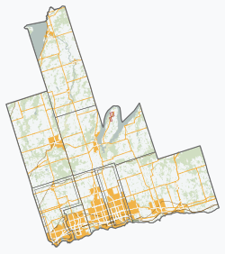
The municipality of Clarington consists of several urban communities, including Bowmanville, Courtice, Newcastle and Orono; as well as several rural communities such as Bond Head, Brownsville, Burketon, Clarke, Cowanville, Crooked Creek, Enfield, Enniskillen, Gaud Corners, Hampton, Haydon, Kendal, Kirby, Leskard, Lovekin, Maple Grove, Mitchell Corners, New Park, Newtonville, Port Darlington, Port Granby, Salem, Solina, Starkville, Taunton (east portion; west portion split with Oshawa along Townline Road), Tyrone, West Side Beach and Wilmot Creek.

Infrastructure

Transportation

A CN Rail freight train at Lovekin, March 1980 Roger Puta Shot One Afternoon at Lovekin, Ontario -- 7 Photos (34765549211).jpg
A CN Rail freight train at Lovekin, March 1980

Clarington is home to several highways; three of which are 400 series highways. Highway 401 stretches through the entirety of Clarington, connecting Newtonville, Newcastle, Bowmanville, and Courtice along the route. Highway 407 is located in north Clarington. It was extended to and terminates at Highway 35/115. The 35/115, also in Clarington, begins at Highway 401 in Newcastle, and run concurrently until they split north of Kirby and head separate directions towards Lindsay and Peterborough. Highway 418, begins at Highway 401 and heads north to connect to Highway 407. The 418 opened on December 9, 2019, as a toll highway. [11] The tolls were removed on April 5, 2022, by the Ontario government. [12] Highway 2, once the primary east–west route across the southern portion of Ontario, runs through Clarington. Downtown Newcastle and Bowmanville are situated along Highway 2.

Bus services are offered by Durham Region Transit and GO Transit.

Freight rail is carried along the Canadian National Kingston subdivision and Canadian Pacific Belleville subdivision which pass through Clarington. The wooden bridge on Lakeshore Road in Lovekin, Ontario, which traverses the CN train line is a popular destination for rail photographers.

On June 20, 2016, it was announced that the Lakeshore East line of GO Transit would be extended to Bowmanville. [13] Clarington gained two new stations. Darlington GO Station, in Courtice and the terminus; Bowmanville GO Station. As of the announcement, the stations are scheduled to open in 2024.

Power

The Darlington Nuclear Generating Station Darlington Nuclear GS-3.jpg
The Darlington Nuclear Generating Station

Clarington is home to the Darlington Nuclear Generating Station.

The Durham-York Energy Centre is located in Clarington. It is home to a 20 MW energy-from-waste (EFW) generation unit that opened in early 2016 that takes waste (140,000 tonnes per year) from Durham and York Regions to burn to generate electricity. [14]

Co-developed by Durham and York Region [15] cost $295 million Canadian to build [14] was built and operated by American-based Covanta. [14] The unit sells and transmits electricity onto Hydro One's distribution network.

Clarington was a candidate location to host ITER in 2001, but the bid was withdrawn two years later. [16]

Climate

Environment Canada operates a weather station in Bowmanville. Under the Köppen climate classification Bowmanville has a humid continental climate with warm summers and cold winters. [17] Unlike many other locations on similar latitudes on the eastern half of the North American continent the winters are relatively mild, with cold extremes being moderated by the proximity to Lake Ontario. In spite of this the average low is around −10 °C (14 °F) in January. Summers are normally moderately warm with averages of around 26 °C (79 °F) during the day but with nights cooling off rapidly to fall below 15 °C (59 °F) on many occasions.

Climate data for Bowmanville Mostert (Clarington)
Climate ID: 6150830; coordinates 43°55′N78°40′W / 43.917°N 78.667°W / 43.917; -78.667 (Bowmanville Mostert) ; elevation 99.1 m (325 ft), 1981–2010 normals
MonthJanFebMarAprMayJunJulAugSepOctNovDecYear
Record high °C (°F)13.0
(55.4)
12.5
(54.5)
21.5
(70.7)
29.0
(84.2)
33.0
(91.4)
33.5
(92.3)
36.0
(96.8)
35.0
(95.0)
32.2
(90.0)
26.0
(78.8)
21.1
(70.0)
17.5
(63.5)
36.0
(96.8)
Mean daily maximum °C (°F)−1.4
(29.5)
0.0
(32.0)
4.3
(39.7)
11.3
(52.3)
18.0
(64.4)
23.1
(73.6)
25.8
(78.4)
24.8
(76.6)
20.4
(68.7)
13.7
(56.7)
7.2
(45.0)
1.6
(34.9)
12.4
(54.3)
Daily mean °C (°F)−5.6
(21.9)
−4.4
(24.1)
−0.2
(31.6)
6.4
(43.5)
12.4
(54.3)
17.5
(63.5)
20.0
(68.0)
19.2
(66.6)
15.0
(59.0)
8.7
(47.7)
3.4
(38.1)
−2.2
(28.0)
7.5
(45.5)
Mean daily minimum °C (°F)−9.9
(14.2)
−8.8
(16.2)
−4.6
(23.7)
1.5
(34.7)
6.8
(44.2)
11.8
(53.2)
14.3
(57.7)
13.5
(56.3)
9.5
(49.1)
3.6
(38.5)
−0.4
(31.3)
−6.0
(21.2)
2.6
(36.7)
Record low °C (°F)−34.0
(−29.2)
−30.0
(−22.0)
−26.0
(−14.8)
−14.4
(6.1)
−5.0
(23.0)
−1.0
(30.2)
2.8
(37.0)
−0.5
(31.1)
−3.3
(26.1)
−8.3
(17.1)
−17.8
(0.0)
−34.5
(−30.1)
−34.5
(−30.1)
Average precipitation mm (inches)63.1
(2.48)
50.5
(1.99)
55.0
(2.17)
70.6
(2.78)
75.9
(2.99)
83.8
(3.30)
63.2
(2.49)
78.1
(3.07)
98.7
(3.89)
70.8
(2.79)
88.6
(3.49)
68.1
(2.68)
866.5
(34.11)
Average rainfall mm (inches)32.2
(1.27)
32.8
(1.29)
41.0
(1.61)
68.0
(2.68)
75.9
(2.99)
83.8
(3.30)
63.2
(2.49)
78.1
(3.07)
98.7
(3.89)
70.6
(2.78)
83.1
(3.27)
46.1
(1.81)
773.3
(30.44)
Average snowfall cm (inches)31.0
(12.2)
17.7
(7.0)
14.1
(5.6)
2.6
(1.0)
0.0
(0.0)
0.0
(0.0)
0.0
(0.0)
0.0
(0.0)
0.0
(0.0)
0.1
(0.0)
5.6
(2.2)
22.0
(8.7)
93.1
(36.7)
Average precipitation days (≥ 0.2 mm)12.510.811.212.512.212.010.411.513.013.014.313.0146.4
Average rainy days (≥ 0.2 mm)5.55.38.011.812.212.010.411.513.013.012.77.4122.7
Average snowy days (≥ 0.2 cm)7.86.34.01.10.00.00.00.00.00.12.16.527.9
Source: Environment Canada [18]

Attractions

Clarington is home to five Christmas parades. It has more Santa Claus/Christmas parades than any other town-sized municipality in Canada [ dubious ]. The parades are run in: Bowmanville, Newcastle, Courtice, Orono, and Enniskillen/Tyrone. The latter parade is organized by "T.H.E.E. Farmer's Parade of Lights", which is a special Christmas parade put on by the farmers from the communities of Tyrone, Haydon, Enniskillen and Enfield.

Enniskillen, which is located in the northern part of Clarington, was the birthplace of Samuel McLaughlin. Mr. McLaughlin started the McLaughlin Motor Car Co. in 1904 and was one of the first major automobile manufacturers in Canada, which evolved into General Motors of Canada. Enniskillen is home to the Enniskillen General Store which opened in 1840 and stills operates today.

Clarington is home to Jungle Cat World.

Clarington Museums & Archives is the local museum in the municipality. [19]

Clarington is home to Camp 30, a World War II Prisoner-of-war camp, and located on Lambs Road, in Bowmanville.

Clarington is also home to Brimacombe, a ski resort located near Kirby, Ontario. [20]

Clarington is home to Darlington Provincial Park, which is located in Darlington. [21]

Bowmanville Zoo

Clarington was home to the Bowmanville Zoo, until its closure in 2016. [22] The Clarington Family Outdoor Adventure Park occupied the same property as the former Bowmanville Zoo lands for several years under the same ownership, until closure. [23] As of 2022, the Township is working with volunteers at Valley 2000 to convert the Zoo grounds into a town park, with trails connection the surrounding housing areas. [24]

Canadian Tire Motorsport Park

NASCAR Pinty's Series taking place at the park in 2021. NASCAR Pinty's Series - 2021 Canadian Tire Motorsport Park.jpg
NASCAR Pinty's Series taking place at the park in 2021.

A major attraction in the municipality is the Canadian Tire Motorsport Park (formerly Mosport Park), a multi-track facility located north of Bowmanville that features a 2.459-mile (4.0 km), 10-turn road course; a half-mile paved oval; a 2.4 km advanced driver and race driver training facility and a 1.4 km kart track (Mosport International Karting). It was also a host of the Canadian Grand Prix of Formula One before the event was moved to a circuit in Montreal in the 1970s.

Canadian Tire Motorsport Park (CTMP) was also the location of three major music festivals held between 1970 and 1980. The Strawberry Fields Festival held August 7–9, 1970 featured Alice Cooper, Jethro Tull, Grand Funk Railroad, Procol Harum, Ten Years After, Lighthouse, Crowbar and Sly and the Family Stone. John Lennon was to be the headline act, bidding to gain exposure for his peace campaign, but after months of planning he backed out due to differences with the show's promoter. However, the event still used the title of The Beatles' 1967 single of the same name. Led Zeppelin were booked to play but also backed out.

Canada Jam was held August 26, 1978 and the Heatwave Festival was held August 23, 1980.

CTMP was home to Republic Live's Boots and Hearts Music Festival, which first opened in the summer of 2012. In 2015, the event was abruptly moved to Burl's Creek Event Grounds, near Barrie. [25]

Notable residents

See also

Notes

  1. Statistic includes all persons that did not make up part of a visible minority or an indigenous identity.
  2. Statistic includes total responses of "Filipino" and "Southeast Asian" under visible minority section on census.
  3. Statistic includes total responses of "West Asian" and "Arab" under visible minority section on census.
  4. Statistic includes total responses of "Chinese", "Korean", and "Japanese" under visible minority section on census.
  5. Statistic includes total responses of "Visible minority, n.i.e." and "Multiple visible minorities" under visible minority section on census.

Related Research Articles

<span class="mw-page-title-main">Ajax, Ontario</span> Town in Ontario, Canada

Ajax is a waterfront town in Durham Region in Southern Ontario, Canada, located in the eastern part of the Greater Toronto Area.

<span class="mw-page-title-main">Oshawa</span> City in Ontario, Canada

Oshawa is a city in Ontario, Canada, on the Lake Ontario shoreline. It lies in Southern Ontario, approximately 60 km (37 mi) east of Downtown Toronto. It is commonly viewed as the eastern anchor of the Greater Toronto Area and of the Golden Horseshoe. It is the largest municipality in the Regional Municipality of Durham. The name Oshawa originates from the Ojibwa term aazhawe, meaning "the crossing place" or just "a cross".

<span class="mw-page-title-main">Whitby, Ontario</span> Town in Ontario, Canada

Whitby is a town in Durham Region. Whitby is located in Southern Ontario east of Ajax and west of Oshawa, on the north shore of Lake Ontario and is home to the headquarters of Durham Region. It had a population of 138,501 at the 2021 census. It is approximately 45 km (28 mi) east of Toronto, and it is known as a commuter suburb in the Durham Region, east of the Greater Toronto Area. While the southern portion of Whitby is predominantly urban and an economic hub, the northern part of the municipality is more rural and includes the communities of Ashburn, Brooklin, Myrtle, Myrtle Station, and Macedonian Village.

<span class="mw-page-title-main">Regional Municipality of Durham</span> Regional municipality in Ontario, Canada

The Regional Municipality of Durham, informally referred to as Durham Region, is a regional municipality in Southern Ontario, Canada. Located east of Toronto and the Regional Municipality of York, Durham forms the east-end of the Greater Toronto Area and part of the Golden Horseshoe region. It has an area of approximately 2,500 km2 (970 sq mi). The regional government is headquartered in Whitby.

<span class="mw-page-title-main">Greater Toronto Area</span> Metropolitan area in Ontario, Canada

The Greater Toronto Area, commonly referred to as the GTA, includes the City of Toronto and the regional municipalities of Durham, Halton, Peel, and York. In total, the region contains 25 urban, suburban, and rural municipalities. The Greater Toronto Area begins in Burlington in Halton Region to the west, and extends along Lake Ontario past downtown Toronto eastward to Clarington in Durham Region.

<span class="mw-page-title-main">Golden Horseshoe</span> Secondary region in Ontario, Canada

The Golden Horseshoe is a secondary region of Southern Ontario, Canada, which lies at the western end of Lake Ontario, with outer boundaries stretching south to Lake Erie and north to Lake Scugog, Lake Simcoe and Georgian Bay of Lake Huron. The region is the most densely populated and industrialized in Canada. Based on the 2021 census, with a population of 7,759,635 people in its core and 9,765,188 in its greater area, the Golden Horseshoe accounts for over 20 percent of the population of Canada and more than 54 percent of Ontario's population. It is part of the Quebec City–Windsor Corridor, itself part of the Great Lakes megalopolis.

<span class="mw-page-title-main">Northumberland County, Ontario</span> County in Ontario, Canada

Northumberland County is an upper-tier municipality situated on the north shore of Lake Ontario, east of Toronto in Central Ontario. The Northumberland County headquarters are located in Cobourg.

<span class="mw-page-title-main">Peterborough County</span> County in Ontario, Canada

Peterborough County is located in Southern Ontario, Canada. The county seat is The City of Peterborough, which is independent of the county.

<span class="mw-page-title-main">Kawartha Lakes</span> City in Ontario, Canada

The City of Kawartha Lakes is a unitary municipality in Central Ontario, Canada. It is a municipality legally structured as a single-tier city; however, Kawartha Lakes is the size of a typical Ontario county and is mostly rural. It is the second largest single-tier municipality in Ontario by land area.

<span class="mw-page-title-main">Haliburton—Kawartha Lakes—Brock (federal electoral district)</span> Federal electoral district in Ontario, Canada

Haliburton—Kawartha Lakes—Brock is a federal electoral district in central Ontario, Canada, that has been represented in the House of Commons of Canada since 1968.

<span class="mw-page-title-main">Bowmanville</span> Place in Ontario, Canada

Bowmanville is a town of approximately 40,000 people located in the Municipality of Clarington, Durham Region, Ontario, Canada. It is approximately 75 km (47 mi) east of Toronto, and 15 km (9.3 mi) east of Oshawa along Highway 2. Bowmanville was first incorporated as a town in 1858, but later incorporated with the neighbouring townships of Clarke and Darlington in 1974 forming the Town of Newcastle, which was renamed in 1994 to the Municipality of Clarington. Bowmanville is part of the Greater Toronto Area.

Durham County is an historic county in Ontario, Canada. It was named for the English County Durham and city of Durham. It was created in 1792 but was later merged Northumberland County to form the United Counties of Northumberland and Durham. In 1974, the two counties were split and reorganized, with the former portions of Durham County reorganized into the Regional Municipality of Durham.

<span class="mw-page-title-main">Etobicoke—Lakeshore (federal electoral district)</span> Federal electoral district in Ontario, Canada

Etobicoke—Lakeshore is a federal electoral district in Ontario, Canada, that has been represented in the House of Commons of Canada since 1968.

<span class="mw-page-title-main">Durham (federal electoral district)</span> Federal electoral district in Ontario, Canada

Durham is a federal electoral district in Ontario, Canada, that has been represented in the House of Commons of Canada from 1904 to 1968 and since 1988.

<span class="mw-page-title-main">Newcastle, Ontario</span> Unincorporated community in Ontario, Canada

Newcastle is a community in the municipality of Clarington in Durham Region, Ontario, Canada. The community inherits the former name of the present-day municipality which it belongs to.

<span class="mw-page-title-main">Courtice</span> Unincorporated community in Ontario, Canada

Courtice is a community in Ontario, Canada, about 60 km (37 mi) east of Toronto, within the Municipality of Clarington. Adjacent to Oshawa, it is west of Bowmanville, which is also part of Clarington. Courtice Road connects with Highway 401 at Interchange 425, providing arterial access to the community. Darlington Provincial Park is located just south of Courtice.

<span class="mw-page-title-main">Kawartha Pine Ridge District School Board</span>

Kawartha Pine Ridge District School Board is a public, secular, English language school board headquartered in Peterborough, Ontario. It is the amalgamation of the former Peterborough County Board of Education and the Northumberland-Clarington Board of Education and serves the communities located in the Kawarthas to the north, and south to Lake Ontario. Hastings County is its eastern border and its western border extends to the City of Kawartha Lakes and to the edge of the City of Oshawa.

<span class="mw-page-title-main">Darlington Provincial Park</span> Provincial park in Ontario, Canada

Darlington Provincial Park is a provincial park in Ontario, Canada. It is located just south of Highway 401 near the town of Courtice, between the cities of Bowmanville and Oshawa. A small park, the topography is dominated by gentle hills formed by a terminal moraine deposited by glaciers at the end of the last Ice Age. The park borders on the northern shore of Lake Ontario and also encloses McLaughlin Bay. The bay is shallow and at some point in the 1990s was completely closed off from the lake by the action of the waves. The property bordering the park to the west is the home of General Motors Corporation's Canadian headquarters. Kintigh Generating Station can be seen from this provincial park even though it is on the other side of the lake in Somerset, New York.

<span class="mw-page-title-main">Demographics of Ontario</span>

Ontario, one of the 13 provinces and territories of Canada, is located in east-central Canada. It is Canada's most populous province by a large margin, accounting for nearly 40 percent of all Canadians, and is the second-largest province in total area. Ontario is fourth-largest in total area when the territories of the Northwest Territories and Nunavut are included. It is home to the nation's capital city, Ottawa, and the nation's most populous city, Toronto.

<span class="mw-page-title-main">Bowmanville Creek</span> River in Ontario, Canada

Bowmanville Creek is a stream in the municipality of Clarington, Regional Municipality of Durham in south-central Ontario, Canada. It flows from the Oak Ridges Moraine to Lake Ontario at Bowmanville. The creek is under the auspices of the Central Lake Ontario Conservation Authority.

References

  1. "Clarington, Municipality Ontario (Census Subdivision)". Census Profile, Canada 2011 Census . Statistics Canada. 8 February 2012. Retrieved 2012-02-24.
  2. 1 2 3 "Population and dwelling counts: Canada, provinces and territories, census divisions and census subdivisions (municipalities), Ontario". Statistics Canada. February 9, 2022. Retrieved March 31, 2022.
  3. "Orono Weekly Times, 2 Jan 1974, p. 1". Clarington Digital Newspaper Collection. CPL / CMA. Retrieved 27 October 2022.
  4. Data Management Group (2006). "Municipality of Clarington, 2006 Statistics" (PDF). Travel Survey Summaries for the Greater Toronto and Hamilton Area. University of Toronto. Retrieved 25 September 2012. For trips from Clarington, 6% go to Pickering, 5% to Ajax, 12% to Whitby, 40% to Oshawa and 15% to Toronto, for a total of 78%.
  5. Government of Canada, Statistics Canada (2022-10-26). "Census Profile, 2021 Census of Population". www12.statcan.gc.ca. Retrieved 2023-01-15.
  6. Government of Canada, Statistics Canada (2021-10-27). "Census Profile, 2016 Census". www12.statcan.gc.ca. Retrieved 2023-01-15.
  7. Government of Canada, Statistics Canada (2015-11-27). "NHS Profile". www12.statcan.gc.ca. Retrieved 2023-01-15.
  8. Government of Canada, Statistics Canada (2019-08-20). "2006 Community Profiles". www12.statcan.gc.ca. Retrieved 2023-01-15.
  9. Government of Canada, Statistics Canada (2019-07-02). "2001 Community Profiles". www12.statcan.gc.ca. Retrieved 2023-01-15.
  10. "Census Profile for the Census Subvision of Clarington (Municipality), Ontario". Statistics Canada. 8 February 2012. Archived from the original on 4 March 2016. Retrieved November 24, 2018.
  11. "About Highway 407, Highway 412 and Highway 418". Highway 407. Retrieved 13 September 2022.
  12. "Unfair Tolls Officially Gone on Highways 412 and 418". Ontario.ca. Government of Ontario. Retrieved 13 September 2022.
  13. "GO trains going to Bowmanville starting in 2024". CityNews Toronto. CityNews. Retrieved September 13, 2022.
  14. 1 2 3 Javed, Noor (January 28, 2016). "Durham Region gives incinerator green light". The Toronto Star. Retrieved April 16, 2018.
  15. "The Ontario Power Authority has merged with the Independent Electricity System Operator". www.powerauthority.on.ca. Archived from the original on April 16, 2016. Retrieved April 16, 2018.
  16. McCabe, Heather (August 3, 2000). "France may bid for fusion reactor". Nature. 406 (6795): 447. doi: 10.1038/35020229 . PMID   10952280.
  17. "Bowmanville, Ontario Climate Summary". Weatherbase. Retrieved 2 January 2016.
  18. "Bowmanville Mostert". Canadian Climate Normals 1981-2010 Station Data. Environment and Climate Change Canada. Retrieved 2021-10-22.
  19. "Clarington Museums & Archives". Clarington Museums & Archives. Retrieved August 7, 2018.
  20. "Brimacombe". Oshawa Ski Club. Retrieved October 23, 2022.
  21. "Ontario Parks". Ontario Parks. Retrieved 13 September 2022.
  22. Farooqui, Salmaan (10 October 2016). "Bowmanville Zoo closes for good after animal abuse claims against director". Toronto Star. Retrieved 14 June 2018.
  23. Calis, Kristen. "Outdoor fun park opens at former Bowmanville Zoo". Durham Region News. Retrieved 14 June 2018.
  24. "New plans for old Bowmanville Zoo". Toronto Star. Clarington This Week. Retrieved 13 September 2022.
  25. Andrews, Brad. "Boots and Hearts leaving Clarington 'great loss to the region'". DurhamRegion.com. Retrieved 22 October 2018.