Oshtemo Township, Michigan

Last updated
Oshtemo Township, Michigan
Oshtemo Charter Township
Oshtemo Chater Township, MI location.png
Location within Kalamazoo County
USA Michigan location map.svg
Red pog.svg
Oshtemo Township
Location within the state of Michigan
Usa edcp location map.svg
Red pog.svg
Oshtemo Township
Location within the United States
Coordinates: 42°17′0″N85°40′56″W / 42.28333°N 85.68222°W / 42.28333; -85.68222
Country United States
State Michigan
County Kalamazoo
Area
  Total36.0 sq mi (93.2 km2)
  Land35.9 sq mi (92.9 km2)
  Water0.1 sq mi (0.3 km2)
Elevation
945 ft (288 m)
Population
 (2020)
  Total23,747
  Density660/sq mi (250/km2)
Time zone UTC-5 (Eastern (EST))
  Summer (DST) UTC-4 (EDT)
ZIP code
49009, 49077 (Oshtemo post office boxes only)
Area code 269
FIPS code 26-61400 [1]
GNIS feature ID1626865 [2]
Website www.oshtemo.org

Oshtemo Charter Township is a charter township of Kalamazoo County in the U.S. state of Michigan. The 2020 census recorded a population of 23,747 [3] , up from 21,705 at the 2010 census [4] . The township was organized in 1839.

Contents

Geography

According to the United States Census Bureau, the township has a total area of 36.0 square miles (93.2 km2), of which 35.9 square miles (92.9 km2) are land and 0.1 square miles (0.3 km2), or 0.37%, are water. [4]

Oshtemo Township is located at the Kalamazoo County - Van Buren County line, adjacent to and west of the city of Kalamazoo and Kalamazoo Township; adjacent to and north of Texas Charter Township and adjacent to and south of Alamo Township.

A Superfund site is located in the township at K & L Avenue Landfill. [5]

Demographics

As of the census [1] of 2000, there were 17,003 people, 7,551 households, and 4,024 families residing in the township. The population density was 472.8 inhabitants per square mile (182.5/km2). There were 7,987 housing units at an average density of 222.1 per square mile (85.8/km2). The racial makeup of the township was 84.97% White, 9.39% African American, 0.30% Native American, 2.26% Asian, 0.02% Pacific Islander, 1.08% from other races, and 1.97% from two or more races. Hispanic or Latino of any race were 2.33% of the population.

There were 7,551 households, out of which 24.7% had children under the age of 18 living with them, 41.2% were married couples living together, 9.1% had a female householder with no husband present, and 46.7% were non-families. 33.9% of all households were made up of individuals, and 8.7% had someone living alone who was 65 years of age or older. The average household size was 2.19 and the average family size was 2.87.

In the township the population was spread out, with 20.8% under the age of 18, 17.1% from 18 to 24, 27.6% from 25 to 44, 21.1% from 45 to 64, and 13.3% who were 65 years of age or older. The median age was 33 years. For every 100 females, there were 89.4 males. For every 100 females age 18 and over, there were 86.1 males.

The median income for a household in the township was $38,433, and the median income for a family was $57,515. Males had a median income of $40,798 versus $28,257 for females. The per capita income for the township was $24,249. About 7.6% of families and 13.8% of the population were below the poverty line, including 15.1% of those under age 18 and 7.2% of those age 65 or over.

Related Research Articles

<span class="mw-page-title-main">Kalamazoo County, Michigan</span> County in Michigan, United States

Kalamazoo County is a county located in the U.S. state of Michigan. As of 2020, the population was 261,670. The county seat is Kalamazoo.

Gun Plain Charter Township is a charter township of Allegan County in the U.S. state of Michigan. As of the 2020 census, the township population was 6,148.

Saugatuck Township is a civil township of Allegan County in the U.S. state of Michigan. The population was 3,443 at the 2020 census, up from 2944 at the 2010 census.

<span class="mw-page-title-main">St. Joseph Charter Township, Michigan</span> Charter township in Michigan, United States

St. Joseph Charter Township is a charter township of Berrien County in the U.S. state of Michigan. The population was 9,993 at the 2020 census. The township is on the shores of Lake Michigan in the west central portion of the county, south of and adjacent to the city of St. Joseph.

<span class="mw-page-title-main">Bedford Charter Township, Michigan</span> Charter township in Michigan, United States

Bedford Charter Township is a charter township located in the northwest corner of Calhoun County in the U.S. state of Michigan. It is part of the Battle Creek, Michigan Metropolitan Statistical Area. As of the 2020 census, the township population was 9,198. Most of the township lies north of the Kalamazoo River and the city of Battle Creek. Three small noncontiguous areas of the township lie south of the Kalamazoo River.

<span class="mw-page-title-main">Emmett Charter Township, Michigan</span> Charter township in Michigan, United States

Emmett Charter Township is a charter township of Calhoun County in the U.S. state of Michigan. It is part of the Battle Creek Metropolitan Statistical Area. The population was 11,744 at the 2020 census.

<span class="mw-page-title-main">Spring Arbor Township, Michigan</span> Civil township in Michigan, United States

Spring Arbor Township is a civil township of Jackson County in the U.S. state of Michigan. The population was 8,267 at the 2010 census, up from 7,577 at the 2000 census.

<span class="mw-page-title-main">Charleston Township, Kalamazoo County, Michigan</span> Civil township in Michigan, United States

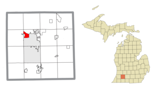
Charleston Township is a civil township of Kalamazoo County in the U.S. state of Michigan. The 2020 census recorded a population of 1,904, slightly down from 1,975 at the 2010 census.

<span class="mw-page-title-main">Comstock Northwest, Michigan</span> Census-designated place & unincorporated community in Michigan, United States

Comstock Northwest is a census-designated place (CDP) in Kalamazoo County in the U.S. state of Michigan. The population was 5,455 at the 2010 census, up from 4,472 at the 2000 census.

<span class="mw-page-title-main">Cooper Township, Michigan</span> Charter township in Michigan, United States

Cooper Charter Township is a charter township of Kalamazoo County in the U.S. state of Michigan. The population was 10,418 at the 2020 census, up from 10,111 at the 2010 census. The township was organized in 1837.

<span class="mw-page-title-main">Eastwood, Michigan</span> Census-designated place & unincorporated community in Michigan, United States

Eastwood is an unincorporated community in Kalamazoo Charter Township, Kalamazoo County in the U.S. state of Michigan. It is a census-designated place (CDP) for statistical purposes and does not have any legal status as an incorporated municipality. The population was 6,340 at the 2010 census.

<span class="mw-page-title-main">Kalamazoo Township, Michigan</span> Charter township in Michigan, United States

Kalamazoo Charter Township is a charter township of Kalamazoo County in the U.S. state of Michigan. The population was 22,777 at the 2020 census.

<span class="mw-page-title-main">Ross Township, Michigan</span> Civil township in Michigan, United States

Ross Township is a township in Kalamazoo County in the U.S. state of Michigan. The population was 4,851 at the 2020 census, up from 4,664 at the 2010 census.

<span class="mw-page-title-main">Texas Charter Township, Michigan</span> Charter township in Michigan, United States

Texas Charter Township, officially named the Charter Township of Texas, is a charter township of Kalamazoo County, in the U.S. state of Michigan. As of the 2020 census, the township population was 17,691, up from 14,697 at the 2010 census. It encompasses the entire portion of the survey township T3S R12W.

<span class="mw-page-title-main">Wakeshma Township, Michigan</span> Civil township in Michigan, United States

Wakeshma Township is a civil township of Kalamazoo County in the U.S. state of Michigan. The 2020 census recorded a population of 1,341, up from 1,301 at the 2010 census.

<span class="mw-page-title-main">Westwood, Michigan</span> Census-designated place & unincorporated community in Michigan, United States

Westwood is an unincorporated community in Kalamazoo Charter Township, Kalamazoo County in the U.S. state of Michigan. It is a census-designated place (CDP) for statistical purposes and does not have any legal status as an incorporated municipality. The population was 8,653 at the 2010 census, down from 9,122 at the 2000 census.

<span class="mw-page-title-main">Midland Township, Michigan</span> Charter township in Michigan, United States

Midland Charter Township is a charter township of Midland County in the U.S. state of Michigan. The population was 2,223 at the 2020 census. The township consists of three non-contiguous segments adjacent to the city of Midland, and the township and city are administered autonomously.

<span class="mw-page-title-main">Georgetown Township, Michigan</span> Charter township in Michigan, United States

Georgetown Charter Township is a charter township of Ottawa County in the U.S. state of Michigan. The population was 54,091 at the time of the 2020 census. The city of Hudsonville is adjacent to the township and the unincorporated community of Jenison is within the township, which includes about half the township's population.

Holland Charter Township is a charter township of Ottawa County in the U.S. state of Michigan. As of the 2020 census, the population was 38,276.

<span class="mw-page-title-main">Richland Township, Kalamazoo County, Michigan</span> Civil township in Michigan, United States

Richland Township is a civil township of Kalamazoo County in the U.S. state of Michigan. The population was 8,693 at the 2020 census, up from 7,580 at the 2010 census.

References

  1. 1 2 "U.S. Census website". United States Census Bureau . Retrieved 2008-01-31.
  2. U.S. Geological Survey Geographic Names Information System: Oshtemo Township, Michigan
  3. "Explore Census Data". data.census.gov. Retrieved 2024-04-21.
  4. 1 2 "Geographic Identifiers: 2010 Census Summary File 1 (G001), Oshtemo charter township, Kalamazoo County, Michigan". American FactFinder. U.S. Census Bureau. Archived from the original on February 13, 2020. Retrieved March 29, 2019.
  5. "K&L AVENUE LANDFILL Site Profile". cumulis.epa.gov. United States Environmental Protection Agency . Retrieved 2019-02-20.