Wakeshma Township, Michigan

Last updated

Wakeshma Township, Michigan
Wakeshma Township, MI location.png
Location within Kalamazoo County
USA Michigan location map.svg
Red pog.svg
Wakeshma Township
Location within the state of Michigan
Usa edcp location map.svg
Red pog.svg
Wakeshma Township
Location within the United States
Coordinates: 42°6′56″N85°21′13″W / 42.11556°N 85.35361°W / 42.11556; -85.35361
Country United States
State Michigan
County Kalamazoo
Area
  Total36.0 sq mi (93.3 km2)
  Land36.0 sq mi (93.3 km2)
  Water0.0 sq mi (0.0 km2)
Elevation
906 ft (276 m)
Population
 (2020)
  Total1,341
  Density37/sq mi (14/km2)
Time zone UTC-5 (Eastern (EST))
  Summer (DST) UTC-4 (EDT)
FIPS code 26-077-82840 [1]
GNIS feature ID1627206 [2]
Website wakeshmatownship.com

Wakeshma Township is a civil township of Kalamazoo County in the U.S. state of Michigan. The 2020 census recorded a population of 1,341, [3] up from 1,301 at the 2010 census. [4]

Contents

Communities

Fulton is the site of the headquarters of the federally recognized Nottawaseppi Huron Band of Potawatomi. The Band has a reservation near here and jurisdiction over tribal members in neighboring counties. It owns and operates a gaming casino in Battle Creek, Michigan, about 25 miles (40 km) to the northeast of the township.

Geography

According to the United States Census Bureau, the township has a total area of 36.0 square miles (93.3 km2), all land. [4] Little Portage Creek and Bear Creek flow through the township.

Adjacent townships in Kalamazoo County are: Brady (west), Pavilion (northwest) and Climax (north). In Calhoun County: Leroy (northeast) and Athens (east). In Branch County: Sherwood (southeast). In St. Joseph County: Leonidas (south) and Mendon (southwest).

Demographics

As of the census [1] of 2000, there were 1,414 people, 486 households, and 402 families residing in the township. The population density was 39.3 inhabitants per square mile (15.2/km2). There were 502 housing units at an average density of 13.9 per square mile (5.4/km2). The racial makeup of the township was 97.60% White, 0.50% African American, 0.07% Native American, 0.35% Asian, 0.64% from other races, and 0.85% from two or more races. Hispanic or Latino of any race were 0.64% of the population.

There were 486 households, out of which 40.7% had children under the age of 18 living with them, 69.8% were married couples living together, 7.8% had a female householder with no husband present, and 17.1% were non-families. 13.6% of all households were made up of individuals, and 4.5% had someone living alone who was 65 years of age or older. The average household size was 2.88 and the average family size was 3.14.

In the township the population was spread out, with 28.8% under the age of 18, 6.6% from 18 to 24, 30.6% from 25 to 44, 23.8% from 45 to 64, and 10.3% who were 65 years of age or older. The median age was 36 years. For every 100 females, there were 107.0 males. For every 100 females age 18 and over, there were 108.1 males.

The median income for a household in the township was $52,328, and the median income for a family was $53,264. Males had a median income of $36,739 versus $27,292 for females. The per capita income for the township was $20,051. About 7.3% of families and 8.7% of the population were below the poverty line, including 13.2% of those under age 18 and 8.3% of those age 65 or over.

Related Research Articles

<span class="mw-page-title-main">Kalamazoo County, Michigan</span> County in Michigan, United States

Kalamazoo County is a county located in the U.S. state of Michigan. As of 2020, the population was 261,670. The county seat is Kalamazoo.

<span class="mw-page-title-main">Calhoun County, Michigan</span> County in Michigan, United States

Calhoun County is a county in the U.S. state of Michigan. As of the 2020 Census, the population was 134,310. The county seat is Marshall. The county was established on October 19, 1829, and named after John C. Calhoun, who was at the time Vice President under Andrew Jackson, making it one of Michigan's Cabinet counties. County government was first organized on March 6, 1833. Calhoun County comprises the Battle Creek Metropolitan Statistical Area and is included in the Kalamazoo-Battle Creek-Portage Combined Statistical Area.

<span class="mw-page-title-main">Barry County, Michigan</span> County in Michigan, United States

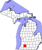
Barry County is a county in the U.S. state of Michigan. As of the 2020 United States Census, the population was 62,423. The county seat is Hastings.

Hope Township is a civil township of Barry County in the U.S. state of Michigan. The population was 3,154 at the 2020 census.

Albion Township is a civil township of Calhoun County in the U.S. state of Michigan. It is part of the Battle Creek, Michigan Metropolitan Statistical Area. As of the 2020 census, the township population was 1,094.

Athens Township is a civil township of southwest Calhoun County in the U.S. state of Michigan, about 15 miles (24 km) south of Battle Creek. It is part of the Battle Creek, Michigan Metropolitan Statistical Area. As of the 2020 census, the township population was 2,444. The Nottawaseppi Huron Band of Potawatomi is based in Athens Township.

<span class="mw-page-title-main">Bedford Charter Township, Michigan</span> Charter township in Michigan, United States

Bedford Charter Township is a charter township located in the northwest corner of Calhoun County in the U.S. state of Michigan. It is part of the Battle Creek, Michigan Metropolitan Statistical Area. As of the 2020 census, the township population was 9,198. Most of the township lies north of the Kalamazoo River and the city of Battle Creek. Three small noncontiguous areas of the township lie south of the Kalamazoo River.

Clarence Township is a civil township located in northeast Calhoun County in the U.S. state of Michigan. It is part of the Battle Creek, Michigan Metropolitan Statistical Area. The population was 1,903 at the 2020 census. The township was originally named Pinkney Township.

<span class="mw-page-title-main">Emmett Charter Township, Michigan</span> Charter township in Michigan, United States

Emmett Charter Township is a charter township of Calhoun County in the U.S. state of Michigan. It is part of the Battle Creek Metropolitan Statistical Area. The population was 11,744 at the 2020 census.

Homer Township is a civil township of Calhoun County in the U.S. state of Michigan. It is part of the Battle Creek, Michigan Metropolitan Statistical Area. The population was 2,896 at the 2020 census.

Leroy Township is a civil township of Calhoun County in the U.S. state of Michigan. It is part of the Battle Creek, Michigan Metropolitan Statistical Area. The population was 3,659 at the 2020 census.

<span class="mw-page-title-main">Level Park–Oak Park, Michigan</span> Census-designated place & unincorporated community in Michigan, United States

Level Park–Oak Park is a census-designated place for statistical purposes in Calhoun County in the U.S. state of Michigan. The CDP population was 3,260 at the 2020 census. The CDP is immediately northwest of the city of Battle Creek and is part of the Battle Creek Metropolitan Statistical Area.

Marengo Township is a civil township of Calhoun County in the U.S. state of Michigan. It is part of the Battle Creek, Michigan Metropolitan Statistical Area. As of the 2020 census, the township population was 2,205.

Marshall Township is a civil township of Calhoun County in the U.S. state of Michigan. It is part of the Battle Creek, Michigan Metropolitan Statistical Area. The population was 3,157 at the 2020 census. The city of Marshall is adjacent to the township, but is administratively autonomous.

Pennfield Charter Township is a charter township of Calhoun County in the U.S. state of Michigan. It is part of the Battle Creek, Michigan Metropolitan Statistical Area. The population was 8,781 at the 2020 census.

Sheridan Township is a civil township of Calhoun County in the U.S. state of Michigan. It is part of the Battle Creek, Michigan Metropolitan Statistical Area. The population was 1,809 at the 2020 census.

Tekonsha Township is a civil township of Calhoun County in the U.S. state of Michigan. It is part of the Battle Creek, Michigan Metropolitan Statistical Area. The population was 1,520 at the 2020 census.

<span class="mw-page-title-main">Charleston Township, Kalamazoo County, Michigan</span> Civil township in Michigan, United States

Charleston Township is a civil township of Kalamazoo County in the U.S. state of Michigan. The 2020 census recorded a population of 1,904, slightly down from 1,975 at the 2010 census.

<span class="mw-page-title-main">Climax Township, Michigan</span> Civil township in Michigan, United States

Climax Township is a civil township of Kalamazoo County in the U.S. state of Michigan. The 2020 census recorded a population of 2,364.

<span class="mw-page-title-main">Texas Charter Township, Michigan</span> Charter township in Michigan, United States

Texas Charter Township, officially named the Charter Township of Texas, is a charter township of Kalamazoo County, in the U.S. state of Michigan. As of the 2020 census, the township population was 17,691, up from 14,697 at the 2010 census. It encompasses the entire portion of the survey township T3S R12W.

References

  1. 1 2 "U.S. Census website". United States Census Bureau . Retrieved January 31, 2008.
  2. U.S. Geological Survey Geographic Names Information System: Wakeshma Township, Michigan
  3. "Explore Census Data". data.census.gov. Retrieved April 21, 2024.
  4. 1 2 "Geographic Identifiers: 2010 Census Summary File 1 (G001), Wakeshma township, Kalamazoo County, Michigan". American FactFinder. U.S. Census Bureau. Archived from the original on February 13, 2020. Retrieved April 5, 2019.
  5. U.S. Geological Survey Geographic Names Information System: Fulton
  6. "Map of 49052 ZIP code tabulation area". Archived from the original on June 8, 2011. Retrieved February 11, 2007.