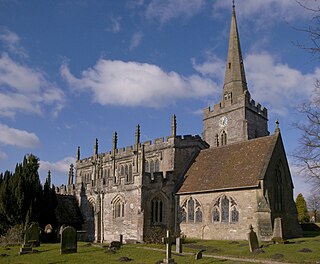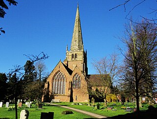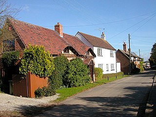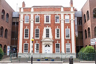
Southam is a market town and civil parish in the Stratford-on-Avon district of Warwickshire, England. Southam is situated on the River Stowe, which flows from Napton-on-the-Hill and joins Warwickshire's River Itchen at Stoneythorpe, just outside the town.

Warwickshire is a ceremonial county in the West Midlands of England. It is bordered by Staffordshire and Leicestershire to the north, Northamptonshire to the east, Oxfordshire and Gloucestershire to the south, and Worcestershire and the West Midlands county to the west. The largest settlement is Nuneaton and the county town is Warwick.

Warwick is a local government district in Warwickshire, England. It is named after the historic county town of Warwick, which is the district's second largest town; the largest town is Royal Leamington Spa, where the council is based. The district also includes the towns of Kenilworth and Whitnash and surrounding villages and rural areas. Leamington Spa, Warwick and Whitnash form a conurbation which has about two thirds of the district's population.

The Metropolitan Borough of Solihull is a metropolitan borough in West Midlands county, England. It is named after its largest town, Solihull, from which Solihull Metropolitan Borough Council is based. For Eurostat purposes it is a NUTS 3 region and is one of seven boroughs or unitary districts that comprise the "West Midlands" NUTS 2 region. Much of the large residential population in the north of the borough centres on the communities of Castle Bromwich, Kingshurst, Marston Green and Smith's Wood as well as the towns of Chelmsley Wood and Fordbridge. In the south are the towns of Shirley and Solihull, as well as the large villages of Knowle, Dorridge, Meriden and Balsall Common.

Bilton is a suburb of Rugby in Warwickshire, England, located about 1.5 miles (2.4 km) south-west of Rugby town centre. It is also a ward of the Borough of Rugby, which at the 2021 Census had a population of 6,544. It comprises much of the western half of the town. Historically a village in its own right, Bilton was incorporated into Rugby in 1932.

Lapworth is a village and civil parish in Warwickshire, England, which had a population of 2,100 according to the 2001 census; this had fallen to 1,828 at the 2011 Census. It lies seven miles (11 km) south of Solihull and ten miles (16 km) northwest of Warwick, and incorporates the hamlet of Kingswood. Lapworth boasts a historic church, the Church of St Mary the Virgin, a chapel. Two National Trust sites are nearby: Baddesley Clinton, a medieval moated manor house and garden located in the village of Baddesley Clinton; and Packwood House, a Tudor manor house and yew garden with over 100 trees in Packwood.

Bickenhill is a village in the civil parish of Bickenhill and Marston Green, in the Metropolitan Borough of Solihull, in the West Midlands county, England, on the eastern fringe of the West Midlands conurbation. Bickenhill is also a ward and was within the historic county of Warwickshire. Birmingham Airport is also located within the civil parish.

Hockley Heath is a large village and civil parish in the Arden area mostly within the Metropolitan Borough of Solihull, West Midlands, England. It incorporates the hamlet of Nuthurst, and has a history dating back to the year 705 AD as a wood owned by Worcester Cathedral. The parish, known as Nuthurst cum Hockley Heath, is to the south of the West Midlands conurbation, 12 miles (19 km) southeast of Birmingham 5.5 miles (8.9 km) from Solihull town centre and 13 miles (21 km) north of Stratford-upon-Avon. The village forms part of the border with Warwickshire and the District of Stratford-on-Avon to the south, with some parts of the village on either side of the border. According to the 2001 census, the parish had a population of 6,771, being measured at the 2011 Census as 2,038.

Packwood House is a timber-framed Tudor manor house in Packwood on the Solihull border near Lapworth, Warwickshire. Owned by the National Trust since 1941, the house is a Grade I listed building. It has a wealth of tapestries and fine furniture, and is known for the garden of yews.

Solihull is a market town and the administrative centre of the Metropolitan Borough of Solihull, in the West Midlands, England. Solihull is situated on the River Blythe in the Forest of Arden area. The town had a population of 126,577 at the 2021 Census, and its wider borough had a population of 216,240. The town is located 8 miles southeast of Birmingham and 13 miles west of Coventry.

Warwickshire County Council is the county council that governs the non-metropolitan county of Warwickshire in England. Its headquarters are at Shire Hall in the centre of Warwick, the county town. The council's principal functions are county roads and rights of way, social services, education and libraries, but it also provides numerous other local government services in its area.

Elmdon is a suburban village in the civil parish of Bickenhill and Marston Green, in the Solihull district, in the county of the West Midlands, England. The population of this Solihull Ward at the 2011 census was 12,067. In 1931 the parish had a population of 225. On 1 April 1932 the parish was abolished and merged with Bickenhill and Solihull Urban.

Moat House is a Grade II* listed building situated in Lichfield Road, Sutton Coldfield, West Midlands. It is part of the Anchorage Road conservation area.

Staffordshire County Council is the upper-tier local authority for the non-metropolitan county of Staffordshire, England. The non-metropolitan county differs from the ceremonial county, which additionally includes Stoke-on-Trent.

Church Lawford is a village and civil parish in Warwickshire, England. It is located just under 2.5 miles (4 km) west of the town of Rugby and 4.5 miles (7 km) east of Coventry. The population of the civil parish taken at the 2021 census was 432.

Great Rollright is a village and former civil parish, now in the parish of Rollright, in the West Oxfordshire district, in Oxfordshire, England, and about 2.5 miles (4 km) north of Chipping Norton.

There are 19 Grade I listed buildings in the City of Coventry. In the United Kingdom, a listed building is a building or structure of special historical or architectural importance. These buildings are legally protected from demolition, as well as from any extensions or alterations that would adversely affect the building's character or destroy historic features. Listed buildings in England and Wales are divided into three categories—Grade II buildings are buildings of special interest; Grade II* buildings are Grade II buildings of particular interest; and Grade I buildings, which are those of "exceptional" interest. Only around four per cent of listed buildings are given Grade I status.

There are 24 Grade II* listed buildings in the City of Coventry. In the United Kingdom, a listed building is a building or structure of special historical or architectural importance. These buildings are legally protected from demolition, as well as from any extensions or alterations that would adversely affect the building's character or destroy historic features. Listed buildings are divided into three categories—Grade I buildings are buildings of "exceptional" interest, Grade II buildings are buildings of special interest, and Grade II* buildings are Grade II buildings that are of particular interest. Coventry is an ancient city and a metropolitan borough in the West Midlands of England. The city's history dates back to at least the 11th century (CE), and it was a thriving centre of commerce in mediaeval times.

Tidmington is a village and civil parish in the Stratford-on-Avon District of Warwickshire, England. It is 11 miles (18 km) south from the town of Stratford-upon-Avon, and at the extreme southern edge of the county bordering Gloucestershire. Within the parish is the Grade II* listed c.1600 Tidmington House, and the Grade II* early 13th-century church of unknown dedication. At the 2001 Census, which for statistical purposes now includes the neighbouring parish of Burmington, the combined population was 153.

Hampton in Arden packhorse bridge crosses the River Blythe near Hampton in Arden in the West Midlands of England, between Birmingham and Coventry. Dating from the 15th century, it is the only bridge of its kind in the area now covered by the West Midlands, and is a grade II* listed building and a scheduled monument.


