
Chittoor is a city and district headquarters in Chittoor district of the Indian state of Andhra Pradesh. It is also the mandal and divisional headquarters of Chittoor mandal and Chittoor revenue division respectively. The city has a population of 153,756 and that of the agglomeration is 175,647.

Madanapalle is the largest city in Annamayya district and Rajampet Lok Sabha constituency of the Indian state of Andhra Pradesh. It is a Selection Grade Municipal City Council. Madanapalle is headquarters of Madanapalle Mandal,Madanapalle revenue division and PKM Urban Development Authority.

Gooty is a town in Anantapur district of the Indian state of Andhra Pradesh. It is the headquarters of Gooty mandal in Anantapur revenue division. The town is renowned for the Gooty hill fort.

Chittoor district is one of the eight districts in the Rayalaseema region of the Indian state of Andhra Pradesh. It has a population of 18,72,951 according to 2011 census of India. It is a major market centre for mangoes, grains, sugarcane, and peanuts. The district headquarters is located at Chittoor.

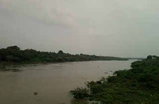
Proddatur (1915) is a city in the YSR Kadapa District of Andhra Pradesh, located on the banks of the Penna River. The city is a municipality, and also the mandal headquarters of Proddatur mandal. It is the second-largest town in former Kadapa District. It is the oldest municipality which formed before Independence.
Atmakur is a small town in Nellore district of the Indian state of Andhra Pradesh. It is a municipality in Atmakur mandal. The town is the headquarters of Atmakur mandal and Assembly Constituency.
Pedana is a municipality and the headquarters of Pedana mandal under Machilipatnam revenue division of Krishna district of the Indian state of Andhra Pradesh. It is located at a distance of 8 km (5.0 mi) from the district headquarters, Machilipatnam.
Ponnur is a major city/town in Guntur district of the Indian state of Andhra Pradesh. A road to Chandole goes south-east and comes to Nidubrolu, where there is a temple with a stone bearing inscription recording the erection of 90 temple in A.D. 1132. An ancient Telugu manuscript entitled 'Ponnuru-Chandavolu Shasanam' was present in Potti Sreeramulu Telugu University. Kilari Venkata Rosaiah of YSRCP party is the current MLA of the constituency, who won the 2019 Andhra Pradesh Legislative Assembly election. It is a municipality and the mandal headquarter of Ponnur mandal under Tenali revenue division.
Punganur(Pulinadu) is a Municipality city in Chittoor district of the Indian state of Andhra Pradesh. It is the headquarters of Punganur Mandel of Palamaner Revenue Division.

Repalle is a town in Bapatla district of the Indian state of Andhra Pradesh. The town is one of the 12 municipalities in Bapatla district and the headquarters of Repalle mandal under the administration of Repalle revenue division. It is situated near Krishna River in the Coastal Andhra region of the state.
Salur or Saluru is a municipal town and mandal headquarters in Parvathipuram Manyam district, of the Indian state of Andhra Pradesh.

Srikalahasti is a holy town at Tirupati district in the Indian state of Andhra Pradesh. It is a municipality and the revenue division of Srikalahasti mandal and Srikalahasti revenue division. It is a part of the Tirupati Urban Development Authority, which is located on the banks of the River Swarnamukhi.

Yerraguntla is a town and Nagar Panchayat in YSR Kadapa District. It is an industrial area in YSR Kadapa district, Andhra Pradesh. It is located in Yerraguntla mandal of Kadapa revenue division.

Nagari is a town in Chittoor district of the Indian state of Andhra Pradesh. It is the mandal headquarters of Nagari mandal in Nagari revenue division.

Puttur is a town in Tirupati district of the Indian state of Andhra Pradesh. It is the mandal headquarters of Puttur mandal in Tirupati revenue division. It is known for a traditional method of splinting/bandaging bone fractures.

Pileru is a census town in Annamayya district of Rayalaseema region of the Indian state of Andhra Pradesh. Pileru is located 197 Km North East of Bangalore, The Capital City Of Karnataka and 189 Km North West of Chennai, The Capital City Of Tamil Nadu and 464 Km South To The State Capital Amaravati .It is the mandal headquarters of Pileru mandal in Rayachoti revenue division. The name 'Pileru' means a "small river stream" or "Pilla Eru" in Telugu.

Pathikonda is a village in Gangavaram mandal in Chittoor district in the state of Andhra Pradesh in India.

Angalakuduru is an area of Tenali in Guntur district of the Indian state of Andhra Pradesh. It is located in Tenali mandal of Tenali revenue division. It is a residential area in Tenali. It forms a part of Andhra Pradesh Capital Region.

Burripalem is an area of Tenali in Guntur district of the Indian state of Andhra Pradesh. It is located in Tenali, Tenali mandal of Tenali revenue division. It forms a part of Andhra Pradesh Capital Region.

Kolakaluru is a neighborhood of Tenali city in Guntur district of the Indian state of Andhra Pradesh. It is located in Tenali mandal of Tenali revenue division. It forms a part of Andhra Pradesh Capital Region.
