Pallister is an area in the borough of Middlesbrough, North Yorkshire, England. It is located within the TS3 postcode area. The Pallister Ward (shared with the larger Berwick Hills) had population at the 2011 Census of 6,069, the ward was later renamed in 2015 to Berwick Hills and Pallister. [1] [2]
Contents
The area, made up of mostly housing association houses, has developed a reputation over the years for crime and anti-social behaviour.
 Pallister Park
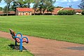 Pallister Park field


It is also known as Pallister Park or Pally Park because of the public park located at the northern edge of the area.