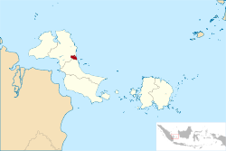
Pangkalpinang

Last updated

Pangkalpinang
City of Pangkalpinang
Kota Pangkalpinang
Regional transcription(s)
   Jawi ڤڠكل ڤينڠ
   Chinese 邦加檳港
Pangkalpinang-Bangka Island.jpg
Street view
Flag of Pangkalpinang City.png
Lambang Kota Pangkalpinang.png
Motto(s): 
Pangkal Kemenangan (Malay)
"Base of Victory"
Lokasi Babel Kota Pangkal Pinang.svg
Location within Bangka Belitung Islands
Indonesia Sumatra location map.svg
Red pog.svg
Pangkalpinang
Location in Sumatra and Indonesia
Indonesia location map.svg
Red pog.svg
Pangkalpinang
Pangkalpinang (Indonesia)
Coordinates: 2°8′S106°7′E / 2.133°S 106.117°E / -2.133; 106.117
CountryFlag of Indonesia.svg  Indonesia
Region Sumatra
Province Flag of Bangka-Belitung.svg  Bangka Belitung Islands
Founded17 September 1757
Government
  MayorMaulan Aklil
  Vice MayorMuhammad Sopian
Area
  Total104.54 km2 (40.36 sq mi)
Elevation
0−13 m (−43 ft)
Population
 (mid 2022 estimate) [1]
  Total226,297
  Density2,200/km2 (5,600/sq mi)
Demographics
  Ethnic groups Malay
Javanese
Batak,
Chinese
Bugis [2]
  Religion Islam 52.31%
Buddhism 36.18%
Confucianism 4.56%
Christian 3.41%
Catholic 3.21%
Hinduism 0.04%
Others 0.27% [3]
  Languages Indonesian (official)
Chinese
Malay
English (regional)
Time zone UTC+7 (Indonesia Western Time)
Area code (+62) 717
Vehicle registration BN
Website pangkalpinangkota.go.id

Around 1709, tin was found on the banks of the Olin River in Toboali District. With the discovery of tin, merchants from China and elsewhere flocked to the region; the Sultan of Palembang sent representatives to China in search of tin experts. In 1717, the Palembang Sultanate began developing trade relationships with the Dutch East India Company (VOC). With the company's help, the sultan attempted to eradicate piracy and tin smuggling.

The Netherlands was occupied by France at the height of the Napoleonic Wars, and the British seized all areas in Nusantara under Dutch governance. In accordance with the Tuntang Agreement, on 18 September 1811 the Dutch handed over the island of Java, Timor, Makassar, and Palembang to the British; Pangkalpinang become a British colony. Stamford Raffles sent emissaries to Palembang to take over the Dutch fort in Sungai Aur, but they were rejected by Sultan Mahmud Badaruddin II. Raffles also demanded the tin mines in Pangkalpinang from Badaruddin.

Raffles sent an expedition to Palembang, led by Rollo Gillespie, on 20 March 1812. Gillespie replaced Mahmud Badaruddin II with Prince Adipati, giving him the title of Sultan Ahmad Najamuddin II, and the new sultan handed over the islands of Belitung and Bangka Islands to the British.

In accordance with the Anglo-Dutch Treaty of 1824, the Netherlands regained areas occupied in 1803 by the British (including Pangkalpinang). The native people were subjected to fraud, extortion, and forced labor by the Dutch and the British. The Dutch exploited the tin reserves; guerrilla warfare was fought in Musi Rawas, and Pangkalpinang fought to expel the Dutch.

During World War II, Bangka Island was occupied by Japanese troops. Although the occupation of Pangkalpinang was brief, shortages of food and clothing were severe.

Independent Indonesia

After Japan surrendered to the Allies and the Indonesia proclaimed its independence, Pangkalpinang became part of Indonesia. (initially as part of the province of South Sumatra). After the country's political landscape changed, Bangka Belitung Islands were separated from South Sumatra and combined as a province with Pangkalpinang its capital.

Demographics

Fu De Temple Bang Jia Bin Gang Fu De Ci 1.jpg
Fu De Temple
Pangkalpinang
Traditional Chinese 邦加檳港
Simplified Chinese 邦加槟港
Ethnicities of Pangkal Pinang - 2000 Census [7]
Ethnic groupPercent
Malay
45.63%
Chinese
44.27%
Javanese
8.60%
Other
0.72%

Pangkalpinang's population was 108,411 in 1990, and 174,838 in the 2010 census, [5] rising to 218,568 at the 2020 Census; [6] the official estimate as at mid 2022 was 226,297. [1] Half are Malay, and primarily speak Bangka Malay. The remainder are Chinese, descendants of 18th-century emigrants from Guangdong province. Locally known as Peranakan (Children of the Indies), they primarily speak Hakka; a small community speaks Cantonese. Their endonym is Thong Ngin (唐人; 'Tang people"'), and other Malays are known as Fan Ngin (番人; 'Malay people"').

Islam is the largest religion. The Chinese primarily adhere to Buddhism and Christianity, with a minority embracing Taoism and Confucianism.

Geography

Topography

The city's topography is generally undulating and hilly, with an altitude of 20–50 metres (66–164 ft) above sea level. Hilly areas are primarily in the west and south, including Mount Girimaya (50 metres above sea level) and Tower Hill. A 290-hectare (720-acre) urban forest is in the Old Village area. An area of 1,562 hectares (3,860 acres) is under cultivation for food crops, fisheries and forestry. Fallow land is 1,163 hectares (2,870 acres), and 4,130 hectares (10,200 acres) are developed. The remaining 2,085 hectares (5,150 acres) are swamps and forest.

Geology

The city's soil has an average pH below 5, with red-yellow podzolic soil and regosol. A small area is bog soil and light-gray regosol derived from the deposition of sand and clay. Although such soil is less suitable for rice, other crops may be grown. The oldest formations are Permo-Carboniferous limestone, Late Triassic slate and Triassic-Jurassic granite. Composition of the granitic rocks includes dark-colored (occasionally green) biotite and amphibole.

Hydrology

The Rangkui River flows through the city, and the Pedindang River is in the south. They drain into the Baturusa River, which flows to the South China Sea. The rivers provided transport to markets, and make Pangkalpinang prone to flooding (especially during the rainy season or at times of high tide).

Climate

Pangkalpinang has a tropical rainforest climate (Af) with heavy rainfall year-round. Rain gets noticeably heavier from November to April.

Climate data for Pangkalpinang (Depati Amir Airport, 1991–2020 normals)
MonthJanFebMarAprMayJunJulAugSepOctNovDecYear
Record high °C (°F)34.8
(94.6)
33.8
(92.8)
34.3
(93.7)
34.4
(93.9)
35.0
(95.0)
34.4
(93.9)
34.0
(93.2)
33.9
(93.0)
35.9
(96.6)
36.1
(97.0)
34.9
(94.8)
34.4
(93.9)
36.1
(97.0)
Mean daily maximum °C (°F)30.2
(86.4)
30.6
(87.1)
31.2
(88.2)
31.6
(88.9)
31.8
(89.2)
31.5
(88.7)
31.3
(88.3)
31.6
(88.9)
32.0
(89.6)
31.9
(89.4)
31.3
(88.3)
30.3
(86.5)
31.3
(88.3)
Daily mean °C (°F)26.1
(79.0)
26.3
(79.3)
26.5
(79.7)
26.9
(80.4)
27.5
(81.5)
27.4
(81.3)
27.2
(81.0)
27.4
(81.3)
27.5
(81.5)
27.3
(81.1)
26.8
(80.2)
26.2
(79.2)
26.9
(80.4)
Mean daily minimum °C (°F)23.5
(74.3)
23.5
(74.3)
23.6
(74.5)
23.9
(75.0)
24.5
(76.1)
24.4
(75.9)
24.1
(75.4)
24.1
(75.4)
24.1
(75.4)
24.0
(75.2)
23.8
(74.8)
23.5
(74.3)
23.9
(75.0)
Record low °C (°F)19.6
(67.3)
19.0
(66.2)
19.8
(67.6)
20.2
(68.4)
20.4
(68.7)
21.5
(70.7)
21.0
(69.8)
21.0
(69.8)
21.4
(70.5)
21.0
(69.8)
21.1
(70.0)
19.8
(67.6)
19.0
(66.2)
Average precipitation mm (inches)284.4
(11.20)
233.3
(9.19)
258.9
(10.19)
244.7
(9.63)
207.6
(8.17)
135.4
(5.33)
131.4
(5.17)
104.8
(4.13)
100.3
(3.95)
169.3
(6.67)
226.8
(8.93)
296.1
(11.66)
2,393
(94.21)
Average precipitation days (≥ 1.0 mm)18.313.316.215.614.411.710.97.57.711.416.219.2162.4
Source: World Meteorological Organization [8]

Administrative Districts

At the time of the 2010 Census, the city was divided into five districts (kecamatan), [5] but two additional districts were created subsequently. These are all tabulated below with their areas and their populations at the 2010 Census [5] and 2020 Census, [6] together with the official estimates as at mid 2022. [1] The table also includes the locations of the district administrative centres, the numbers of administrative villages (all classed as urban kelurahan) in each district, and its postal code.

Kode
Wilayah
Name of
District
(kecamatan)
Area
in
km2
Pop'n
Census
2010
Pop'n
Census
2020
Pop'n
Estimate
mid 2022
Admin
centre
No.
of
kelurahan
Post
codes
19.71.04Rangkui5.0139,93835,70336,965Keramat833132 - 33139
19.71.01Bukit Intan35.6843,32541,34342,805Air Itam733147 - 33149
19.71.07Girimaya4.35(a)18,12918,770Sriwijaya533141 - 33146
19.71.03Pangkal Balam4.7441,05522,14122,925Kotapang533111 - 33115
19.71.06Gabek20.46(a)35,01336,251Gabek Dua633111 - 33119
19.71.02Taman Sari3.2213,11718,47319,126Gedung Nasional533121 - 33127
19.71.05Gerunggang31.0937,32347,76649,455Bukit Merapin633123 - 33125
Totals104.54174,838218,568226,29742

Notes: (a) the 2010 population of the areas which later became Girimaya and Gabek districts is included in the figures for the districts from which they were cut out.

Attractions

Nganggung, a food-sharing tradition, is usually performed on religious holidays such as Lebaran and Eid al-Adha. The Qingming Festival (Ceng Beng, 清明, in Hakka Chinese) is also celebrated.

The Tin Museum is Asia's only tin museum, and was the site of the 7 May 1949 Roem–Van Roijen Agreement on the future of independent Indonesia. The 1936 Jamik Mosque, in Jalan Masjid Jamik, is one of the largest and oldest mosques in Pangkalpinang. Kwan Tie Miaw temple (關帝廟), on the Jalan Mayor Muhidin, is one of the oldest temples on the island of Bangka. Formerly known as the Kwan Tie Bio Temple, it is estimated to have been built in 1841 and dedicated to Lord Guan. GPIB Maranatha, originally the Kerkeraad der Protestansche Gemeente to Pangkalpinang, was built in 1927. After independence, the church's name was changed to Western Indonesian Protestant Church (GPIB) Maranatha Pangkalpinang. [9]

Cuisine

Tai Fu Sui (豆腐水), also known as fu sui (腐水) is a popular drink similar to soy milk. Pantiaw or kwetiaw (盤条) is made from sago and rice flour and usually served with fish soup.

Transportation

Angkots are used in and around the city in lieu of public transit.

Air

Depati Amir Airport is the airport serving Bangka Belitung, with daily flights to Jakarta, Palembang, Tanjungpandan, Surabaya and Batam by Garuda Indonesia, Citilink, Lion Air and Sriwijaya Air. A new terminal began operation on 11 January 2017, with an annual capacity of 1,500,000 passengers and an area of 12,000 square metres (3.0 acres).

Sea

Pangkal Balam is the city's main seaport, providing daily export and import, inter-island trade and passenger transport to and from Jakarta and Tanjungpandan. Smaller seaports, such as Muntok, serves speedboats to and from Palembang.

Economy

The city's economy is based on agricultural products: food crops, livestock, marine and freshwater fishing and small plantations (rubber, pepper and coconut). Pangkalpinang also has a scenic beach.

Notable residents

Sister city

See also

Related Research Articles

<span class="mw-page-title-main">Palembang</span> City and capital of South Sumatra, Indonesia

Palembang is the capital city of the Indonesian province of South Sumatra. The city proper covers 352.51 square kilometres on both banks of the Musi River in the eastern lowlands of southern Sumatra. It had a population of 1,668,848 at the 2020 Census; the official estimate as at mid 2022 was 1,729,546. Palembang is the second most populous city in Sumatra, after Medan, and the twelfth most populous city in Indonesia.

<span class="mw-page-title-main">South Sumatra</span> Province of Indonesia

South Sumatra is a province of Indonesia, located in the southeast of the island of Sumatra. The capital and largest city of the province is the city of Palembang. The province borders the provinces of Jambi to the north, Bengkulu to the west and Lampung to the south, as well a maritime border with the Bangka Belitung Islands to the east. It is the largest province in the island of Sumatra, and it is slightly smaller than Portugal. The Bangka Strait in the east separates South Sumatra and the island of Bangka, which is part of the Bangka Belitung Islands province. The province has an area of 91,592.43 km2 (35,364 sq mi) and had a population of 8,467,432 at the 2020 Census; the official estimate as at mid-2022 was 8,657,008. The province is rich in natural resources, such as petroleum, natural gas and coal. The province is inhabited by many different ethnic groups, with Palembangese being largest ethnic group. Most speak the Palembang language, which is mutually intelligible to both Indonesian and local Palembang Malay. Other ethnic groups include the Javanese, Sundanese, Minangkabau and Chinese. Most are concentrated in urban areas and are largely immigrants from other parts of Indonesia.

<span class="mw-page-title-main">Jambi</span> Province of Indonesia

Jambi is a province of Indonesia. It is located on the east coast of central Sumatra and spans to the Barisan Mountains in the west. Its capital and largest city is also called Jambi. It is bordered by the provinces of Riau to the north, West Sumatra to the west, Bengkulu to the southwest, South Sumatra to the south, and sharing a maritime border with the Riau Islands to the east and the Pacific Ocean to the east. The province has a land area of 49,026.58 km2, and a sea area of 3,274.95 km2. It had a population of 3,092,265 according to the 2010 census and 3,548,228 according to the 2020 census; the official estimate as at mid 2022 was 3,631,136.

<span class="mw-page-title-main">Bangka Belitung Islands</span> Island province of Indonesia east of Sumatra

The Bangka Belitung Islands is a province of Indonesia. Situated off the southeastern coast of Sumatra, the province comprises two main land masses — Bangka and Belitung — and numerous smaller islands. Bangka Belitung is bordered by the Bangka Strait to the west, the Natuna Sea to the north, the Java Sea is to the south and the Karimata Strait to the east. The province's capital and largest city is Pangkalpinang. The province shares maritime borders with South Sumatra to the west, Riau Islands to the north, Banten, the Special Capital Region of Jakarta, West Java, and Central Java to the south, and West Kalimantan to the east. Bangka Belitung covers a land area of 16,690.54 km2 (6,444.25 sq mi) and had a population of 1,455,678 according to the 2020 census; the official estimate as at mid 2022 was 1,494,621.

<span class="mw-page-title-main">Riau Islands</span> Province of Indonesia

The Riau Islands is a province of Indonesia - not to be confused with neighbouring Riau Province from which the islands were separated in 2002. The capital of the province is Tanjung Pinang and the largest city is Batam. It shares a maritime border with Riau and Jambi to the east, Bangka Belitung Islands to the south, Singapore to the northeast, Malaysia and West Kalimantan to the west, and Vietnam and Cambodia to the north.It comprises a total of 1,796 islands scattered between Sumatra, Malay Peninsula, and Borneo including the Riau Archipelago. Situated on one of the world's busiest shipping lanes along the Malacca Strait and the Natuna Sea, the province shares water borders with neighboring countries such as Singapore, Malaysia, and Brunei. The Riau Islands also have relatively large potential mineral resources and energy, as well as marine resources.

<span class="mw-page-title-main">Bangka Island</span> Island in Indonesia

Bangka is an island lying east of Sumatra, Indonesia. It is administered under the province of the Bangka Belitung Islands, being one of its namesakes alongside the smaller island of Belitung across the Gaspar Strait. The 9th largest island in Indonesia, it had a population of 1,146,581 at the 2020 census. It is the location of the provincial capital of Pangkal Pinang, and is administratively divided into four regencies and a city. The island itself and the surrounding sea suffers considerable environmental damage from its thriving tin mining industry which operates on- and offshore.

Belitung is an island on the east coast of Sumatra, Indonesia in the Java Sea. It covers 4,800.6 km2 (1,853.5 sq mi), and had a population of 309,097 at the 2020 Census. Administratively, it forms two regencies within the province of Bangka-Belitung Islands. The island is known for its pepper and for its tin. It was in the possession of the United Kingdom from 1812 until Britain ceded control of the island to the Netherlands in the Anglo-Dutch Treaty of 1824. Its main town is Tanjung Pandan. The United Nations Educational, Scientific and Cultural Organization has declared 17 tourist attractions in the Belitung Geopark as world geoparks.

<span class="mw-page-title-main">Lingga Regency</span> Group of islands in Indonesia

The Lingga Regency is a group of islands in Indonesia, located south of Singapore, along both sides of the equator, off the eastern coast of Riau Province on Sumatra island. They are south of the populated Riau Archipelago, known for the industrial island of Batam and the tourist-frequented island of Bintan, although the Lingga Islands themselves are rarely visited due to the infrequent local transportation. The equator goes through the northern tip of Lingga Island, the main island in the archipelago.

<span class="mw-page-title-main">Tanjungpinang</span> City and capital of Riau Islands, Indonesia

Tanjungpinang, also colloquially written as Tanjung Pinang, is the capital city of the Indonesian province of Riau Islands. It covers a land area of 144.56 km2, mainly on the southern Bintan Island, as well as other smaller islands such as Dompak Island and Penyengat Island. With a population of 227,663 at the 2020 Census, it is the second largest city of the province, after Batam; the official estimate as at mid 2022 was 239,854. Tanjungpinang is a historic city of the Malay culture, having served as the capital of both Johor Sultanate and Riau-Lingga Sultanate.

<span class="mw-page-title-main">Sungailiat</span> City in Bangka Belitung Islands, Indonesia

Sungailiat is a city and district (kecamatan) of Bangka Regency, in the Bangka-Belitung province of Indonesia. It is also the regency seat.

<span class="mw-page-title-main">Roman Catholic Diocese of Pangkal-Pinang</span> Roman Catholic diocese in Bangka Belitung Islands, Indonesia

The Roman Catholic Diocese of Pangkal-Pinang is a diocese in the Ecclesiastical province of the metropolitan Archdiocese of Palembang on Bangka Belitung Islands in Indonesia, yet depends on the missionary Congregation for the Evangelization of Peoples.

<span class="mw-page-title-main">Muntok</span>

Muntok or, more commonly, Mentok is a town in the Indonesian province of Bangka-Belitung on the island of Sumatra. The capital of West Bangka Regency, it is the site of the biggest tin smelter on the world. Mentok refers to the tip of the island.

<span class="mw-page-title-main">Toboali</span> Town in Bangka Belitung, Indonesia

Toboali is a town in the Indonesian province of Bangka-Belitung, Indonesia. Toboali is the capital of the South Bangka Regency.

<span class="mw-page-title-main">Tanjungpandan</span> Town in Bangka Belitung Islands, Indonesia

Tanjungpandan, also colloquially written as Tanjung Pandan, is the largest town on the island of Belitung in the Indonesian province of Bangka Belitung Islands, Indonesia. Tanjungpandan is the capital of the Belitung Regency comprising one of the five districts (kecamatan) within that Regency. It covers an area of 378.45 km2 and had a population of 86,487 at the 2010 Census and 103,062 at the 2020 Census.

<span class="mw-page-title-main">Central Bangka Regency</span> Regency in Bangka Belitung Islands, Indonesia

Central Bangka Regency is a regency (kabupaten) of the Bangka Belitung Islands Province, Indonesia. It covers an area of 2,155.77 km2 and had a population of 161,075 at the 2010 Census, rising to 198,946 at the 2020 Census; the official estimate as at mid 2022 was 205,510 - comprising 106,340 males and 99,170 females. The town of Koba is its regency seat.

<span class="mw-page-title-main">Belitung Regency</span> Regency in Bangka Belitung Islands, Indonesia

Belitung Regency is a regency (kabupaten) of Bangka Belitung Islands Province, Indonesia, with the town of Tanjungpandan as the regency seat. It formerly covered the whole of Belitung island, but subsequently the eastern districts on the island have been cut out to create a new East Belitung Regency. The regency now covers an area of 2,293.69 km2, and had a population of 156,765 at the 2010 Census and 182,079 at the 2020 Census; the official estimate as at mid 2022 was 186,331.

<span class="mw-page-title-main">East Belitung Regency</span> Regency in Bangka Belitung Islands, Indonesia

East Belitung Regency is a regency (kabupaten) of Bangka Belitung Islands Province, Indonesia, encompassing the eastern half of Belitung Island. It covers an area of 2,506.91 km2 and had a population of 106,463 at the 2010 Census and 127,018 at the 2020 Census; the official estimate as at mid 2022 was 130,463 - comprising 67,145 males and 63,318 females. Its regency seat is the town of Manggar.

Chinese Indonesians have lived in Bangka Belitung Islands, Indonesia for centuries. Bangka Belitung is one of the regions with the largest Chinese population in Indonesia besides Java, Riau, Eastern Sumatra and West Borneo.

<span class="mw-page-title-main">Ibnu Saleh</span> Indonesian politician (1961–2020)

Ibnu Saleh was an Indonesian politician, member of the Nasdem Party. Between 2016 and 2017, he was Deputy Regent of the Central Bangka Regency, and Regent from 2017 till his death in office during the COVID-19 pandemic in Indonesia.

Sungai Selan is a district (kecamatan) of Central Bangka Regency, in the Bangka-Belitung province of Indonesia.

References

  1. 1 2 3 4 Badan Pusat Statistik, Jakarta, 2023, Kota Pangkalpinang Dalam Angka 2023 (Katalog-BPS 1102001.1971)
  2. Aris Ananta; Evi Nurvidya Arifin; M. Sairi Hasbullah; Nur Budi Handayani; dan Agus Pramono (2015). Demography of Indonesia's Ethnicity. Institute of Southeast Asian Studies dan BPS – Statistics Indonesia.
  3. Data Sensus Penduduk 2010 - Badan Pusat Statistik Republik Indonesia <http://sp2010.bps.go.id/index.php/site/tabel?tid=321&wid=8100000000>
  4. There is a discrepancy with the figures reported by national office of BPS and that reported by the local BPS, which gives 104.54 km2 as shown in the table of districts.
  5. 1 2 3 4 Biro Pusat Statistik, Jakarta, 2011.
  6. 1 2 3 Badan Pusat Statistik, Jakarta, 2021.
  7. Indonesia's Population: Ethnicity and Religion in a Changing Political Landscape. Institute of Southeast Asian Studies. 2003. ISBN   9812302123
  8. "World Meteorological Organization Climate Normals for 1991–2020". World Meteorological Organization. Retrieved 19 October 2023.
  9. "WISATA SEJARAH & PERIBADATAN".

Notes