
The Allen Hotel is an historic hotel building in Pittsfield, Massachusetts. Built in 1915 and first operated as the Park Hotel, it is a significant local example of Renaissance Revival architecture, designed by the prominent local architect Joseph McArthur Vance. It was individually listed on the National Register of Historic Places in 1975, and included in an expansion of Pittsfield's Park Square Historic District in 1991. It no longer houses a hotel, and has been repurposed for other uses.

The Amherst Central Business District is a historic district encompassing the heart of downtown Amherst, Massachusetts. Centered on the northern section of the long town common, the area has been the civic and commercial heart of the town since the 18th century. The district was listed on the National Register of Historic Places in 1991, and slightly enlarged in 2011.

The Town Hall Square Historic District is a historic district encompassing the center of Sandwich, Massachusetts. The original 54-acre (22 ha) district was visually centered on Sandwich Town Hall, Shawme Pond, and the reconstructed Dexter Grist Mill. When first listed on the National Register of Historic Places in 1975, it was roughly bounded by Main, Grove, Water Sts., and Tupper Rd. from Beale Ave. to MA 6A. In 2010 the district was expanded, adding another 170 acres (69 ha) and more than 150 contributing resources.

Becket Center Historic District is a historic district encompassing the historic early center of Becket, Massachusetts. Centered at the junction of Massachusetts Route 8 and YMCA Road, this area was the town's civic heart and a center of industry until it was eclipsed in importance by North Becket, which was served by the railroad. Most of the architecture in the district is in the Federal and Greek Revival styles popular in the late 18th to mid 19th centuries. The district was added to the National Register of Historic Places in 1982.

Berkshire Life Insurance Company Building is a historic commercial building at 5-7 North Street in Pittsfield, Massachusetts. It is located in the heart of downtown Pittsfield, facing Park Square across North Street. Built in 1868, it is one of a trio of Second Empire buildings designed by Louis Weisbsein, a Boston architect, whose style influenced later construction in the city. The building was listed on the National Register of Historic Places in 1986, and was included in an expansion of Pittsfield's Park Square Historic District in 1991.

The Monument Square–Eagle Street Historic District is a historic district encompassing the civic heart of North Adams, Massachusetts. When it was originally designated in 1972, the district encompassed Monument Square – west of the intersection of Main Street and Church Street, and the location of a Civil War memorial – and the area around it. This designation included the North Adams Public Library, the First Baptist Church and First Congregational Church, and a block of shops Eagle Street. In 1988, the district's boundaries were increased to be roughly bounded by Holden, Center and Union Streets, the East Middle School, Summer Street, and Main Street. This expansion extended the district westward along Summer Street to include the US Post Office building and St. John's Church, and eastward to include Colgrove Park, the middle school, and St. Francis Catholic Church. An additional block of commercial buildings was also added on the north side of West Main Street, extending just west of Holden Street.

The Old Central Fire Station is a historic fire station at 66 Allen Street in Pittsfield, Massachusetts. Built in 1895, it is the city's oldest surviving fire station, and a prominent local example of Romanesque architecture. The station was listed on the National Register of Historic Places in 1977, and was included in an expansion of Pittsfield's Park Square Historic District in 1991. It now houses offices.

The Old Town Hall is a historic building on Park Square in the heart of downtown Pittsfield, Massachusetts. This 1832 building served for 135 years as the center of municipal government. Built in the Federal style to serve as the town hall, it became City Hall when Pittsfield became a city in 1891, serving in that role until 1968. It is the city's oldest municipal building. The hall was listed on the National Register of Historic Places in 1972, and included in the Park Square Historic District in 1975.
The Sheffield Center Historic District encompasses the historic village center of Sheffield, Massachusetts. The village extends linearly along United States Route 7, roughly between Maple Avenue and Berkshire School Road, and includes the town's major civic and religious buildings. The area's principal period of development was between 1760 and the 1890s. It was listed on the National Register of Historic Places in 1989.

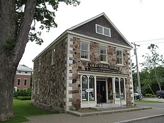
The Wollison–Shipton Building is a historic commercial block located at 142-156 North Street in Pittsfield, Massachusetts. Designed by architect H. Neil Wilson, it was built in 1888 when the area north of Park Square developed as a commercial and retail part of downtown Pittsfield.

The Upper North Street Commercial District is a historic district on the north side of downtown Pittsfield, Massachusetts, United States. Representing an expansion of Pittsfield's historic downtown area northward from Park Square in the late 19th century, the district encompasses primarily commercial buildings fronting on North Street between Columbus and Madison Avenues on the west side, and between Eagle and Maplewood Avenues on the east side. The notable exceptions are the Berkshire Eagle building, located on Eagle Street next to Sottile Park, and the St. Joseph's Church complex. The district features Colonial Revival and Renaissance style architecture. It was added to the National Register of Historic Places in 2002.

The Hadley Center Historic District is an expansive, 2,500-acre (1,000 ha) historic district encompassing the village center of Hadley, Massachusetts. When it was first listed on the National Register of Historic Places in 1977, the district encompassed the town green and 17 buildings that faced it, at the junction of Russell Street and Middle Street. The district was expanded significantly in 1994, adding more than 400 buildings representative of the village's growth from colonial days into the first decades of the 20th century. This expansion encompasses the entirety of a tongue of land extending west from East Street and bounded by a bend in the Connecticut River, which separates Hadley from Northampton. Its oldest property, the Samuel Porter House on West Street, was built in 1713.

The North High Street Historic District is a historic district encompassing part of the downtown area of Holyoke, Massachusetts. When first added to the National Register of Historic Places in 1986, the district encompassed North High Street, between Dwight and Lyman Streets. This part of High Street was built between 1850 and 1885, and is lined with masonry buildings in Italianate and Second Empire styles. In 1992 the district was extended southward, adding three blocks of High Street between Dwight and Essex Streets. This expansions encompasses the growth of Holyoke during the height of its commercial success, between 1880 and 1930; it also includes the separately-listed Holyoke City Hall. The district was extended a third time, in 2008, adding a complex of three buildings at Dwight and Maple Streets that now houses the Holyoke Health Center.

The Lynn Common Historic District encompasses the town common of Lynn, Massachusetts and the surrounding buildings which face it. Although its establishment dates to the late 17th century, the area's time of development is predominantly in the 19th century, when the common was transformed into a park. The common is an elongated grassy area, flanked by North and South Common Streets, with a number of small cross streets breaking it into several pieces. City Hall Square marks its eastern boundary, and Market Square its western.

The Common Historic District is a historic district encompassing the civic and institutional heart of Reading, Massachusetts. The district is centered on the town common, at the intersection of Main and Salem Streets. The common has been communally owned since at least 1737, with the original burying ground to the north. In 1769 the area's first meeting house was built, giving the area a sense of identity separate from portions of Reading that would later be set off as Wakefield and North Reading. Since then the area has become a focal point for religious and civic institutions in the town.

The Common District encompasses the main civic center of Wakefield, Massachusetts. It is centered on the historic town common, just south of Lake Quannapowitt, which was laid in 1644, when it became the heart of Old Reading. The area was separated from Reading as South Reading in 1818, and renamed Wakefield in 1868. The 25 acre district includes the buildings that line the common on Common Street and Main Street, which include the town hall, public library, YMCA, post office, and several churches. It was listed on the National Register of Historic Places in 1990.

The Leverett Center Historic District is an expansive 467-acre (189 ha) historic district encompassing the historic heart of the rural community of Leverett in eastern Franklin County, Massachusetts. The district is focused on a two-mile stretch of Depot and Montague Roads, at whose center is the civic heart of the town. It includes the 1838 Greek Revival First Congregational Church, the town hall, whose present form was achieved in 1895 by raising the 1845 construction and building a first floor underneath it, and the Colonial Revival Field Memorial Library (1916). It also includes a town pound built c. 1822, and a number of 18th century residences. The district was listed on the National Register of Historic Places in 2008.

The Westfield Center Historic District is a historic district encompassing 157 acres (64 ha) of the civic, commercial, and industrial heart of Westfield, Massachusetts. It represents a major expansion of the Westfield Center Commercial Historic District, which included only two blocks of buildings along Elm Street in downtown Westfield. The district includes buildings representing the city's growth in the 19th century as a center of the whip-making industry, and its early years as a center for statewide educational institutions, as well as its growth as a regional center of western Hampden County. The commercial district was added to the National Register of Historic Places in 2008; the expansion and renaming of the district took place in 2013.

The Chesterfield Center Historic District is a historic district that encompasses the traditional village center of the town of Chesterfield, Massachusetts. The village is reflective of the town's 18th and 19th-century development as an agrarian hill community, with architectural styles before about 1850 predominating. The district was listed on the National Register of Historic Places in 2000.
The Pittsfield Center Historic District encompasses the civic and commercial heart of Pittsfield, New Hampshire. This area is defined by a roughly square bend in the Suncook River, whose power provided an impetus for the development of the town in the 19th century. The dominant feature of the district is the 1827 Joy Cotton Mill, a four-story brick building at the base of Main Street. There are three churches, including the 1863 Gothic Revival St. Stephen's Episcopal Church, and the town office building, a significantly altered 1789 meeting house. The district also includes the main commercial district and some of the surrounding residential areas. It was listed on the National Register of Historic Places in 1980.


