
Acton is a suburb of Canberra, ACT, Australia. Acton covers an area west of the CBD, bordered by Black Mountain to the west and Lake Burley Griffin in the south. The Australian National University campus covers most of the suburb, though also located in Acton is the National Film and Sound Archive, a branch of the CSIRO and the National Museum of Australia.
Forrest is a suburb of Canberra, Australian Capital Territory, Australia. Forrest is named after Sir John Forrest, an explorer, legislator, federalist, Premier of Western Australia, and one of the fathers of the Australian Constitution. Streets in Forrest are named after explorers and governors. According to the Australian Bureau of Statistics Forrest is the second most Socio-Economic advantaged location in Australia after the neighbouring suburb of Barton.

Capital Hill is the location of Parliament House, Canberra, at the south apex of the land axis of the Parliamentary Triangle.

Barton is a suburb of Canberra, Australian Capital Territory, Australia. At the 2021 census, Barton had a population of 1,946 people.

Red Hill is a suburb of Canberra, Australian Capital Territory, Australia. The suburb is named after the northernmost hill of the ridge to the west of the suburb. The ridge is a reserve and managed as part of the Canberra Nature Park. The hill is an element of the central Canberra design axis.
Symonston is a primarily industrial and agricultural suburb of Canberra, Australian Capital Territory, Australia. Symonston is named after Sir Josiah Symon a Legislator, Federalist and one of the Founders of the Constitution of Australia.
Hawker is a suburb of the Belconnen district of Canberra, located within the Australian Capital Territory, Australia.

Lyneham is a suburb of Canberra, Australia in the North Canberra district. It is named after Sir William Lyne, premier of New South Wales from 1899 to 1901. The suburb name was gazetted in 1928, but development did not commence until 1958. The streets of Lyneham are named after artists and people associated with the development of early Canberra.

Bruce is a suburb of the Belconnen district of Canberra, that is located within the Australian Capital Territory, Australia. The suburb was gazetted on 6 June 1968 and named for The Viscount Bruce of Melbourne (1883–1967), the eighth Prime Minister of Australia and the first Chancellor of the Australian National University.

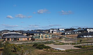
Jacka is a suburb of Gungahlin, Canberra, the National Capital of Australia. The suburb was gazetted on 25 April 2001 and development began in 2013. It had some residents at the beginning of 2014. The suburb is named after Albert Jacka, the first Australian to be decorated with the Victoria Cross during the First World War, receiving the medal for his actions during the Gallipoli Campaign. Jacka is located in north Gungahlin adjacent to the suburbs of Amaroo, Taylor, Bonner and Moncrieff. The suburb is located approximately 4 km from the Gungahlin Town Centre and 16 km from the centre of Canberra.

Mitchell is a light-industrial estate of Canberra, Australia in the district of Gungahlin. Mitchell was named in honour of Major Sir Thomas Livingstone Mitchell, an explorer of inland New South Wales and Surveyor-General of New South Wales. The streets in Mitchell are named after Australian industrialists.

Hume is a suburb of Canberra, and is adjacent to the District of Jerrabomberra in New South Wales.The suburb is named after the explorer Hamilton Hume and streets are named after Australian industrialists and businessmen. Hume is a light-industrial suburb and there is no significant housing development. At the 2021 census, Hume had a population of 395, up from six in 2006, as a result of the construction of the Alexander Maconochie Centre. The location of the prison has also given Hume a highly unusual gender ratio with 92.7% of the permanent population being male.

Giralang is a suburb of the Belconnen district of Canberra, located within the Australian Capital Territory, Australia.

Lawson is a suburb in the Belconnen district of Canberra, located within the Australian Capital Territory, Australia. The suburb is surrounded by Baldwin Drive, Gundaroo Drive and Ginninderra Drive. It lies next to the suburbs of McKellar, Giralang, Kaleen, Bruce and Belconnen.

Gungahlin is a suburb in the Canberra, Australia district with the same name; Gungahlin. The postcode is 2912. Gungahlin is the name for the entire district, and also the town centre, but it is also the name of the suburb which Gungahlin Town Centre is in.

Phillip is a suburb of Canberra, Australia in the district of Woden Valley. It is located in the centre of the district and contains the district's main commercial centre, Woden Town Centre. Phillip had a residential population of 5,197 at the 2021 census. 67.0% of the population lived in flats. Many more flats are being planned or built.
Bonner is a suburb in the district of Gungahlin in Canberra in the Australian Capital Territory, Australia.

Crace is a suburb of Canberra, Australia in the district of Gungahlin. It was named after Edward Kendall Crace an original settler in the Gungahlin area. Streets in Crace are named after parishes and land divisions from colonial times. It is bounded by the Barton Highway, Gundaroo Drive, Nudurr Drive and Gungahlin Drive. Located in the suburb is the Canberra Nature Park of Gungaderra Grasslands nature reserve. At the 2016 census, it had a population of 4,459.

Canberra Central is a district in the Australian Capital Territory in Australia. Consisting of both the subdivisions of North Canberra and South Canberra. The district is subdivided into divisions (suburbs), sections and blocks. The district of Canberra Central lies entirely within the bounds of the city of Canberra, the capital city of Australia.
Wright is a suburb in the Molonglo Valley district of Canberra, located within the Australian Capital Territory, Australia. It is named in honour of Judith Wright, a poet, environmentalist and Aboriginal land rights advocate.


