Culiacán, officially Culiacán Rosales, is a city in northwestern Mexico, the capital and largest city of both Culiacán Municipality and the state of Sinaloa. The city was founded on 29 September 1531 by the Spanish conquerors Lázaro de Cebreros and Nuño Beltrán de Guzmán under the name "Villa de San Miguel", referring to its patron saint, Michael the Archangel.

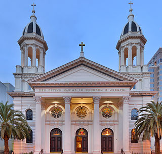
The Cathedral Basilica of St. Joseph is a large Roman Catholic church in Downtown San Jose, which serves as the cathedral for the Roman Catholic Diocese of San Jose in California, with the distinction of minor basilica.

San José State University is a public university in San Jose, California. Established in 1857, SJSU is the oldest public university on the West Coast and the founding campus of the California State University (CSU) system.

The Plaza de César Chávez is an urban plaza and park in Downtown San Jose, California. The plaza's origins date to 1797 as the plaza mayor of the Spanish Pueblo de San José de Guadalupe, making it the oldest public space in Northern California. The plaza was rededicated after Californian civil rights activist César Chávez in 1993.

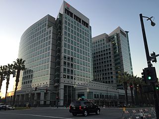
Downtown San Jose is the central business district of San Jose, California. Downtown is one of the largest tech clusters in Silicon Valley, as well as the cultural and political center of San Jose.

The main segment of the Los Gatos Creek Trail is a 9.7-mile (15.6 km) pedestrian and bicycle trail that runs through western Santa Clara County in California. It runs from Lexington Reservoir in Los Gatos, California through Campbell, California to Meridian Avenue in San Jose, California alongside Los Gatos Creek.

The Alameda is a historic district of Central San Jose, California, west of Downtown San Jose. The district is centered on an alameda, a historic portion of El Camino Real connecting Downtown San Jose to Mission Santa Clara de Asís, and includes the smaller, surrounding neighborhoods to the north and east, like College Park and St. Leo's.

Río Piedras, Puerto Rico is a populous district of San Juan, and former town and municipality of Puerto Rico, which was merged with the municipality of San Juan in 1951. The district today is composed of various barrios such as Pueblo and Universidad. The historic town was founded in 1714 as El Roble, it was given municipality rights in 1823, and since 1903 it has been the home of the University of Puerto Rico's main campus, earning the popular name of Ciudad Universitaria today. The downtown and historic center of Río Piedras is officially known as the Pueblo barrio of the municipality of San Juan.

Paseo de San Antonio station is an at-grade light rail station on the Blue Line and the Green Line of the VTA light rail system. The station platforms run along the Downtown San Jose transit mall, with the northbound platform located alongside 1st Street and the southbound platform located alongside 2nd Street. The two platforms are connected by a pedestrian plaza, the Paseo de San Antonio, after which the station is named.

The San Jose State Spartans are the intercollegiate athletic teams that represent San José State University. SJSU sports teams compete in the Mountain West Conference at the NCAA Division I level, with football competing in the Football Bowl Subdivision (FBS).
The city of San Antonio in the U.S. state of Texas is composed of a number of neighborhoods and districts, spreading out surrounding the central Downtown Area.

Silicon Valley Pride, also known as San Jose Pride, is an annual LGBT pride celebration in San Jose, California, the largest city in Silicon Valley. Founded in 1975, it is organized by the Gay Pride Celebration Committee of San Jose.

The Paseo de San Antonio is a pedestrian paseo in Downtown San Jose, spanning from Plaza de César Chávez in the west to San Jose State University's campus in the east.

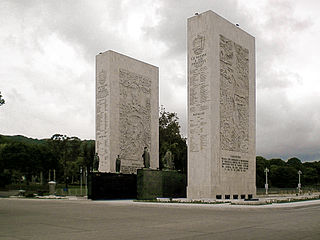
The Paseo Los Próceres is a monument located in the Venezuelan city of Caracas, near Fort Tiuna and the Military Academy of the Bolivarian Army. On the promenade there are statues of the heroes of the War of Independence, as well as fountains, stairs, squares, roads and walls. Since 1993, the Paseo Los Próceres and the entire annex system was declared a National Historic Landmark.

The Paseo de César Chávez is a pedestrian paseo in Downtown San Jose, spanning across San Jose State University's campus.

Fountain Alley is a pedestrian paseo in Downtown San Jose.

Mayfair is a neighborhood of San Jose, California, located in the Alum Rock district of East San Jose. It is one of San Jose's most historic Chicano/Mexican-American districts and noted for being a center of the Chicano Movement and grassroots activists like Californian civil rights leader César Chávez.


