Peacham, Vermont

Last updated

Peacham, Vermont
Peacham, Vermont Church.jpg
Peacham Congregational Church
Peacham vt highlight.png
Location of Peacham in Vermont
Usa edcp location map.svg
Red pog.svg
Peacham, Vermont
Location in the United States
Coordinates: 44°20′N72°11′W / 44.333°N 72.183°W / 44.333; -72.183
Country United States
State Vermont
County Caledonia
Communities Peacham
East Peacham
Ewells Mills
Green Bay
South Peacham
Area
  Total47.7 sq mi (123.5 km2)
  Land46.6 sq mi (120.8 km2)
  Water1.0 sq mi (2.7 km2)
Elevation
1,526 ft (465 m)
Population
 (2020)
  Total715
  Density15/sq mi (5.9/km2)
Time zone UTC-5 (Eastern (EST))
  Summer (DST) UTC-4 (EDT)
ZIP code
05862
Area code 802
FIPS code 50-54400 [1]
GNIS feature ID1462171 [1]
Website www.peacham.net

Peacham is a town in Caledonia County, Vermont, United States. The population was 715 at the 2020 census. [2]

Contents

History

Harvey Mountain from the Peacham Cemetery Harvey Mountain from Peacham Cemetery.jpg
Harvey Mountain from the Peacham Cemetery

In 1763, Governor Benning Wentworth of New Hampshire gave a charter for the region to a group of proprietors, and the town was given the name Peacham (the etymology of the name is unclear). The original proprietors were speculators who surveyed the town, laid a few rudimentary roads, and divided it into lots, though the territory remained unsettled for some time.

In 1775, settlers, primarily from Connecticut and Massachusetts, bought the lots and built homes, developing the land for agriculture. The original settlers survived almost entirely through subsistence farming despite the long winters, hilly terrain, and rocky soil. Nine years later, records show a population of approximately 200 people. The first recorded town meeting took place in 1784, and selectmen were duly elected to govern the affairs of the town. Peacham was early on presented with a choice of having either the county courthouse or the county school, and the residents voted for the school. In 1795 the Caledonia County Grammar School received its charter, and the first school was established in a log structure on the Bayley Hazen Road, halfway between Peacham Corner and South Peacham.

In 1799, a library was established, which traveled from store to store. [3] A congregational church was founded in 1794—the first pastor, Leonard Worcester, was well known for his fiery sermons. His son Samuel went on to be an important missionary to the Cherokee people, creating the first typeface for the Cherokee alphabet and gaining lasting fame as the plaintiff in the supreme court case Worcester v. Georgia .

Early residents, who came to be known as Peachamites, traded butter, eggs, and wheat for goods which they could not make at home, and also relied on the production and sale of items such as whiskey and potash to help augment the relatively poor harvests. Almost from the beginning, various trades and industries—as many as 30–35 at a given time—flourished. Lumbering, coopering, milling, butter making, tin ware, tanneries and leather goods provided goods for local consumption. From 1800 to 1830, sheep farming flourished as a more profitable endeavor than growing crops. In 1840, the town reached its greatest population of 1,443. From that date on, census numbers steadily declined. Farming methods changed, and dairy farming came to replace sheep. The larger, more industrially advanced farms of the late 19th century could not support large families, and youth began to leave home.[ citation needed ]

In the 20th century, the population continued to decline to a low in the mid-600s. Farming also became less common due to competition with larger dairy farms in the West, and many farms either consolidated or went under. Tourism became important during the 20th century as people opened their homes to visitors from the cities of the Atlantic seaboard, often derisively referred to as "flatlanders". With the advent of the railroad in Barnet and then motor vehicles, Peacham became a popular location for summer residents, some of whom were educators from Boston and New York City. In the second half of the 20th century, Peacham became a popular vacation spot and retirement home for prominent intellectuals and liberal thinkers—individuals such as David Dellinger, William Lederer, Roman Jakobson, and the historian Shepard Clough all owned houses in town. Their interests and stimulation enhanced the cultural interests of the town. [4]

Geography

View from Devils Hill over Groton State Forest in western Peacham Devils Hill Summit in April.jpg
View from Devils Hill over Groton State Forest in western Peacham

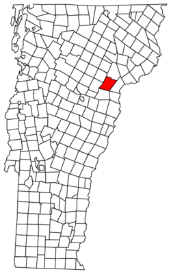
According to the United States Census Bureau, the town has a total area of 47.7 square miles (123.5 km2), of which 46.6 square miles (120.8 km2) is land and 1.0 square mile (2.7 km2), or 2.18%, is water.[ citation needed ] Neighboring towns are Danville to the north, Barnet to the east, Ryegate to the southeast, Groton to the south, Marshfield to the west, and Cabot to the northwest. No numbered state highways pass through the town.

The highest point in Peacham is the 2,566-foot (782 m) summit of Cow Hill near the northern corner of town. [5]

Demographics

Historical population
CensusPop.Note
1790 365
1800 873139.2%
1810 1,30149.0%
1820 1,294−0.5%
1830 1,3514.4%
1840 1,4436.8%
1850 1,377−4.6%
1860 1,247−9.4%
1870 1,141−8.5%
1880 1,041−8.8%
1890 892−14.3%
1900 794−11.0%
1910 777−2.1%
1920 657−15.4%
1930 620−5.6%
1940 543−12.4%
1950 501−7.7%
1960 433−13.6%
1970 4463.0%
1980 53119.1%
1990 62718.1%
2000 6656.1%
2010 73210.1%
2020 715−2.3%
U.S. Decennial Census [6]

As of the census of 2010, [1] there were 732 people, 299 households, and 213 families residing in the town. The population density was 15.7 people per square mile (6.1 per square kilometer). There were 542 housing units at an average density of 11.6 per square mile (4.5 per square kilometer). The racial makeup of the town was 98.0% White (717), 0.4% African American (3), 0.5% Native American or Alaska Native (4), 0.1% some other race (1), and 1.0% two or more races (7). Hispanic or Latino of any race were 0.4% of the population (3). There were no Asians. [1]

There were 299 households, out of which 25.8% had children under the age of 18 living with them, 8.0% had a female householder with no husband present, and 28.8% were non-families. 25.1% of all households were made up of individuals, and 11.7% were someone living alone who was 65 years of age or older. The average household size was 2.45, and the average family size was 2.90. [1]

In the town, the population was largely older with a median age of 48.5. Of the total population, 81.5% were 16 or older. Under the age of 5 were 4.8%, 6.9% were between 15 and 19, 13.1% between 25 and 44, 34.7% between 45 and 64, and 17.4% were 65 years of age or older, with 4.7% were 80 or older. For every 100 females, there were 92.1 males. The population was 48.0% male and 52.0% female. [1]

For the period 2007–2011, the estimated median annual income for a household in the town was $62,344, and the median income for a family was $81,719. Male full-time workers had a median income of $45,078 versus $43,958 for females. The per capita income for the town was $30,373. About 1.7% of families and 5.4% of the population were below the poverty line, including none under age 18 and 15.0% of those age 65 or over. [7]

Culture

The Peacham Historical Association (PHA) has been preserving records since 1916. The PHA has published a number of works on the town and has archives which chronicle the town's history from 1776. [8]

The Peacham Library is a private library founded in 1810 as a resource for the debating team of the Caledonia County Grammar School. For the first century of its existence, the library possessed no fixed location and rotated from store to store around the town. The original library building was purchased in 1909. It burned in 1959, destroying almost the entire collection. The current library was constructed on the same location in 1960 and enlarged in 2001. The library has over 9,200 volumes and over 500 registered patrons. [9]

Peacham has hosted the yearly Peacham Acoustic Music Festival since 2011, typically in mid-August. [10] Other yearly events include the Fall Foliage celebration [11] and the yearly July 4 festivities, including the traditional tractor parade. [12]

In September 2005, Peacham was designated "Best New England Village" by Yankee magazine, which wrote, "Of all the villages in New England, Peacham (population 665) is unsurpassed." [13]

Points of interest

On the National Register of Historic Places

Other points of interest

Education

The town operates Peacham Elementary. [18]

The following schools once operated in town, but have been closed:

Films

A number of movies have been filmed in Peacham. These include:

Notable people

Summer residents and retirees

Related Research Articles

<span class="mw-page-title-main">Washington County, Vermont</span> County in Vermont, United States

Washington County is a county located in the U.S. state of Vermont. Named after George Washington, its shire town is the city of Montpelier and the most populous municipality is the city of Barre. As of the 2020 census, the population was 59,807, making it the third-most populous county in Vermont, but the third-least populous capital county in the United States after Hughes County, South Dakota and Franklin County, Kentucky. Washington County comprises the Barre, Vermont micropolitan statistical area. In 2010, the center of population of Vermont was located in Washington County, in the town of Warren.

<span class="mw-page-title-main">Caledonia County, Vermont</span> County in Vermont, United States

Caledonia County is a county located in the northeastern part of the U.S. state of Vermont. As of the 2020 census, the population was 30,233. Its shire town is the town of St. Johnsbury. The county was created in 1792 and organized in 1796. It was given the Latin name for Scotland, in honor of the many settlers who claimed ancestry there.

<span class="mw-page-title-main">Hardwick, Massachusetts</span> Town in Massachusetts, United States

Hardwick is a town in Worcester County, Massachusetts, United States, about 20 miles (32 km) west of the city of Worcester. It had a population of 2,667 at the 2020 census. It includes the villages of Hardwick, Gilbertville, Wheelwright and Old Furnace.

<span class="mw-page-title-main">Barnet, Vermont</span> Town in Vermont, United States

Barnet is a town in Caledonia County, Vermont, United States. The population was 1,663 at the 2020 census. Barnet contains the locations of Barnet Center, East Barnet, McIndoe Falls, Mosquitoville, Passumpsic and West Barnet. The main settlement of Barnet is recorded as a census-designated place by the U.S. Census Bureau, with a population of 127 at the 2020 census.

<span class="mw-page-title-main">Danville, Vermont</span> Town in Vermont, United States

Danville is a town in Caledonia County, Vermont, United States. The population was 2,335 at the 2020 census. The primary settlement in town is recorded as the Danville census-designated place (CDP) and had a population of 385 at the 2020 census.

<span class="mw-page-title-main">Groton, Vermont</span> Town in Vermont, United States

Groton is a town in Caledonia County, Vermont, United States. The population was 984 at the 2020 census. It contains the places Groton Pond, Rickers Mills, Rickers and West Groton. The unincorporated village of Groton in the southeast corner of town is recorded as the Groton census-designated place (CDP), with a population of 419 at the 2020 census.

<span class="mw-page-title-main">Hardwick, Vermont</span> Town in Vermont, United States

Hardwick is a town in Caledonia County, Vermont, United States. The population was 2,920 at the 2020 census. It contains the unincorporated villages of Hardwick, East Hardwick, and Mackville. The town is a commercial center for the region's farming population.

<span class="mw-page-title-main">Kirby, Vermont</span> Town in Vermont, United States

Kirby is a town in Caledonia County, Vermont, United States. The population was 575 at the 2020 census.

<span class="mw-page-title-main">Lyndon, Vermont</span> Town in Vermont, United States

Lyndon is a town in Caledonia County, Vermont, United States. As of the 2020 census, the population was 5,491. Lyndon is the home of Lyndon State College. The town contains five unincorporated villages, Lyndonville just east of the geographic center of town, Lyndon Corner in the south, Lyndon Center in the center of town on the west side of Lyndonville, Little Egypt in the north, and East Lyndon in the southeast.

<span class="mw-page-title-main">Newark, Vermont</span> Town in Vermont, United States

Newark is a town in Caledonia County, Vermont, United States. The population was 584 at the 2020 census.

<span class="mw-page-title-main">Ryegate, Vermont</span> Town in Vermont, United States

Ryegate is a town in Caledonia County, Vermont, United States. The population was 1,165 at the 2020 census. The town contains the villages of South Ryegate, East Ryegate, and Ryegate Corner.

<span class="mw-page-title-main">Stannard, Vermont</span> Town in Vermont, United States

Stannard is a town in Caledonia County, Vermont. The population was 208 at the 2020 census. The town has no paved roads.

<span class="mw-page-title-main">Sutton, Vermont</span> Town in Vermont, United States

Sutton is a town in Caledonia County, Vermont, United States. The population was 913 at the 2020 census.

<span class="mw-page-title-main">Waterford, Vermont</span> Town in Vermont, United States

Waterford is a town in Caledonia County, Vermont, United States. The population was 1,268 at the 2020 census.

<span class="mw-page-title-main">Wheelock, Vermont</span> Town in Vermont, United States

Wheelock is a town in Caledonia County, Vermont, United States. The population was 759 at the 2020 census.

<span class="mw-page-title-main">Guildhall, Vermont</span> Town in Vermont, United States

Guildhall is a town in and the shire town of Essex County, Vermont. As of the 2020 census, the population was 262. According to a large sign in the town center, it is the only town in the world so named. The name derives from a meeting house on the square called the Guildhall.

<span class="mw-page-title-main">Elmore, Vermont</span> Town in Vermont, United States

Elmore is a town in Lamoille County, Vermont, United States. It was granted by the Vermont Republic in 1780, and was named for Colonel Samuel Elmore (1720–1805), one of the original grantees. The population was 886 at the 2020 census. Elmore contains the villages of East Elmore and Lake Elmore, as well as Elmore State Park, a 700-acre (2.8 km2) recreational area on the 219-acre (0.9 km2) Lake Elmore and on Elmore Mountain to the west.

<span class="mw-page-title-main">East Montpelier, Vermont</span> Town in Vermont, United States

East Montpelier is a town in Washington County, Vermont, United States. The population was 2,598 at the 2020 census.

<span class="mw-page-title-main">St. Johnsbury, Vermont</span> Town in Vermont, United States

St. Johnsbury is the shire town of Caledonia County, Vermont, United States. As of the 2020 census, the population was 7,364. St. Johnsbury is situated on the Passumpsic River and is located approximately six miles northwest of the Connecticut River and 48 miles (77 km) south of the Canada–U.S. border.

William Chamberlain was an American politician from Vermont. He served as a United States representative and as the fourth lieutenant governor of Vermont.

References

  1. 1 2 3 4 5 6 "Geographic Identifiers: 2010 Demographic Profile Data (G001): Peacham town, Caledonia County, Vermont". United States Census Bureau . Retrieved April 25, 2014.
  2. "Census - Geography Profile: Peacham town, Caledonia County, Vermont". United States Census Bureau . Retrieved January 4, 2022.
  3. Early History of Peacham
  4. Peacham Town Plan
  5. U.S. Geological Survey St. Johnsbury, VT 7.5 by 15-minute quadrangle, 1983.
  6. "U.S. Decennial Census". United States Census Bureau. Retrieved May 16, 2015.
  7. "Selected Economic Characteristics: 2007–2011 American Community Survey 5-Year Estimates (DP03): Peacham town, Caledonia County, Vermont". U.S. Census Bureau, American Factfinder. Archived from the original on February 12, 2020. Retrieved February 6, 2013.
  8. "Peacham Historical Association, Peacham, Vermont". Peacham Historical Association.
  9. "Peacham Library". Peacham Library.
  10. "Peacham Acoustic Music Festival". www.pamfest.com.
  11. "Peacham Fall Foliage Index". www.peacham.net.
  12. Peacham Parade Rolls On
  13. "Peacham". www.peacham.net.
  14. Davis, Jeremy. "Peacham Slopes". www.nelsap.org.
  15. "The Ski Tow « when kids were allowed to be kids". whenkidswereallowedtobekids.com.
  16. http://www.vermonthistory.org/journal/68/vt683_403.pdf [ bare URL PDF ]
  17. "Northeast Kingdom Astronomy Foundation". Northeast Kingdom Astronomy Foundation.
  18. "Peacham Elementary School | A community of learners". www.peachamschool.org.
  19. "Thaddeus Stevens School". www.thestevensschool.com.
  20. A Return to Salem's Lot (1987)
  21. "Food, Wine, & Taste | The Art of Eating Magazine". www.artofeating.com.
  22. "Demise of Alexander Dunnett" . The Evening Argus . Montpelier, VT. September 15, 1920. p. 4 via Newspapers.com.
  23. Tilton, Sarah (February 17, 2012). "An Ambassador's Vermont Posting". Wall Street Journal. ISSN   0099-9660.
  24. "Obituary of David Dellinger". Archived from the original on June 17, 2013. Retrieved July 20, 2012.
  25. "The View From Alger's Window". www.nytimes.com.
  26. A Tribute to Roman Jakobson 1896–1982. Walter de Gruyter. January 1, 1983. p. 64. ISBN   9783110868548.
  27. Palm, Edward F. (February 16, 2010). "Leaves of the Palm: Portrait of an "Ugly American"". Leaves of the Palm.