Sutton, Vermont | |
|---|---|
 Sutton  Sutton | |
| Coordinates: 44°37′57″N72°1′34″W / 44.63250°N 72.02611°W | |
| Country | United States |
| State | Vermont |
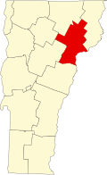
| County | Caledonia |
| Town | Sutton |
| Area | |
• Total | 1.78 sq mi (4.61 km2) |
| • Land | 1.78 sq mi (4.61 km2) |
| • Water | 0 sq mi (0.0 km2) |
| Elevation | 1,230 ft (375 m) |
| Time zone | UTC-5 (Eastern (EST)) |
| • Summer (DST) | UTC-4 (EDT) |
| ZIP Code | 05867 |
| Area code | 802 |
| FIPS code | 50-71500 |
| GNIS feature ID | 2805710 [2] |
Sutton is the primary village and a census-designated place (CDP) in the town of Sutton, Caledonia County, Vermont, United States. It was first listed as a CDP prior to the 2020 census.
The village is in northern Caledonia County, in the southern part of the town of Sutton. It sits on a hillside draining southward to Calendar Brook, a southeast-flowing tributary of the West Branch of the Passumpsic River, part of the Connecticut River watershed.
The village is 1.8 miles (2.9 km) south of U.S. Route 5 at the locale known as Sutton Station, and it is 8 miles (13 km) north of Lyndonville.