
Cherokee County is a county located in the U.S. state of Oklahoma. As of the 2020 census, the population was 47,078. Its county seat is Tahlequah, which is also the capital of the Cherokee Nation.

Bell is a census-designated place (CDP) in Adair County, Oklahoma, United States. The population was 535 at the 2010 census, an 11.1 percent decline from the figure of 602 recorded in 2000.

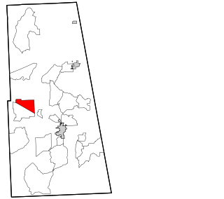
Eldon is an unincorporated community and census-designated place (CDP) in Cherokee County, Oklahoma, United States. The population was 368 at the 2010 census, a loss of 62.3 percent from 991 at the 2000 census, due largely to shrinkage of the CDP boundaries. It lies east of Tahlequah at the junction of U.S. Highway 62 and State Highway 51. The Eldon Post Office existed from March 20, 1911, until May 30, 1936. The community is said to have been named for Eldon, Illinois.

Park Hill is an unincorporated community and census-designated place (CDP) in southwestern Cherokee County, Oklahoma, United States. The population was 3,909 at the 2010 census. It lies near Tahlequah, east of the junction of U.S. Route 62 and State Highway 82.

Shady Grove is an unincorporated community and census-designated place (CDP) in Cherokee County, Oklahoma, United States. The population was 556 at the 2010 census. This is not to be confused with the similarly-named Shady Grove in McIntosh County, or the Shady Grove in Pawnee County.

Tahlequah is a city in Cherokee County, Oklahoma located at the foothills of the Ozark Mountains. It is part of the Green Country region of Oklahoma and was established as a capital of the 19th-century Cherokee Nation in 1839, as part of the new settlement in Indian Territory after the Cherokee Native Americans were forced west from the American Southeast on the Trail of Tears.

Locust Grove is a town in Mayes County, Oklahoma, United States. The population was 1,423 at the 2010 census, a 4.2 percent increase over the figure of 1,366 recorded in 2000.
Sequoyah High School is a Native American boarding school serving students in grades 7 through 12, who are members of a federally recognized Native American tribe. The school is located in Park Hill, Oklahoma, with a Tahlequah post office address, and is a Bureau of Indian Education (BIE) grant school operated by the Cherokee Nation.
Titanic is a census-designated place (CDP) in Adair County, Oklahoma, United States. The population was 356 at the 2010 census. It was presumably named after the famous ocean liner RMS Titanic.
Gideon is an unincorporated community and census-designated place (CDP) in Cherokee County, Oklahoma, United States. The population was 49 at the 2010 census.
Teresita is an unincorporated community and census-designated place (CDP) in Cherokee County, Oklahoma, United States. The population was 159 at the 2010 census.
Barber is an unincorporated community and census-designated place (CDP) in Cherokee County, Oklahoma, United States, in the Cherokee Nation. It was first listed as a CDP prior to the 2020 census.
Caney is a census-designated place (CDP) in Cherokee County, Oklahoma, United States, within the Cherokee Nation. It was first listed as a CDP prior to the 2020 census. It includes the unincorporated community of Tailholt.
Caney Ridge is an unincorporated community and census-designated place (CDP) in Cherokee County, Oklahoma, United States, within the Cherokee Nation. It was first listed as a CDP prior to the 2020 census.
Etta is a census-designated place (CDP) in Cherokee County, Oklahoma, United States, within the Cherokee Nation. It was first listed as a CDP prior to the 2020 census.
Johnson Prairie is a census-designated place (CDP) in Cherokee County, Oklahoma, United States. It was first listed as a CDP prior to the 2020 census. It includes the unincorporated community of Liberty.
Lowrey is an unincorporated community and census-designated place (CDP) in Cherokee County, Oklahoma, United States. It was first listed as a CDP prior to the 2020 census.
Norwood is a census-designated place (CDP) in Cherokee and Muskogee counties, Oklahoma, United States. It was first listed as a CDP prior to the 2020 census.
Pumpkin Hollow is a census-designated place (CDP) in Cherokee County, Oklahoma, United States, within the Cherokee Nation. It was first listed as a CDP prior to the 2020 census.
Little Rock is an unincorporated community and census-designated place (CDP) in Mayes County, Oklahoma, United States. It was first listed as a CDP prior to the 2020 census.

