Pennsylvania Route 837

Last updated

PA-837.svg

Pennsylvania Route 837

Pennsylvania Route 837
Route information
Maintained by PennDOT
Length40.3 mi [1]  (64.9 km)
ExistedMay 27, 1935 [2] –present
Major junctions
South endPA-88.svg PA 88 in Carroll Township
Major intersectionsI-376.svg I-376 in Pittsburgh
North endUS 19.svgPA-51.svgPA-60.svg US 19  / PA 51  / PA 60 in Pittsburgh
Location
Country United States
State Pennsylvania
Counties Washington, Allegheny
Highway system
PA-836 (1926).svg PA 836 PA-838 (1926).svg PA 838

Pennsylvania Route 837 (PA 837) is a state route located in western Pennsylvania. The southern terminus of the route is at Pennsylvania Route 88 in the Carroll Township hamlet of Wickerham Manor. The northern terminus is at U.S. Route 19 (US 19) and PA 51 near downtown Pittsburgh at the junction of the Ohio, Allegheny and Monongahela rivers. The highway parallels the Monongahela River for all of its route with the exceptions of its extreme north and south ends. Popular amusement park Kennywood is located along this route.

Contents

Route description

PA 837 northbound in Donora 2022-05-14 16 19 47 View north along Pennsylvania State Route 837 (South McKean Avenue) at Walnut Street and Galiffa Drive in Donora, Washington County, Pennsylvania.jpg
PA 837 northbound in Donora

Washington County

PA 837 begins at PA 88 in Carroll Township. It actually starts toward the east-southeast toward the borough of Donora. Before entering Donora, it turns to the north and passes the Monessen Bridge and becomes S. McKean Avenue. It leaves Donora as Meldon Avenue after passing the former site of the Donora-Webster Bridge at 10th Street.

After turning west, PA 837 enters the city of Monongahela where it meets PA 88 again. It joins PA 88 for 2.5 miles (4.0 km) through Monongahela and the borough of New Eagle. After rounding another bend in the Monongahela River, PA 837 heads for the borough of West Elizabeth. Sixteen miles of PA 837 is in Washington County. [1]

Allegheny County

In West Elizabeth PA 837 is known as 5th Street (alternately, the Charles McDevitt Memorial Highway, after the former Mayor of that town) before it intersects PA 51 at the Elizabeth Bridge and turns back to the northwest toward the city of Clairton. In Clairton, PA 837 is known as State Street and passes the Clairton Works, a large coke manufacturer. Paralleling the Monongahela River, winds through the borough of Dravosburg and the city of Duquesne. Upon leaving Duquesne, Route 837 becomes Kennywood Blvd. as it passes Kennywood Park, a well-known amusement park in western Pennsylvania.

Shortly after passing Kennywood, PA 837 becomes 8th Avenue in the borough of Homestead. In Homestead, the highway passes The Waterfront, a large shopping center on the banks of the Monongahela. West of Homestead, PA 837 encounters a complex interchange with PA 885, Baldwin Rd., and Glass Run Rd.

PA 837 at Station Square PA 837 at Station Square.jpg
PA 837 at Station Square

PA 837 becomes East Carson Street in the South Side Flats neighborhood of the city of Pittsburgh. East Carson Street is the main road of a major business district in the South Side. Carson Street then passes Station Square before travelling under the Fort Pitt Bridge and ending at the West End Circle.

PA 837 spends almost 25 miles (40 km) in Allegheny County. It is the south end of five bridges in Pittsburgh and passes under two others. [1]

Allegheny County Belt routes

Two of Allegheny County's colored belt routes align PA 837:

A portion of the Orange Belt that was decommissioned in the 1970s also ran along PA 837 for 2.5 miles from the Regis Malady Bridge in Elizabeth to Finleyville-Elrama Road in Elrama

Major intersections

CountyLocationmi [1] kmDestinationsNotes
Washington Carroll Township 0.00.0PA-88.svg PA 88 (Country Club Road) Charleroi, Monongahela Southern terminus of PA 837
Donora To plate blue.svg
I-70.svg
To plate.svg
PA-906.svg
Donora-Monessen Bridge to I-70  / PA 906  Monessen
Interchange
Monongahela 8.513.7South plate.svg
PA-88.svg
East plate.svg
PA-136.svg
PA 88 south / PA 136 east Charleroi
Southern terminus of PA 88 / PA 136 concurrency
8.714.0South plate.svg
PA-481.svg
PA 481 south (Park Avenue) / First Street
Northern terminus of PA 481
9.715.6West plate.svg
PA-136.svg
To plate green.svg
Toll plate yellow.svg
Turnpike-43.svg
PA 136 west (Dry Run Road) to PA Turnpike 43  Eighty Four
Northern terminus of PA 136 concurrency
New Eagle 10.917.5North plate.svg
PA-88.svg
PA 88 north (Union Street) Finleyville
Northern terminus of PA 88 concurrency
Allegheny West Elizabeth 17.828.6PA-51.svg PA 51  Pittsburgh, Elizabeth Interchange
Clairton 20.833.5North plate.svg
PA-885.svg
PA 885 north (Walnut Avenue)
Southern terminus of PA 885
Duquesne 26.442.5Pittsburgh PA Green Belt shield.svgTo plate.svg
PA-148.svg
Green Belt (McKeesport-Duquesne Bridge) to PA 148  McKeesport
Interchange, southern terminus of Green Belt concurrency
Whitaker 31.851.2Pittsburgh PA Green Belt shield.svgTo plate blue.svg
I-376.svg
Green Belt (Rankin Bridge) to I-376  Swissvale
Southwest end of bridge, northern terminus of Green Belt concurrency
Homestead 32.151.7Pittsburgh PA Blue Belt shield.svg Blue Belt (Homestead Grays Bridge) / West StreetSoutheast end of bridge, eastern terminus of Blue Belt concurrency
Pittsburgh 33.654.1PA-885.svg PA 885 (Glenwood Bridge/Mifflin Road) / Glass Run RoadInterchange
35.457.0Pittsburgh PA Blue Belt shield.svg Blue Belt (Becks Run Road) Carrick Western terminus of Blue Belt concurrency
36.658.9 Hot Metal Street
37.159.7 Birmingham BridgeOakland South end of Birmingham Bridge
37.961.0 S. Tenth StreetDowntown South end of South Tenth Street Bridge
38.862.4 Smithfield Street BridgeDowntown South end of Smithfield Street Bridge
39.864.1East plate blue.svg
I-376.svg
To plate blue.svg
North plate blue.svg
I-279.svg
I-376 east (US 22 east / US 30 east/Penn-Lincoln Parkway/Fort Pitt Bridge) to I-279 north
Exit 69C (I-376); access only from PA 837 south to I-376 east / I-376 west to PA 837 north
40.364.9US 19.svgPA-51.svg US 19  / PA 51 (West End Bridge) McKees Rocks, West End, Airport
North plate.svg
PA-60.svg
PA 60 north (South Main Street) Crafton
Northern terminus of PA 837, southern terminus of PA 60
1.000 mi = 1.609 km; 1.000 km = 0.621 mi

PA 837 Truck

Truck plate.svg

PA-837.svg

Pennsylvania Route 837 Truck

Location West Elizabeth, Pennsylvania
Existed2007–present

Pennsylvania Route 837 Truck is a truck route of PA 837 signed in 2007.

The route was established for trucks coming onto PA 837 from PA 51 south. It first utilizes the exit ramps from PA 837 to PA 51 south. It follows PA 51 south to an interchange at Ridge Road. It turns left on Ridge Road and makes a U-Turn back onto PA 51 north. It then utilizes the PA 51 exit ramps to PA 837.

See also

Related Research Articles

<span class="mw-page-title-main">Jefferson Hills, Pennsylvania</span> Borough in Pennsylvania, United States

Jefferson Hills is a borough in Allegheny County, Pennsylvania, United States. In the 2020 census, the population was 12,424. It is part of the Pittsburgh metropolitan area.

<span class="mw-page-title-main">West Mifflin, Pennsylvania</span> Borough in Pennsylvania, United States

West Mifflin is a borough in Allegheny County, Pennsylvania, United States, located southeast of downtown Pittsburgh. The population was 19,589 at the 2020 census. It is named after Thomas Mifflin, 1st Governor of Pennsylvania, signer of the United States Constitution, and 1st Quartermaster General of the United States Army.

<span class="mw-page-title-main">Interstate 579</span> Highway in Pennsylvania

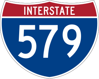
Interstate 579 (I-579) is a north–south Interstate Highway entirely within Pittsburgh, Pennsylvania. The highway is 2.73 miles (4.39 km) long. I-579 is also known as the Crosstown Boulevard since it crosses the backside of Downtown Pittsburgh.

<span class="mw-page-title-main">Allegheny County belt system</span> Allegheny County belt system

The Allegheny County Belt System color codes various county roads to form a unique system of routes in Allegheny County, Pennsylvania, and around the city of Pittsburgh.

The Mon–Fayette Expressway is a partially-completed controlled-access toll road that is planned to eventually link Interstate 68 near Morgantown, West Virginia with Interstate 376 near Monroeville, Pennsylvania. The ultimate goal of the highway is to provide a high speed north–south connection between Morgantown and the eastern side of Pittsburgh while revitalizing economically distressed Monongahela River Valley towns in Fayette and Washington counties, serving as an alternative to Interstate 79 to the west, as well as relieving the PA 51 alignment from Pittsburgh to Uniontown.

<span class="mw-page-title-main">Rankin Bridge</span> Bridge in Pennsylvania and Rankin, Pennsylvania

The George Rankin Jr. Memorial Bridge is a cantilever bridge that carries the Green Belt across the Monongahela River between Whitaker and Rankin in Pennsylvania in the USA. It carries four lanes of automobile traffic, plus pedestrian walkways, both paved with concrete. The bridge carries over 22,500 people per day. The bridge and many of its approach ramps were originally built with tram tracks, all of which have since been removed.

<span class="mw-page-title-main">Transportation in Pittsburgh</span> Transportation in Pittsburgh, Pennsylvania, United States

A large metropolitan area that is surrounded by rivers and hills, Pittsburgh has an infrastructure system that has been built out over the years to include roads, tunnels, bridges, railroads, inclines, bike paths, and stairways; however, the hills and rivers still form many barriers to transportation within the city.

<span class="mw-page-title-main">Union Railroad (Pittsburgh)</span>

Union Railroad is a Class III switching railroad located in Allegheny County in Western Pennsylvania. The company is owned by Transtar, Inc., which is a subsidiary of Fortress Transportation and Infrastructure Investors, after being acquired from U.S. Steel in 2021. The railroad's primary customers are the three plants of the USS Mon Valley Works, the USS Edgar Thomson Steel Works, the USS Irvin Works and the USS Clairton Works.

<span class="mw-page-title-main">Pennsylvania Route 65</span> State highway in Pennsylvania, US

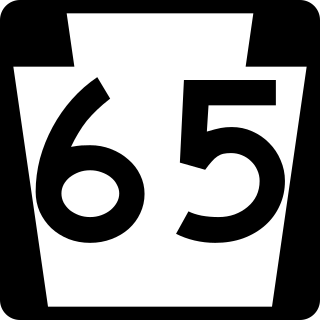
Pennsylvania Route 65 is a major 51-mile-long (82 km) state highway located in western Pennsylvania, United States. The route, traveling north–south from the Interstate 279/U.S. Route 19 Truck concurrency in Pittsburgh north to the PA 108/PA 168 concurrency in New Castle, connects downtown Pittsburgh to the northwestern portion of the Pittsburgh Metropolitan Area. PA 65 is similar in its purpose to PA 18 and PA 51, both of which run parallel to PA 65 at one point or another; however, the three routes pass through different cities for most of their respective alignments.

<span class="mw-page-title-main">Pennsylvania Route 51</span> State highway in Pennsylvania

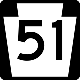
Pennsylvania Route 51 is a major state highway that is located in Western Pennsylvania in the United States. It runs for 89 miles (143 km) from Uniontown to the Ohio state line near Darlington, where it connects with Ohio State Route 14.

<span class="mw-page-title-main">Pennsylvania Route 21</span> State highway in Pennsylvania, US

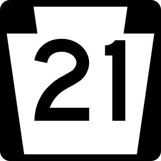
Pennsylvania Route 21 is a 50.75-mile (81.67 km) long east–west state highway in the US state of Pennsylvania. The western terminus of the route is at the West Virginia state line in Richhill Township, where PA 21 continues into West Virginia as West Virginia Route 891. The eastern terminus is at U.S. Route 40 Business in Uniontown. The route is known as the Roy E. Furman Highway for most of its length. PA 21 serves Waynesburg and Masontown along the way.

<span class="mw-page-title-main">Pennsylvania Route 48</span> State highway in Allegheny County, Pennsylvania, US

Pennsylvania Route 48 is an 18.9-mile-long (30.4 km) state highway located in the Pittsburgh, Pennsylvania area. The route is predominantly a two-lane highway as it runs through McKeesport and other suburbs. The entire routing of PA 48 is part of the Orange Belt, both reaching their southern termini at PA 51, southeast of Elizabeth. Until 1998, the northern terminus of PA 48 was at the intersection of Old Haymaker and Center Roads, about 1/2 mile from its current terminus at U.S. Route 22 Business in Monroeville.

<span class="mw-page-title-main">Pennsylvania Route 88</span> State highway in Pennsylvania, US

Pennsylvania Route 88 is a 68-mile-long (109 km) north–south state highway located in southwestern Pennsylvania. The southern terminus of the route is at U.S. Route 119 (US 119) in Point Marion less than 2 miles (3 km) from the Pennsylvania-West Virginia border. The northern terminus is at PA 51 in Pittsburgh. PA 88 runs parallel to the Monongahela River for almost its entire length.

<span class="mw-page-title-main">Pennsylvania Route 885</span> State highway in Allegheny County, Pennsylvania, US

Pennsylvania Route 885 is a 14.1-mile-long (22.69 km) north–south state highway in the U.S. state of Pennsylvania. It runs from Pennsylvania Route 837 in Clairton north to Interstate 579 in Pittsburgh. The route is entirely within Allegheny County and serves as a connector between the city of Pittsburgh and its southern suburbs.

<span class="mw-page-title-main">Pennsylvania Route 136</span> State highway in Pennsylvania, US

Pennsylvania Route 136 is a 40-mile-long (64 km) state highway located in Washington, Allegheny, and Westmoreland counties in Pennsylvania. The western terminus is at US 40 and PA 18 in Washington. The eastern terminus is at US 30 in Greensburg.

<span class="mw-page-title-main">Pennsylvania Route 148</span> State highway in Allegheny County, Pennsylvania, US

Pennsylvania Route 148 is a 6.50-mile-long (10.46 km), north–south state highway located in Allegheny County, Pennsylvania. The southern terminus is at PA 48 in McKeesport. The northern terminus is at U.S. Route 30 in East McKeesport.

<span class="mw-page-title-main">Pennsylvania Route 366</span> State highway in Pennsylvania, US

Pennsylvania Route 366 is a 14.8-mile-long (23.8 km) state highway located in Allegheny and Westmoreland counties in Pennsylvania. The western terminus is at PA 28 in Tarentum. The eastern terminus is at PA 66 in Murrysville. The last 1/2 mile of the Red Belt route of the Allegheny County belt system runs along PA 366 in Tarentum from its eastbound beginning at the PA 28 interchange to the intersection of Freeport Rd. and Ross St. where the Red Belt terminates.

<span class="mw-page-title-main">Pennsylvania Route 481</span> State highway in Washington County, Pennsylvania, US

Pennsylvania Route 481 is a 12.9-mile-long (20.8 km) state highway located in Washington County, Pennsylvania. The southern terminus is at US 40 in Centerville. The northern terminus is at PA 88/PA 136/PA 837 in Monongahela.

<span class="mw-page-title-main">Pennsylvania Route 906</span> State highway in Pennsylvania, US

Pennsylvania Route 906 is a 10.6-mile-long (17.1 km) state highway located in Fayette, Westmoreland, and Allegheny counties in Pennsylvania. The southern terminus is at PA 201 in Washington Township. The northern terminus is at PA 136 in Forward Township.

References

  1. 1 2 3 4 Google (June 22, 2014). "Pennsylvania Route 837" (Map). Google Maps . Google. Retrieved June 22, 2014.
  2. "Make Changes in Route Numbers". The Morning Call. April 18, 1935. p. 2. Retrieved May 2, 2018 via Newspapers.com. Open Access logo PLoS transparent.svg
Template:Attached KML/Pennsylvania Route 837
KML is from Wikidata