
St Olave's Church, Hart Street, is a Church of England church in the City of London, located on the corner of Hart Street and Seething Lane near Fenchurch Street railway station.
Mark Lane is a disused station on the London Underground. It was served by the Circle and District lines.

Fenchurch Street is a street in London, England, linking Aldgate at its eastern end with Lombard Street and Gracechurch Street in the west. It is a well-known thoroughfare in the City of London financial district and is the site of many corporate offices and headquarters. The name "Fenchurch" means "church in the fenny or marshy ground" and presumably refers to St Gabriel Fenchurch, which stood at the junction of Fenchurch Street and Cullum Street until it was destroyed by the Great Fire.
Ironmonger Lane is a narrow one-way street in the City of London running southbound between Gresham Street and Cheapside.

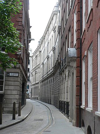
Exchange Alley or Change Alley is a narrow alleyway connecting shops and coffeehouses in an old neighbourhood of the City of London. It served as a convenient shortcut from the Royal Exchange on Cornhill to the Post Office on Lombard Street and remains as one of a number of alleys linking the two streets. Shops once located in Exchange Alley included ship chandlers, makers of navigation instruments such as telescopes, and goldsmiths from Lombardy in Italy.

St Michael, Crooked Lane, was an ancient parish church situated on the east side of Miles's Lane in Candlewick ward in the City of London. It was rebuilt after the Great Fire of London by Sir Christopher Wren, and demolished in 1831.

Old Jewry is a one-way street in the City of London, the historic and financial centre of London. It is located within Coleman Street ward and links Poultry to Gresham Street.

Tower is one of the 25 wards of the City of London and takes its name from its proximity to the Tower of London. The ward covers the area of the City that is closest to the Tower.
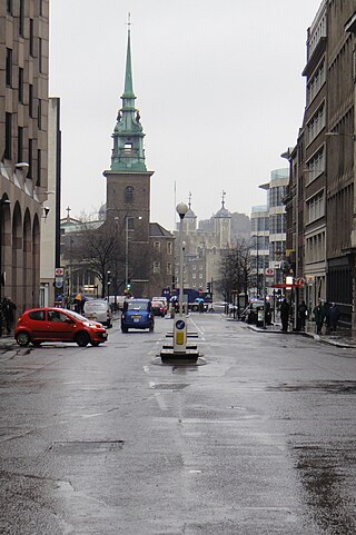
Great Tower Street, originally known just as Tower Street, is a street in the City of London, the historic nucleus and modern financial centre of London, England. It forms an eastern continuation of Eastcheap starting at Idol Lane, and leads towards Byward Street and Tower Hill. On Byward Street, opposite Great Tower Street, is the historic church All Hallows-by-the-Tower.

Foster Lane is a short street within Cheap ward, in the City of London, England. It is situated northeast of St Paul's Cathedral and runs southbound Gresham Street to Cheapside.

Byward Street is a road in the City of London, the historic and financial centre of London. It forms part of the A3211 route and, if travelling eastward, is a short continuation of Lower Thames Street from a junction with Great Tower Street, to Tower Hill. It is located within the City ward of Tower.

America Square is a street and small square in London, off Crosswall and located near Minories. The square was built in about 1760 and dedicated to the American colonies.
Crosswall is a street in the City of London.
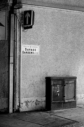
Savage Gardens is a minor street in the City of London, connecting Crutched Friars in the north to Trinity Square in the south, crossing Pepys Street. It was part-pedestrianised in 2011, with the carriageway remaining between Pepys Street and Trinity Square.

Thames Street, divided into Lower and Upper Thames Street, is a road in the City of London, the historic and financial centre of London. It forms part of the busy A3211 route from Tower Hill to Westminster. The London Bridge underpass marks the divide between Upper and Lower Thames Street, with Lower to the east and Upper to the west.
Lombard Street is a street notable for its connections with the City of London's merchant, banking and insurance industries, stretching back to medieval times.

Mark Lane is a street in the City of London linking Great Tower Street and Fenchurch Street. It gave its name to the nearby Mark Lane tube station, which was opened in 1884, renamed Tower Hill in 1964, and closed three years later. For some 240 years, Mark Lane was known for the corn exchange ; it occupied a series of properties on the east side of the southern end of the street.

Beer Lane was a short street of the City of London from at least 1570 to 1910. It ran from almost the east end of Great Tower Street, from opposite Seething Lane, to 53 Lower Thames Street, opposite the east warehouse block of Custom House. John Stow wrote "At the east end of Tower Street, on the south side, have ye Beare Lane, wherein are many fair houses, and runneth down to Thames Street."
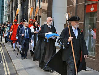
The Knollys Rose Ceremony is an annual event led by the Company of Watermen and Lightermen. The ceremony dates to 1381 and is held each year in June. A single red rose is snipped from the garden in Seething Lane, placed on an altar cushion from All Hallows-by-the-Tower and carried in procession west to the Mansion House where it is presented to the Lord Mayor of London.

Seething Lane is a street in the City of London. It connects All Hallows-by-the-Tower, Byward Street, with St Olave's Church, Hart Street. The street is named after an Old English expression meaning "full of chaff", which was derived from the nearby corn market in Fenchurch Street. Samuel Pepys lived there and is buried in St Olave's Church at the junction with Hart Street. A bust of Pepys, created by Karin Jonzen, sits in the public garden at the south end of the street.
