Pharoah, Oklahoma

Last updated

Pharoah
USA Oklahoma location map.svg
Red pog.svg
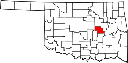
Pharoah
Location within the state of Oklahoma
Usa edcp location map.svg
Red pog.svg
Pharoah
Pharoah (the United States)
Coordinates: 35°25′13″N96°07′23″W / 35.42028°N 96.12306°W / 35.42028; -96.12306
Country United States
State Oklahoma
County Okfuskee
Elevation
[1]
768 ft (234 m)
Time zone UTC-6 (Central (CST))
  Summer (DST) UTC-5 (CDT)
GNIS feature ID1096590 [1]

Pharoah is an unincorporated community in Okfuskee County, Oklahoma, United States. [1] It is nine miles east of Okemah [2] just south of Interstate 40 on US Route 75. [3] The community was named after a rancher and cattleman, O.J. Pharoah. [2] [4] Oil and gas production have historically been important industries in Okfuskee County, and, in the 1920s, oil wells were drilled around Pharoah. [5] A post office opened in Pharoah on June 8, 1921; [5] the current nearest post office is in Weleetka. [6]

Related Research Articles

<span class="mw-page-title-main">Washington County, Oklahoma</span> County in Oklahoma, United States

<span class="mw-page-title-main">Seminole County, Oklahoma</span> County in Oklahoma, United States

Seminole County is a county located in the U.S. state of Oklahoma. As of the 2020 census, the population was 23,556. Its county seat is Wewoka. Most of the county was a reservation for the Seminole Nation of Oklahoma which still retains jurisdiction over some land in the county. A small portion of land at the eastern end of the county belonged to the Muscogee (Creek) Nation.

<span class="mw-page-title-main">Okmulgee County, Oklahoma</span> County in Oklahoma, United States

Okmulgee County is a county in the U.S. state of Oklahoma. As of the 2020 census, the population was 36,706. The county seat is Okmulgee. Located within the Muscogee Nation Reservation, the county was created at statehood in 1907. The name Okmulgee is derived from the Hitchita word okimulgi, meaning "boiling waters".

<span class="mw-page-title-main">Okfuskee County, Oklahoma</span> County in Oklahoma, United States

Okfuskee County is a county located in the U.S. state of Oklahoma. As of the 2020 census, its population was 11,310. Its county seat is Okemah. The county is named for a former Muscogee town in present Cleburne County, Alabama, that in turn was named for the Okfuskee, a Muscogee tribe.

<span class="mw-page-title-main">McIntosh County, Oklahoma</span> County in Oklahoma, United States

McIntosh County is a county located in the U.S. state of Oklahoma. As of the 2020 census, the population was 18,941. Its county seat is Eufaula. The county is named for an influential Muscogee Creek family, whose members led the migration of the Lower Towns to Indian Territory and served as leaders for generations.

<span class="mw-page-title-main">Lincoln County, Oklahoma</span> County in Oklahoma, United States

Lincoln County is a county in eastern Central Oklahoma. As of the 2020 census, the population was 33,458. Its county seat is Chandler.

<span class="mw-page-title-main">Hughes County, Oklahoma</span> County in Oklahoma, United States

Hughes County is a county located in south central U.S. state of Oklahoma. As of the 2020 census, the population was 13,367. Its county seat is Holdenville. The county was named for W. C. Hughes, an Oklahoma City lawyer who was a member of the Oklahoma Constitutional Convention.

<span class="mw-page-title-main">Creek County, Oklahoma</span> County in Oklahoma, United States

Creek County is a county located in the U.S. state of Oklahoma. As of the 2020 census, the population was 71,754. Its county seat is Sapulpa.

<span class="mw-page-title-main">Bristow, Oklahoma</span> City in Oklahoma, United States

Bristow is a city in Creek County, Oklahoma, United States. The population was 4,222 at the 2010 census, down 2.4 percent from the figure of 4,325 recorded in 2000.

<span class="mw-page-title-main">Okmulgee, Oklahoma</span> City in Oklahoma, United States

Okmulgee is a city in, and the county seat of, Okmulgee County, Oklahoma. The name is from the Mvskoke word okimulgee, which means "boiling waters". The site was chosen because of the nearby rivers and springs. Okmulgee is 38 miles south of Tulsa and 13 miles north of Henryetta via US-75.

<span class="mw-page-title-main">Cleveland, Oklahoma</span> City in Oklahoma, United States

Cleveland is a city in Pawnee County, Oklahoma, United States. The 2010 census population was 3,251, a decrease of 0.9 percent from the figure of 3,282 recorded in 2000.

<span class="mw-page-title-main">Bartlesville, Oklahoma</span> City in Oklahoma, United States

Bartlesville is a city mostly in Washington County in the U.S. state of Oklahoma. The population was 37,290 at the 2020 census. Bartlesville is 47 miles (76 km) north of Tulsa and 18 miles (29 km) south of the Kansas border. It is the county seat of Washington County. The Caney River runs through Bartlesville.

<span class="mw-page-title-main">Deep Fork River</span>

The Deep Fork River is an Oklahoma tributary of the North Canadian River. The headwaters flow from northern Oklahoma City and the river empties into the North Canadian River, now impounded by Lake Eufaula.

Welty is an unincorporated community in Okfuskee County, Oklahoma, United States. Named for the town developer, Edwin A. Welty, its post office was established October 12, 1905, with Jerimiah D. Wilson as the first postmaster.

<span class="mw-page-title-main">Oklahoma State Highway 56</span> Highway in Oklahoma, United States

State Highway 56 is a state highway in the U.S. state of Oklahoma. The road serves Seminole County, Okfuskee County, and Okmulgee Counties in central and east-central Oklahoma. In Seminole County, it is also designated as the Seminole Nation Highway in honor of the contributions the Seminole Nation has made to the state of Oklahoma.

<span class="mw-page-title-main">Bison, Oklahoma</span> Census-designated place in Oklahoma, United States

Bison is an unincorporated community and census-designated place (CDP) located on US Highway 81 in Garfield County, Oklahoma, United States, consisting of a 30-acre (12 ha) town plat. As of the 2010 census, it had a population of 65.

Honobia is an unincorporated community on the border between western LeFlore County and eastern Pushmataha County, Oklahoma, United States, 15 miles southeast of Talihina.

Bryant is a Creek Indian Nation townsite in Okmulgee County, Oklahoma, United States. Bryant is southwest of Henryetta and southeast of the town of Pharoah, being both south of Interstate 40 and east of U.S. Route 75 on Bryant Road.

<span class="mw-page-title-main">Gilmore, Oklahoma</span> Unincorporated community in Oklahoma, United States

Gilmore is an unincorporated community in Le Flore County, Oklahoma, United States. The town, formerly incorporated, boasted a small post office, city hall, and Mayor Pratt McMillin, a rancher and oil distributor who died in April 2001, aged 84.

References

  1. 1 2 3 1096590
  2. 1 2 Shirk, George H. (1987). Oklahoma Place Names (Revised ed.). Norman, Oklahoma: University of Oklahoma Press. p. 191. ISBN   9780806120287.
  3. "Pharoah, OK". Google Maps. Retrieved June 30, 2020.
  4. "Oklahoma's Strangely Named Towns—Pharoah, OK". Gary Horcher, The Oklahoman, August 19, 2000. Retrieved June 30, 2020.
  5. 1 2 Wilson, Linda D. "Okfuskee County," Encyclopedia of Oklahoma History and Culture. Oklahoma Historical Society. Accessed October 7, 2016.
  6. "Find USPS Locations (using Pharoah, Oklahoma as the search term)". U.S. Postal Service. Retrieved June 3, 2021.