Pickstown, South Dakota

Last updated

Pickstown, South Dakota
Town
Charles Mix County South Dakota Incorporated and Unincorporated areas Pickstown Highlighted.svg
Location in Charles Mix County and the state of South Dakota
Coordinates: 43°04′01″N98°31′47″W / 43.06694°N 98.52972°W / 43.06694; -98.52972 [1]
CountryUnited States
State South Dakota
County Charles Mix
Area
[2]
  Total0.61 sq mi (1.58 km2)
  Land0.61 sq mi (1.58 km2)
  Water0.00 sq mi (0.00 km2)
Elevation
[1]
1,483 ft (452 m)
Population
 (2020) [3]
  Total230
  Density376.43/sq mi (145.23/km2)
Time zone UTC-6 (Central (CST))
  Summer (DST) UTC-5 (CDT)
ZIP code
57367
Area code 605
FIPS code 46-49460 [4]
GNIS feature ID1267531 [1]
Website www.pickstown-sd.net
U.S. Army General Lewis A. Pick, namesake of Pickstown. Lewis A Pick.jpg
U.S. Army General Lewis A. Pick, namesake of Pickstown.

Pickstown is a town in southern Charles Mix County, South Dakota, United States. The population was 230 at the 2020 census. [5] It was named after U.S. Army General Lewis A. Pick, former director of the Missouri River Office of the United States Army Corps of Engineers.

Contents

History

Pickstown began as a government town for U.S. Army Corps of Engineers employees building and then operating nearby Fort Randall Dam. United States Air Force officers and airmen arrived in the 1950s to operate a Strategic Air Command radar base built on a hill three miles east of town, locally known as "Radar Hill". Air Force personnel left in the 1970s after the base closed. Currently, the "Fort Randall Casino and Hotel" owned and operated by the Yankton Sioux Tribe is located at the abandoned radar base.

The U.S. Army Corps of Engineers owned Pickstown until the town incorporated in 1985.

High school

The high school athletic teams were nicknamed the Engineers. [6] The high school closed in 1968. Students attend the Lake Andes high school.

Geography

Pickstown is located adjacent to the east side of the Fort Randall Dam on the Missouri River. The town is served by U.S. Route 18, U.S. Route 281 and South Dakota Highway 46.

According to the United States Census Bureau, the town has a total area of 0.65 square miles (1.68 km2), all land. [7]

Demographics

Historical population
CensusPop.Note
1990 95
2000 16876.8%
2010 20119.6%
2020 23014.4%
U.S. Decennial Census [8] [3]

2010 census

As of the census [9] of 2010, there were 201 people, 93 households, and 62 families residing in the town. The population density was 309.2 inhabitants per square mile (119.4/km2). There were 114 housing units at an average density of 175.4 per square mile (67.7/km2). The racial makeup of the town was 82.6% White, 10.4% Native American, 0.5% Asian, and 6.5% from two or more races. Hispanic or Latino of any race were 1.0% of the population.

There were 93 households, of which 19.4% had children under the age of 18 living with them, 58.1% were married couples living together, 4.3% had a female householder with no husband present, 4.3% had a male householder with no wife present, and 33.3% were non-families. 28.0% of all households were made up of individuals, and 11.8% had someone living alone who was 65 years of age or older. The average household size was 2.16 and the average family size was 2.58.

The median age in the town was 51.2 years. 17.4% of residents were under the age of 18; 5.1% were between the ages of 18 and 24; 19% were from 25 to 44; 36.8% were from 45 to 64; and 21.9% were 65 years of age or older. The gender makeup of the town was 49.8% male and 50.2% female.

2000 census

As of the census [4] of 2000, there were 168 people, 76 households, and 49 families residing in the town. The population density was 260.7 inhabitants per square mile (100.7/km2). There were 88 housing units at an average density of 136.5 per square mile (52.7/km2). The racial makeup of the town was 85.12% White, 11.31% Native American, 0.60% Asian, and 2.98% from two or more races.

There were 76 households, out of which 22.4% had children under the age of 18 living with them, 57.9% were married couples living together, 2.6% had a female householder with no husband present, and 35.5% were non-families. 26.3% of all households were made up of individuals, and 6.6% had someone living alone who was 65 years of age or older. The average household size was 2.21 and the average family size was 2.69.

In the town, the population was spread out, with 19.6% under the age of 18, 3.6% from 18 to 24, 28.6% from 25 to 44, 28.0% from 45 to 64, and 20.2% who were 65 years of age or older. The median age was 44 years. For every 100 females, there were 124.0 males. For every 100 females age 18 and over, there were 121.3 males.

The median income for a household in the town was $50,250, and the median income for a family was $55,250. Males had a median income of $39,375 versus $19,792 for females. The per capita income for the town was $20,755. None of the families and 1.1% of the population were living below the poverty line, including no under eighteens and 6.3% of those over 64.

Climate

This climatic region is typified by large seasonal temperature differences, with warm to hot (and often humid) summers and cold (sometimes severely cold) winters. According to the Köppen Climate Classification system, Pickstown has a humid continental climate, abbreviated "Dfa" on climate maps. [10]

Climate data for Pickstown, South Dakota
MonthJanFebMarAprMayJunJulAugSepOctNovDecYear
Mean daily maximum °C (°F)−1
(31)
2
(36)
8
(46)
16
(61)
22
(72)
28
(82)
31
(88)
31
(87)
25
(77)
18
(64)
8
(47)
2
(35)
16
(60)
Mean daily minimum °C (°F)−13
(9)
−10
(14)
−4
(24)
2
(36)
9
(48)
14
(58)
17
(63)
17
(62)
11
(52)
4
(40)
−3
(26)
−9
(15)
3
(37)
Average precipitation mm (inches)10
(0.4)
15
(0.6)
36
(1.4)
66
(2.6)
81
(3.2)
94
(3.7)
66
(2.6)
64
(2.5)
61
(2.4)
43
(1.7)
23
(0.9)
15
(0.6)
570
(22.5)
Source: Weatherbase [11]
Fort Randall Dam: Pickstown began as a government town for U.S. Army Corps of Engineers employees building and then operating the nearby dam. Fort Randall Dam, South Dakota.jpg
Fort Randall Dam: Pickstown began as a government town for U.S. Army Corps of Engineers employees building and then operating the nearby dam.

Points of interest

Notable person

See also

Related Research Articles

<span class="mw-page-title-main">Loraine, North Dakota</span> City in North Dakota, United States

Loraine is a city in Renville County, North Dakota, United States. The population was 9 at the 2020 census. It is part of the Minot Micropolitan Statistical Area.

<span class="mw-page-title-main">Tabor, South Dakota</span> Town in South Dakota, United States

Tabor is a town in Bon Homme County, South Dakota, United States. The population was 407 at the 2020 census.

<span class="mw-page-title-main">Westport, South Dakota</span> Town in South Dakota, United States

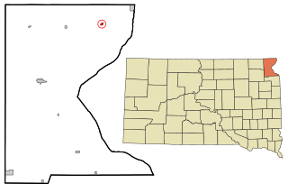
Westport is a town in western Brown County, South Dakota, United States. The population was 88 at the 2020 census.

<span class="mw-page-title-main">Fort Thompson, South Dakota</span> CDP in South Dakota, United States

Fort Thompson is a census-designated place (CDP) in Buffalo County, South Dakota, United States. The population was 1,282 at the 2010 census, making it the largest settlement on the Crow Creek Reservation.

<span class="mw-page-title-main">Lake Andes, South Dakota</span> City in South Dakota, United States

Lake Andes is a city in, and the county seat of, Charles Mix County, South Dakota, United States. The population was 710 at the 2020 census.

<span class="mw-page-title-main">Platte, South Dakota</span> City in South Dakota, United States

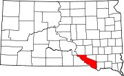
Platte is a city in Charles Mix County, South Dakota, United States. The population was 1,311 at the 2022 census. The community is named after the Platte Creek, a tributary of the Missouri River reservoir Lake Francis Case. Platte is located 15 miles east of Lake Francis Case on the Missouri River.

<span class="mw-page-title-main">Ravinia, South Dakota</span> Town in South Dakota, United States

Ravinia is a town in Charles Mix County, South Dakota, United States. The population was 71 at the 2020 census.

<span class="mw-page-title-main">Ethan, South Dakota</span> Town in South Dakota, United States

Ethan is a town in Davison County, South Dakota, United States. It is part of the Mitchell, South Dakota Micropolitan Statistical Area. The population was 365 at the 2020 census. Ethan is located 10 miles south of Mitchell.

<span class="mw-page-title-main">Revillo, South Dakota</span> Town in South Dakota, United States

Revillo is a town in southeastern Grant County, South Dakota, United States. The population was 99 at the 2020 census.

<span class="mw-page-title-main">Stockholm, South Dakota</span> Town in South Dakota, United States

Stockholm is a town in Grant County, South Dakota, United States. The population was 102 at the 2020 census.

<span class="mw-page-title-main">Kadoka, South Dakota</span> City in South Dakota, United States

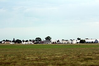
Kadoka is a city in, and the county seat of, Jackson County, South Dakota, United States. The population was 543 at the 2020 census. The town occupies about 2.3 square miles.

<span class="mw-page-title-main">Reliance, South Dakota</span> Town in South Dakota, United States

Reliance is a town in Lyman County, South Dakota, United States. The population was 128 at the 2020 census.

<span class="mw-page-title-main">Lake City, South Dakota</span> Town in South Dakota, United States

Lake City is a town in Marshall County, South Dakota, United States. The population was 45 at the 2020 census. Fort Sisseton Historic State Park, whose fort is listed on the National Register of Historic Places, is located nearby.

<span class="mw-page-title-main">Sherman, South Dakota</span> Town in South Dakota, United States

Sherman is a town in Minnehaha County, South Dakota, United States. The population was 81 at the 2020 census.

<span class="mw-page-title-main">Ortley, South Dakota</span> Town in South Dakota, United States

Ortley is a town in Roberts County, South Dakota, United States. The population was 50 according to the 2020 census.

<span class="mw-page-title-main">Rosholt, South Dakota</span> Town in South Dakota, United States

Rosholt is a town in Roberts County, South Dakota, United States. The population was 379 at the 2020 census.

<span class="mw-page-title-main">Tulare, South Dakota</span> Town in South Dakota, United States

Tulare is a town in Spink County, South Dakota, United States. The population was 211 at the 2020 census.

<span class="mw-page-title-main">New Witten, South Dakota</span> Town in South Dakota, United States

New Witten is a town in Tripp County, South Dakota, United States. The population was 54 at the 2020 census.

<span class="mw-page-title-main">Davis, South Dakota</span> Town in South Dakota, United States

Davis is a town in Turner County, South Dakota, United States. The population was 54 at the 2020 census.

<span class="mw-page-title-main">Lowry, South Dakota</span> Town in South Dakota, United States

Lowry is a town in Walworth County, South Dakota, United States. The population was 10 at the 2020 census. The town is home to Lowry Pilgrim Community Church, Swan Creek Harness Shop, J & C Repair, Karst Service and a fire station. Lowry also has an abandoned school, and a post office, which closed to service in the early 1970s.

References

  1. 1 2 3 U.S. Geological Survey Geographic Names Information System: Pickstown, South Dakota
  2. "ArcGIS REST Services Directory". United States Census Bureau. Retrieved October 15, 2022.
  3. 1 2 "Census Population API". United States Census Bureau. Retrieved October 15, 2022.
  4. 1 2 "U.S. Census website". United States Census Bureau . Retrieved January 31, 2008.
  5. "U.S. Census Bureau: Pickstown town, South Dakota". www.census.gov. United States Census Bureau. Retrieved February 5, 2022.
  6. "Sports".
  7. "US Gazetteer files 2010". United States Census Bureau. Archived from the original on July 2, 2012. Retrieved June 21, 2012.
  8. "Census of Population and Housing". Census.gov. Retrieved June 4, 2015.
  9. "U.S. Census website". United States Census Bureau . Retrieved June 21, 2012.
  10. Climate Summary for Pickstown, South Dakota
  11. "Weatherbase.com". Weatherbase. 2013. Retrieved on October 10, 2013.