
The N3 is a national route in South Africa that connects Johannesburg and Durban, respectively South Africa's largest and third-largest cities. Johannesburg is the financial and commercial heartland of South Africa, while Durban is South Africa's key port and one of the busiest ports in the Southern Hemisphere and is also a holiday destination. Durban is the port through which Johannesburg imports and exports most of its goods. As a result, the N3 is a very busy highway and has a high volume of traffic.

The Durban Outer Ring Road is a half ring road that circles the coastal city of Durban, South Africa. It is part of the N2 highway which links the North and South Coasts of KwaZulu-Natal.

The Western Bypass is a section of the N1 and the Johannesburg Ring Road located in the city of Johannesburg, South Africa. Known at the time as the Concrete Highway, the freeway was initially opened in 1975 as a route to avoid the city centre of Johannesburg and to provide access to the western areas of the Witwatersrand. From the south, the Western Bypass begins at the Diepkloof Interchange in Soweto, where it splits from the N12 freeway and ends at the Buccleuch Interchange, where it merges with the N3 Eastern Bypass, M1 South and N1 Ben Schoeman freeways.

National routes in South Africa are a class of trunk roads and freeways which connect major cities. They form the highest category in the South African route numbering scheme, and are designated with route numbers beginning with "N", from N1 to N18. Most segments of the national route network are officially proclaimed National Roads that are maintained by the South African National Roads Agency (SANRAL), but some segments are maintained by provincial or local road authorities.

The N1 is a national route in South Africa that runs from Cape Town through Bloemfontein, Johannesburg, Pretoria and Polokwane to Beit Bridge on the border with Zimbabwe. It forms the first section of the famed Cape to Cairo Road.

The R24 is a major East-West provincial route in the Gauteng and North West provinces that links OR Tambo International Airport with Rustenburg via Johannesburg, Krugersdorp and Magaliesburg. The process of renaming the streets and freeway that form the route from Krugersdorp eastward to OR Tambo International after anti-apartheid stalwart Albertina Sisulu was completed in 2013.

The R30 is a provincial route in South Africa that connects Bloemfontein with Rustenburg via Brandfort, Welkom, Bothaville, Klerksdorp and Ventersdorp. The southern part of the route is tolled, as the R30 forms the first section of the ZR Mahabane Toll Route, with the Brandfort Toll Plaza found 10 kilometres north of its Southern junction with the N1 National Route. The tolled portion ends at the junction with the R730.

The R56 is a provincial route in South Africa that connects Middelburg with Pietermaritzburg via Molteno, Maclear and Kokstad. It is co-signed with the N2 between Kokstad and Stafford's Post for 39 kilometres.
The R103 is a Regional Route in South Africa that is the designation for some of the old sections of roads that were previously the N3, prior to upgrading. It only has 3 sections, from Hillcrest to Ladysmith, from Warden to Villiers and from Heidelberg to Johannesburg.

The N2 is a national route in South Africa that runs from Cape Town through George, Gqeberha, East London, Mthatha, Port Shepstone and Durban to Ermelo. It is the main highway along the Indian Ocean coast of the country. Its current length of 2,255 kilometres (1,401 mi) makes it the longest numbered route in South Africa.

The N4 is a national route in South Africa that runs from Skilpadshek on the Botswana border, past Rustenburg, Pretoria, eMalahleni and Mbombela, to Komatipoort on the Mozambique border. It forms the South African section of the Trans-Kalahari Corridor, which runs from Walvis Bay to Maputo, meaning that it links the east and west coasts of Southern Africa. Since the completion of the A2 through Botswana, the entire Corridor is now a world-class standard highway; it features at least one carriageway in each direction of high-speed traffic plus a paved shoulder for its entire length.

The N17 is a national route in South Africa which runs from Johannesburg to Oshoek (Ngwenya) on the border with Eswatini. It passes through Springs, Bethal and Ermelo.

The South African National Roads Agency SOC Ltd or SANRAL is a South African parastatal responsible for the management, maintenance and development of South Africa's proclaimed National Road network which includes many National ("N") and some Provincial and Regional ("R") route segments.
The R101 is a Regional Route in South Africa that is the designation for some of the old sections of roads that were previously the N1, prior to upgrading. It only has 2 sections, from Bellville to Worcester and from Johannesburg to Polokwane.
The R512 is a Regional Route in South Africa that connects Brits, North West with Randburg, Gauteng via the western side of Hartbeespoort. It is an alternative route to the R511 for travel between the Johannesburg Metropole and Brits.
The R573 is a Regional Route in South Africa that connects Pretoria with Marble Hall via KwaMhlanga and Siyabuswa. As the road passes through Moloto, the entire route is known as the Moloto Road. It is maintained by the South African National Roads Agency.
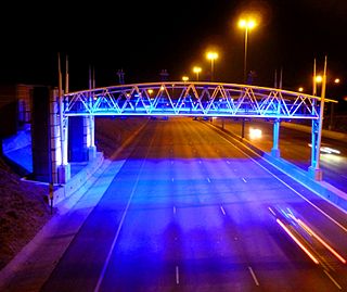
e-toll consists of the electronic toll collection (ETC) processes employed by South Africa's roads agency SANRAL on selected toll roads or toll lanes in the Gauteng province, subject to the Sanral Act of 1998. SANRAL derives its income both from toll income and the national fiscus, while initial capital outlay for large projects are funded by open market bond issues. In total SANRAL manages 13,000 km of non-toll roads in South Africa, besides the majority of its toll roads, including 187 km of Gauteng's freeways which are subject to e-toll.
There are a number of ring roads found in South Africa.
The Bloemfontein Ring Road, also known as The Bloemfontein bypass is a halfway ring road that circles the city of Bloemfontein, South Africa. It is part of the N1 National Route.
The Polokwane Ring Road, also known as The Polokwane Eastern Ring Road is a halfway ring road that circles the city of Polokwane, South Africa. It is part of the N1 National Route.