Erosion is the action of surface processes that removes soil, rock, or dissolved material from one location on the Earth's crust, and then transports it to another location where it is deposited. Erosion is distinct from weathering which involves no movement. Removal of rock or soil as clastic sediment is referred to as physical or mechanical erosion; this contrasts with chemical erosion, where soil or rock material is removed from an area by dissolution. Eroded sediment or solutes may be transported just a few millimetres, or for thousands of kilometres.

A mountain range or hill range is a series of mountains or hills ranged in a line and connected by high ground. A mountain system or mountain belt is a group of mountain ranges with similarity in form, structure, and alignment that have arisen from the same cause, usually an orogeny. Mountain ranges are formed by a variety of geological processes, but most of the significant ones on Earth are the result of plate tectonics. Mountain ranges are also found on many planetary mass objects in the Solar System and are likely a feature of most terrestrial planets.

A valley is an elongated low area often running between hills or mountains, which will typically contain a river or stream running from one end to the other. Most valleys are formed by erosion of the land surface by rivers or streams over a very long period of time. Some valleys are formed through erosion by glacial ice. These glaciers may remain present in valleys in high mountain or polar areas. At lower latitudes and altitudes, these glacially formed valleys may have been created or enlarged during ice ages but now are ice-free and occupied by streams or rivers. In desert areas, valleys may be entirely dry or carry a watercourse only rarely. In areas of limestone bedrock, dry valleys may also result from drainage taking place underground rather than at the surface. Rift valleys arise principally from earth movements, rather than erosion. Many different types of valley are described by geographers, using terms that may be global in use or else applied only locally.

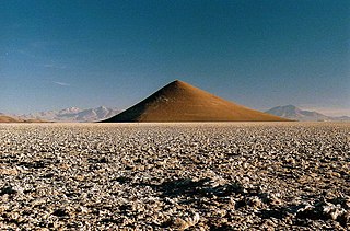
A mountain is an elevated portion of the Earth's crust, generally with steep sides that show significant exposed bedrock. Although definitions vary, a mountain may differ from a plateau in having a limited summit area, and is usually higher than a hill, typically rising at least 300 metres above the surrounding land. A few mountains are isolated summits, but most occur in mountain ranges.

A waterfall is a point in a river or stream where water flows over a vertical drop or a series of steep drops. Waterfalls also occur where meltwater drops over the edge of a tabular iceberg or ice shelf.

Geomorphology is the scientific study of the origin and evolution of topographic and bathymetric features created by physical, chemical or biological processes operating at or near the Earth's surface. Geomorphologists seek to understand why landscapes look the way they do, to understand landform and terrain history and dynamics and to predict changes through a combination of field observations, physical experiments and numerical modeling. Geomorphologists work within disciplines such as physical geography, geology, geodesy, engineering geology, archaeology, climatology and geotechnical engineering. This broad base of interests contributes to many research styles and interests within the field.

Gravel is a loose aggregation of rock fragments. Gravel occurs naturally throughout the world as a result of sedimentary and erosive geologic processes; it is also produced in large quantities commercially as crushed stone.

Alluvium is loose clay, silt, sand, or gravel that has been deposited by running water in a stream bed, on a floodplain, in an alluvial fan or beach, or in similar settings. Alluvium is also sometimes called alluvial deposit. Alluvium is typically geologically young and is not consolidated into solid rock. Sediments deposited underwater, in seas, estuaries, lakes, or ponds, are not described as alluvium.

A landform is a natural or artificial land feature on the solid surface of the Earth or other planetary body. Landforms together make up a given terrain, and their arrangement in the landscape is known as topography. Landforms include hills, mountains, canyons, and valleys, as well as shoreline features such as bays, peninsulas, and seas, including submerged features such as mid-ocean ridges, volcanoes, and the great ocean basins.

The natural environment or natural world encompasses all living and non-living things occurring naturally, meaning in this case not artificial. The term is most often applied to the Earth or some parts of Earth. This environment encompasses the interaction of all living species, climate, weather and natural resources that affect human survival and economic activity. The concept of the natural environment can be distinguished as components:

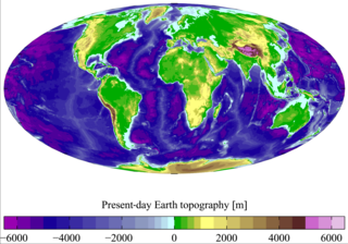
Terrain or relief involves the vertical and horizontal dimensions of land surface. The term bathymetry is used to describe underwater relief, while hypsometry studies terrain relative to sea level. The Latin word terra means "earth."

In geology, bedrock is solid rock that lies under loose material (regolith) within the crust of Earth or another terrestrial planet.

A hoodoo is a tall, thin spire of rock formed by erosion. Hoodoos typically consist of relatively soft rock topped by harder, less easily eroded stone that protects each column from the elements. They generally form within sedimentary rock and volcanic rock formations.

A craton is an old and stable part of the continental lithosphere, which consists of Earth's two topmost layers, the crust and the uppermost mantle. Having often survived cycles of merging and rifting of continents, cratons are generally found in the interiors of tectonic plates; the exceptions occur where geologically recent rifting events have separated cratons and created passive margins along their edges. Cratons are characteristically composed of ancient crystalline basement rock, which may be covered by younger sedimentary rock. They have a thick crust and deep lithospheric roots that extend as much as several hundred kilometres into Earth's mantle.

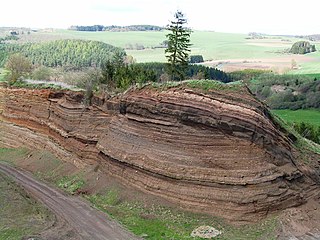
A geological formation, or simply formation, is a body of rock having a consistent set of physical characteristics (lithology) that distinguishes it from adjacent bodies of rock, and which occupies a particular position in the layers of rock exposed in a geographical region. It is the fundamental unit of lithostratigraphy, the study of strata or rock layers.

A hill is a landform that extends above the surrounding terrain. It often has a distinct summit.

An outcrop or rocky outcrop is a visible exposure of bedrock or ancient superficial deposits on the surface of the Earth.

In glaciology, a roche moutonnée is a rock formation created by the passing of a glacier. The passage of glacial ice over underlying bedrock often results in asymmetric erosional forms as a result of abrasion on the "stoss" (upstream) side of the rock and plucking on the "lee" (downstream) side. These erosional features are seen on scales of less than a metre to several hundred metres.

The Putangirua Pinnacles are a geological formation and one of New Zealand's best examples of badlands erosion. They consist of a large number of earth pillars or hoodoos located at the head of a valley in the Aorangi Ranges, on the North Island of New Zealand, in the Wellington region.

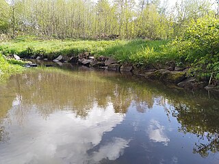
A stream is a continuous body of surface water flowing within the bed and banks of a channel. Depending on its location or certain characteristics, a stream may be referred to by a variety of local or regional names. Long large streams are usually called rivers, while smaller, less voluminous and more intermittent streams are known as streamlets, brooks or creeks.


