
Gippsland is an economic rural region of Victoria, Australia, located in the south-eastern part of that state. It covers an area of 41,556 square kilometres (16,045 sq mi), and lies to the east of the eastern suburbs of Greater Melbourne, to the north of Bass Strait, to the west of the Tasman Sea, to the south of the Black-Allan Line that marks part of the Victorian/New South Wales border, and to the east and southeast of the Great Dividing Range that lies within the Hume region and the Victorian Alps. Gippsland is generally broken down into the East Gippsland, South Gippsland, West Gippsland, and the Latrobe Valley statistical divisions.

Cooma is a town in the south of New South Wales, Australia. It is located 114 kilometres (71 mi) south of the national capital, Canberra, via the Monaro Highway. It is also on the Snowy Mountains Highway, connecting Bega with the Riverina.

Perisher Valley, commonly called Perisher, is a valley formed below Mount Perisher, a mountain that is located in the Snowy Mountains of New South Wales, Australia.

Blue Cow is a ski resort that is part of Perisher located in the Snowy Mountains of New South Wales, Australia, within the Snowy Monaro Regional Council. The resort is situated within the Kosciuszko National Park and is administered by the NSW National Parks & Wildlife Service. During winter months, the only access to the village is via the Skitube underground railway. In summer, access is via off-road only. Blue Cow is one of the four resort bases within Perisher, Australia's largest ski resort.

Jindabyne is a town in south-east New South Wales, Australia that overlooks Lake Jindabyne near the Snowy Mountains, in Snowy Monaro Regional Council. It is a popular holiday destination year round, especially in winter. This is due to its proximity to major ski resort developments within the Kosciuszko National Park, including Thredbo, Perisher and Charlotte Pass.

Glenworth Valley is a suburb of the Central Coast Council local government area in the Central Coast region of New South Wales, Australia. About 73 km (45 mi) north of Sydney and 20 km (12 mi) west of Gosford, at the 2016 census it had a population of only 10 people.

Rosewood is a village community and locality in the south east part of the Riverina, New South Wales, Australia. It is situated about 16 kilometres (9.9 mi) south east from Carabost and 19 kilometres (12 mi) north west from Tumbarumba. At the 2016 census, Rosewood had a population of 214. The village is administered by two local governments; the northern part of the locality by the Greater Hume Shire and the southern part of the locality by the Snowy Valleys Council. The village of Rosewood is within the Snowy Valleys Council area.

Brindabella is a locality in south-east New South Wales, Australia, mainly in the area of Snowy Valleys Council and partly in Yass Valley Council. It is reached by the Brindabella Road from the Australian Capital Territory over the Brindabella Ranges. It is significant as the early home of Miles Franklin, who wrote a well known book called Childhood at Brindabella. It had a population of 22 at the 2016 census, who live in the Brindabella Valley. The locality also includes a large unpopulated area consisting of parts of the Brindabella National Park, the Kosciuszko National Park and the Bimberi Nature Reserve and of state forests.

The Snowy Monaro Regional Council is a local government area located in the Snowy Mountains and Monaro regions of New South Wales, Australia. The council was formed on 12 May 2016 through a merger of the Bombala, Cooma-Monaro and Snowy River shires.

The Snowy Valleys Council is a local government area located in the South West Slopes region of New South Wales, Australia. This area was formed in 2016 from the merger of the Tumut Shire with the neighbouring Tumbarumba Shire.
Nanima is a locality in the Yass Valley Council area, New South Wales, Australia. It lies on the both sides of the Murrumbateman Road between Murrumbateman and Gundaroo, about 37 km north of Canberra. At the 2016 census, it had a population of 165.
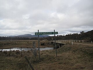
Yaouk is a locality in the Snowy Monaro Region, New South Wales, Australia. It lies in open grassland valleys surrounded by mountains on both sides of the Murrumbidgee River, downstream from and east of the Tantangara Dam, north of Adaminaby, east of the Kosciuszko National Park and south of the Namadgi National Park in the Australian Capital Territory, but separated from it by the mountainous Scabby Range. It is about 110 km south of Canberra and about 75 km northwest of Cooma. At the 2016 census, it had a population of 25.

Dry Plain is a locality in the Snowy Monaro Region, New South Wales, Australia. It is located in grasslands mainly to the east of the Snowy Mountains Highway, about 25 km southeast of Adaminaby and 40 km northwest of Cooma, straddling an altitude of approximately 1,260 m above mean sea level. It is about 160 km south of Canberra. At the 2016 census, it had a population of 42.
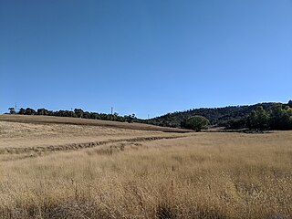
Wambrook is a locality in the Snowy Monaro Region, New South Wales, Australia. It it located in grasslands mainly to the northeast of the Snowy Mountains Highway, about 30 km southeast of Adaminaby and 25 km northwest of Cooma, situated at the foot of the ranges at an altitude of 865 m above mean sea level. It is about 140 km south of Canberra. At the 2016 census, it had a population of 44.

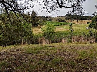
Dairymans Plains is a locality in the Snowy Monaro Region, New South Wales, Australia. It is located to the north of the Snowy Mountains Highway, to the immediate northwest of Cooma. At the 2016 census, it had a population of 152. It contains grazing country, a rural residential development, Cooma Golf Course and a large car wrecking yard.
Yarrangobilly, New South Wales is a rural locality in the Snowy Mountains, west of Canberra, Australia, and is also a civil Parish of Buccleuch County.
Eucumbene is a locality in the Snowy Monaro Regional Council in New South Wales, Australia. In the 2016 census, Eucumbene had a population of 12 people.
Kosciuszko is a locality in Snowy Valleys Council, New South Wales, Australia. It was previously spelled as Kosciusko. In the 2016 census, Kosciuszko had no population.
Tumut Plains is a locality in the Snowy Valleys Council, New South Wales, Australia. In the 2016 census, Tumut Plains had a population of 60 people.
Rhine Falls is a locality within the Snowy Monaro Regional Council, straddling between Wambrook and Dry Plain; at an altitude of 1,320 m above mean sea level, thereby ranking as one of the highest-elevated localities in Australia. Likewise, snow falls heavily and frequently from May through to September, and can fall at any time of the year. At the 2016 census, it had a population of 42, the same as neighbouring Dry Plain.

